The Lawson Trek
  • Home
    • About
    • Interactive Map
    • The Trek
  • Along the Path: Blog
  • John Lawson
    • "A New Voyage to Carolina"
    • The Carolina Colony
  • Talk to us!
  • Store
  • Press

Along the Path

Updates as we learned about Lawson's journey and times -- and reports from the trail as we progressed along it. Plus tales of the process of publishing the result.

A New Voyage to Albion, I: Making Ready

4/30/2015

0 Comments

 
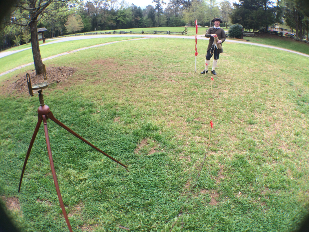
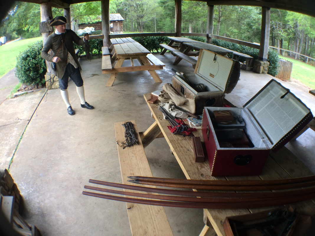
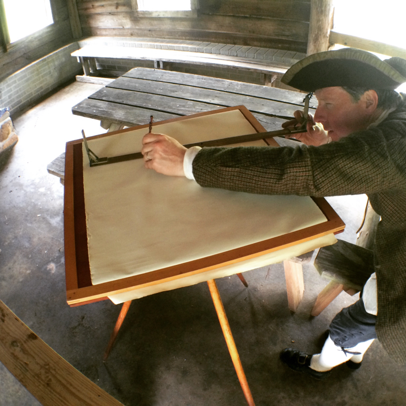
Lawson's A New Voyage to Carolina made quite a splash in England in 1709 -- his publisher even slipped it into print before something already on the schedule of A New Collection of Voyages and Travels with Historical Accounts of Discoveries and Conquests in all Parts of the World, a sort of anthology series of dispatches from explorers hither and yon. Lawson showed up in London in 1709 and James Knapton, of the "St. Paul's Church-Yard," the title page says, slipped Lawson's work right into the schedule. I'm jealous of this editorial treatment even from 315 years away.
Picture
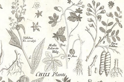
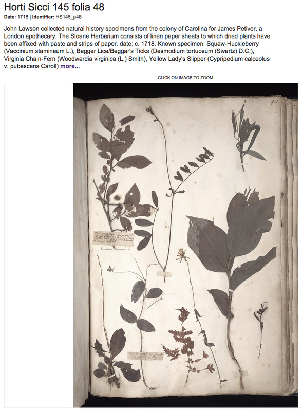
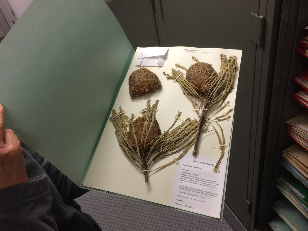
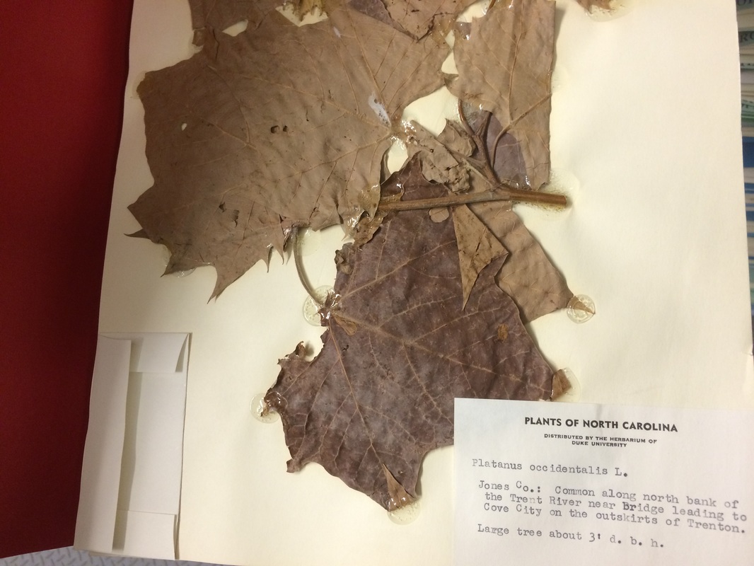
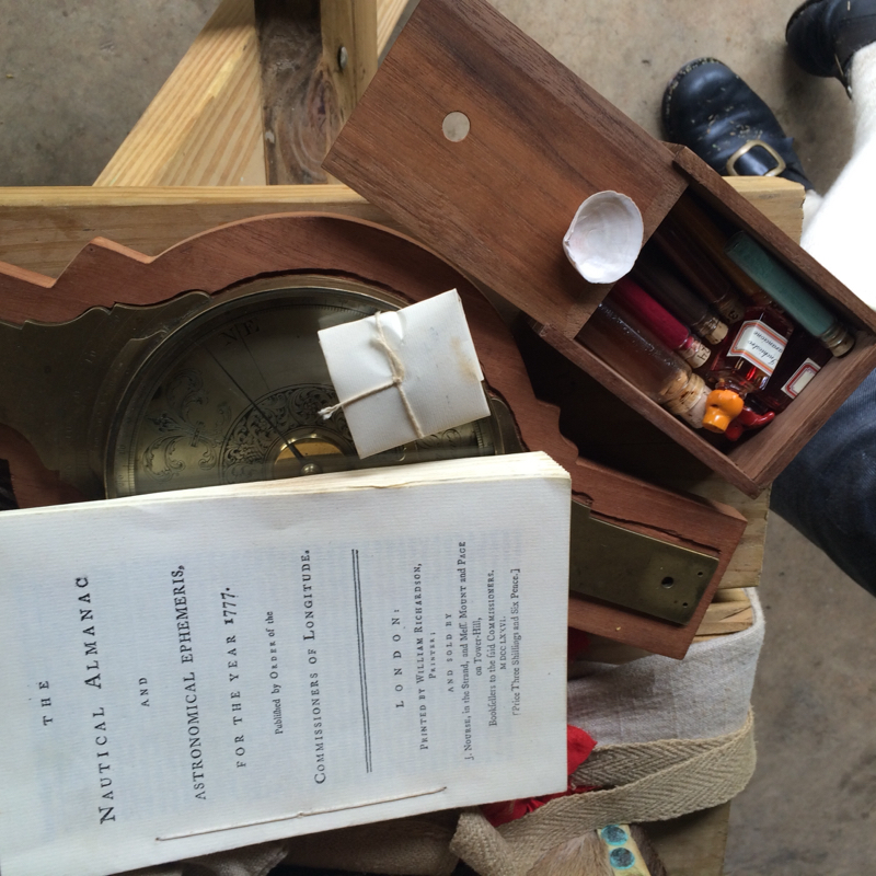
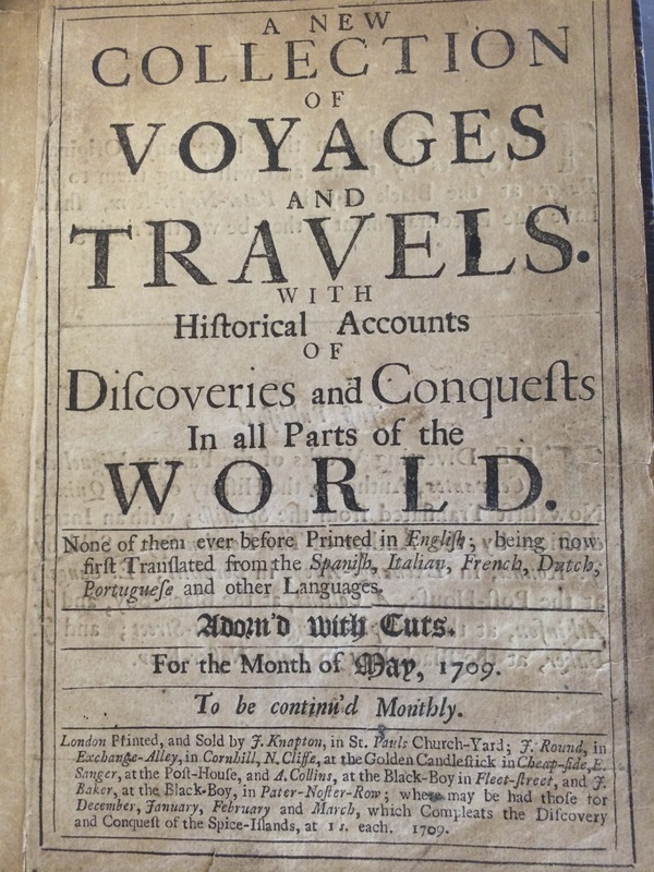
They stuffed Lawson into print just as fast as they could once he showed up. Someday maybe that will happen to me. A fellow can dream, right?
Anyhow, Lawson's work did great in the anthology and was eventually printed, we know, as A New Voyage to Carolina, with all its attendant histories and a single page of weird drawings and all the rest. 

Another thing I'm jealous of, though, is that Lawson had going for him that nobody knew anything about his territory. Carolina was pretty big news if you were a London gentleman hanging around a coffee shop with time on your hands. Not so much now -- I'm rediscovering everything I find. If occasionally I cast a bit of new light on something that's fine, but it's like Ecclesiastes says -- there's nothing new under the sun. 

Given which, thank goodness for little kids. 

As I mentioned, to see some of the botanical specimens Lawson gathered, I'm going to England, to the Natural History Museum, where they remain. But speaking of new discoveries, my wife, June, and I will be taking along two very scientific young men -- my sons, Louie, 10, and Gus, 6.  I profoundly hope they add a spirit of first-viewing to what we see there, and I thought it would be worth looking at our travel in the kind of observational spirit the
Lawson Trek has undertaken for this whole enterprise. Here, then, is a look at our preparations for a New Voyage to Albion, with Observations by Scientific and Unusual Youth.

Thing one is passports. I have a deep love of passports, and getting passports for my sons was, though something of a pain in the patoot, an emotional experience for me. Once you have a passport, you can go anyplace, and that's a kind of threatening thought when the passport holders are in elementary school.

Just the same, it's thrilling, too. A passport is a document, a souvenir, a create-as-you go memoir, and I gaze at my old passport with a fondness bordering on the absurd. 

For one thing, I'm in favor of actual things. Of paper things, of things with stickers and stamps, with initials and dates and signatures and embossments. A passport carries more than thousands of years of history of international border control. Lawson would likely have had nothing in the way of passport, though he might have had some sort of letter of introduction. Not so today, with our tight focus on borders, but that's not a bad thing at all. A passport carries with it a memory of your actual physical movements on an actual physical planet. A passport is real. Which, today, is no small matter. Electronic ticketing means that instead of colorful stickers on steamer trunks or even cardboard seat-assignment stubs, most travelers return with no document more romantic than a folded sheet of copy paper. In this dreary virtual universe, of paperless voting and checkless bills, of correspondence without stationery and reading without pages, the use of a passport -- a real honest-to-goodness travel document, which a real person will stamp with real ink -- seems stabilizing and even comforting.
Picture
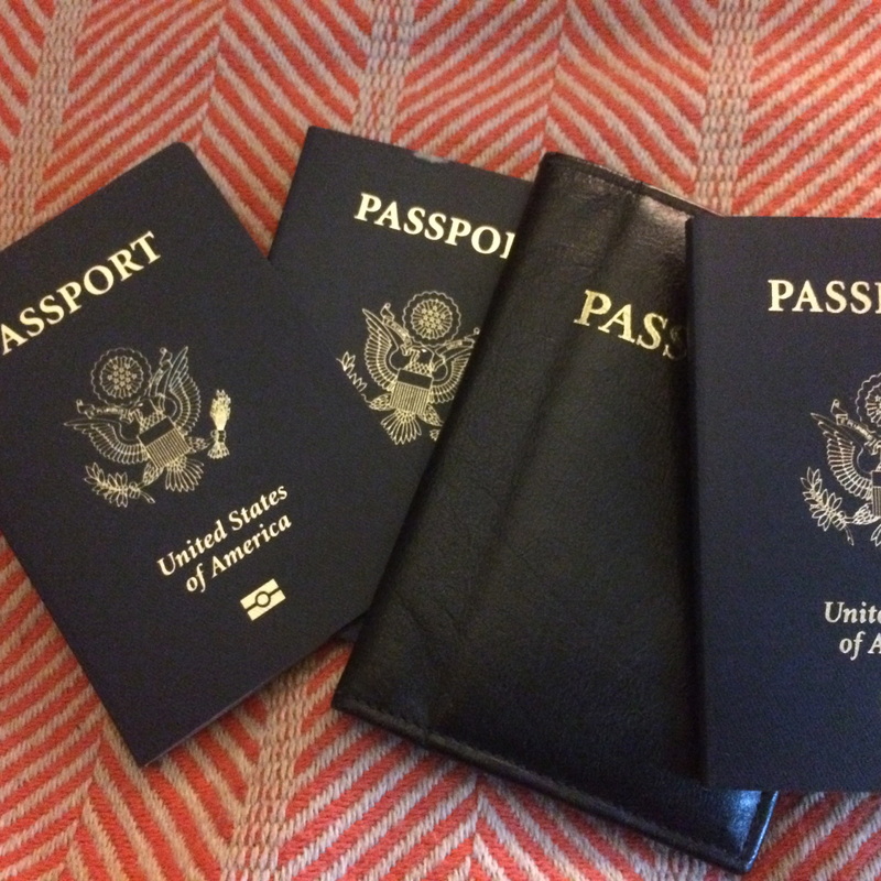
Mine is in its little cover, but the boys' and June's are just there. Passports! My babies! I took out my old passport to show the boys -- visas to Nepal, India, Turkey; stamps, signatures, all kinds of stuff. They didn't even try to feign interest. I hope their own stamps will prove more exciting.
Picture
And we'll be using these things. Yes, I always have a bag full of my vitals that, like the secret service supposedly does with the briefcase fulll of nuclear bomb codes, I call "the football" and try never to lose track of. But passports and cash? Those stay on my person, around my neck. Call me crazy.
With watermarks, microprinting, hidden inks (hold a passport under a black light -- whoa, dude!), and sticker visas topped by stamps topped by signatures topped by endorsements, passports are now almost as hard to counterfeit as money. A passport, just as it ought to, has meaning: It's a note, from the Secretary of State, asking "all whom it may concern" to give "aid and protection" to you while, far from home, you hold it. A passport is the direct relative of the note from the king mentioned in the Bible (Nehemiah 2:7, "If it please the king, let letters be given me to the governors beyond the River, that they may let me pass through, till I come unto Judah") -- and those romantic letters of transport that Humphrey Bogart hid inside the piano in Rick's American Cafe. To be sure, nothing will bring back the romance of travel back when travel was travel, before your and everybody's grandparents started going on safari to Kenya, but just the same, it's worth remembering that when you go even to Canada or Mexico, you're leaving the country. Passport control may remind you of that.

Which is another important benefit. Picking up passport stamps is a worthy and satisfying goal. You can show them to your friends upon return, compare them while you travel, flip through pages of them as your airplane descends into foreign territory and you anticipate passport control, a foreign language, the need to find transportation, lodging, food. Your passport stamps remind you: I've done this before; I can do it again.
So I'm thrilled my boys will get their first passport stamps, their first "I've been theres." And their first international money, too -- pounds sterling in Britain and Krona in Iceland, coins of which will hopefully litter their treasure boxes for the rest of their lives.

So we're planning now. We've got the folder of every single printout, itinerary, receipt, and schedule, which we always know where it is -- something of a wonder in our house. Little piles are appearing: bathing suits here, raingear there, a little travel diary for each kid, with pens, pencils, sharpeners. We're getting ready to go somewhere. It's not undiscovered, but it's new for us.

We'll keep you posted.

P.S. A little note -- parts of this post appeared in somewhat different form in 2007 in a freelance story I wrote for the News & Observer. If there  were a way to link to it, I'd do that in a second. No such luck. Man, newspapers are just charging ahead in this digital universe, are they not?
0 Comments

Filing the Botanicals

4/29/2015

0 Comments

 
So as you well know, Lawson spent two months taking this enormous walk, and then he, uh ... well, then came the rest of his life, and he was real busy doing things like cofound and survey the town of Bath, cofound and populate the town of New Bern, become Surveyor-General of the North Carolina colony, and then get killed by the Tuscarora, in 1711. 

But he did something profoundly important just before that -- in 1710: he gathered botanical specimens that he sent back to England, for one James Petiver, an apothecary "at the sign of the White Cross in Aldersgate Street, London." Collectors in those days were the equivalent of museum directors and scientific foundations now, sending agents all over the world to gather specimens or reaching out to travelers and asking them for any specimens they could provide. Lawson wrote to Petiver in 1701, after the completion of his journey, responding to an ad Petiver had run: "I design yr. advertismts. in order to for yr. collections of Animals Vegitables etc.," he tells Petiver. "I shall be very industrious in that Employ I hope to yr. satisfaction & my own, thinking it more than sufficient Reward to have the Conversation of so great a Vertuosi," vertuosi being what such collectors were called back then. In 1698 Petiver wrote to his apprentice, traveling through the West Indies, "Wherever you come enquire of the Physitians of Natives what herbs etc. they have of any Value or other use in Building, Dying etc. or what shrubs, Herbs etc. they have that yield any Gum, Balsam, or are taken notice of for their Smell, taste etc. and each of these get Samples with the names they call them by."


Picture
Above, some of the text from Petiver's "The South Sea Herbal" (okay, the Hortus Peruvianus medicinalis, you happy now?) published in 1715; at right some of the pictures.
Picture
To another collector, further clarifying the goals of these "vertuosi," Petiver wrote "It is, Sir, to such Curious Persons as your selfe that we at this distance must owe what your parts of the late discovered World can afford us." That is, people like Lawson -- go-getters, out in the field, who grabbed up specimens of the plants and animals they encountered and shipped them back to England, were the eyes and ears of the Enlightenment hitting its stride. 
Evidently Petiver never responded to Lawson's first letter, or in any case Lawson got busy with other things. The next piece of correspondence we have (on file in the British Library, no less) is from 1709, thanking Petiver for a book and pledging to stay in touch when he returned to Carolina. Lawson was then preparing to return from England, where he had gone to publish his book and be appointed Surveyor-General for North Carolina, which would require considerable travel, allowing him to gather the samples he promised Petiver.

"Sr. I hope long since you have Received ye Collection of plants & Insects in 4 vials wch I sent for you," Lawson writes to Petiver in 1711, including "one book of plants very slovingly packt up." Lawson blames "ye distracted Circumstances our Country has laboured under" (the colony was suffering under the political and religious war called the Cary Rebellion), but you and I both know that's just a variety of the usual mealy mouthed deadline apologies we all send.

Anyhow, Petiver got the stuff, and he included the specimens in his collection. An example of what eventually came of Petiver's collections can be found here, in the South Sea Herbal, one of many books (pamphlets, more like) made showing off the kind of stuff Petiver was collecting and sharing. So you can understand why our pal Lawson, interested in 
Picture
Here's one of Lawson's specimens, now in the Natural History Museum in London. I'm going to go see it!
PictureHans Sloane, whose collection formed the foundation of the British Museum.
making a scientific name for himself, wanted to play. He even hoped his specimens would form what writer Marcus Simpson fully explains in an essay in the just-published The Curious Mister Catesby was going to be what Lawson calls "a foundation towards a Compleat History of these parts," which Lawson mentions in a letter dated October 30 1710. Of course Lawson was killed in 1711, so no Compleat History.

But a bunch of specimens, yes. About 300 total, according to Vince Bellis of East Carolina University, who got images of the specimens from the Natural History Museum in London, where they reside. You can see them all online through ECU, here.

Wait -- the specimens reside? Somewhere? Still? Like, I could actually go see them?

Yep. So that's what's up right now. See, Petiver's collection was so good that ubercollector Hans Sloane tried to buy it, and after Petiver died, Sloane did. Then, when Sloane died, he left his collection to England, which used it to begin the British Museum. In 1992 the botanical (and some other) stuff peeled off to become the Natural History Museum, its own entity. And at the Natural History Museum they have an herbarium.

Those, I get. I have been to the herbarium at Duke University. An herbarium is pretty much just a bunch of drawers full of plants, but they're of course climate controlled and organized and filed. In fact, the whole Duke Herbarium is basically a set of those sliding file cabinets that you work by cranks. As far as "archive museum old books sexy" goes, you might as well go to your public library's microfiche collection.

Picture
Doesn't exactly radiate atmosphere, does it?
Picture
Once you open the folders, though ....
But once you start looking through folders it gets kinda cool. Duke research scientist Layne Huiet took me down to theirs and showed stuff off. Big on bryophytes and lichens, Duke also has 400,000 specimens of vascular plants -- of which 821 are Type Specimens. If you think of specimens as baseball cards -- and they are; the herbaria trade them to fill out their collections -- a type specimen is one that is the sort of king main specimen for a species. The first example of a new species, discovered and named? That specimen is likely the type specimen -- in this case called the holotype, though there are about a dozen types of type you can be.

The point: you can go into an herbarium and see all these cool original specimens gathered over the last half-millenium or so, and when you look at them you get that sense of being with a scientist as she or he gathers, prepares, dries, and presents a piece of the world for classification and understanding. 
Picture
A specimen from the Duke Herbarium
You read about where the specimen was gathered, who gathered it, what they noticed. It's like you're with the scientist.

So I am going to the Natural History Museum, where I'm meeting Charlie Jarvis, a friendly researcher in the museums historical collections who will bring out Lawson's specimens from Petiver's portion of Sloane's collection and let me see them. I'll get to see Lawson's handwriting and his style, and I can estimate to what degree his speciments were "slovingly" collected as well as packt up. They were mostly gathered near New Bern, according to Bellis.
I can't promise I'll gather any special information about Lawson, his time period, or his methods from looking at specimens prepared from his work three centuries ago. But it gives me a chance to commune with him, with the material of his world, and I'm looking forward to it. I'll keep you posted.
0 Comments

The Sounds of Earth Day

4/22/2015

0 Comments

 
One of the loveliest pieces I've seen about Earth Day today is this one, from Mental Floss, about acoustic ecologist Gordon Hempton, who works to capture the sounds of nature, and especially the sounds of nature unaffected by human development.

Cool enough, but I'm not quite on board. One of the things I fear about the dichotomy between humankind and nature is that I think it's false. That is, if a beaver dam is natural, how is the Hoover Dam not natural? If the robin's nest in your yard is natural, how is the Empire State Building not natural? If the sound of water rushing down a creek after a rain is natural, how is the sound of the constant flow of the same water rushing through a buried storm drain not natural? One step further, if a deer pees in the woods and you hear it, that's natural, right? If you do? If you hear the soothing, constant trickle of the sanitary sewer beneath your street, is that natural? 

Obviously I think yes. So today for Earth Day I'm sharing some videos I've taken along my way, and I ask you to think of each one: natural? or not? Hempton notes there are fewer and fewer places you can go to where you can spend a few minutes without hearing the sound of (other) people. True enough. I have always believed -- and I believe more strongly with each step of this trek -- that true nature is harmony: it's not the absence of humankind, it's the appropriate presence of whatever is there. I have walked the last few treks more and more along enormous roads, built, because people have gone mad, without sidewalks of any sort. This is a terrible experience, but it's no more unnatural than walking down a deerpath, or an Indian path, or a hiking trail. It's lousy, but it's not unnatural.

So here are a few videos, following the lead of the excellent Mr. Hempton, who gathers sounds without humans. Mine were gathered without worry about that. Everyplace I have been there are overhead wires, forest roads, buried cables, bridges. I still love the sounds I hear. Here are a few worth sharing, and worth thinking about. What's natural to you? 
To me all these little moments sound like the natural world. I don't like the sound of leaf blowers, but I love the sound of people raking. I don't mind the sound of cars, but I hate the pointlessly loud blat of motorcycles. I hate the constant whir of air conditioners on a summer evening, but I find the buzz of an electric substation oddly comforting.

So listen. And think. That's what Lawson did on his trip, and what I'm trying to do on mine.

And take care of what you value, okay?
0 Comments

The Mathematical Devices

4/16/2015

0 Comments

 
Today I fulfilled a dream that has been almost lifelong: I learned (in a sort of general way) to survey.

I did a newspaper story once about surveying, and though the trigonometry involved strained my brain's math app, I loved the idea: you are here. EXACTLY here, and once you know a few places you can find a way to connect every other place on the map. You can even make the map. (The trigonometry, by the way, is mostly involved in triangulation: you know various angles and lengths of sides of various triangles, and you use trig to fill in any lengths you'd like to know.)


So when I found out Lawson was a surveyor I was thrilled, and when I connected with Dale Loberger, a living history practitioner who reenacts seventeenth- and eighteenth-century surveying techniques, I realized: not only could I learn the basics of surveying, I could learn them in the simple way young men of Lawson's time would have learned them.

"Every educated man was taught surveying," Dale told me, dressed in his eighteenth-century garb and setting up the equipment of Lawson's time. "You're going to buy land, you've got to know whether you're getting what you're paying for.

"It was a practical skill that taught you all these concepts."

So naturally, the first thing I learned about surveying was, counterintuitively, what backbreaking work it was. Surveying, especially the newly divided land early colonial surveyors like Lawson would have surveyed, was usually covered with scrub, so just hacking your way through the brush took enormous effort. Then place yourself in Carolina, where it was nice and hot most of the year, to say nothing of bugs. Take a big honking knife, start whacking away, and there you are: surveying.
Picture
This hooky knife was a big part of surveying: you had to whack away enough underbrush so the surveyor and his crew could see each other. In the Carolinas, where Lawson surveyed? Not so easy.
Next, amazingly, was how much surveying was done by people who DIDN'T know the math. The surveyor would use complex equipment like the circumferentor, a surveyor's compass that enabled the surveyor to sight a distant object through slots called an alidade.

He would look through the sights and call to his assistant, who would stand where the surveyor told him and perhaps blaze a tree, stone, or other object while the surveyor noted on the circumferentor the exact angle to the object from his starting point. Then the surveyor would carry his equipment -- a tripod and his circumferentor -- to the spot, send his assistant to the next spot he wanted to sight, and begin again
Picture
Loberger here holds his circumferentor.
Meanwhile, the chain gang -- they were actually called that -- would take surveyor's chains and measure the distance from point to point. A surveyor's chain was 66 feet long and consisted of 100 links, and the chain gang measured to the nearest link. With the surveyor measuring angles to the nearest degree and the chain gang measuring distance to the nearest link there was plenty of wiggle room, but when your landmarks are inherently nonpermanent things like trees, close enough will do.
Picture
That's Loberger, showing about how far surveyors could get from one another. Those are arrows in the ground.
It only gets better. The chain gang measured by poking stakes -- called arrows, they were pieces of wood with a flutter of silk on the end, much like the stakes surveyors use even today -- in every time they reached the end of a chain. (Four rods per chain. The weird numbering comes because the surveyor's chain represents a genius-level metricization and combination of the ancient units of miles and acres. Long story; just trust me.)

Anyhow, the two assistants had quivers; the front one would have nine arrows, the back one none. The front one would stake an arrow into the ground at each chain, and when he ran out he would measure one more chain, then call "out," at which point the surveyor himself would note and track the out, whether on a special scorekeeper on his circumferentor or, lacking one of those, by moving a marker of some sort up the buttonholes of his waistcoat.

"An out was a unit of measure," Loberger told me. "You'd have one out and one arrow," he said, giving a possible measurement. So again: the chain gang did nothing more complex than count from one to nine (or ten, depending on whether you include "out"), and the design of the chains and links meant that simple multiplication yielded areas in acres. "The whole idea," he told me, "was to remove the mathematics." Being that the strong back was a bit more important than the strong mind. In places like Carolina, in fact, where brush was heavy, surveying crews often used half-chains instead of full chains so they could stay close enough to see and hear each other well enough to do their work. A half-chain is 33 feet, or a little more than ten yards. Which means it took a hooked machete, several pieces of equipment, and a crew of at least four to get a first down. Add in a guard and an instrument bearer and a couple guys to hold the staffs that were used for sighting to (and measuring smaller distances) and you can see that surveying took up a lot of energy of a lot of people.

An entire seized continent isn't going to carve up itself, right?
Picture
Boxes of surveying and drafting tools. Thank goodness for bearers!
But that's not even the cool part!

After demonstrating the use and lore of the circumferentor, Loberger pulled out the plane table and proceded to entirely blow my mind. With the plane table and a procedure called resection, a surveyor could map an entire area by taking sightings from two positions and end up with a perfect map of the area without leaving those two spots.

It's kind of insane, but let me explain. You take your plane table -- a flat surface on a tripod, basically -- and orient it towards the north. You may not need a compass -- you may just use a "needle box," a narrow box with 20 degrees of play or so for a compass needle. You orient the plane table, arbitrarily mark a spot on the paper on the table, and sight from there to several points, drawing a long pencil line along the straight edge of the alidade. Loberger demonstrated by sighting to the corners of the shelter in which we stood.

Then move the plane table, orient it exactly the same with the needlebox, and sight to the same spots, from a second arbitrarily chosen point on the paper. Your pair of pencil lines to each point will cross, and then you use a straightedge to connect the points where they cross.

Voila! You've mapped your site. Measure the distance between your two sighting spots, compare it to the distance between your sighting points on your map, and you've got your scale.

Mind blown.
Picture
It just doesn't seem right for something to be as intrinsically cool as the way a plane table can take points on the earth, place them on the plane in their exact proportional interrelationship, and result in a perfect map without your having to move beyond your two viewpoints. I mean, it's kind of crazy.
I could go on. Well, okay, I rather HAVE gone on, have I not.

Blame me, I dare you. Loberger also demonstrated the use of a sextant, with which observers on sea (or on land, with an artificial horizon, which I'd explain but your head might explode) could determine their position by measuring the height above the horizon of various celestial objects. (A predecessor to the sextant was the forestaff, which required you to squint directly into the sun as you measured its height above the horizon; ever wonder why pirates wore eyepatches? They were burning out their eyes. I am completely not kidding.)

The point is this: using technology available in 1700 and mathematics he would surely have known, Lawson was able to determine his position and, later, when he became the Surveyor-General of the Carolina Colony, parcel out land and design the towns of Bath and New Bern.

The point, really, is the do-ability of all this stuff. It wasn't magic -- it didn't require modern total stations and thousands of dollars of computing equipment. It required only the mathematics a young gentleman would know, a few pieces of equipment, and a little bit of want-to. You and I could do all of it with a pocket compass, a pencil, a pad, and a tape measure and come up with maps and measures that weren't all that ridiculous.

The world is amazing; the world Lawson wandered was perhaps even more so, because people hadn't yet forgotten that you could understand it so well by using mostly your brain, your hands, your feet, and your back.

Lawson's trail reminds me of all that. People like Dale Loberger stay reminded of that and try to remind the rest of us. You can still get the lay of the land.

Picture
Seriously: the pocket surveyor's kit. Loberger is sure Lawson had one just like it.
Picture
Dyes for colors, statistics on where celestial objects would be, and all kinds of scales and rulers, to say nothing of rudimentary mechanical pencils and pens you made yourself out of quills. Please -- may I go on a surveying trip in the early eighteenth century?
Picture
This is a reproduction, but Loberger is certain to the marrow of his bones that Lawson had one just like it: a little pocket globe, useful for pontificating in bars during discussions of matters political or geographical. I bet he's right. I mean, I'd have one. Wouldn't you?
0 Comments

Tue, Apr 14, 2015

4/14/2015

2 Comments


I'm sitting at a picnic table across from Dale Loberger, a GIS professional who also is a living history practitioner about surveying and mapmaking (the term "cartography" postdates the 17th century).

Dale slept in a mid-18th century tent,is wearing period clothing, and will spend the rest of the day teaching me to use period surveying tools. Dale is another in a long string of Heroes of the Lawson Trek who is giving time and energy to help us understand what life would have been like for Lawson.

Picture

Anyhow Dale tried manfully to get a fire going this wet and humid morning with flint and steel and charcloth, but no soap. We couldn't even make fire with my lighter, though when we finally used Dale's candle we got things going. Dale cooked sausage and potatoes. I made coffee on my gas camp stove.

It's been that kind of morning. In between starting fire and eating with his knife like a proper explorer, Dale takes calls for his work and at one point pulled out his laptop to send someone a spreadsheet. Meanwhile I document everything with my phone and now sit and type with my keyboard and tablet. This feels far from inauthentic -- it feels perfectly true and valid. We are here now.

Picture

The food tastes like the fire. The coffee tastes like plastic. "If Lawson only had mobile hotspots," Dale says. You mean he didn't?

My travel this segment takes me from Lancaster into Pineville, NC, about 32 miles. To give myself enough time to spend today learning with Dale, I walked 24 miles yesterday. That's a lot of walking.

The last few miles came as I slogged my way through briars in a not-recently-maintained right of way along a power line. That was Plan B; Plan A was following a trail drawn by my absolutely trustworthy source for Lawson's route, Val Green. I suspect I might have been able to follow Val's trail had I had energy and spirit, but for the last couple miles of a 24-mile day I wasn't prepared, and when the going got rough I headed along the power line -- at least I knew where that would take me.

I hadn't expected the briars, though, and I was in shorts, and it was late and I was just powering along, scraping my legs and saying, "Damn, you, Val!" pretty frequently. Here's the thing, though. As I followed that power line, I crossed the kind of indentation that, from my trip near the Catawba last trek and my walks along other roads Val has sent me on (and Dale has explained to me), I was able to instantly recognize as old roadbeds. That is, the place is crawling with old roads. People have been trying to get from hither to yon for generations, for centuries, and the signaures of their efforts remain on the land. One of them may have been the exact trail Lawson followed. I'd have never seen these without following Val's suggestions. So ok, Val -- not damn you. Still: briars.

Picture

Anyhow, this breakfast is by far the best the Lawson Trek has enjoyed, and it's about time to go learn to survey the way Lawson would have.

Also -- today, April 14, at 4 pm, the Lawson Trek will do a live stream on Periscope. Look for a stream from either @huler or @lawsontrek (i can never tell which I am; Twitter makes me crazy) at 4 pm. Sign on, listen in, and heart the crap out of us. See you then!

By the way -- I got a flame started myself, using flint, steel, magnesium shaving, and saved dryer lint. It was cool: my first no-match flame. But once you've used mined magnesium shavings and dryer lint, I'm not sure that flame qualifies as less technologically advanced than a match. Just saying.

Picture
2 Comments

Back to the Land

4/10/2015

0 Comments

 
You want to know how things have changed since Lawson's time? Look at the land; if I'm learning anything on the Lawson Trek it's that it all comes down to the land.

I spent my last trek focused on Lancaster, SC, where the Native American Studies Center of the University of South Carolina-Lancaster was holding, coincidentally, its annual Native American Studies Week, and the Lawson Trek got to play. As ever, I'd rather be lucky than good. I'll tell you about that soon, and about the welcome I received (again, like Lawson) from the Catawbas themselves.
Picture
We also saw this black vulture doing sun salutations on a chimney. We saw cormorants doing the same when they got wet. Animals understand the value of solar energy. Wonder if people ever will.
But I was talking about land. Walking north out of Camden left no doubt we were in the midlands, the Piedmont of South Carolina. In Camden we had noticed that the walk into town from the south had been almost completely flat but that the walk out of town to the north had enough rolling hills that you might not notice them as you walked but you would notice morning fog settling in the low places. 

We saw the land shift from pure loam and clay to rock, which was most notable in the copses of trees surrounding rocks too big for farmers to clear that pop up in the middle of the pastures for beef cattle that now have joined the cotton and soy fields and the pine farms we pass by. In fact, we now regularly pass by enormous boulders, which just like the lay of the land help determine the land's use. Not for nothing is Camden the beginning of horse country.
But for the clearest  indication of how a culture has changed is to look at what's come next, and the place to do that is The Ivy Place, a few miles up the Catawba River from Lancaster. Built in 1850 by one Adam Ivy, Ivy Place is still owned by the descendants of James Nisbet, a New York physician who had grown up in the area and bought the house as a homeplace in the 1880s. But the Ivy Place has more than just that beautiful 1850 house, barns, pick-your-own strawberry patches, and a great facility you can rent for weddings. 

It also has a future as open land. Because its owners have placed a conservation easement on it through the Katawba Valley Land Trust, the Ivy Place will never be developed. It will continue to be a working farm, and the family will own it, use it for its own purposes, farm strawberries and pine trees and beef cattle, host events -- but the land will never be developed. If you want to know what that means, look to the right. On the lower left of the image is the Catawba Reservation; across the river is Ivy Place and other land owned by the Nesbit family. North of that is what happens to land without conservation easements. 
Picture
Long-term residents of Lancaster County see Sun City and its ilk as tentacles of Charlotte moving down.
Sun City Carolina Lakes is a development for adults 55 and older, and it could not be more different from the landscape it replaced. To see that land, we spent a morning walking with Jimmy White (a member of the Nisbet family), Barry Beasley of the Land Trust, and Chris Judge, of the Native American Studies Center. We walked along the Catawba River, at least a quarter mile wide and rarely more than knee deep; we saw bluffs of that piedmont granite overlooking the river. We saw eagles nesting in snags, the sites of old Catawba and Waxhaw towns, the remains of an old mill, and piles and piles of empty plastic bottles and other flotsam that comes down the Sugar Creek, which drains Charlotte and enters the Catawba just upstream. Barry told us that one dedicated paddler has pulled more than 17,000 basketballs out of the Catawba in recent years.
"It's the typical story," Barry told us. "People move into the panhandle [the portion of Lancaster County also called Indian Land] for a better quality of life." As more people come, the sprawl they fled follows them. In the early 1990s the county added sewer and water services, and once you've done that, land is easy to develop -- and mostly gone. "Now it's Charlotte," Chris says of the way northern Lancaster County has connected to the Charlotte amoeba.

Which was why Jimmy was so pleased as he showed us the territory his family owns (and even some his family sold, though with easements on it protecting the river). Until the late 1950s the Catawbas operated a one-car ferry where route 5 now crosses the river, but the new road ended that. The more than 3 miles of riverside the Nesbits own at least give open land a fighting chance. Jimmy walked us to a site that had once been a Catawba town, and doing nothing more difficult than idly kicking around dirt he unearthed 18th-century pottery fragments that he gave to me -- a connection with centuries past.

Not that the land as it is now, with lovely second-growth forest and old mills and town sites and such, would have been as it is now when Lawson passed. "The coastal plain would've been magnificent longleaf pine forests," Barry reminded us, as we followed old Waxhaw paths and double-tracks as old as horse and buggies along the conserved land.
Picture
Do you have an 18th- or 19th-century potsherd in your house? I do.
Picture
Jimmy White led us around the conserved land where you had to blur your eyes only the smallest bit to be able to perceive trails that could be hundreds of years old.
Not, mind you, that it's wrong to develop housing subdivisions, or that it's wrong to sell your land when your land is your only resource. But what the Land Trust does, with and families like the Nesbits, is preserve an earth that can retain its memories of the Lawsons and Waxhaws and Catawbas (and Nesbits!) of this world. There's an enormous value to that.

After all, you need somewhere to dock your kayak when it's time to gather the basketballs. 
0 Comments

Civilization, or Something

4/8/2015

0 Comments

 
PictureIndian man in match coat, drawn by John White during his 1585 visit to Carolina. The term "match-coat" appears to be a folk etymology from the Algonquian word "mantchcor" or "matchcor." Interesting world, yes? (Image from virtualjamestown.com.)
Lawson, as he goes about his business, speaks mostly of visual observations. Of the Indians he meets, he describes their clothing (they almost always wear "match coats," a sort of toga-style piece of fabric worn connected over one shoulder):

Their Feather Match-Coats are very pretty, especially some of them, which are made extraordinary charming, containing several pretty Figures wrought in Feathers, making them seem like a fine Flower Silk-Shag; and when new and fresh, they become a Bed very well, instead of a Quilt. Some of another sort are made of Hare, Raccoon, Bever, or Squirrel-Skins, which are very warm. Others again are made of the green Part of the Skin of a Mallard's Head, which they few perfectly well together, their Thread being either the Sinews of a Deer divided very small, or Silk-Grass. When these are finish'd, they look very finely, though they must needs be very troublesome to make. Some of their great Men, as Rulers and such, that have Plenty of Deer Skins by them, will often buy the English-made Coats, which they wear on Festivals and other Days of Visiting. Yet none ever buy any Breeches, saying, that they are too much confin'd in them, which prevents their Speed in running, &c.

He describes the forests and greenery he encounters, in this part of the world noticing an end to the Spanish Moss: "From the Nation of Indians until such Time as you come to the Turkeiruros in North Carolina, you will see no long Moss upon the Trees," and he's exactly right -- we saw Spanish Moss at the beginning of the trek that took us from the High Hills of Santee to the town of Camden, and I haven't seen a strand of it since. He notices that the Indians have a special mark of respect:  "At Noon, we stay'd and refresh'd ourselves at a Cabin, where we met with one of their War-Captains, a Man of great Esteem among them. At his Departure from the Cabin, the Man of the House scratch'd this War-Captain on the Shoulder, which is look'd upon as a very great Compliment among them. "

Something about that shoulder scratch appeals to me; Lawson mentions it more than once, and it seems like such a lovely predecessor of the vaguely uncomfortably two-guy sidehug or the performance level shoulders-touching-two-thump handshake that it reminds me: Lawson was a guy just like I am, and the people he met were just people. Just like the people I meet.

Picture
Like Lawson, we come across many abandoned properties.
Picture
Developed territory indeed. Lawson never saw a prison.
Speaking of people, we walked into Camden thinking about the longstanding groups of people whose territories we're walking through. Walking through the High Hills of Santee -- the hills overlooking the upper Santee River and its formation at the confluence of the Wateree and Congaree rivers -- I took what I fear may have been the last truly backpack-style trip during this undertaking. Through there I -- mostly alone -- walked along sand roads and even on actual forest trails, sleeping in state and county campgrounds. Once I made it north of Manchester State Forest, though, I was on mostly two-lane asphalt, which means different shoes (yes sneakers or trail runners; hiking boots no, no, a thousand times no) and a different experience. Now I'm always among people, in at least farmed and often developed territory. In a way this is more Lawsonian anyhow.

That is, Lawson himself when he got to this part of the world was just moving from Indian town to Indian town, and he and his friends only rarely had to sleep out of doors. Not that he always liked the Indian hospitality he received: The People of this Nation are likely tall Persons, and great Pilferers, stealing from us any Thing they could lay their Hands on, though very respectful in giving us what Victuals we wanted," he says of the Wateree-Chickanee Indians he meets not far from here. "We lay in their Cabins all Night, being dark smoaky Holes, as ever I saw any Indians dwell in."

Two friends joined me for the walk into Camden, though I entered Camden alone (described here). But our lodgings were anything but dark smoaky holes. The delightful Joanna Craig of Historic Camden offered us the basement of the historic Kershaw-Cornwallis house, which enabled us to stay bone dry on what was actually a rather rainy weekend. Some nearby Boy Scouts had a somewhat harder time of it.
Picture
Troop 5 from Rock Hill manfully braved the elements. We urban dandies from the Lawson Trek stayed warm and dry in the basement of the Kershaw-Cornwallis House.
Picture
This house was originally built in the mid-1700s. It survived the Revolution but not the Civil War and was rebuilt on its original foundations in 1977.
PictureThe map of Camden from the 1825 Mills Atlas. You can see how it's just off the Wateree, and that the old road -- surely the one Lawson would have followed up from the Santee. (Image from South Carolina Digital Library -- http://digital.tcl.sc.edu/cdm/search/collection/rma.)
Joanna Craig gave us a mile-a-minute explanation of the history of Camden, which, founded in 1732, was the first inland Carolina town settled by Europeans. King George II was looking to get the Indians off prime riverside land and spread English settlement. The town was first planned as Fredericksburg, right on the Wateree River, then called Pine Tree Hill, then finally put in its current spot (actually rather swampy; it still floods, Joanna assures me) in 1758, when Joseph Kershaw arrived from England, established a store, and got things going. The town was called Pine Tree Hill until it was renamed after Lord Camden, a supporter of colonial rights. Its downtown main street -- Broad Street; Lawson would have walked the Indian trail on which it's lain -- is filled with buildings designed by Robert Mills, the designer of the Washington Monument and many other neoclassical buildings, to say nothing of the author of the 1825 Mills Atlas of South Carolina, from which the wonderful description of the rock house near Forty-Acre Rock comes.  The revolutionaries lost the Battle of Camden, by the way, lost it big time. Cornwallis took over the Kershaw house and imprisoned its owner for the duration; "hundreds of unhappy prisoners" of the revolutionaries had the same fate penned in the yard.

So anyhow, into, and through, and past, Camden we went, and in Camden as in Charleston and in McClellanville and in Jamestown and in Horatio we found friends to help us out. I've already mentioned Joanna Craig, who helped and organized and gave us warm and dry sleeping quarters, but at Books on Broad we met owner Laurie Funderburk, who organized a meet-and-greet that was absurdly well attended, the Camdenites coming out and introducing themselves en masse and in all ways making the Lawson Trek feel welcome. 

So we wandered. A day into Camden, a day in Camden, then another day north, partway to Lancaster. We visited Boykin on our way into town, where we met Susan Simpson, the broom lady, going about the business of making brooms in a little cabin that had housed slaves in 1740, and saw the mill pond, there since 1792 and the church built six years earlier. 

We saw cemeteries and plantation houses, cotton fields and tree farms, and the usual spate of abandoned houses, including one that took our breath away, not least because as we made our way across a cottonfield to explore it a machine came out to spray the field with nitrogen. It looked like an average machine until it automatically spread its pipes to begin spraying. Michael saw praying mantis; I saw vampire; and Katie, the ecologist, saw, she said, "threat behavior." 

What we loved most, though, was the town itself. "Horses and history," Joanna said were the themes of Camden, and it's clearly finding a way to keep itself alive with its historical district, arts and antiques dealers, and the nation's second oldest polo field. Camden became a resort town for late-nineteenth-century snowbirds, which gave the horse community its beginning, and it's remained ever since. 

Walking through town was delightful; this was the first town the Lawson Trek has come through whose primary history did not involve Lawson, explorers, or Indians. Seeing the tidy streets of old houses, many from the years immediately after the revolution, was thrilling and homey and peaceful.
Picture
Streets so homey and adorable you could just wiggle.
Picture
Susan Simpson, the broom lady, working on brooms. She has a two-year order backlog, but she'll be glad to see you just the same.
Picture
You really had to kind of be there, though.
More, we noticed among the porches that most Southern of traditions -- many with ceilings painted haint blue, supposedly to keep ghosts away because the ghosts perceive the blue paint as water and won't cross it. 

Oh, yeah -- Indians. Of course Camden has an Indian history. It was probably very near the center of the town of Cofitachequi, an Indian polity visited by de Soto, Pardo, and, as late as 1670, by Henry Woodward, the first British colonist of South Carolina. It was gone by the time Lawson came through, when the territory was the southern reach of the Catawba people.
Lawson met tremendous hospitality among the Catawbas (as he did everywhere), though not long after Lawson passed through things got less cheerful. King Haigler, a revered Catawba chief, would have been an infant when Lawson passed through -- he was born in 1700, so Lawson may have chucked him under the chin or dandled him on his knee. In any case, in 1754 he became chief, and he was evidently much beloved: he's considered the "patron saint" of Camden and he's in the South Carolina Hall of Fame. His image is everywhere in Camden. 
Picture
Picture
Fat lot of good it did him. He's the chief who signed the treaty that supposedly provided a 15-square-mile reservation for the Catawbas in South Carolina. That didn't work out too well (long story, but the Catawbas finally regained federal recognition in 1993), and Haigler was killed by a band of Shawnee. 
0 Comments

The Lay of the Land

4/7/2015

0 Comments

 
Picture
You're telling me.
Lawson talks a lot about the land he's passing through, and every time he faces something unusual he keeps us posted. He talks about the Santee temple mounds: "A Mole or Pyramid of Earth is rais'd, the Mould thereof being work'd very smooth and even, sometimes higher or lower, according to the Dignity of the Person whose Monument it is. On the Top thereof is an Umbrella, made Ridge-ways, like the Roof of an House," and we saw just such a mound -- they're part of Mississippian culture -- near Lake Marian.

And it was of just such mounds that I thought as I walked, through the rain, into the first major town the Trek visited since leaving Charleston: Camden, which by coincidence happens to be the first inland town in South Carolina, founded in 1732 as part of an effort by King George II to establish settlements on the rivers, further pushing away the Indians (who had been defeated at great cost in South Carolina in the Yamassee War decades earlier).  So we encountered in Camden history of the Revolutionary War period, many years after Lawson's day. Among other things, through the good offices of Joanna Craig, executive director of Historic Camden, we got to sleep in the basement of the rebuilt Kershaw House, the original of which survived the Revolution but was burned in the Civil War. The Battle of Camden, by the way, was a big fat loser for the colonists -- their biggest land loss of the war, as it happens.

Anyhow. As interesting as all that is, what fascinated me about Camden was the lay of the land. I walked into Camden in the rain on a quiet morning, and to get there I had to walk along a big four-lane highway, and that was the good road; on that I had to walk under Interstate 20.

And the first thing I thought of was those Mississippian Indian mounds.
Picture
Above, the slope of one of the berms where I-20 crosses route 521 south of Camden; at right the Santee Indian Mound. Not much changes when you're building with earth.
Picture
So you can't fail to notice, right? The Indian mound and the highway embankment at the base of the bridge 50 miles to its north could be twins. The same slopes, the same general design. One used for burying chiefs and erecting temples, the other used to bury costs and erect temples to automobiles, but still. Once people get up to building earth mounds, they're going to look about the same. 

I checked with an engineer who works with highways and he said that's right on. You can have a slope of 4 or even 3 to 1 (that's run to rise, so the smaller the first number, the steeper the slope) and you're okay. But go any higher and you need special reinforcement -- you can't even get grass to grow, to say nothing of the kind of erosion that a slope that steep will suffer. 
Picture
Greetings, foot traveler! What the hell is wrong with you? You do not belong here!
The other thing I noticede -- could not fail to notice -- on my way into Camden was that the roads I walked on had utterly no interest in my passage. I did not belong there, nobody thought about my needs, my safety, or my experience. That intersection is for cars, not for people, and if you happen to be a person trying to cross it, too bad.

I wondered what the people in cars would make of me, teetering along with my knapsack and my camping hat. Double-takes from windshields? Delighted children waving from the back seats? 

Nope -- worse. Nobody noticed me. Nobody noticed me at all. In an environment designed for big things moving at machine speeds, not a single person even glanced at me, a small thing moving at human speed. I scurried across lanes of traffic one direction at a time, and I crossed exit and entrance ramps only when I could see nobody was near; drivers slowing down or speeding up appear especially preoccupied with things other than vulnerable pedestrians. 

The interstate highway itself gave a moment of shelter from the rain -- and a drip line where the bridge shed its water. Along west side of the road, once I passed the interstate, was the Big Pine Tree Creek, and behind one of the several vast parking lots with a little gas station and convenience store in the center it was entered by a nameless tributary. As ever I love seeing the way tiny little microclimates set themselves up: creekside, by the pipes in ditches were tufts of grasses; a dirt road entered 521 that I could have driven be 200 times without ever noticing; the post and pylons of infrastructure systems were everywhere.
Picture
Picture
Picture
You cannot help wondering, even as you walk into a lovely little town like Camden, rich with history and filled with kindness (more on all that tomorrow): what kind of culture erects roads on which people cannot walk? Along which you travel without noticing ... anything? I say it over and over, but just walking the surface of the earth fills you with questions and ideas minute by minute. I'm sorry we all zoom by it so quickly.

Before I got into Camden proper I walked by two fast food restaurants and three convenience stores. It's not wrong to have so many of those; we have to fill our cars and our bellies. But lord have mercy, there are an awful lot of them. 

Anyhow, next time you get onto or off a highway, slow down and turn off your phone. It's improbable, but you might see someone walking.
0 Comments

Rocks

4/6/2015

0 Comments

 
Picture
Brent Burgin of the Native American Studies Center at USC Lancaster guided me around some rocky places.
So I've reached Lancaster, and Lawson, in his delicious prose, describes the surrounding terrain: "The Land here is pleasantly seated, with pretty little Hills and Valleys, the rising Sun at once shewing his glorious reflecting Rays on a great many of these little Mountains."

Which sounds, frankly, exactly like my own feelings as I traverse this lovely Piedmont terrain. I've fallen behind in descriptions and observation, so I'm staying home this week to catch up, hopefully blogging every day this week. Look out!

Lawson noted not just the hilliness but the stone beneath the surface that is responsible for the hills.
"These Parts likewise affords good free Stone, fit for Building, and of several Sorts." Which I see everywhere now -- I passed recently Hanging Rock Battleground, site of a Revolutionary War battle (the good guys won, on August 6, 1780; unlike the Battle of Camden, a few miles south, ten days later, when the Patriots absorbed a butt-whipping). More interesting than the battle to me -- and to Lawsonians, given that Lawson passed through three-quarters of a century before the war -- is the enormous rocks that give the field its name. 

In fact, Lawson describes a specific spot nearby where he stopped and had lunch: "At Noon we halted, getting our Dinner upon a Marble-Stone, that rose it self half a Foot about the Surface of the Earth, and might contain the Compass of a Quarter of an Acre of Land, being very even." This specific spot? As usual, guided by the unerring Val Green, I found it where he sent me. It lies along -- of course -- Flat Rock Road. I sat on that rock and had lunch, like Lawson did. Meanwhile, across from the road is, naturally, a quarry, and down the road a bit I had passed a monuments business, so it's clear we've entered stone territory.
Picture
This looks like asphalt rotting back into the earth but what it is is granite poking out.
Picture
Yep. All the stone you can quarry.
Here's the story, according to sources more modern than Lawson (I trust Exploring the Geology of the Carolinas for my info and suggest you do too). We've encountered rock and hills because we're crossing the fall line between the flat coastal plain and the hilly piedmont. "Granite forms when a body of magma rich in silica cools slowly deep underground," Exploring tells me. And some 300 million years ago, Gondwana, containing parts of what are now Africa and South America, banged into Laurentia, which contained what is now North America. Together they formed the supercontinent Pangea (think of Cream and Traffic whanging together to form Blind Faith). Anyhow, what with all the pressure and heat of two such enormous bodies you end up smashing and heating the earth's crust, which, "rich in silica," cooled to form granite -- in this case what's called Pageland granite, after the nearby town of Pageland. Because the granite is so tough, it weathers much more slowly than the surrounding earth and you get big pieces of it sticking out -- like here on Flat Rock Road or like on Pilot Mountain or Hanging Rock State Park (both in North Carolina). And I loved eating my lunch on the same flat rock on which Lawson would have sat (it likely extended beneath the road and formed the rock that has since been quarried). 

But what I loved even more was Forty Acre Rock Heritage Preserve, an outcropping of the same granite a few miles away. There the rock -- it's actually only 14 acres, but who's counting -- spreads out and shows its face, collecting water in low places and creating pool ecosystems that support plants like elf orpine, a tiny plant "strictly limited to vernal pools on hard, crystalline rock." It has red berrylike structures, but you don't need me to tell you that; Lawson himself mentions "growing upon it in some Places a small red Berry, like a Salmon-Spawn, there boiling out of the main Rock curious Springs of as delicious Water, as ever I drank in any Parts I ever travell'd in."  Not sure I'd drink of these pools, but the orpine is all over Forty Acre Rock, and I found those vernal pools some of the loveliest microclimates I've ever seen. Take away the graffiti and this is very much like what Lawson would have seen. 
Picture
That's elf orpine (diamorpha smallii), which you find all over granite outcrops like these. Lawson did and so did I.
Picture
It took a fisheye lens to squeeze in the entire vernal pool atop 40-Acre Rock. The slight acidity of the rain helps make the pools deeper all the time. Thus they last longer, which means more acid on the rock, which means deeper still.
Yes, the rock face is sadly covered in many places with graffiti, and Brent Burgin, the archivist at the Native American Studies Center of USC-Lancaster, who guided me around what he called one of his favorite places, wished aloud he could chase down some of the cretins who defaced the rock with their initials, just to see if they really did last 4-ever with whichever girlfriend those initials were.  He didn't call them cretins, by the way -- that was me.

Anyhow, Brent judged me worthy and took me off the beaten track to what he called the rock house, a place he promised I would never find on the Forty Acre Rock territory if left to my own devices. He provided this description, from the Mills Atlas of South Carolina from 1825:

"We must not omit however the extraordinary rocks in the Lancaster District, which are thus described by an intelligent traveler.

“We proceeded on horseback along the low lands up the creek, proposing first to visit a place called the rock house. After having advanced two miles, we descried at the head of a deep valley, in which we rode, a beautiful cascade of water tumbling from the side of the hill, on which this rock-house stands. This spot is highly romantic. The rocks rise in rude piles above the valley, to the height of about two hundred and fifty feet; crowned occasionally with red cedar and saving. About half way up the hill, is the rock-house, resembling the roof of a house. And at the lower end of it is an aperture, from which a small stream of clear water issues forth; falling over the rocks below into the valley.  We clambered up the side of the hill to the source of the cascade, and found the rock-house to be composed of two large flat rocks; leaning against each other at the top; forming a complete shelter from the sun and rains. The area of this shelter may be about ninety feet in circumference, remarkably dark and cool;  at the bottom, the stream forming the cascade, brawls along over the rocks, and approaches the steep part of the hill, and is precipitated down its side. Upon the whole the cascade of Juan Fernandez, celebrated by circumnavigators, may be more beautiful; as that of Niagra is more grand and sublime; but still this rock and cascade would rank high in ornamental gardening with all those who either for pleasure or pride covet the possession of these natural beauties. "

I will not debase this lovely description with unequal words of my own: "brawls along over the rocks" -- who could write that? Lawson, perhaps, but he never saw it, and I would not have either, had I not had a generous guide. The state of South Carolina would love to create a trail leading to the rock house, but with the constant assaults on Forty Acre Rock by vandals, one can understand their reluctance to proceed. I agree, and thus I tell you about it -- and I will provide images -- but I will not tell you how to get there. If you're good, we'll see later on.
Picture
These enormous rocks are just the base of the area known as the rock house.
Picture
An old millstone shows that this waterfall once was dammed and did work.
The best part about this segment of the trek leading through boulders -- besides the people, of course; more on Brent and his ilk later -- was that most wondrous of hiking souvenirs, a piece of stone. Every hiker picks up a pretty piece of quartz or some such as a lucky stone, and the right stone hasn't yet presented itself. The rules expressly forbid taking a piece out of a park of any sort, and most natural stones are where they are because Nature wants them there, and Nature I trust and try not to defy.

But in front of Georgia Stone on Flat Rock Road were large pieces of that granite set on edge to keep people from driving onto the property (or into the quarry, I think), and around them were countless shards of rock. (A broken piece of old pottery, I learn, is a sherd, or potsherd, not a shard; I'm pretty sure I'm right on the rock, though.) Without fear that I was defrauding the company, I gathered up a few. A couple went to my wife and sons. A small one (I am scarcely looking for much extra weight) will walk the rest of the way along the Lawson Trek. 
0 Comments

Backpack Publishing: A Flawed Discussion

4/3/2015

0 Comments


A big part -- an enormous part -- of the Lawson Trek has nothing to do with Lawson and everything to do with telling stories, and as I read over what I've written and shared so far I feel I've underrepresented that. We'll have more cool stories about Indians and wildlife and such later. 

But one thing I have to worry about that Lawson did not have to worry about is what tools to use to document my journey. Lawson had pens, likely made from the quills of the turkeys he and his companions constantly ate, and he had notebooks. And that was it. Eight years later when he got over to England to visit, he published a book about his experiences, and that was about the usual order of things: something happened, and then eight years later a book came out and people got to hear about it.

That's not quite how it is now. Lawson did not, as I commonly suggest, have to make his way from wifi hotspot to wifi hotspot, constantly looking for a decent signal so he could update his blog or his Instagram feed. I do, though. I update Instagram several times most days -- every day when I'm on the trail -- and try to blog once or twice a week. So anybody who wants to know about the Lawson Trek is never more than an internet connection away from what's up, not just lately but right now.

So last night, through the good offices of the
Science Communicators of North Carolina (SCONC) and the UNC Science and Medical Journalism Program I was invited to share my methods, which I did, and here's a video of that.

The good news is, yay, video! An hour's discussion of all the issues -- connectivity, equipment, frequency, audience -- that the modern one-person band who is both journalist and publishing company needs to consider. The bad news is the sound is pretty awful throughout, for some reason, and in a way that's a great object lesson. We used a YouTube streaming process, which I've never used before, and we learned by doing. One of the things I learned is that the sound quality needs tweaking -- whether there's a way to do this I do not know. 

Another little glitch is that no matter how many times YouTube tells Weebly (my blog editor) that it wants the video to start at 38 seconds, Weebly starts the video at 00, which gives you 38 lovely seconds of blackness to scrub through before you get to watch the video. This is the kind of stuff you find out by doing it -- much the way I learned that
Instagram, not Twitter, was my sharing tool of first resort. Using Twitter made sharing with other apps complex, whereas Instagram plays well with everybody -- to say nothing of giving me lots of caption space. One single Instagram post and voila! Instagram, two Twitter feeds, two Facebook pages, and my blog landing page all have a pretty picture. You do and you learn.

We'll figure out YouTube's psychological issues and we'll move forward.

I know for live-streaming I can now use tools like
Periscope and Meerkat -- I've tried them and they work.  I'm especially interested in Periscope. So if you're a fourth-grade teacher, or a journalism class, or a group from anyplace else that thinks it would be cool to talk to the Lawson Trek from the trail (or a science journalism fellowship at the greatest technical university in the world), drop a line -- we'd love to try it out.

And anyhow, whatever else you do, try out
these iPhone lenses. They're amazing.

0 Comments
<<Previous

    Archives

    January 2020
    October 2019
    May 2019
    February 2019
    November 2018
    October 2018
    May 2018
    March 2018
    August 2017
    May 2017
    August 2016
    June 2016
    March 2016
    February 2016
    November 2015
    October 2015
    September 2015
    August 2015
    July 2015
    June 2015
    May 2015
    April 2015
    March 2015
    February 2015
    January 2015
    December 2014
    November 2014
    October 2014
    September 2014
    August 2014

    Categories

    All
    Adventure
    African American
    Angie Clemmons
    Anthropocene
    Apothecary
    Appalachian
    Archaeologists
    Archaeology
    Army-navy
    Art
    Artifacts
    Atlanta
    Backpack
    Banking
    Barbecue
    Barry Beasley
    Bath
    Beaufort
    Beckee Garris
    Beetle
    Beginning
    Ben Franklin
    Berm
    Bill
    Birds
    Blister
    Book
    Bookstore
    Boston
    Botanical
    Boykin
    Breach
    Brent Burgin
    Brownlee
    Buck
    Buffer
    Cabelas
    Cambridge
    Camden
    Camera
    Canoe
    Canty
    Catawba
    Chain
    Charleston
    Charlotte
    Chelsea
    Chocolate
    Chris Judge
    Church
    Cincinnati
    City Of Raleigh Museum
    Civilization
    Coe
    Comment
    Community
    Concord
    Confederate
    Contentnea
    Cornwallis
    Country Music
    Couture
    Crawford
    Creek
    Croatoan
    Cutler
    Cypress
    Danger
    Davis
    Death
    Delightsome
    Delk's
    Denton
    Devices
    Drake
    Drawing
    Drunk
    Duck
    Durham
    Eagle
    Earnhardt
    Earth Day
    East
    Ecologist
    Effron
    Embankment
    End
    Error
    Evans
    Exhibit
    Expeditions
    Facebook
    Feather
    Fern
    Finish
    Fire
    Flag
    Flintlock
    Flood
    Francis
    French
    Gaillard
    Gander Mountain
    Garden
    Geology
    Gimpy
    GIS
    Google
    Great Wagon Road
    Green
    Greenville
    Grifton
    Guerry
    Gun
    Guns
    Haigler
    Hallenbeck
    Hampton
    Hanging
    Hannah Smith
    Harris
    Hartford
    Harvest
    Heat
    Hempton
    Highway
    Hillsborough
    Hips
    Historic Bath
    Hollow Rocks
    Home
    Homeness
    Hortus Siccus
    Hospitality
    Huguenots
    Huntley
    Indians
    Instagram
    Interstate
    Island
    Ivy
    Ivy Place
    Jamaica
    Jarvis
    Jennifer Landin
    Jered
    Jimmy White
    John Jeffries
    John White
    Journalism
    Kadaupau
    Kannapolis
    Katawba Valley Land Trust
    Katie Winsett
    Kayak
    Kershaw
    Keyauwee
    King
    Knife
    Lame
    Land
    Language
    Lawson
    Lawsonians
    Lecture
    Legacy
    Legare
    Legislators
    Leigh Swain
    Lenoir
    Lenoir Store
    Lenses
    Library
    Lichen
    Lies
    Loberger
    Locke
    London
    Longleaf
    Lost Colony
    Lynch
    Lynching
    Magnuson
    Mansplaining
    Maps
    Mass Shooting
    Match-coat
    Mathematical
    Meerkat
    Memorial
    Mental Floss
    Mill
    Millstone
    Miniature
    Monkeyshine
    Moonshine
    Museum
    Museum Day Live
    Musings
    Nancy
    Nascar
    Native American Studies Center
    Natural History Museum
    Nature
    Nesbit
    Netherton
    Neuse
    Newspaper
    Nonfiction
    Notebooks
    Occaneechi
    Orlando
    Pack's Landing
    Palmetto
    Pamlico
    Park
    Patent Leather
    Pedestrian
    Peggy Scott
    Periscope
    Petiver
    Photography
    Physic
    Pig
    Pig Man
    Pittsburgh
    Pocket
    Poinsett
    Polo
    Potsherd
    Pottery
    Preparation
    Presentation
    Press
    Process
    Proofreading
    Property
    Publishing
    Raccoon
    Racing
    Racism
    Racist
    Raleigh
    Rape
    Ray
    Readings
    Reconsideration
    Records
    Revolution
    Richard Smith
    Richardson
    Rights
    Riparian
    Rivulet
    Road
    Roadness
    Roanoke
    Robert Off
    Roland Kays
    Rolling Stone
    Roombox
    Rules
    Salisbury
    Santee
    Sapona
    Sassafras
    Scan
    Sconc
    Seneca
    Seth
    Shakespeare
    Sir Walter Raleigh
    Slavery
    Slime Mold
    Sloane
    Slope
    Small Town
    Smith
    Smithsonian
    Snow
    Sore
    Sounds
    Spanish Moss
    Specimens
    Speedway
    Spencer
    State Fair
    Steve Grant
    Stewart
    St. Mark's
    Suburban
    Sumter County
    Surveying
    Swamp
    Tar River
    Technology
    Textile
    Tide
    Tobacco
    Toms River
    Tool
    Towel
    Trade
    Trading Ford
    Trading Girls
    Trail
    Trap
    Traunter
    Tree
    Tree Farming
    Trek
    Trilobite
    Troi Perkins
    Truth
    Tryon
    Tupelo
    Turkey
    Tuscarora
    Twitter
    Ugly
    Unc
    Val
    Val Green
    Virginia
    Virginia Dare
    Virginia Historical Society
    Walking
    Washington
    Waxhaw
    Weather
    Website
    White
    Writing
    Wrong
    Yadkin
    Yoga

    RSS Feed

Proudly powered by Weebly