The Lawson Trek
  • Home
    • About
    • Interactive Map
    • The Trek
  • Along the Path: Blog
  • John Lawson
    • "A New Voyage to Carolina"
    • The Carolina Colony
  • Talk to us!
  • Store
  • Press

Along the Path

Updates as we learned about Lawson's journey and times -- and reports from the trail as we progressed along it. Plus tales of the process of publishing the result.

The Hollow Rocks

8/19/2015

1 Comment

 
Picture
This could be the hollow rock of which Lawson speaks, but there's tons of them. I love seeing the exact things he did.
Picture
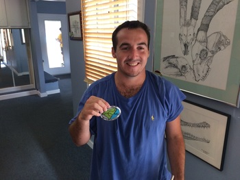
Christopher Jacques: Hero of the Lawson Trek.
Not long after he left the Occanneechee village that we know was on the Eno River at present-day Hillsborough, Lawson tells of a strange custom his Indian guides demonstrate.

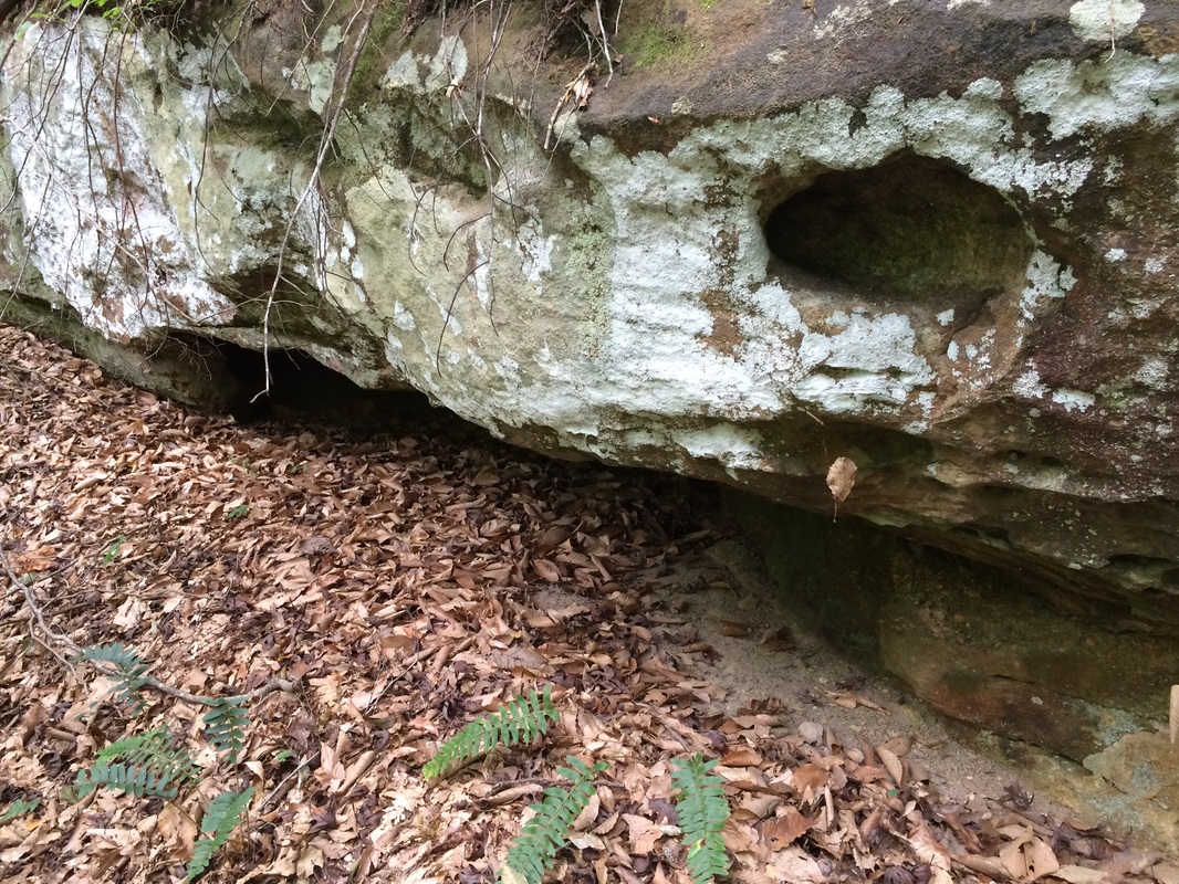
"The next day, we went over several Tracts of rich Land, but mix'd with Pines and other indifferent Soil. In our way, there stood a great Stone about the Size of a large Oven, and hollow; this the Indians took great Notice of, putting some Tobacco into the Concavity, and spitting after it. I ask'd them the reason of their so doing, but they made me no Answer."

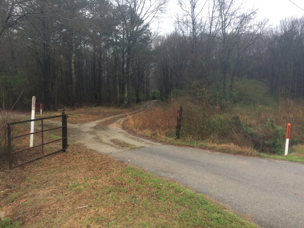
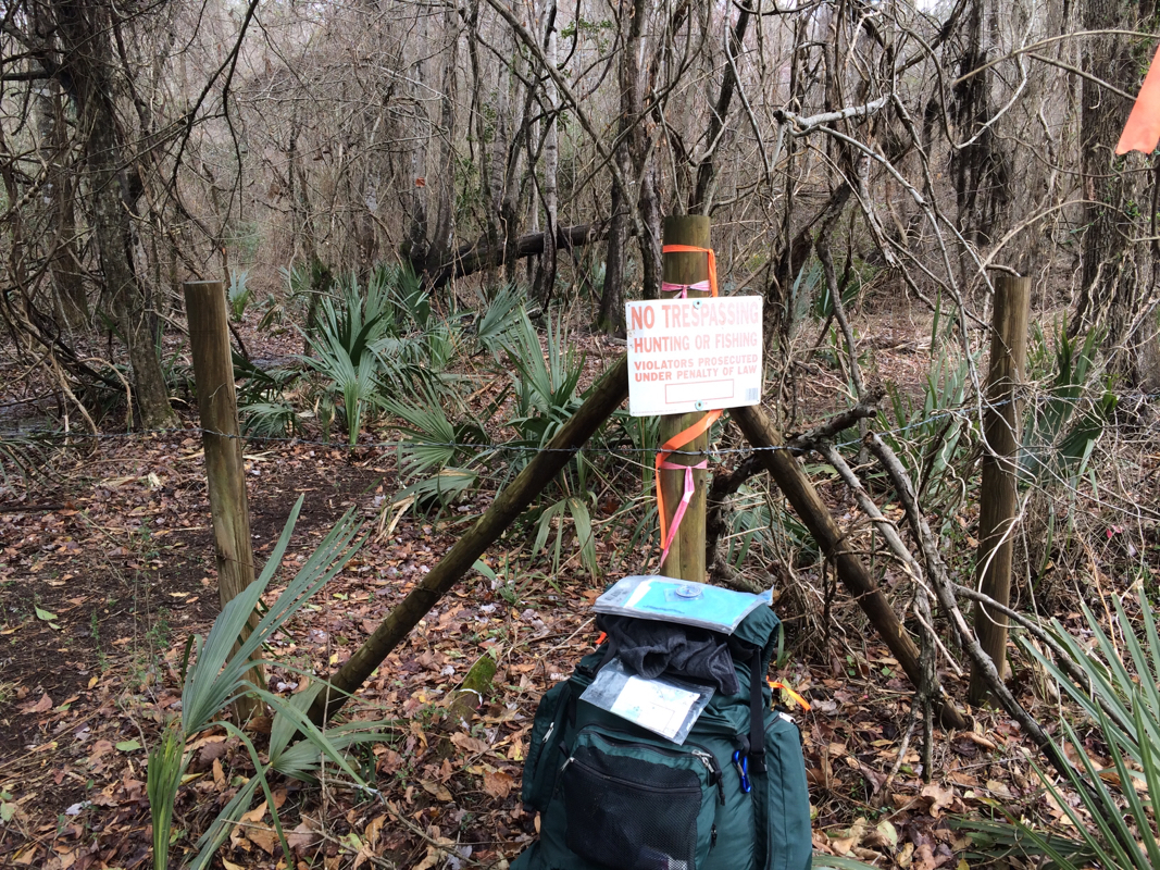
Given which, when you find that your path takes you by the Hollow Rock Racquet & Swim Club in western Durham, you have to feel like you're on the right track. Not that I found this by myself, mind you; my ever trustworthy guide Val Green sent me looking for the rock, which he's found himself, and when I couldn't get exact directions I did what any reporter would do: I reached out to the club. 

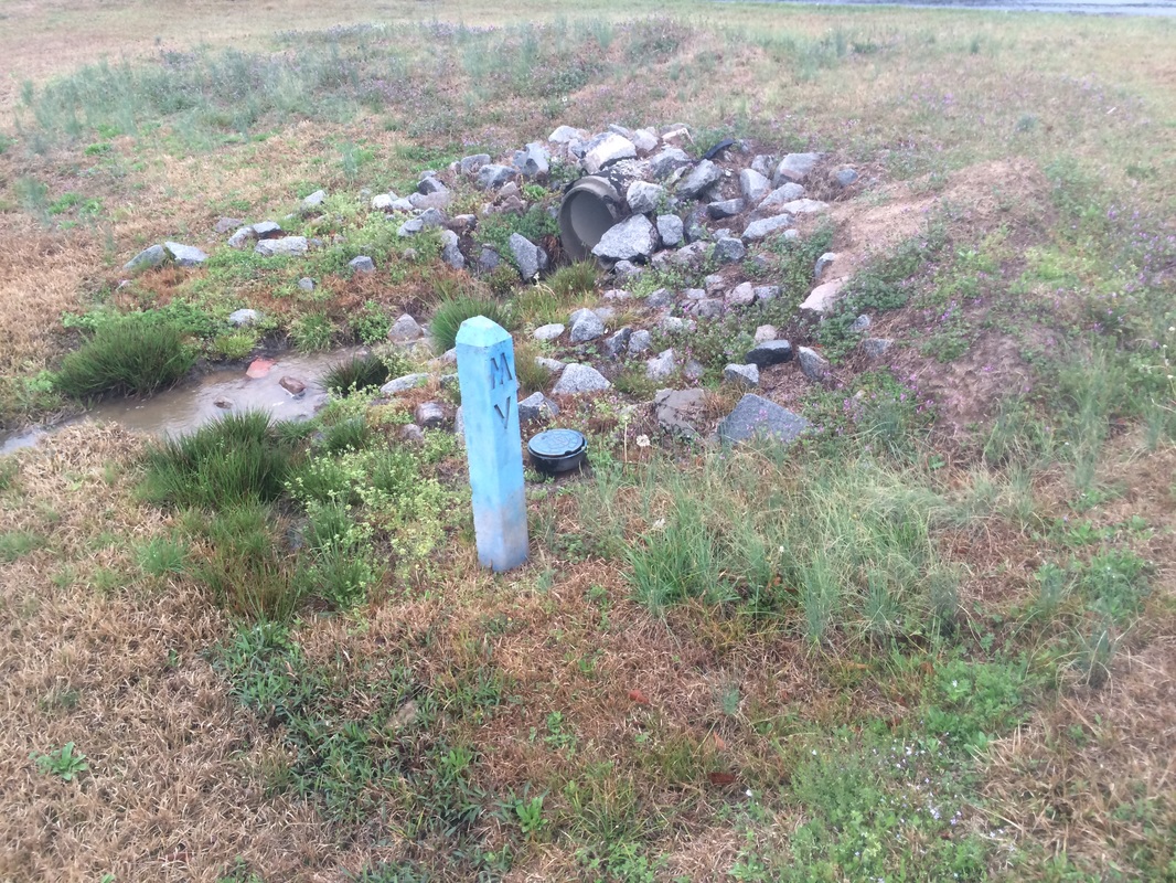
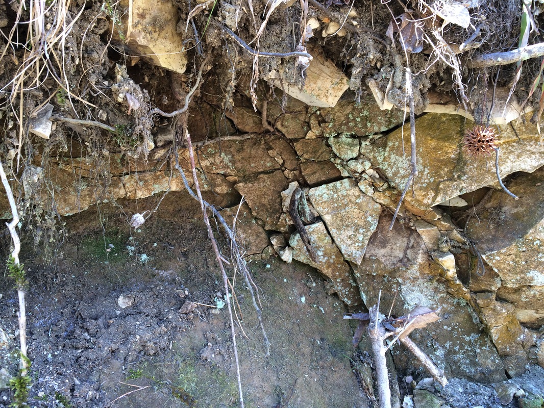
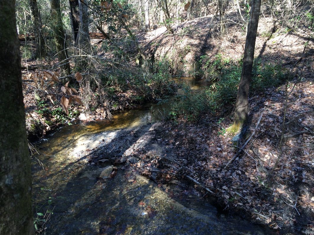
Within a day or two I had heard from activities and camp director Christopher Jacques, who told me that his query caused a nameless board member to go on a quest he'd meant to make for five years: "namely, where is the actual Hollow Rock," the member said. Well, not far off, as it happens. Just down Erwin Road from the club you follow a private drive up to the New Hope Creek, which runs along a seam of granite on its south side, the creek a good ten feet or more below the gravel road above. In  the side of that outcropping that is almost a cliff, beneath the lichens and the mosses, are many large  expressions of granite, and in some of them you find little potholes -- rendering the stone hollow, just as Lawson said. 

Potholes in granite on the top are easy to understand -- rain collects in low places, begins to erode the rock, whether because of acids in the water or the action of freezing and cooling. That makes the depression deeper and soon you have a pothole; in rivers or areas that food the flow of water, swirling around sediment that scours the hole, makes the pothole even deeper.

What makes a pothole in the side of a rock I have no idea; I'll check with a geologist and get back to you.

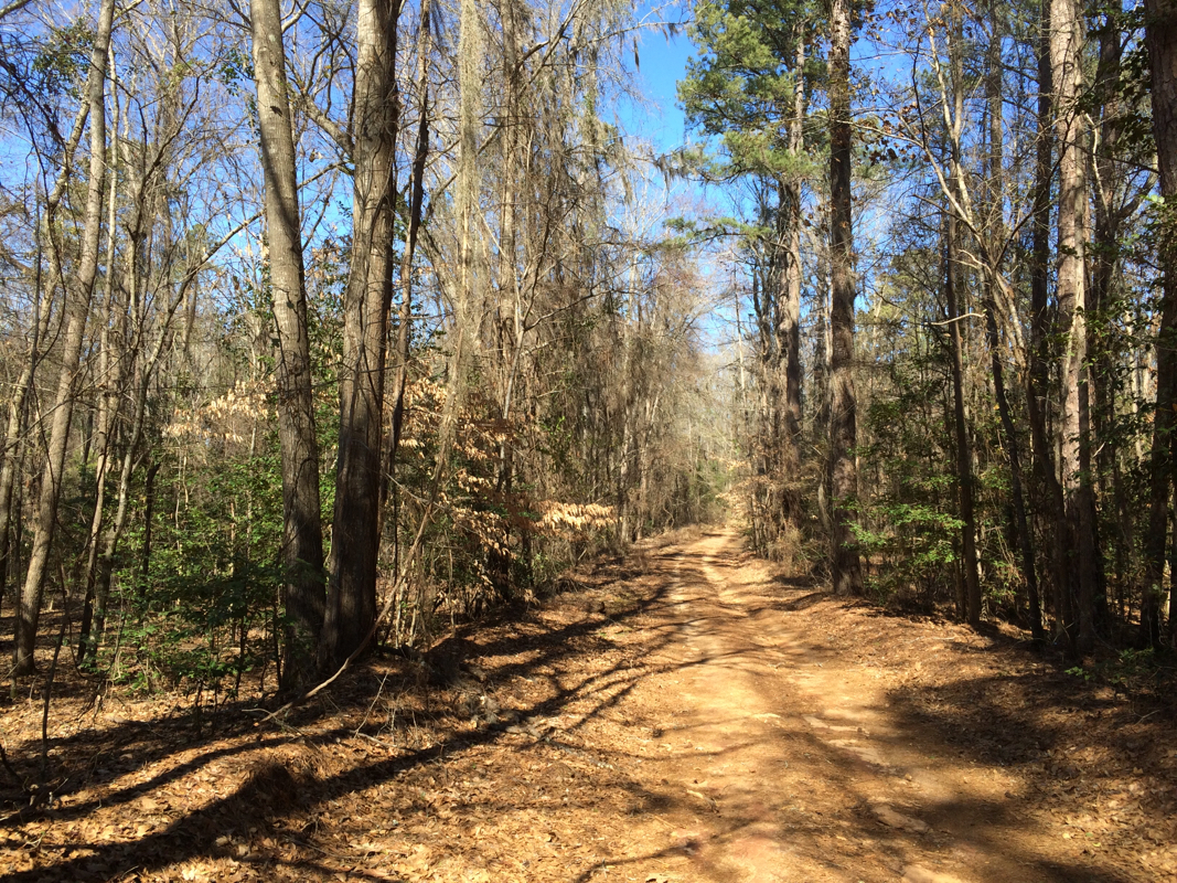
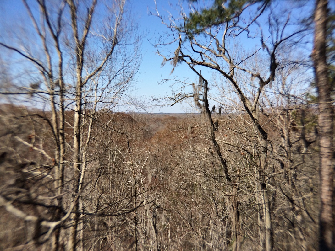
Anyhow, along the way from Hillsborough to western Durham, Lawson followed what Tom Magnuson of the  Trading Path Association called "the old central coast road -- it goes all the way from the mountains to the sea." Magnuson doubts that Lawson ever actually made it to Hillsborough, mind you -- he believes he stopped somewhat short of there and didn't cross the Eno until days later -- but from that area to the Indian settlement Lawson called Adshusheer, the central coast road was the way. That road turned into Old NC 10, which I walked along towards the Hollow Rocks. 
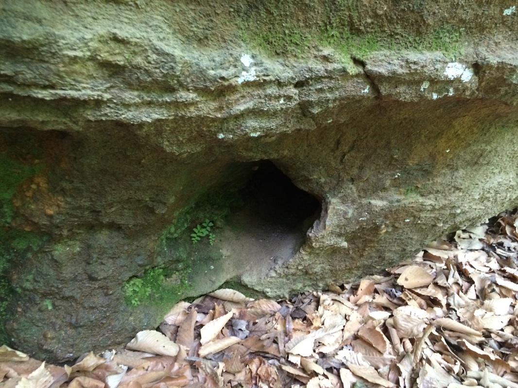
Picture
This one?
Picture
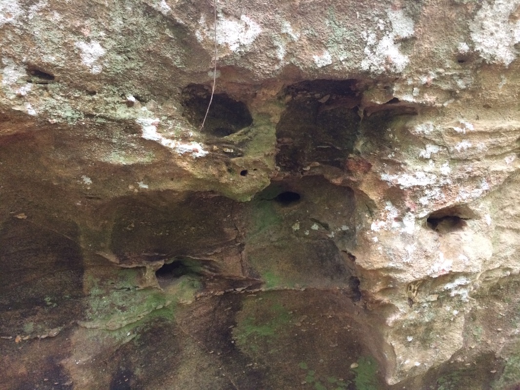
No tobacco or spit in here.
Picture
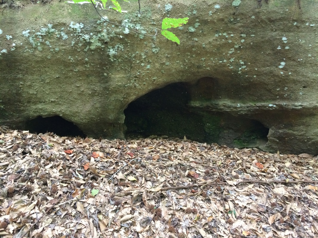
Hollower and hollower.
Magnuson and my constant inspiration and informer Val Green disagree about Lawson's exact route here -- Magnuson has him walking north of the hollows and Green has him coming up from the south. Green's route has to recommend it that it actually walks right past them, but either route takes you within a quarter mile of these potholes. I explored them and found utterly thrilling that I was where I KNEW Lawson had been. By what route he got there seemed somehow less important. I had no tobacco, and I didn't spit. Val tells me he's heard from somewhere that the Indian families used to tell their children that lightning would hide in those holes, so they should keep their hands out of them. Val suspects the tall tale was a scare tactic to keep children from sticking their hands in and encountering venomous snakes.

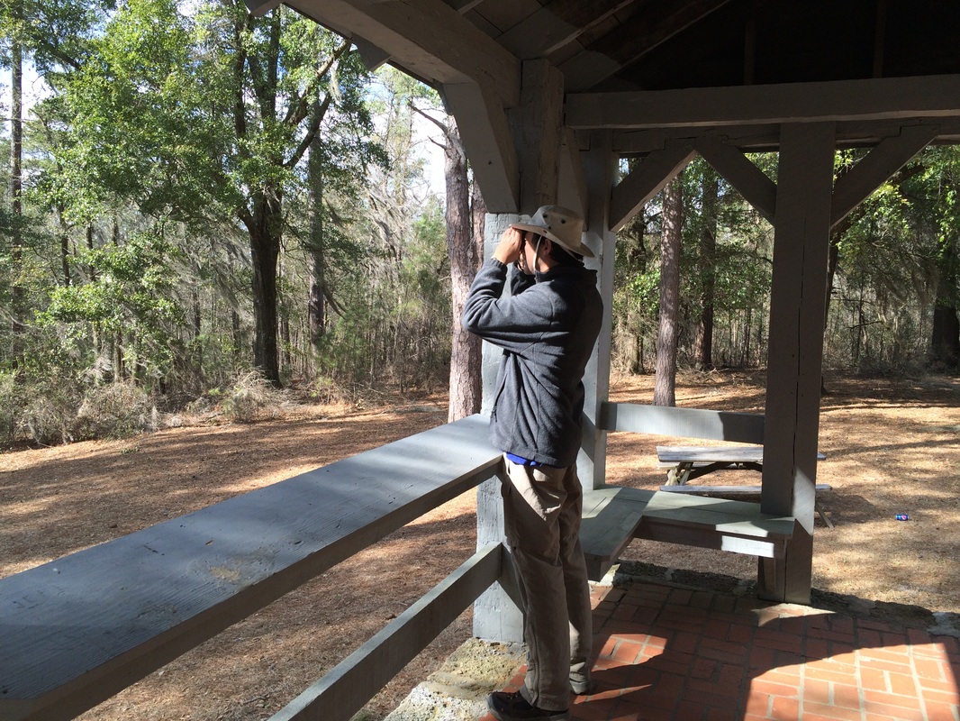
Magnuson, already generous with his time, became a true Hero of the Lawson Trek by taking me on a driving tour of the area, stopping here and there to show me spots where fragments of the old road still exist. I loved seeing them -- you can usually tell because there are berms to the side, showing where road builders dug to maintain slope, which Magnuson links back to the English Highways Act of 1555, which first organized highway cost and maintenance as an obligation of the population.
Picture
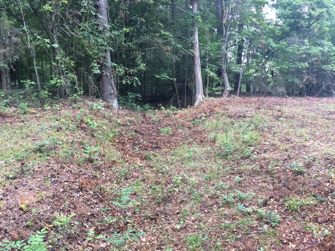
It's obviously an old road when Tom Magnuson tells you it is. But I walked right by it without noticing it a couple hours later.
Picture
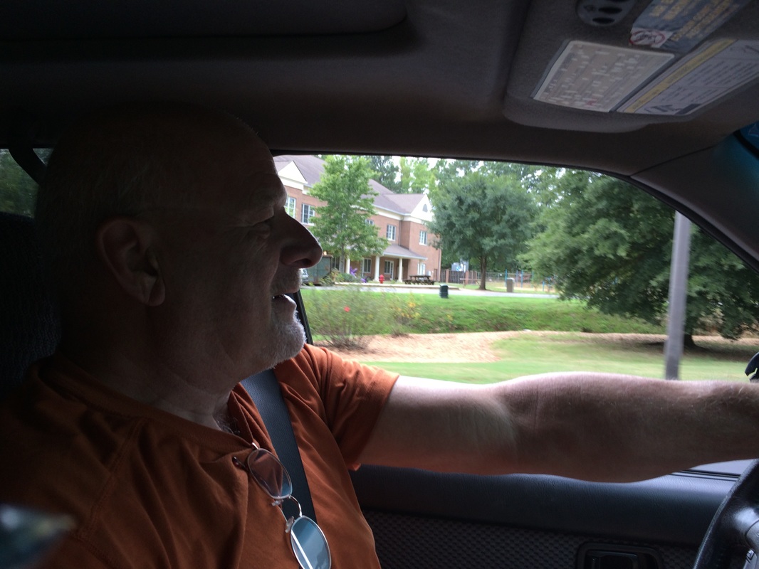
That's Tom Magnuson, driving me all over hell and gone to show off old pieces of the paths Lawson trod -- and help me get started.
Of all the things I found at the hollow rocks, though, I most loved two things. One was how easy it is to see these old roads -- when you have Tom or Val to point them out, as I so often have. But with Tom I found, as I have with Val, that even though when they point me in their direction in the morning, I am perfectly capable of walking past an old road and utterly failing to notice it by noon that same day. This stuff takes work, and their hours of study enriches us all.

The other thing I deeply loved was Lawson's note that the Indians just refused to answer his question. "Hey, you guys -- why'd you spit in that rock, huh? What's the deal with the tobacco, too?" No answer. Shut up, tourist -- not everything is your business. Anybody who's ever been a reporter or interviewed anybody for any reason at all recognizes this interaction. No matter how helpful people are, after a while even the nicest and most patient just get sick of you. Lawson had been following Indian guides for nearly two months, and though he went from guide to guide, one can easily imagine they were getting sick of his questions.

So as I stood at the hollow rocks, because of the patient, generous help of countless people answering constant questions, I took a moment of pure gratitude. Lawson never mentioned it, but I suspect that when he noted for one of the very few times in his book that someone refused to answer one of his questions, he took a moment to reflect on how grateful he was that mostly they did answer him.

I know I did.
1 Comment

The Lay of the Land

4/7/2015

0 Comments

 
Picture
You're telling me.
Lawson talks a lot about the land he's passing through, and every time he faces something unusual he keeps us posted. He talks about the Santee temple mounds: "A Mole or Pyramid of Earth is rais'd, the Mould thereof being work'd very smooth and even, sometimes higher or lower, according to the Dignity of the Person whose Monument it is. On the Top thereof is an Umbrella, made Ridge-ways, like the Roof of an House," and we saw just such a mound -- they're part of Mississippian culture -- near Lake Marian.

And it was of just such mounds that I thought as I walked, through the rain, into the first major town the Trek visited since leaving Charleston: Camden, which by coincidence happens to be the first inland town in South Carolina, founded in 1732 as part of an effort by King George II to establish settlements on the rivers, further pushing away the Indians (who had been defeated at great cost in South Carolina in the Yamassee War decades earlier).  So we encountered in Camden history of the Revolutionary War period, many years after Lawson's day. Among other things, through the good offices of Joanna Craig, executive director of Historic Camden, we got to sleep in the basement of the rebuilt Kershaw House, the original of which survived the Revolution but was burned in the Civil War. The Battle of Camden, by the way, was a big fat loser for the colonists -- their biggest land loss of the war, as it happens.

Anyhow. As interesting as all that is, what fascinated me about Camden was the lay of the land. I walked into Camden in the rain on a quiet morning, and to get there I had to walk along a big four-lane highway, and that was the good road; on that I had to walk under Interstate 20.

And the first thing I thought of was those Mississippian Indian mounds.
Picture
Above, the slope of one of the berms where I-20 crosses route 521 south of Camden; at right the Santee Indian Mound. Not much changes when you're building with earth.
Picture
So you can't fail to notice, right? The Indian mound and the highway embankment at the base of the bridge 50 miles to its north could be twins. The same slopes, the same general design. One used for burying chiefs and erecting temples, the other used to bury costs and erect temples to automobiles, but still. Once people get up to building earth mounds, they're going to look about the same. 

I checked with an engineer who works with highways and he said that's right on. You can have a slope of 4 or even 3 to 1 (that's run to rise, so the smaller the first number, the steeper the slope) and you're okay. But go any higher and you need special reinforcement -- you can't even get grass to grow, to say nothing of the kind of erosion that a slope that steep will suffer. 
Picture
Greetings, foot traveler! What the hell is wrong with you? You do not belong here!
The other thing I noticede -- could not fail to notice -- on my way into Camden was that the roads I walked on had utterly no interest in my passage. I did not belong there, nobody thought about my needs, my safety, or my experience. That intersection is for cars, not for people, and if you happen to be a person trying to cross it, too bad.

I wondered what the people in cars would make of me, teetering along with my knapsack and my camping hat. Double-takes from windshields? Delighted children waving from the back seats? 

Nope -- worse. Nobody noticed me. Nobody noticed me at all. In an environment designed for big things moving at machine speeds, not a single person even glanced at me, a small thing moving at human speed. I scurried across lanes of traffic one direction at a time, and I crossed exit and entrance ramps only when I could see nobody was near; drivers slowing down or speeding up appear especially preoccupied with things other than vulnerable pedestrians. 

The interstate highway itself gave a moment of shelter from the rain -- and a drip line where the bridge shed its water. Along west side of the road, once I passed the interstate, was the Big Pine Tree Creek, and behind one of the several vast parking lots with a little gas station and convenience store in the center it was entered by a nameless tributary. As ever I love seeing the way tiny little microclimates set themselves up: creekside, by the pipes in ditches were tufts of grasses; a dirt road entered 521 that I could have driven be 200 times without ever noticing; the post and pylons of infrastructure systems were everywhere.
Picture
Picture
Picture
You cannot help wondering, even as you walk into a lovely little town like Camden, rich with history and filled with kindness (more on all that tomorrow): what kind of culture erects roads on which people cannot walk? Along which you travel without noticing ... anything? I say it over and over, but just walking the surface of the earth fills you with questions and ideas minute by minute. I'm sorry we all zoom by it so quickly.

Before I got into Camden proper I walked by two fast food restaurants and three convenience stores. It's not wrong to have so many of those; we have to fill our cars and our bellies. But lord have mercy, there are an awful lot of them. 

Anyhow, next time you get onto or off a highway, slow down and turn off your phone. It's improbable, but you might see someone walking.
0 Comments

The Roadness of Roads

2/23/2015

0 Comments

 
At the intersection of swamp and No Trespassing, the trail ran out. No sign, no further blazes, no marking: nothing. It just ran out there in the swamp.
Picture
So I did what you do, wandering and poking and eventually finding A path, which was going sort of in the right direction and eventually hooked up with THE path, a quarter mile away or so, and I went along my way. But this is what comes of walking on wilderness paths rather than roads, and I have walked a good bit on both over the last segment of the Trek and, surprising nobody, I have something to say about it.

My friend Dale Loberger not long ago gave a small seminar on how to find old roads -- I remember thinking he was talking about the Roadness of roads. That is, a road is a fairly simple thing: it starts someplace travelers are, and it leads someplace travelers wish to be. Whether those travelers are animals, native Americans, colonists, carts, railroad trains, or automobiles -- or, as in many cases, each of those in succession -- a road is a connector. Perhaps not the shortest but the best way between two points.


Look at an old map, Loberger told us, and the drawings of roads worried less about exact representations of twists and turns than on connections: from the Indian town to the good place to ford the river; from the trading post to the harbor; from the town to the good pass through the mountain. A road in some way invented itself. It partook, Platonists might say, of Roadness.

Picture
Like, for example, the way I've been traveling this Trek, when i'm not cursing my way along sometimes-maintained wilderness trails whose organizations are trying to do a great deal with few resources. (The trail that frustrated me this time was the Palmetto Trail, a fine trail-in-progress stretching the length of South Carolina that suffers from logging that destroys it and, again, with trying very hard to do much with little.)

I've been walking along a sand road that has probably been trodden by human feet for a thousand years of more. It follows a route that was an Indian path during the Mississippian period, stretching all the way to the Santee Mound we visited during our last trek. The Indians walked it. Lawson and his group walked it. Colonials walked it. "There aren't too many roads in American that are a thousand years old," my friend and fellow Lawsonian Val Green says. "But this one is." (More on Val soon, by the way.) (And by the way, calling Val a "fellow Lawsonian" is a bit like calling LeBron James a fellow basketball player; Val is the king of the hill, by an order of magnitude.)

Anyhow. I spoke to Val as I planned this segment, which follows the swamp on the northeastern edge of the Wateree River, which joins the Congaree to form the Santee, on which the Trek has spent so much time. These rivers are named for the native tribes who lived along them, and Lawson describes them all, visiting their towns as he moves along.

But the path he describes would have lain, naturally, on the far edge of the swamp -- the path that could have been depended on to be dry most times, regardless of the state of the river or swamp. Last segment we visited the Santee Indian Mound, considered the easternmost edge of the Mississippian Indian culture. Since then, more or less, we've been following a trail along the Santee and Wateree that would have connected all the tribes along the waterway. 

It's been mostly asphalt before, but this time I've been on dirt roads -- more correctly sand roads, since as we've exited the coastal plain we've entered sand hills, the result of the floor of an ancient sea near its shore. 

Anyhow, I've walked these sandy miles, and every step has radiated roadness. A stand of holly -- a ton of holly in these hills -- to the left, commonly a pine farm to the other side. Dips down to creeks, rises to plateaus, and occasionally a home site or church, a graveyard, a stand of deciduous trees showing that once upon a time a home stood nearby. It's a lovely kind of walking that makes you feel that you simply are where you ought to be. To be sure, Route 261, the state asphalt two-lane that generally follows the same path only more smoothly and faster, is a half-mile to the west. But this sand road, skirting the edge of the swamp, exudes a kind of patient assuredness that its adolescent asphalt cousin cannot duplicate.

Lawson describes this path, mentioning camping "by a small swift Run of Water, which was pav'd at the Bottom with a Sort of Stone much like to Tripoli," a kind of silica schist often called rottenstone or fuller's earth. I passed while walking this segment at the Tavern Creek, whose banks are covered with just that, and it flows just as swiftly as ever. More important, when Lawson and his friends told their Indian guide, Santee Jack, that they'd like to hang around the creek another day, he assured them they'd be happier half a day further. 
Picture
Call it Tripoli, as Lawson did, or Fuller's Earth or rottenstone, this stuff crumbles from the banks of the Tavern Creek, assuring historian Val Green that he had pegged Lawson exactly where Green thought he was. And me too, once Green pointed the way.
Picture
Swift running to be sure, to say nothing of lovely and delightful. If I hadn't been chilly, I'd have sat down for lunch by this shady spot.
So they went -- as did I -- and a half day further we were all rewarded with the view from the overlook at Poinsett State Park. (Named for Joel Poinsett, the South Carolinian for whom we name the Poinsettia). Atop a genuine hill -- it's several hundred feet up, and you notice it when you climb -- you look to the west, down across the swamp the road has skirted for miles.

""We mov'd forwards, and about twelve a Clock came to the most amazing Prospect I had seen since I had been in Carolina; we travell'd by a Swamp-side, which Swamp I believe to be no less than twenty Miles over, the other Side being as far as I could well discern, there appearing great Ridges of Mountains, bearing from us. W.N.W."

If you go to Poinsett State Park (and I think you should), there is an Overlook Shelter, a little gazebo atop the park's high point. and from it, looking west and northwest, you have a view over the swamps that is, truly, the first great prospect you'll find as you travel into the Carolina midlands. Val Green (him again!) met me here, and he pointed out that if you look carelessly you easily see the ridge of pines on the far edge of the Wateree Swamp, which is several miles distant. But if you look very carefully -- I brought binoculars against just such a possibility and was glad of it -- you can see, in distant, faded blue, the line of hills on the far side of the Congaree swamp, a good twenty miles distant.
Picture
If you look carefully, you can see more than the close row of trees, which defines the far edge of the Wateree Swamp -- the other edge of the swamp along the river Lawson was following. You can also see, towards the left of the horizon, another deep blue line. That's the range of hills on the far edge of the Congaree Swamp. And just as Lawson thought, it's a good 15 to 20 miles distant. An amazing Prospect indeed.
Lawson mentions that "One Alp, with a Top like a Sugar-loaf, advanc'd its Head above all the resst very considerably," and until recent years, both Val and park manager Zabo McCants tell me, you could see Cook's Mountain, ten or so miles away to the north-northwest. Timber has grown up to block the view, but since a paper mill now stands in that direction too, Zabo says he's loth to cut down the screening woods, because exposing the charming Cook's Mountain would expose much that is less lovely.
Picture
That's me in the gazebo, making with the stoic pose, looking through binoculars at the far row of hills.
Picture
Kinda hard to see, but if you look right in the middle, you can see one "peak" higher than the others. I believe that's the same mountain Lawson saw, now called Cook's Mountain, even though it's only 300 or so feet high.
In any case. I stood atop a ridge where Lawson stood and I saw what he saw. And above all I left tracks in the sand along the same path trodden by Lawson, by Val, by traders and colonists and Indians -- and by walkers and timber farmers and locals today. I don't think many asphalt roads can equal this.

I spent a few days on the road -- a REAL road.

I recommend it.
0 Comments

    Archives

    January 2020
    October 2019
    May 2019
    February 2019
    November 2018
    October 2018
    May 2018
    March 2018
    August 2017
    May 2017
    August 2016
    June 2016
    March 2016
    February 2016
    November 2015
    October 2015
    September 2015
    August 2015
    July 2015
    June 2015
    May 2015
    April 2015
    March 2015
    February 2015
    January 2015
    December 2014
    November 2014
    October 2014
    September 2014
    August 2014

    Categories

    All
    Adventure
    African American
    Angie Clemmons
    Anthropocene
    Apothecary
    Appalachian
    Archaeologists
    Archaeology
    Army-navy
    Art
    Artifacts
    Atlanta
    Backpack
    Banking
    Barbecue
    Barry Beasley
    Bath
    Beaufort
    Beckee Garris
    Beetle
    Beginning
    Ben Franklin
    Berm
    Bill
    Birds
    Blister
    Book
    Bookstore
    Boston
    Botanical
    Boykin
    Breach
    Brent Burgin
    Brownlee
    Buck
    Buffer
    Cabelas
    Cambridge
    Camden
    Camera
    Canoe
    Canty
    Catawba
    Chain
    Charleston
    Charlotte
    Chelsea
    Chocolate
    Chris Judge
    Church
    Cincinnati
    City Of Raleigh Museum
    Civilization
    Coe
    Comment
    Community
    Concord
    Confederate
    Contentnea
    Cornwallis
    Country Music
    Couture
    Crawford
    Creek
    Croatoan
    Cutler
    Cypress
    Danger
    Davis
    Death
    Delightsome
    Delk's
    Denton
    Devices
    Drake
    Drawing
    Drunk
    Duck
    Durham
    Eagle
    Earnhardt
    Earth Day
    East
    Ecologist
    Effron
    Embankment
    End
    Error
    Evans
    Exhibit
    Expeditions
    Facebook
    Feather
    Fern
    Finish
    Fire
    Flag
    Flintlock
    Flood
    Francis
    French
    Gaillard
    Gander Mountain
    Garden
    Geology
    Gimpy
    GIS
    Google
    Great Wagon Road
    Green
    Greenville
    Grifton
    Guerry
    Gun
    Guns
    Haigler
    Hallenbeck
    Hampton
    Hanging
    Hannah Smith
    Harris
    Hartford
    Harvest
    Heat
    Hempton
    Highway
    Hillsborough
    Hips
    Historic Bath
    Hollow Rocks
    Home
    Homeness
    Hortus Siccus
    Hospitality
    Huguenots
    Huntley
    Indians
    Instagram
    Interstate
    Island
    Ivy
    Ivy Place
    Jamaica
    Jarvis
    Jennifer Landin
    Jered
    Jimmy White
    John Jeffries
    John White
    Journalism
    Kadaupau
    Kannapolis
    Katawba Valley Land Trust
    Katie Winsett
    Kayak
    Kershaw
    Keyauwee
    King
    Knife
    Lame
    Land
    Language
    Lawson
    Lawsonians
    Lecture
    Legacy
    Legare
    Legislators
    Leigh Swain
    Lenoir
    Lenoir Store
    Lenses
    Library
    Lichen
    Lies
    Loberger
    Locke
    London
    Longleaf
    Lost Colony
    Lynch
    Lynching
    Magnuson
    Mansplaining
    Maps
    Mass Shooting
    Match-coat
    Mathematical
    Meerkat
    Memorial
    Mental Floss
    Mill
    Millstone
    Miniature
    Monkeyshine
    Moonshine
    Museum
    Museum Day Live
    Musings
    Nancy
    Nascar
    Native American Studies Center
    Natural History Museum
    Nature
    Nesbit
    Netherton
    Neuse
    Newspaper
    Nonfiction
    Notebooks
    Occaneechi
    Orlando
    Pack's Landing
    Palmetto
    Pamlico
    Park
    Patent Leather
    Pedestrian
    Peggy Scott
    Periscope
    Petiver
    Photography
    Physic
    Pig
    Pig Man
    Pittsburgh
    Pocket
    Poinsett
    Polo
    Potsherd
    Pottery
    Preparation
    Presentation
    Press
    Process
    Proofreading
    Property
    Publishing
    Raccoon
    Racing
    Racism
    Racist
    Raleigh
    Rape
    Ray
    Readings
    Reconsideration
    Records
    Revolution
    Richard Smith
    Richardson
    Rights
    Riparian
    Rivulet
    Road
    Roadness
    Roanoke
    Robert Off
    Roland Kays
    Rolling Stone
    Roombox
    Rules
    Salisbury
    Santee
    Sapona
    Sassafras
    Scan
    Sconc
    Seneca
    Seth
    Shakespeare
    Sir Walter Raleigh
    Slavery
    Slime Mold
    Sloane
    Slope
    Small Town
    Smith
    Smithsonian
    Snow
    Sore
    Sounds
    Spanish Moss
    Specimens
    Speedway
    Spencer
    State Fair
    Steve Grant
    Stewart
    St. Mark's
    Suburban
    Sumter County
    Surveying
    Swamp
    Tar River
    Technology
    Textile
    Tide
    Tobacco
    Toms River
    Tool
    Towel
    Trade
    Trading Ford
    Trading Girls
    Trail
    Trap
    Traunter
    Tree
    Tree Farming
    Trek
    Trilobite
    Troi Perkins
    Truth
    Tryon
    Tupelo
    Turkey
    Tuscarora
    Twitter
    Ugly
    Unc
    Val
    Val Green
    Virginia
    Virginia Dare
    Virginia Historical Society
    Walking
    Washington
    Waxhaw
    Weather
    Website
    White
    Writing
    Wrong
    Yadkin
    Yoga

    RSS Feed

Proudly powered by Weebly