The Lawson Trek
  • Home
    • About
    • Interactive Map
    • The Trek
  • Along the Path: Blog
  • John Lawson
    • "A New Voyage to Carolina"
    • The Carolina Colony
  • Talk to us!
  • Store
  • Press

Along the Path

Updates as we learned about Lawson's journey and times -- and reports from the trail as we progressed along it. Plus tales of the process of publishing the result.

Travels with My Ecologist.

1/16/2015

2 Comments

 
Picture
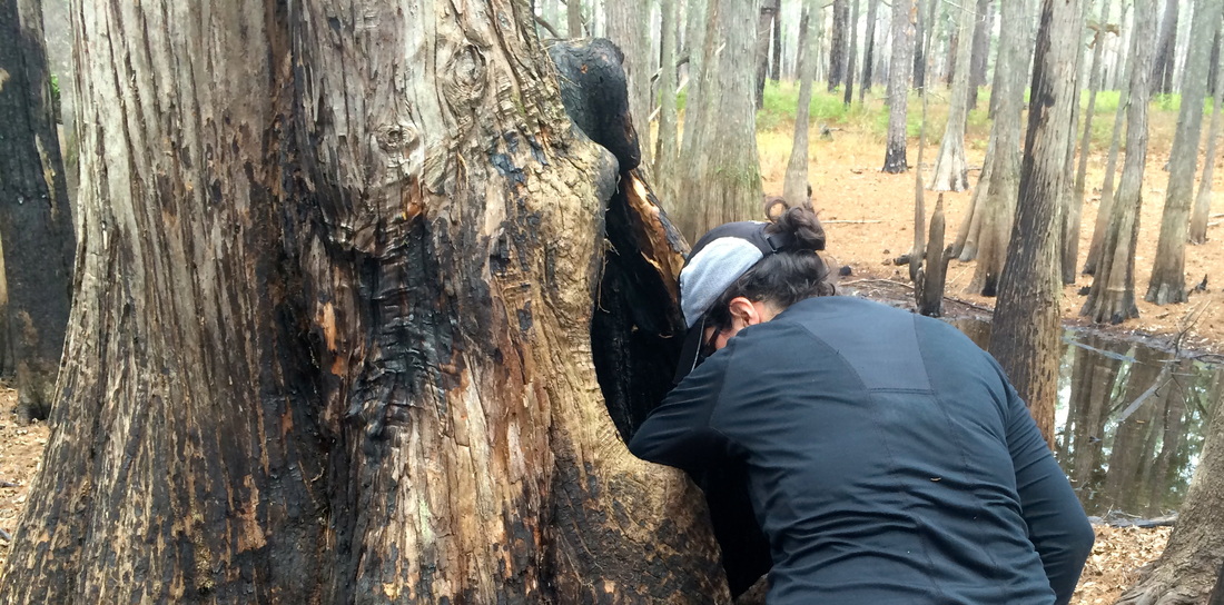
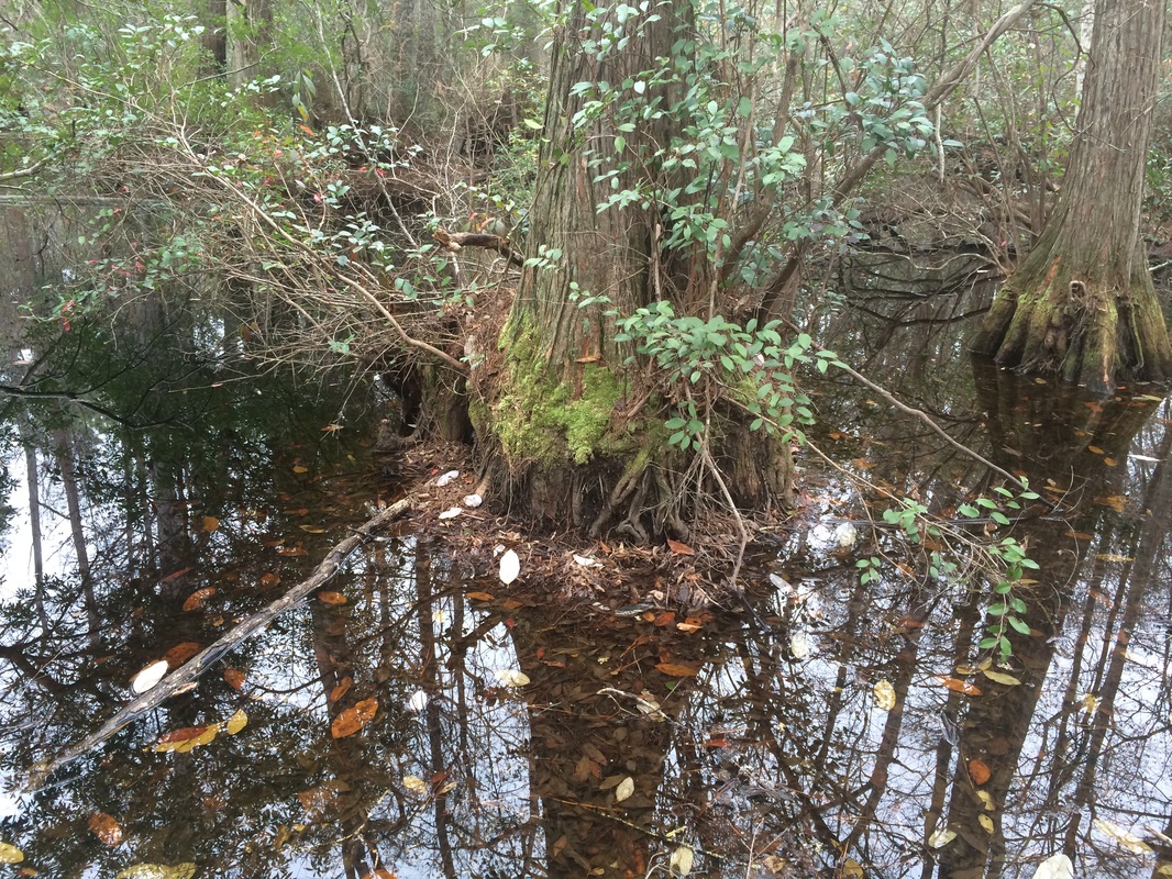
On the first day of Trek Two, in a cypress/tupelo swamp of deep browns and greys, one mostly dead cypress provided a particularly atmospheric yawning stump, maw gaping about four feet above the current waterline. Naturally my companion, NC State University ecologist Katie Winsett, dropped her camera in it.

This I did not see -- but I turned towards her in time to see her arms and head disappear within, as she scrabbled inside to recover them. Seeing her southern latitudes extending from the tree while northern hemisphere wrestled with the insides of the cypress, I found it impossible not to think of Pooh bear.
Picture
Not for the first or last time, I was glad she was along. The Lawson Trek has been committed from the start to getting people who know things to come along. This turns out to be very Lawsonian.

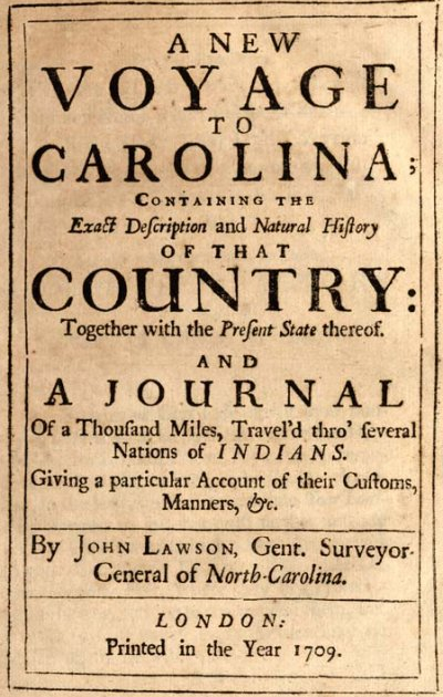
Traditional description of Lawson's trek involves some sort of assignment from the eight Lords Proprietors of the Carolina Colony. In the introduction to the current version of Lawson's A New Voyage to Carolina the author says thus: "Nothing is known of Lawson's sojourn in Charleston until December, 1700, when he was appointed by the Lords Proprietors to make a reconnaissance survey of the interior of Carolina." Interesting enough, but as we say in academic circles, nuh-unh. Lawson clearly took his journey, as his delightful book amply documents. Why he took his journey remains enigmatic. Lawson's family was well connected in London and could easily have had contact with people of that stature, and Lawson was quickly well connected with influential colonials like James Moore, who became governor of Carolina in 1700 and had before that made forays himself into the western backcountry. But we have no evidence that anybody paid, told, or even asked Lawson to go on his journey. We just know he went.
Picture
Picture
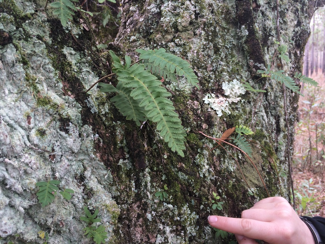
She was a boon to the enterprise. She pointed out resurrection ferns on one Live Oak: "They look dried up now, but when they get wet they come back to life," she said -- they can lose up to 97 percent of their water, shrivel up, and still come right back with wetter weather. Same with a moss she saw near the roots, looking wizened: "It'll wake up when the water comes up." Then she pointed out lichens and moss growing on the tree. "Sure, you see them, but look closer," she said, counting different types. She got to six before stopping, point made: there is a lot more going on if you look closely. "The interesting stuff is the small stuff," she said.

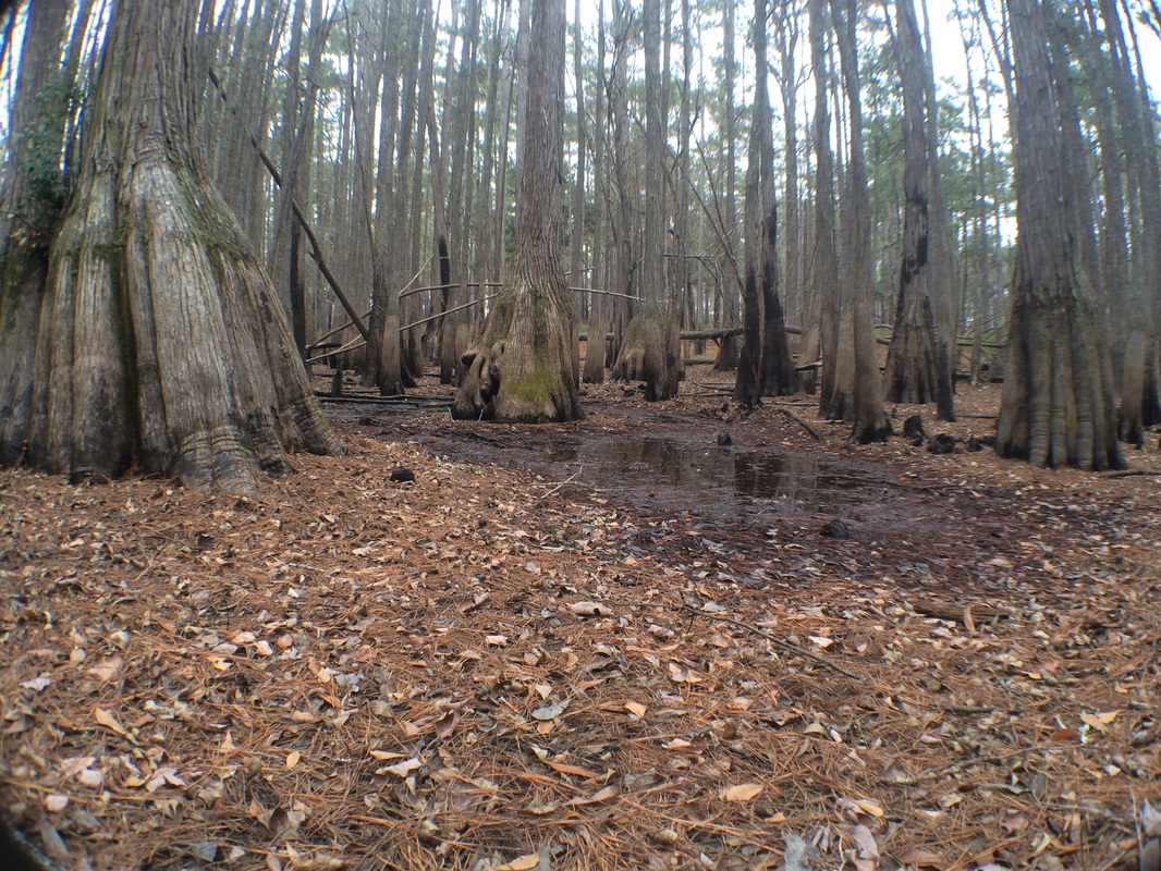
She reads the country like a tracker, too. We found our first cypress swamp when an hour or so into our first day of hiking she narrowed her eyes and said, "That drops off quickly," pointing to a line of trees evident to her but not to me. We left the forest road, descended a few feet, and yes -- there was a swamp: a low bowl, with the obligatory bald cypress knees, tupelos with spreading bells at their trunk bases, and water rendered black by the tannins from leaves, bark, and pine needles.
Picture
First came a disquisition on the nature of those wide trunk bases of the trees comfortable with their feet in the water: the spread is largely for stability. Some say the cypress knees have the same job of mostly engineering; others believe that when the water rises the knees derive oxygen from the air denied to underwater roots.
Picture
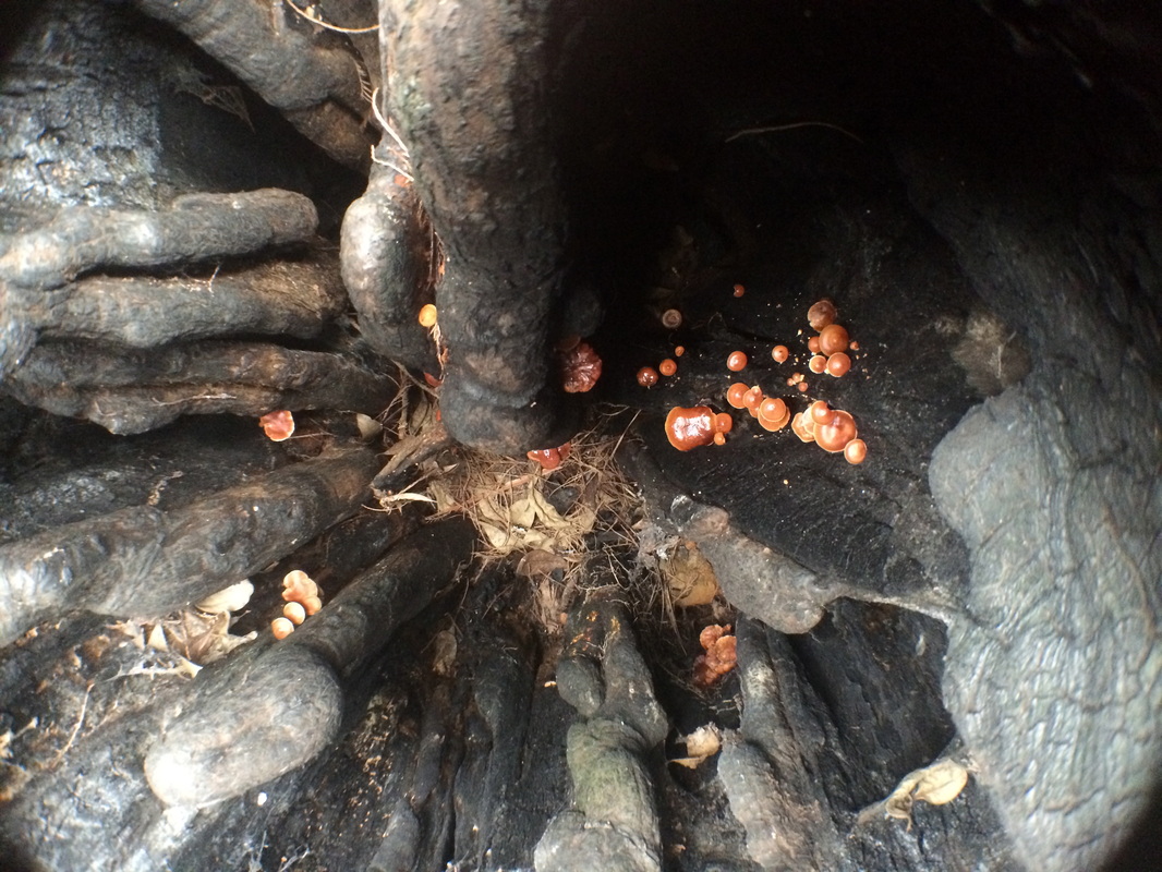
Next the dropped camera, which led to the discovery of some lovely mushrooms in the tree trunk, and most excitingly to the discovery of slime molds, in which Katie is expert. "You never see these in January," she said. "I'm excited to see them." When we started walking back towards the forest road, which naturally tracked a little ridge to stay dry, she called out changes. We stopped squishing in the ground, the palmetto vanished, the cypress and tupelo diminished, and then, roadside, we were surrounded by pines. We couldn't have climbed more than four vertical feet. "We climbed a mountain," Katie said. "An ecological one, anyways."


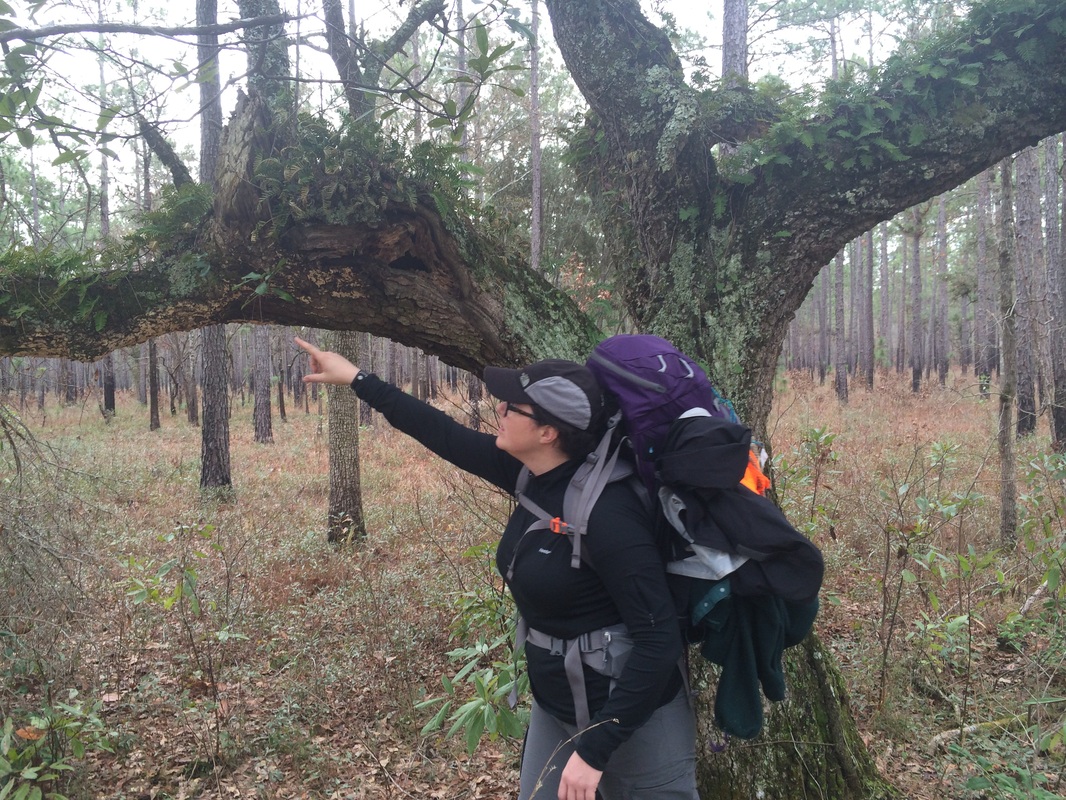
Days passed like this. As an ecologist Katie's training is, basically, in noticing things. My friend and fellow Lawsonian Tom Earnhardt has described Lawson as "a great noticer" -- his book is full of things that he points out, in lovely, satisfying prose, simply because he notices them. That's the value of his book -- not so much that he discovered things, but that he put down what he saw in a way that we can still understand. On Bull's Island, on the coast, for example, he described the first jellyfish he'd ever seen: "There was left by the Tide several strange Species of a mucilagmous slimy Substance, though living, and very aptly mov'd at their first Appearance; yet, being left on the dry Sand, (by the Beams of the Sun) soon exhale and vanish." The slime molds Katie studies Lawson never mentioned, but they’re bizarre creatures that are not fungi, though they used to be classified as such. Some of them exist in enormous supercells with thousands of nuclei; others exist as single-celled protists but on a chemical signal suddenly begin functioning as a unified organism. (Neither of the two we saw in the tree stump looked about to league together to take over the world, but to be honest I’m worried about that now.)
Picture
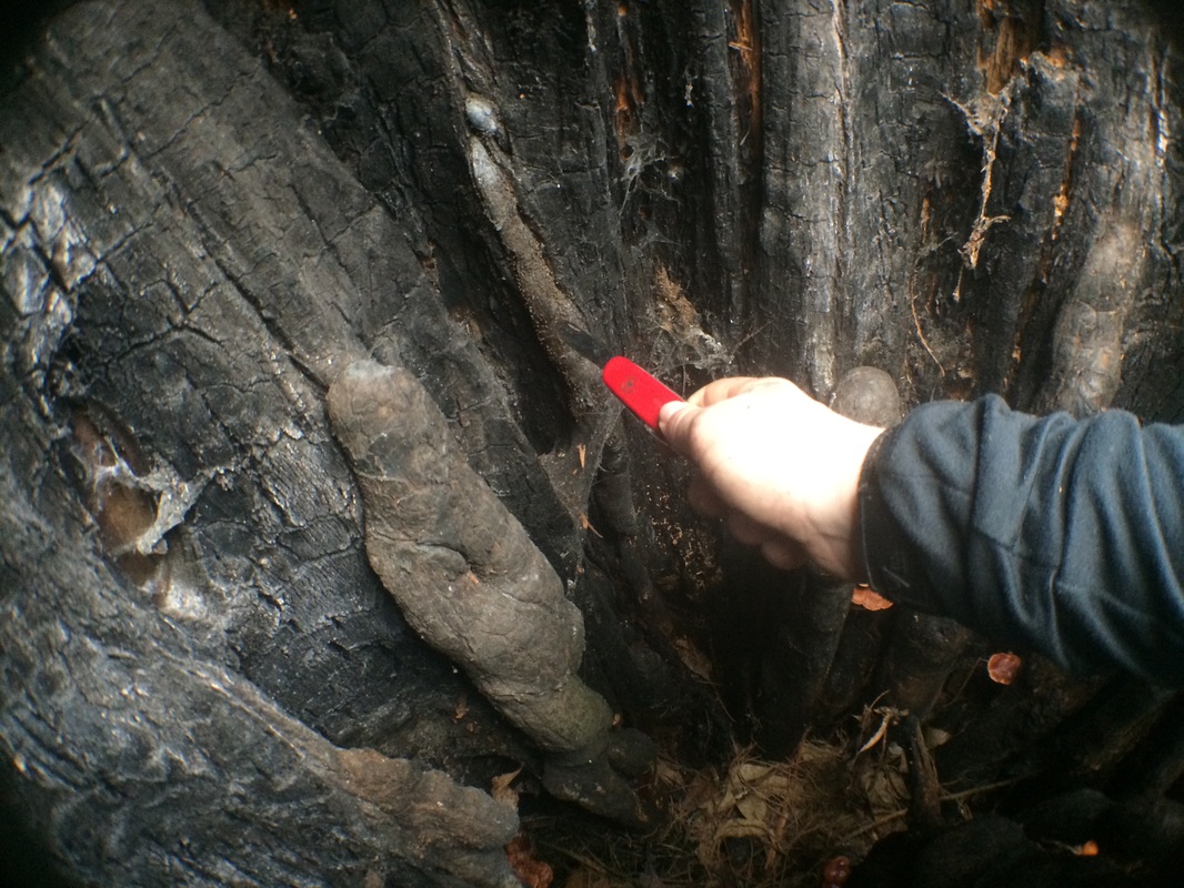
Katie's descriptions are not always as literary but are every bit as pleasant. When I asked more about those microscopic slime molds, she corrected me. "They're not microscopic so much as teensy," she said, and until you have had a scientist describe something to you as teensy you have not spent enough time with scientists. She is very interested in scale -- she says a big part of her job is training her students to see scale as more gradual than they see it. "They see three levels: big, small, and microscopic. But nature doesn't work that way." Nature is comfortable on many levels. Katie recommended to me the classic The Scale of Nature, by biologist (and slime mold expert) John Tyler Bonner, which discusses nature from the scale of galaxies to subatomic particles and has become my bedside reading.
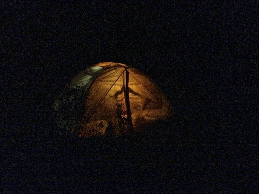
We lay one night in the darkness, each in our own tents out of evening rain, our voices murmuring back and forth across various tent and rainfly walls. A full moon hung in a sky of scudding clouds, shadows of swaying pines scratching illuminated nylon as drizzle occasionally spattered down. Katie free-associated about cypress intraspecies variation: If an animal drags, say, an unusual seed into one bog and not another, the two differ. "Each individual bog develops a personality," she said, with particular species of microorganism in the water -- and water samples from the same bog will differ significantly in the life they contain depending on whether you take the sample from open water or from beneath leaves at the shore, a foot away, she said. "When you work with microorganisms you get a sense of how complicated things are the smaller you get. All those swamps we saw would be considered cypress/tupelo, but each one had a little different character for whatever reason.

"It's not just about deer and squirrels. It's not just a longleaf pine forest. I think it's more interesting what's going on down in the soil. On the level of the microorganisms.”

The rain stopped awhile and we heard only the wind high in the pines. The slime molds we had seen could grow in a short warm spell. “They fruit very quickly,” she said. “But I’ve never seen them in January.” 

More silence. “I like that it’s all more complex than we can really organize in our minds,” she said later.

Overnight we heard owls. The next day we learned the lake we slept near was full of hibernating alligators. 
Picture
2 Comments

Finding Something New

10/11/2014

2 Comments

 
We cannot get away from ourselves.

Camp in the savanna and look up at the contrails. Hike the trail by GPS. Climb the mountain and get better reception. You probably got there in the first place following the advice of a way-finding system accurate to the capacity of saying, “The OTHER side of the street, you idiot.” Or maybe you referred to a map that you bought in easily obtainable staple-bound book form at any number of places within a five-minute drive from your house. Or, if that wasn't satisfactory, you went to an office in a state government building and bought a USGS topographical quadrant map that gives you so much detail about your terrain that you know not only every ten-foot change in elevation but every building on every lot, down to sheds and outhouses.

And that's all good: Google Maps can show you everywhere on the planet; Wikipedia shares information on every place and culture. But no doubt this rising tide of information can feel a bit overwhelming. No surprise, then, that the days when there were still holes on the maps—when uncertainty still held a post of honor—seem attractive.

Picture
Lawson’s book, A New Voyage to Carolina, was widely popular and reprinted several times, with credit and without. Source: North Carolina Collection, University of North Carolina at Chapel Hill

"I accidentally met with a Gentleman, who had been Abroad, and was very well acquainted with the Ways of Living in both Indies," Lawson says in A New Voyage to Carolina, the book that a decade later resulted from this chance meeting. "Of whom," he goes on, "having made Enquiry concerning them, he assur'd me that Carolina was the best Country I could go to; and, that there then lay a Ship in the Thames, in which I might have my Passage. I laid hold on this Opportunity, and was not long on Board before we fell down the River, and sail’d....”


And now you know almost as much as anyone else in the world about the beginning of Lawson's remarkable journey through what is now North Carolina and South Carolina. The two-month journey produced a book of incomparable observations about the Carolina land, inhabitants, flora and fauna; a map that is widely known, if not much of a cartological advance; and a personal story of adventure and tragedy that ended in 1711 with Lawson’s death at the hands of the native people he had befriended.

I stumbled onto Lawson's tale the way most Carolinians do: I wanted to know more about where I was. Interested in the history of my own little piece of ground in Raleigh, I first tried to trace its deed backwards only to quickly land in an insoluble tangle of developers selling it back and forth. So I thought I'd start from the various piedmont Indian tribes, who owned it in 1663 when through the Carolina Charter King Charles II of England first granted it to the eight Lords Proprietors. No luck, but I learned about Lawson’s journey and thought it might hold some clues.
Picture
Either this is the only existing portrait of John Lawson or there isn’t one. It’s the right time period, the right attitude, the right name, and the right artist, but questions remain (for example, Lawson was never knighted, but the portrait’s history identifies him as “sir”). From the private collection of Elizabeth Sparrow. Used by kind permission.
Imagine young John Lawson. In 1700 Lawson was 25, and the well-educated, well-connected son of a physician drifted in London like any young man in any age, searching for a way to make a name for himself – looking for something to do and a good reason to do it. Fascinated by the scientists of the new Royal Society who met at Gresham College in London, where Lawson had attended lectures, Lawson yearned for adventure, accomplishment, notoriety and gain. Which is to say, Lawson was a young man, and it’s easy to understand his interest in the natural world, in science, in discovery.

Hooke, Wren and Halley had made the famous coffee house wager that caused Isaac Newton to write his Principia Mathematica barely 15 years before; it was published when Lawson was a teen. The best map of North America looked like an unfinished child's drawing. DeSoto had wandered and died in the southern region of the modern day United States a century and half before, but little mappable knowledge had emerged from his enterprise. LaSalle had done the same around the Great Lakes and Mississippi River during Lawson's childhood with much the same result. So it hardly surprises to learn that when Lawson considered attending the Grand Jubilee in Rome (it was a big deal, a celebration held every quarter century, and honestly, it was something to do) it took only a casual conversation to quite literally turn him around.
Picture
Lawson saw a lot of cool animals. He describes the turtle grabbing the snake and pulling its head in, the snake killing another snake, and the raccoon going crabbing, using its tail for bait. We don’t think Lawson drew the pictures. Source: North Carolina Collection, University of North Carolina at Chapel Hill.

Yet it held no clues about my property’s history because nobody had ever written a book retracing its exact path—which sounded like something somebody ought to do.

By 1670 the British had planted a colonial city in Carolina: Charles-Town, on the Ashley River. It moved in 1680 to Oyster Point, the spit at the Ashley’s confluence with the Cooper, which made for a more convenient—and not coincidentally defensible—base. Earning its name in the Civil War, the bottom of Charleston is to this day a defensive seawall called the Battery. Lawson certainly sailed there in 1700, and on December 28 of that year certainly set off on a journey, first by canoe and then on foot, that over the subsequent months took him through much of what is now the Carolina interior. Whether he set off because the Lords Proprietors suggested he do so, or because it seemed like something interesting to do, nobody can say for certain, though people have strong opinions on both sides.

What nobody disagrees about is the record Lawson left. Lawson spent the better part of the next decade collecting horticultural specimens, developing land, surveying and learning about the Native Americans. Along with a detailed journal of his long walk, the book Lawson eventually created includes an entire natural history of Carolina, listing plants, animals and native tribes and describing the terrain, rivers and settlements—native and colonial—he encountered. Lawson was above all a model of 17th-century science. He observed and gave full voice to what he saw, regardless of how it squared with what he expected. The book has been called “one of the best travel accounts of the early eighteenth-century colonies.” In an unpublished paper archaeologist Stephen Davis of the University of North Carolina says its significance comes from being, “the first book to provide a detailed, clearly written description of the backcountry, including its fauna, flora, geology, topography, and people.”

Lawson, that is, had his eyes open. Unusual among explorers of the time, Lawson understood he was seeing not a virgin continent, but rather the ragged end of a devastated great civilization, ruined by disease, alcohol, slavery and displacement. He described simply what he encountered, and his record is all the more vital (“uncommonly strong and sprightly,” another historian called it) for its honesty.

Since nobody has ever retraced Lawson’s footsteps, I plan to do exactly as Lawson did. Not just to slavishly retrace his path, but to look around with eyes wide open, trying to leave preconceptions behind and, with the help of historians, geologists, biologists, adventurers and ecologists, record what has changed in 300 years and what, in another 300 years, those who come after might find valuable to know.

Comparing today to the past is foundational to science, and we do it all the time. Recent years have seen scientists return to the observations of Thoreau to document the effects of climate change by comparing the dates of the blossomings and migrations he saw to our current observations; to the works of environmentalist Aldo Leopold to document what he would have heard (Stanley Temple has tried to recreate the sounds he would have encountered in the morning); to the Grinnell-Storer transect of Yosemite to see how the animal populations have changed in the century since the original observations. Climatologists have for years been returning to ships' logs to gather data from centuries ago about wind, temperature and current.

I hope, with help from scientists and other observers (and support from the Knight Science Journalism Fellowships at MIT), to add in a small way to that scientific enterprise, and I’m preparing by learning what I can. But I hope much more simply to add to the conversation by seeing, by spending my months in-country as Lawson did, observing what I see rather than what I expect, and hopefully getting people who understand it—scientists, historians, natives, locals—to help me understand. I’ve begun a website, and I’ll update the blog regularly; I’ll post on Instagram, Twitter and Facebook. I think Lawson would have done the same had those tools been available to him.
Picture
This is a fairly good estimate of Lawson’s journey, though people’s ideas of where he went have changed over time. I expect this one to change a lot as I go. Source: Google Maps, with map points added by the author.
We live our lives in the fog of detail, focusing on our appointments and our phones while the universe desperately tries to whisper its secrets into our ears. We think that if we’ve seen things once, there’s nothing more to notice.

I like to think of the properly observed life as living as though you were on your junior year abroad, when the kind of ticket you get for the bus, the smell of the funicular railroad, the food a vendor sells, is not just the daily detail you pass by. It’s the essence of life. It’s what the people eat, how they get around, how they adapt to hillside, shoreline, riverbank. It’s what you’ll remember and what you’ll tell other people. I think we should live our entire lives paying attention to things like that.

Lawson did. Lawson, a scientist at heart, consciously opened his ears and allowed the universe to whisper to him, and as a result he documented, perhaps better than anyone else of his time, a world that within a few decades had all but disappeared.

With a changing climate and rising seas, our own world may be about to undergo radical change, so it seems appropriate to head out to document it. For my first segment of this trip, like Lawson, I’ll paddle by canoe from Charleston to the mouth of the Santee River and upriver a day – about 50 miles in total. Like Lawson, I’m depending on the kindness of strangers and the guidance of locals.

There are no holes in the map anymore. The holes in our understanding, however, remain. So we go out into the field and hope to fill those.
2 Comments

Sun, Aug 10, 2014, 10:15 pm; 35.8061, -78.6317

8/10/2014

3 Comments

 
Picture
I am setting up the Lawson Trek website, idling beneath a ceiling fan in my living room. June calls this room the den -- living room to her intimates a formal room of uncomfortable furniture set up in rectilinear fashion. Ours is filled with craigslist furniture and repurposed bookshelves; soft and lived in. The room sometimes feels as though it is upholstered in grandmas.

Different word choices, perhaps because June is a native to Raleigh, and words like dinner and supper and living room have long associations with a rural past i do not share. Perhaps it's nothing of the sort. In any case let's call this a blog post.


3 Comments

    Archives

    January 2020
    October 2019
    May 2019
    February 2019
    November 2018
    October 2018
    May 2018
    March 2018
    August 2017
    May 2017
    August 2016
    June 2016
    March 2016
    February 2016
    November 2015
    October 2015
    September 2015
    August 2015
    July 2015
    June 2015
    May 2015
    April 2015
    March 2015
    February 2015
    January 2015
    December 2014
    November 2014
    October 2014
    September 2014
    August 2014

    Categories

    All
    Adventure
    African American
    Angie Clemmons
    Anthropocene
    Apothecary
    Appalachian
    Archaeologists
    Archaeology
    Army-navy
    Art
    Artifacts
    Atlanta
    Backpack
    Banking
    Barbecue
    Barry Beasley
    Bath
    Beaufort
    Beckee Garris
    Beetle
    Beginning
    Ben Franklin
    Berm
    Bill
    Birds
    Blister
    Book
    Bookstore
    Boston
    Botanical
    Boykin
    Breach
    Brent Burgin
    Brownlee
    Buck
    Buffer
    Cabelas
    Cambridge
    Camden
    Camera
    Canoe
    Canty
    Catawba
    Chain
    Charleston
    Charlotte
    Chelsea
    Chocolate
    Chris Judge
    Church
    Cincinnati
    City Of Raleigh Museum
    Civilization
    Coe
    Comment
    Community
    Concord
    Confederate
    Contentnea
    Cornwallis
    Country Music
    Couture
    Crawford
    Creek
    Croatoan
    Cutler
    Cypress
    Danger
    Davis
    Death
    Delightsome
    Delk's
    Denton
    Devices
    Drake
    Drawing
    Drunk
    Duck
    Durham
    Eagle
    Earnhardt
    Earth Day
    East
    Ecologist
    Effron
    Embankment
    End
    Error
    Evans
    Exhibit
    Expeditions
    Facebook
    Feather
    Fern
    Finish
    Fire
    Flag
    Flintlock
    Flood
    Francis
    French
    Gaillard
    Gander Mountain
    Garden
    Geology
    Gimpy
    GIS
    Google
    Great Wagon Road
    Green
    Greenville
    Grifton
    Guerry
    Gun
    Guns
    Haigler
    Hallenbeck
    Hampton
    Hanging
    Hannah Smith
    Harris
    Hartford
    Harvest
    Heat
    Hempton
    Highway
    Hillsborough
    Hips
    Historic Bath
    Hollow Rocks
    Home
    Homeness
    Hortus Siccus
    Hospitality
    Huguenots
    Huntley
    Indians
    Instagram
    Interstate
    Island
    Ivy
    Ivy Place
    Jamaica
    Jarvis
    Jennifer Landin
    Jered
    Jimmy White
    John Jeffries
    John White
    Journalism
    Kadaupau
    Kannapolis
    Katawba Valley Land Trust
    Katie Winsett
    Kayak
    Kershaw
    Keyauwee
    King
    Knife
    Lame
    Land
    Language
    Lawson
    Lawsonians
    Lecture
    Legacy
    Legare
    Legislators
    Leigh Swain
    Lenoir
    Lenoir Store
    Lenses
    Library
    Lichen
    Lies
    Loberger
    Locke
    London
    Longleaf
    Lost Colony
    Lynch
    Lynching
    Magnuson
    Mansplaining
    Maps
    Mass Shooting
    Match-coat
    Mathematical
    Meerkat
    Memorial
    Mental Floss
    Mill
    Millstone
    Miniature
    Monkeyshine
    Moonshine
    Museum
    Museum Day Live
    Musings
    Nancy
    Nascar
    Native American Studies Center
    Natural History Museum
    Nature
    Nesbit
    Netherton
    Neuse
    Newspaper
    Nonfiction
    Notebooks
    Occaneechi
    Orlando
    Pack's Landing
    Palmetto
    Pamlico
    Park
    Patent Leather
    Pedestrian
    Peggy Scott
    Periscope
    Petiver
    Photography
    Physic
    Pig
    Pig Man
    Pittsburgh
    Pocket
    Poinsett
    Polo
    Potsherd
    Pottery
    Preparation
    Presentation
    Press
    Process
    Proofreading
    Property
    Publishing
    Raccoon
    Racing
    Racism
    Racist
    Raleigh
    Rape
    Ray
    Readings
    Reconsideration
    Records
    Revolution
    Richard Smith
    Richardson
    Rights
    Riparian
    Rivulet
    Road
    Roadness
    Roanoke
    Robert Off
    Roland Kays
    Rolling Stone
    Roombox
    Rules
    Salisbury
    Santee
    Sapona
    Sassafras
    Scan
    Sconc
    Seneca
    Seth
    Shakespeare
    Sir Walter Raleigh
    Slavery
    Slime Mold
    Sloane
    Slope
    Small Town
    Smith
    Smithsonian
    Snow
    Sore
    Sounds
    Spanish Moss
    Specimens
    Speedway
    Spencer
    State Fair
    Steve Grant
    Stewart
    St. Mark's
    Suburban
    Sumter County
    Surveying
    Swamp
    Tar River
    Technology
    Textile
    Tide
    Tobacco
    Toms River
    Tool
    Towel
    Trade
    Trading Ford
    Trading Girls
    Trail
    Trap
    Traunter
    Tree
    Tree Farming
    Trek
    Trilobite
    Troi Perkins
    Truth
    Tryon
    Tupelo
    Turkey
    Tuscarora
    Twitter
    Ugly
    Unc
    Val
    Val Green
    Virginia
    Virginia Dare
    Virginia Historical Society
    Walking
    Washington
    Waxhaw
    Weather
    Website
    White
    Writing
    Wrong
    Yadkin
    Yoga

    RSS Feed

Proudly powered by Weebly