The Lawson Trek
  • Home
    • About
    • Interactive Map
    • The Trek
  • Along the Path: Blog
  • John Lawson
    • "A New Voyage to Carolina"
    • The Carolina Colony
  • Talk to us!
  • Store
  • Press

Along the Path

Updates as we learned about Lawson's journey and times -- and reports from the trail as we progressed along it. Plus tales of the process of publishing the result.

The Catawbas Were Nice to Me, which Is Kind of Amazing

5/23/2017

0 Comments

 
Picture
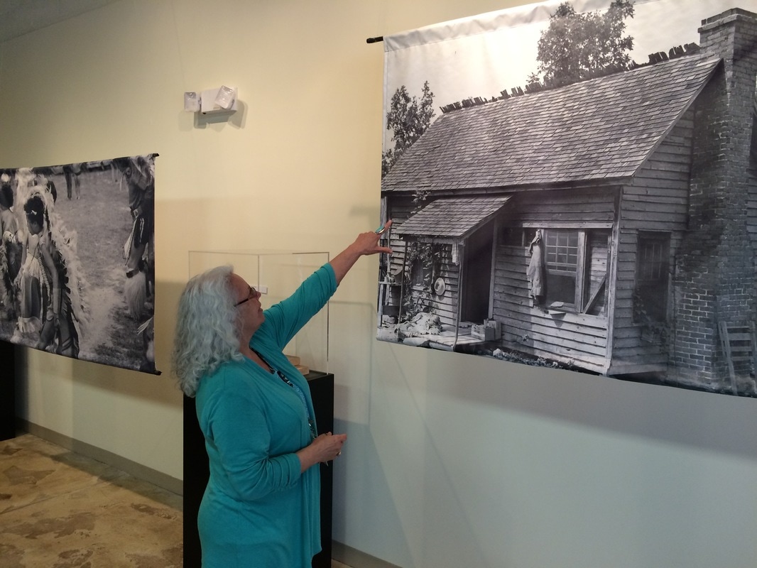
Beckee Garris, visitor coordinator at the Native American Studies Center of the University of South Carolina-Lancaster and member of the Catawba Nation, points to a photo of an old Catawba cabin.
As I work my way through my writing of the book version of A Delicious Country, I have the pleasure or reliving some of my favorite parts of my journey retracing Lawson, though also sometimes in focusing on things not so pleasant. I've just been writing about my visit to the Native American Studies Center of the University of South Carolina Lancaster, where I received exactly the kind of welcome and hospitality Lawson did, though at the time (it was late March 2015) it was one of the stories I skipped telling because of its complexity. So reinvigorating my notes into narrative for the book has reminded me of both some vastly pleasant interactions and a rather terrible story. I'll briefly tell you about both.
Picture
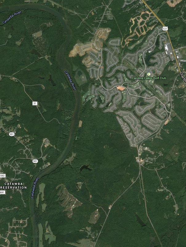
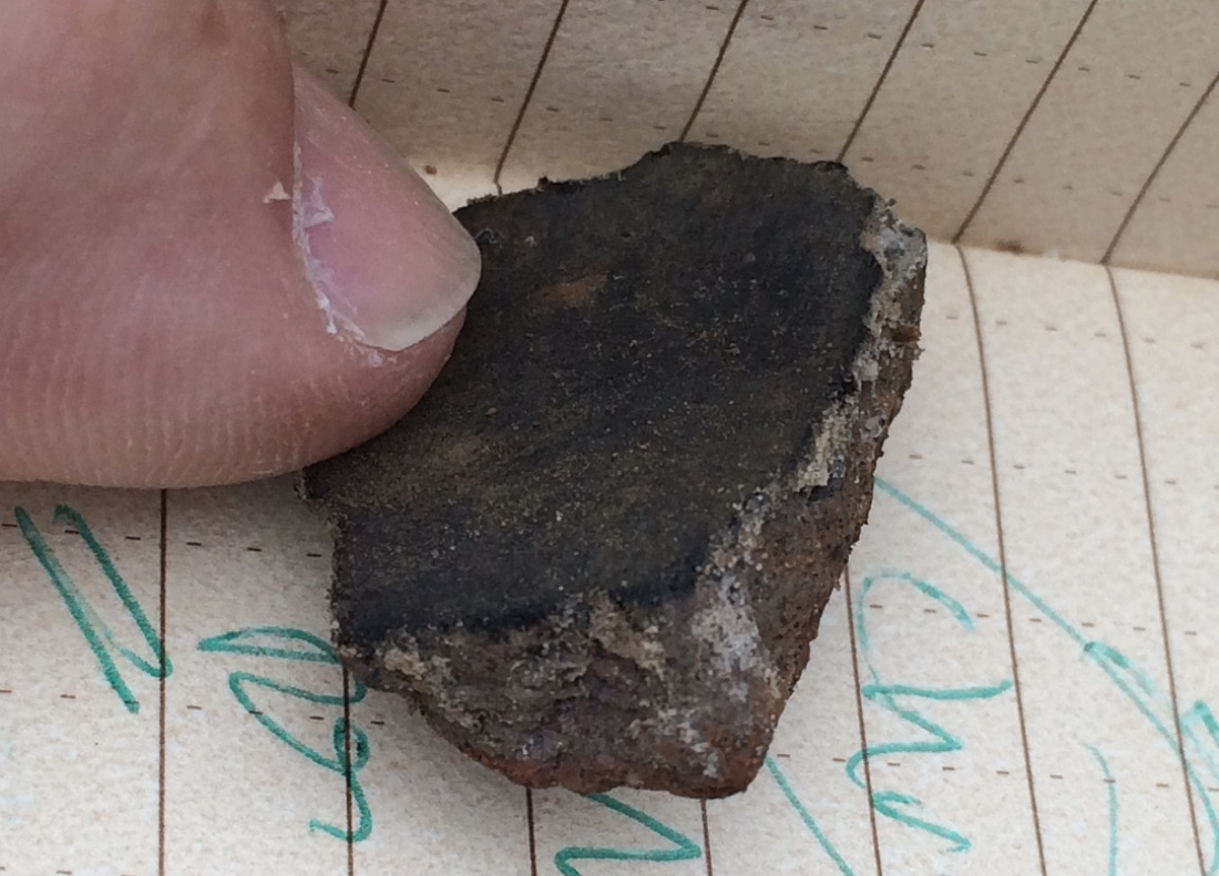
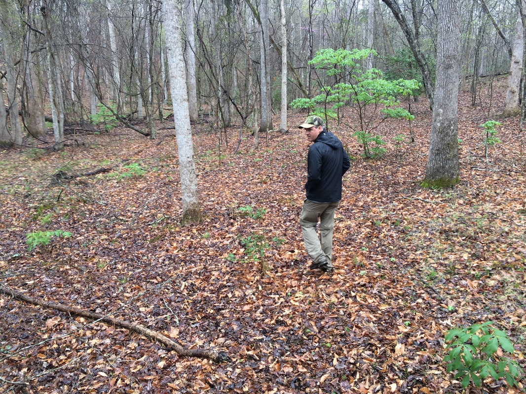
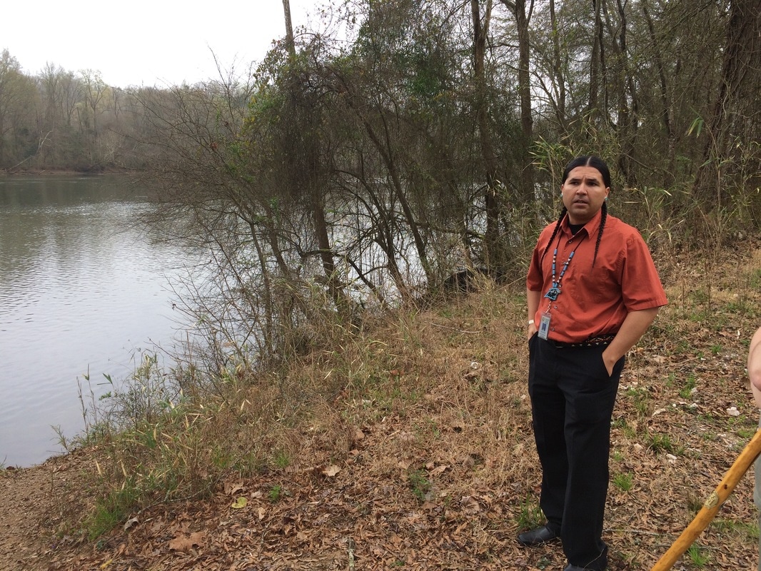
Jered Canty of the Catawba Nation stands by the Catawba River, where he took a memorable walk with me.
About the interactions I'll just say that Chris Judge, Brent Burgin, and Beckee Garris of the center were almost staggeringly helpful and hospitable. About Burgin I have told you a bit here -- he walked with me in some memorable territory where we learned about Piedmont geology and gave me a piece of Catawba pottery I cherish. Judge joined me on a walk on Ivy Place, where we discussed land use and a bit of Catawba history. Most important, though, he introduced me to a bunch of area tribal higher-ups, among whom was Jered Canty, economic development assistant at the Catawba Nation. Canty took a walk with me along the Catawba River on the Catawba Indian Reservation that I will not soon forget. 
We met in the Native American Studies Center on a day of chief's meetings and other presentations. I had lost myself among the pots in the display gallery, while various other conversations occurred, when I realized that in a separate gallery someone was speaking publicly, sharing her experiences with the Catawbas, discussing her feelings about the Catawbas’ relationship with the earth, with their crops, and to be honest she was laying it on a little thick, as non-Indians sometimes do in their descriptions of our brethren the noble savages. I hung around the edge of the crowd and was getting ready to drift away when a response stopped me. The speaker had been talking about the Catawba heart, and the land, and she had said that their spiritual relationship to something or other was the heartbeat of the country. And one fellow, also near the back, said, “No, that’s Chevrolet.”

That stopped the woman for a moment, nonplussed, and I looked at him. Wearing a denim shirt, tight black jeans, and turquoise earrings, he had his thick, shiny black hair done into twin tight braids, one cascading down over each shoulder, framing the necklace of turquoise beads that hung on his chest. He could not have looked more like the white person’s stereotype of an Indian if he had been gazing at roadside litter with a single tear coursing down his cheek. The woman looked at him, and he smiled. “Chevrolet is the heartbeat of America,” he said. “Haven’t you seen the commercial?”

The woman gave a wan smile and carried on with her presentation. As for me, I had a new best friend. That was Jered Canty, and he was at that moment engaged in a campaign to be elected Assistant Chief of the Catawbas. He shook my hand and happily agreed to meet me at the Catawba reservation the next day and walk with me along the Catawba River on his reservation and tell me stories.
Which he did, of course, and we had a large time. We walked along the old roads that had been sidling along the river since Lawon's time -- and long before, and he tole me how he wanted a new generation of leadership to emerge for his tribe. There's more to say, and in the book I say it. But though I was grateful at the time, only now, as I've been writing, have I spent any real time with Catawba history. Regarding which, oy. So just listen to this for a second.
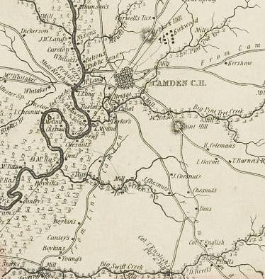
According to various censuses either taken or calculated before Lawson’s time, the Catawbas were the biggest tribe in the Piedmont, numbering 6,000 or so members in the century before Lawson came. Nearby tribes -- the Sugeree, Wateree, Congaree, Waxhaw, all mentioned by Lawson as he moves through -- probably numbered another couple thousand, though all would have been depleted by the time Lawson showed up, victims of the four riders of the Settler Apocalypse: slavery, disease, dispossession, and alcohol.

By Lawson’s time the number may have dropped to below 2,000, according to a chart in the Native American Study Center. By the time of King Hagler, whose story we had learned in Camden, the number of Catawbas had probably diminished to less than a thousand. So when in 1760 Hagler managed to get the crown to cede title to 144,000 acres of land, fully supported by survey and deed, that seemed like a godsend to the remnants of the tribes that were by then fully banded together as Catawba. (The original name of the group was yeh is’wah h’reh, meaning people of the river; Lawson mentions the Esaws, which were probably a part of the people, though he talks of the Catawbas too; it was a complicated time.)
    
Picture
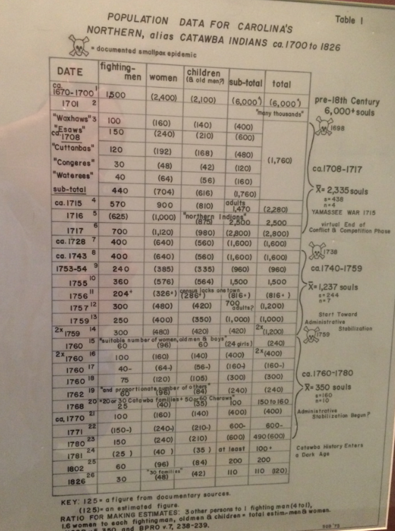
Before European contact? Who knows. By 1600 or so smallpox had been around, but even so by Lawson's time many estimaes place the Catawba population at 2,000 or more. By 1781? A hundred or so. Hey, welcome to our territory, new settlers!
Of course, though, the lingering Catawbas could never defend their land against Europeans who wanted to settle on it, so they began, trusting that power of ink on paper, to lease portions of it to settlers, in the hope they could coexist in that way. Yeah, right. As more settlers leased more land and the time of Indian Removal came in the early 1800s, Catawbas had less and less control of their land and less and less likelihood of regaining it. In 1840 what was left of the tribe agreed to a treaty with the state of South Carolina, yielding all claim to their territory for $5000. “They are, in effect, dissolved,” said then-governor David Johnson.

Importantly, the federal government never bothered to ratify the treaty. In 1934 with the Indian Reorganization Act the United States began trying to develop a reasonable Indian policy, though by the mid-1940s the country had reverted to old habits and adopted the aptly if horrifically named Indian policy of termination. Indians were encouraged to leave reservations, tribes were declared dissolved, and their land was absorbed by the federal government. In 1959 the United States officially ceased to recognize the Catawba tribe. In 1973 organized Catawbas began to fight back -- emerging from hiding, from diaspora, and from poverty much like the Santees' Peggy Scott described to us and filing for recognition. And in 1993 the Catawbas once again attained federally recognized status -- and a settlement of $50 million for the government’s failure to protect the tribe when the 1840 treaty came around. The current reservation, across the Catawba River and northwest of Lancaster, contains less than 5 square miles.

So how's that for backstory? Given which I can scarcely categorize Jered Canty's willingness to walk with me along the river as anything other than an act of hopefulness and belief. 
And, meanwhile, the Catawbas are tough customers. Their pottery remains beautiful as far as I can see, and they don't give up easy. Beckee Garris, who works at the Center, told me stories about her family growing up Catawba, and she told me about her experiences teaching Catawba language to kids on the reservation. Sometimes you meet people and you just don't even know how much you can admire them. It was some time ago, but thanks, Catawbas. And keep holding on. Maybe the rest of us can learn from you.
0 Comments

Sweet Charlotte

6/12/2015

0 Comments

 
Picture
I don't think we're in the Francis Marion National Forest anymore...
In my journal I at one point wrote down the series of transitions I'm making as I follow Lawson's path, seeing the vast differences between the landscape I traverse and the one he did.

Lawson left Charleston and went from ocean to marshland to river to swamp to forest, and as far as that goes so did I: a week along the Intracoastal Waterway by canoe, a day up the Santee still by canoe, then a few days messing around in the cypress-tupelo swamps of the Francis Marion National Forest and the Wee Tee State Forest as the Santee traveled northwest towards its formation at the confluence of the Wateree and the Congaree, visiting the High Hills of Santee and the 150-foot tupelos and acres of cypress knees in the swamps of the Congaree National Park.

Then it was towns. I had cake and coffee in the tiny crossroads hamlet of  Jamestown and slept in the church, visiting little Randolph's Landing, the spot at the end of the road where the government plonked Lake Marion, widely regarded one of the Army Corps of Engineers' worst mistakes in history, drowning an ecosystem and its culture and damaging not only the Santee River but the Cooper River Basin, where it ships some of its water in a wrongheaded attempt to improve Charleston Harbor.

From there I walked on to the tevolutionary town of Camden, where I was treated like a king and slept in the basement of the rebuilt Kershaw House, and from there to Lancaster, where I met not only the delightful people at USC-Lancaster but the Catawba Indians themselves, who treated me as well as they had treated Lawson three centuries ago, and then on up to Pineville, the last little stop before Charlotte.

And this time I walked into Charlotte. So I've gone ocean, marsh, river, swamp, hills, town, city, and now big city. The best surprise I had in Charlotte was the sidewalks. Throughout my walk I have complained, pretty
Picture
Where the sidewalk ends. Good luck!
Picture
The engineer who designed this highway segment came from a planet where people do not have legs, they have wheels.
Picture
much constantly, about the lack of sidewalks and capacity for pedestrians to share the roads. Some of that comes simply from walking through very rural territory. But the approach to every city has meant running for my life, and approaching Charlotte from Pineville, where I stopped last time, was no different. Pineville is a little comfortable suburb, with streets and sidewalks and shops, and then you run out of sidewalk and you cross I-485 and you just pray that you stay lucky. And then you walk along a strip of soul-sucking highway with about 16,741 car dealerships (that's an estimate; I might have missed a couple)

But then an astonishing thing happens. You find yourself on South Boulevard and ... there's sidewalk. And I'm here to tell you, that for the ten-or-so miles it takes you to get into Charlotte, you have sidewalk the whole way, and for that I could just weep with gratitude.

That was hardly the first thing I noticed about Charlotte. First, even as I approached Pineville, I left for the time being any semblance of rural land, as I discussed here. Before the Charlotte metro area, everywhere I went was plantations and forests and pine tree farming and meadows: South Carolina is rural. Starting to near Charlotte, instead of hitting large areas of land and seeing cows and trees and granite, I saw an endless parade of subdivisions -- of Glen Laurels and Clairemonts, of Fox Trails and Bridge Hamptons, Farringtons and Almond Glens. Those are all names of subdivisions I jotted down as I walked past. We've all heard the famous joke that a subdivision is named after the geographical feature they bulldozed and the wildlife they killed to make it, but once you've got to Parkway Crossing (real place!) you have to understand that they're just building them faster than they can name them. I mean what's next: Don't Walk Acres? The Glen at Traffic Circle?

Which brings us to Charlotte! Charlotte's origin story is that Trade and Tryon, the main downtown crossroads, has been a crossroads for time out of mind. Tryon is pretty much the Trading Path, which I've been following (and Lawson followed) since about Camden, SC. Trade was another path, running between the Cherokee settlements to the west and the coast. At the crossroads was a Catawba settlement, and that made a great place to hang out and wait for whatever was next.

In fact, at that point Lawson met someone he didn't expect. Lawson, like me, knew he was coming into the city: "This day, we pass'd through a great many Towns, and Settlements," he says. "About three in the Afternoon, we reach'd the Kadapau King's House, where we met with one John Stewart, a Scot, then an inhabitant of James-River in Virginia ." Stewart was one of the Indian traders from the Chesapeake who made their way up and down the Trading Path, bringing European goods and returning with deerskins and furs. Stewart was waiting around with the Catawbas because a Seneca raiding party was in the area and he didn't care to travel alone. Lawson mentions that Stewart had heard of the approach of Lawson's group nearly three weeks before and had waited for him, giving a little sense of how effective Indians communicated without any help from the Internet. Stewart joined Lawson's gang and they agreed to journey forward together.

But not before Lawson irritated his host by refusing to enjoy the services of "two or three trading Girls" the Catawba King kept around for visitors. When Lawson politely declined -- and even one of his his most ready companions, who had recently woken up to learn he had been robbed by a trading girl he had enjoyed for the night, declined as well -- the king didn't like it. "His Majesty flew into a violet Passion, to be thus slighted, telling the Englishmen they were good for nothing." Still, they hung around a couple days, baking bread and otherwise preparing for their journey, which at this point began to turn eastward back towards the coast.

Picture
We ain't in rural South Carolina no more.
Picture
A chemical company on South Boulevard. Not too much industry in Charlotte though. Banks aplenty, as we could see from the skyscrapers.
Picture
Charlotte honors its history as a place where people meet to do business -- it's an enormous banking capital now, and it has some astonishing skyscrapers to show it, along with the explosive redevelopment that tends to go with prosperous Sun Belt cities. (Read this piece to learn the weird and cool backstory on how Charlotte emerged as a banking center.) It even has a fabulous light rail transit line, which made my life extremely easy. My good friend and leader Val Green helped me leave my car at the southernmost end of the line, so when I made my way into town all I had to do to get back to my car was jump on the trolley. I was glad he helped -- walking from the end of the Lynx line the extra mile back to Pineville would have been one car-dodging trip too many at the end of the day.

Walking into Charlotte up South Boulevard is a delight, though. You walk past about a million self-storage places, which along with the limitless car lots lead a visitor to the conclusion that people in Charlotte -- and I suppose all modern people -- have cars only so they can fill them with stuff, which they then dump off in warehouses. I passed a little chemical plant after walking through neighborhoods easily identifiable through signs on restaurants and roadside stores: hispanic, asian, African-American. Then as I closed in  manufacturing plants-turned-upscale-living-and-shopping started dominating, and by the time I could get glimpses of downtown I was in neighborhoods that took serious coin to inhabit -- off the main drag, you could see one or two of the old millhouses remained, but almost everything else was a teardown. 

Once I got into downtown it was like the Peterson's Guide to the Ecosystems of the Big Cities. Sports stadium? Check (three! minor league baseball, pro football, and pro basketball!). Adorable minipark? Check: One with a literary theme and, for some reason, spitting fish. Then there was Trade and Tryon, and though no Catawba King greeted me, I had been well treated by the Catawbas already (more about that soon!). As for trading girls, I appear to have missed that neighborhood.

Picture
We're hee-eere!
Picture
These fish take turns spitting at each other. It's pretty neat. The rest of the park is all about books.
I'm more worried about cars than raiding parties, though we'll see how that shakes out when I hit the trail again.
0 Comments

Back to the Land

4/10/2015

0 Comments

 
You want to know how things have changed since Lawson's time? Look at the land; if I'm learning anything on the Lawson Trek it's that it all comes down to the land.

I spent my last trek focused on Lancaster, SC, where the Native American Studies Center of the University of South Carolina-Lancaster was holding, coincidentally, its annual Native American Studies Week, and the Lawson Trek got to play. As ever, I'd rather be lucky than good. I'll tell you about that soon, and about the welcome I received (again, like Lawson) from the Catawbas themselves.
Picture
We also saw this black vulture doing sun salutations on a chimney. We saw cormorants doing the same when they got wet. Animals understand the value of solar energy. Wonder if people ever will.
But I was talking about land. Walking north out of Camden left no doubt we were in the midlands, the Piedmont of South Carolina. In Camden we had noticed that the walk into town from the south had been almost completely flat but that the walk out of town to the north had enough rolling hills that you might not notice them as you walked but you would notice morning fog settling in the low places. 

We saw the land shift from pure loam and clay to rock, which was most notable in the copses of trees surrounding rocks too big for farmers to clear that pop up in the middle of the pastures for beef cattle that now have joined the cotton and soy fields and the pine farms we pass by. In fact, we now regularly pass by enormous boulders, which just like the lay of the land help determine the land's use. Not for nothing is Camden the beginning of horse country.
But for the clearest  indication of how a culture has changed is to look at what's come next, and the place to do that is The Ivy Place, a few miles up the Catawba River from Lancaster. Built in 1850 by one Adam Ivy, Ivy Place is still owned by the descendants of James Nisbet, a New York physician who had grown up in the area and bought the house as a homeplace in the 1880s. But the Ivy Place has more than just that beautiful 1850 house, barns, pick-your-own strawberry patches, and a great facility you can rent for weddings. 

It also has a future as open land. Because its owners have placed a conservation easement on it through the Katawba Valley Land Trust, the Ivy Place will never be developed. It will continue to be a working farm, and the family will own it, use it for its own purposes, farm strawberries and pine trees and beef cattle, host events -- but the land will never be developed. If you want to know what that means, look to the right. On the lower left of the image is the Catawba Reservation; across the river is Ivy Place and other land owned by the Nesbit family. North of that is what happens to land without conservation easements. 
Picture
Long-term residents of Lancaster County see Sun City and its ilk as tentacles of Charlotte moving down.
Sun City Carolina Lakes is a development for adults 55 and older, and it could not be more different from the landscape it replaced. To see that land, we spent a morning walking with Jimmy White (a member of the Nisbet family), Barry Beasley of the Land Trust, and Chris Judge, of the Native American Studies Center. We walked along the Catawba River, at least a quarter mile wide and rarely more than knee deep; we saw bluffs of that piedmont granite overlooking the river. We saw eagles nesting in snags, the sites of old Catawba and Waxhaw towns, the remains of an old mill, and piles and piles of empty plastic bottles and other flotsam that comes down the Sugar Creek, which drains Charlotte and enters the Catawba just upstream. Barry told us that one dedicated paddler has pulled more than 17,000 basketballs out of the Catawba in recent years.
"It's the typical story," Barry told us. "People move into the panhandle [the portion of Lancaster County also called Indian Land] for a better quality of life." As more people come, the sprawl they fled follows them. In the early 1990s the county added sewer and water services, and once you've done that, land is easy to develop -- and mostly gone. "Now it's Charlotte," Chris says of the way northern Lancaster County has connected to the Charlotte amoeba.

Which was why Jimmy was so pleased as he showed us the territory his family owns (and even some his family sold, though with easements on it protecting the river). Until the late 1950s the Catawbas operated a one-car ferry where route 5 now crosses the river, but the new road ended that. The more than 3 miles of riverside the Nesbits own at least give open land a fighting chance. Jimmy walked us to a site that had once been a Catawba town, and doing nothing more difficult than idly kicking around dirt he unearthed 18th-century pottery fragments that he gave to me -- a connection with centuries past.

Not that the land as it is now, with lovely second-growth forest and old mills and town sites and such, would have been as it is now when Lawson passed. "The coastal plain would've been magnificent longleaf pine forests," Barry reminded us, as we followed old Waxhaw paths and double-tracks as old as horse and buggies along the conserved land.
Picture
Do you have an 18th- or 19th-century potsherd in your house? I do.
Picture
Jimmy White led us around the conserved land where you had to blur your eyes only the smallest bit to be able to perceive trails that could be hundreds of years old.
Not, mind you, that it's wrong to develop housing subdivisions, or that it's wrong to sell your land when your land is your only resource. But what the Land Trust does, with and families like the Nesbits, is preserve an earth that can retain its memories of the Lawsons and Waxhaws and Catawbas (and Nesbits!) of this world. There's an enormous value to that.

After all, you need somewhere to dock your kayak when it's time to gather the basketballs. 
0 Comments

Civilization, or Something

4/8/2015

0 Comments

 
PictureIndian man in match coat, drawn by John White during his 1585 visit to Carolina. The term "match-coat" appears to be a folk etymology from the Algonquian word "mantchcor" or "matchcor." Interesting world, yes? (Image from virtualjamestown.com.)
Lawson, as he goes about his business, speaks mostly of visual observations. Of the Indians he meets, he describes their clothing (they almost always wear "match coats," a sort of toga-style piece of fabric worn connected over one shoulder):

Their Feather Match-Coats are very pretty, especially some of them, which are made extraordinary charming, containing several pretty Figures wrought in Feathers, making them seem like a fine Flower Silk-Shag; and when new and fresh, they become a Bed very well, instead of a Quilt. Some of another sort are made of Hare, Raccoon, Bever, or Squirrel-Skins, which are very warm. Others again are made of the green Part of the Skin of a Mallard's Head, which they few perfectly well together, their Thread being either the Sinews of a Deer divided very small, or Silk-Grass. When these are finish'd, they look very finely, though they must needs be very troublesome to make. Some of their great Men, as Rulers and such, that have Plenty of Deer Skins by them, will often buy the English-made Coats, which they wear on Festivals and other Days of Visiting. Yet none ever buy any Breeches, saying, that they are too much confin'd in them, which prevents their Speed in running, &c.

He describes the forests and greenery he encounters, in this part of the world noticing an end to the Spanish Moss: "From the Nation of Indians until such Time as you come to the Turkeiruros in North Carolina, you will see no long Moss upon the Trees," and he's exactly right -- we saw Spanish Moss at the beginning of the trek that took us from the High Hills of Santee to the town of Camden, and I haven't seen a strand of it since. He notices that the Indians have a special mark of respect:  "At Noon, we stay'd and refresh'd ourselves at a Cabin, where we met with one of their War-Captains, a Man of great Esteem among them. At his Departure from the Cabin, the Man of the House scratch'd this War-Captain on the Shoulder, which is look'd upon as a very great Compliment among them. "

Something about that shoulder scratch appeals to me; Lawson mentions it more than once, and it seems like such a lovely predecessor of the vaguely uncomfortably two-guy sidehug or the performance level shoulders-touching-two-thump handshake that it reminds me: Lawson was a guy just like I am, and the people he met were just people. Just like the people I meet.

Picture
Like Lawson, we come across many abandoned properties.
Picture
Developed territory indeed. Lawson never saw a prison.
Speaking of people, we walked into Camden thinking about the longstanding groups of people whose territories we're walking through. Walking through the High Hills of Santee -- the hills overlooking the upper Santee River and its formation at the confluence of the Wateree and Congaree rivers -- I took what I fear may have been the last truly backpack-style trip during this undertaking. Through there I -- mostly alone -- walked along sand roads and even on actual forest trails, sleeping in state and county campgrounds. Once I made it north of Manchester State Forest, though, I was on mostly two-lane asphalt, which means different shoes (yes sneakers or trail runners; hiking boots no, no, a thousand times no) and a different experience. Now I'm always among people, in at least farmed and often developed territory. In a way this is more Lawsonian anyhow.

That is, Lawson himself when he got to this part of the world was just moving from Indian town to Indian town, and he and his friends only rarely had to sleep out of doors. Not that he always liked the Indian hospitality he received: The People of this Nation are likely tall Persons, and great Pilferers, stealing from us any Thing they could lay their Hands on, though very respectful in giving us what Victuals we wanted," he says of the Wateree-Chickanee Indians he meets not far from here. "We lay in their Cabins all Night, being dark smoaky Holes, as ever I saw any Indians dwell in."

Two friends joined me for the walk into Camden, though I entered Camden alone (described here). But our lodgings were anything but dark smoaky holes. The delightful Joanna Craig of Historic Camden offered us the basement of the historic Kershaw-Cornwallis house, which enabled us to stay bone dry on what was actually a rather rainy weekend. Some nearby Boy Scouts had a somewhat harder time of it.
Picture
Troop 5 from Rock Hill manfully braved the elements. We urban dandies from the Lawson Trek stayed warm and dry in the basement of the Kershaw-Cornwallis House.
Picture
This house was originally built in the mid-1700s. It survived the Revolution but not the Civil War and was rebuilt on its original foundations in 1977.
PictureThe map of Camden from the 1825 Mills Atlas. You can see how it's just off the Wateree, and that the old road -- surely the one Lawson would have followed up from the Santee. (Image from South Carolina Digital Library -- http://digital.tcl.sc.edu/cdm/search/collection/rma.)
Joanna Craig gave us a mile-a-minute explanation of the history of Camden, which, founded in 1732, was the first inland Carolina town settled by Europeans. King George II was looking to get the Indians off prime riverside land and spread English settlement. The town was first planned as Fredericksburg, right on the Wateree River, then called Pine Tree Hill, then finally put in its current spot (actually rather swampy; it still floods, Joanna assures me) in 1758, when Joseph Kershaw arrived from England, established a store, and got things going. The town was called Pine Tree Hill until it was renamed after Lord Camden, a supporter of colonial rights. Its downtown main street -- Broad Street; Lawson would have walked the Indian trail on which it's lain -- is filled with buildings designed by Robert Mills, the designer of the Washington Monument and many other neoclassical buildings, to say nothing of the author of the 1825 Mills Atlas of South Carolina, from which the wonderful description of the rock house near Forty-Acre Rock comes.  The revolutionaries lost the Battle of Camden, by the way, lost it big time. Cornwallis took over the Kershaw house and imprisoned its owner for the duration; "hundreds of unhappy prisoners" of the revolutionaries had the same fate penned in the yard.

So anyhow, into, and through, and past, Camden we went, and in Camden as in Charleston and in McClellanville and in Jamestown and in Horatio we found friends to help us out. I've already mentioned Joanna Craig, who helped and organized and gave us warm and dry sleeping quarters, but at Books on Broad we met owner Laurie Funderburk, who organized a meet-and-greet that was absurdly well attended, the Camdenites coming out and introducing themselves en masse and in all ways making the Lawson Trek feel welcome. 

So we wandered. A day into Camden, a day in Camden, then another day north, partway to Lancaster. We visited Boykin on our way into town, where we met Susan Simpson, the broom lady, going about the business of making brooms in a little cabin that had housed slaves in 1740, and saw the mill pond, there since 1792 and the church built six years earlier. 

We saw cemeteries and plantation houses, cotton fields and tree farms, and the usual spate of abandoned houses, including one that took our breath away, not least because as we made our way across a cottonfield to explore it a machine came out to spray the field with nitrogen. It looked like an average machine until it automatically spread its pipes to begin spraying. Michael saw praying mantis; I saw vampire; and Katie, the ecologist, saw, she said, "threat behavior." 

What we loved most, though, was the town itself. "Horses and history," Joanna said were the themes of Camden, and it's clearly finding a way to keep itself alive with its historical district, arts and antiques dealers, and the nation's second oldest polo field. Camden became a resort town for late-nineteenth-century snowbirds, which gave the horse community its beginning, and it's remained ever since. 

Walking through town was delightful; this was the first town the Lawson Trek has come through whose primary history did not involve Lawson, explorers, or Indians. Seeing the tidy streets of old houses, many from the years immediately after the revolution, was thrilling and homey and peaceful.
Picture
Streets so homey and adorable you could just wiggle.
Picture
Susan Simpson, the broom lady, working on brooms. She has a two-year order backlog, but she'll be glad to see you just the same.
Picture
You really had to kind of be there, though.
More, we noticed among the porches that most Southern of traditions -- many with ceilings painted haint blue, supposedly to keep ghosts away because the ghosts perceive the blue paint as water and won't cross it. 

Oh, yeah -- Indians. Of course Camden has an Indian history. It was probably very near the center of the town of Cofitachequi, an Indian polity visited by de Soto, Pardo, and, as late as 1670, by Henry Woodward, the first British colonist of South Carolina. It was gone by the time Lawson came through, when the territory was the southern reach of the Catawba people.
Lawson met tremendous hospitality among the Catawbas (as he did everywhere), though not long after Lawson passed through things got less cheerful. King Haigler, a revered Catawba chief, would have been an infant when Lawson passed through -- he was born in 1700, so Lawson may have chucked him under the chin or dandled him on his knee. In any case, in 1754 he became chief, and he was evidently much beloved: he's considered the "patron saint" of Camden and he's in the South Carolina Hall of Fame. His image is everywhere in Camden. 
Picture
Picture
Fat lot of good it did him. He's the chief who signed the treaty that supposedly provided a 15-square-mile reservation for the Catawbas in South Carolina. That didn't work out too well (long story, but the Catawbas finally regained federal recognition in 1993), and Haigler was killed by a band of Shawnee. 
0 Comments

    Archives

    January 2020
    October 2019
    May 2019
    February 2019
    November 2018
    October 2018
    May 2018
    March 2018
    August 2017
    May 2017
    August 2016
    June 2016
    March 2016
    February 2016
    November 2015
    October 2015
    September 2015
    August 2015
    July 2015
    June 2015
    May 2015
    April 2015
    March 2015
    February 2015
    January 2015
    December 2014
    November 2014
    October 2014
    September 2014
    August 2014

    Categories

    All
    Adventure
    African American
    Angie Clemmons
    Anthropocene
    Apothecary
    Appalachian
    Archaeologists
    Archaeology
    Army-navy
    Art
    Artifacts
    Atlanta
    Backpack
    Banking
    Barbecue
    Barry Beasley
    Bath
    Beaufort
    Beckee Garris
    Beetle
    Beginning
    Ben Franklin
    Berm
    Bill
    Birds
    Blister
    Book
    Bookstore
    Boston
    Botanical
    Boykin
    Breach
    Brent Burgin
    Brownlee
    Buck
    Buffer
    Cabelas
    Cambridge
    Camden
    Camera
    Canoe
    Canty
    Catawba
    Chain
    Charleston
    Charlotte
    Chelsea
    Chocolate
    Chris Judge
    Church
    Cincinnati
    City Of Raleigh Museum
    Civilization
    Coe
    Comment
    Community
    Concord
    Confederate
    Contentnea
    Cornwallis
    Country Music
    Couture
    Crawford
    Creek
    Croatoan
    Cutler
    Cypress
    Danger
    Davis
    Death
    Delightsome
    Delk's
    Denton
    Devices
    Drake
    Drawing
    Drunk
    Duck
    Durham
    Eagle
    Earnhardt
    Earth Day
    East
    Ecologist
    Effron
    Embankment
    End
    Error
    Evans
    Exhibit
    Expeditions
    Facebook
    Feather
    Fern
    Finish
    Fire
    Flag
    Flintlock
    Flood
    Francis
    French
    Gaillard
    Gander Mountain
    Garden
    Geology
    Gimpy
    GIS
    Google
    Great Wagon Road
    Green
    Greenville
    Grifton
    Guerry
    Gun
    Guns
    Haigler
    Hallenbeck
    Hampton
    Hanging
    Hannah Smith
    Harris
    Hartford
    Harvest
    Heat
    Hempton
    Highway
    Hillsborough
    Hips
    Historic Bath
    Hollow Rocks
    Home
    Homeness
    Hortus Siccus
    Hospitality
    Huguenots
    Huntley
    Indians
    Instagram
    Interstate
    Island
    Ivy
    Ivy Place
    Jamaica
    Jarvis
    Jennifer Landin
    Jered
    Jimmy White
    John Jeffries
    John White
    Journalism
    Kadaupau
    Kannapolis
    Katawba Valley Land Trust
    Katie Winsett
    Kayak
    Kershaw
    Keyauwee
    King
    Knife
    Lame
    Land
    Language
    Lawson
    Lawsonians
    Lecture
    Legacy
    Legare
    Legislators
    Leigh Swain
    Lenoir
    Lenoir Store
    Lenses
    Library
    Lichen
    Lies
    Loberger
    Locke
    London
    Longleaf
    Lost Colony
    Lynch
    Lynching
    Magnuson
    Mansplaining
    Maps
    Mass Shooting
    Match-coat
    Mathematical
    Meerkat
    Memorial
    Mental Floss
    Mill
    Millstone
    Miniature
    Monkeyshine
    Moonshine
    Museum
    Museum Day Live
    Musings
    Nancy
    Nascar
    Native American Studies Center
    Natural History Museum
    Nature
    Nesbit
    Netherton
    Neuse
    Newspaper
    Nonfiction
    Notebooks
    Occaneechi
    Orlando
    Pack's Landing
    Palmetto
    Pamlico
    Park
    Patent Leather
    Pedestrian
    Peggy Scott
    Periscope
    Petiver
    Photography
    Physic
    Pig
    Pig Man
    Pittsburgh
    Pocket
    Poinsett
    Polo
    Potsherd
    Pottery
    Preparation
    Presentation
    Press
    Process
    Proofreading
    Property
    Publishing
    Raccoon
    Racing
    Racism
    Racist
    Raleigh
    Rape
    Ray
    Readings
    Reconsideration
    Records
    Revolution
    Richard Smith
    Richardson
    Rights
    Riparian
    Rivulet
    Road
    Roadness
    Roanoke
    Robert Off
    Roland Kays
    Rolling Stone
    Roombox
    Rules
    Salisbury
    Santee
    Sapona
    Sassafras
    Scan
    Sconc
    Seneca
    Seth
    Shakespeare
    Sir Walter Raleigh
    Slavery
    Slime Mold
    Sloane
    Slope
    Small Town
    Smith
    Smithsonian
    Snow
    Sore
    Sounds
    Spanish Moss
    Specimens
    Speedway
    Spencer
    State Fair
    Steve Grant
    Stewart
    St. Mark's
    Suburban
    Sumter County
    Surveying
    Swamp
    Tar River
    Technology
    Textile
    Tide
    Tobacco
    Toms River
    Tool
    Towel
    Trade
    Trading Ford
    Trading Girls
    Trail
    Trap
    Traunter
    Tree
    Tree Farming
    Trek
    Trilobite
    Troi Perkins
    Truth
    Tryon
    Tupelo
    Turkey
    Tuscarora
    Twitter
    Ugly
    Unc
    Val
    Val Green
    Virginia
    Virginia Dare
    Virginia Historical Society
    Walking
    Washington
    Waxhaw
    Weather
    Website
    White
    Writing
    Wrong
    Yadkin
    Yoga

    RSS Feed

Proudly powered by Weebly