At the intersection of swamp and No Trespassing, the trail ran out. No sign, no further blazes, no marking: nothing. It just ran out there in the swamp.
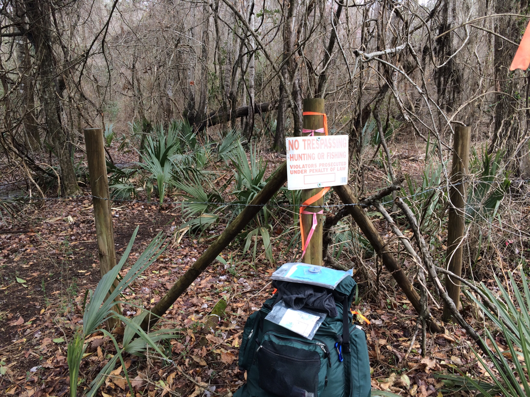
So I did what you do, wandering and poking and eventually finding A path, which was going sort of in the right direction and eventually hooked up with THE path, a quarter mile away or so, and I went along my way. But this is what comes of walking on wilderness paths rather than roads, and I have walked a good bit on both over the last segment of the Trek and, surprising nobody, I have something to say about it.
My friend Dale Loberger not long ago gave a small seminar on how to find old roads -- I remember thinking he was talking about the Roadness of roads. That is, a road is a fairly simple thing: it starts someplace travelers are, and it leads someplace travelers wish to be. Whether those travelers are animals, native Americans, colonists, carts, railroad trains, or automobiles -- or, as in many cases, each of those in succession -- a road is a connector. Perhaps not the shortest but the best way between two points.
Look at an old map, Loberger told us, and the drawings of roads worried less about exact representations of twists and turns than on connections: from the Indian town to the good place to ford the river; from the trading post to the harbor; from the town to the good pass through the mountain. A road in some way invented itself. It partook, Platonists might say, of Roadness.
Like, for example, the way I've been traveling this Trek, when i'm not cursing my way along sometimes-maintained wilderness trails whose organizations are trying to do a great deal with few resources. (The trail that frustrated me this time was the Palmetto Trail, a fine trail-in-progress stretching the length of South Carolina that suffers from logging that destroys it and, again, with trying very hard to do much with little.)
I've been walking along a sand road that has probably been trodden by human feet for a thousand years of more. It follows a route that was an Indian path during the Mississippian period, stretching all the way to the Santee Mound we visited during our last trek. The Indians walked it. Lawson and his group walked it. Colonials walked it. "There aren't too many roads in American that are a thousand years old," my friend and fellow Lawsonian Val Green says. "But this one is." (More on Val soon, by the way.) (And by the way, calling Val a "fellow Lawsonian" is a bit like calling LeBron James a fellow basketball player; Val is the king of the hill, by an order of magnitude.)
Anyhow. I spoke to Val as I planned this segment, which follows the swamp on the northeastern edge of the Wateree River, which joins the Congaree to form the Santee, on which the Trek has spent so much time. These rivers are named for the native tribes who lived along them, and Lawson describes them all, visiting their towns as he moves along.
But the path he describes would have lain, naturally, on the far edge of the swamp -- the path that could have been depended on to be dry most times, regardless of the state of the river or swamp. Last segment we visited the Santee Indian Mound, considered the easternmost edge of the Mississippian Indian culture. Since then, more or less, we've been following a trail along the Santee and Wateree that would have connected all the tribes along the waterway.
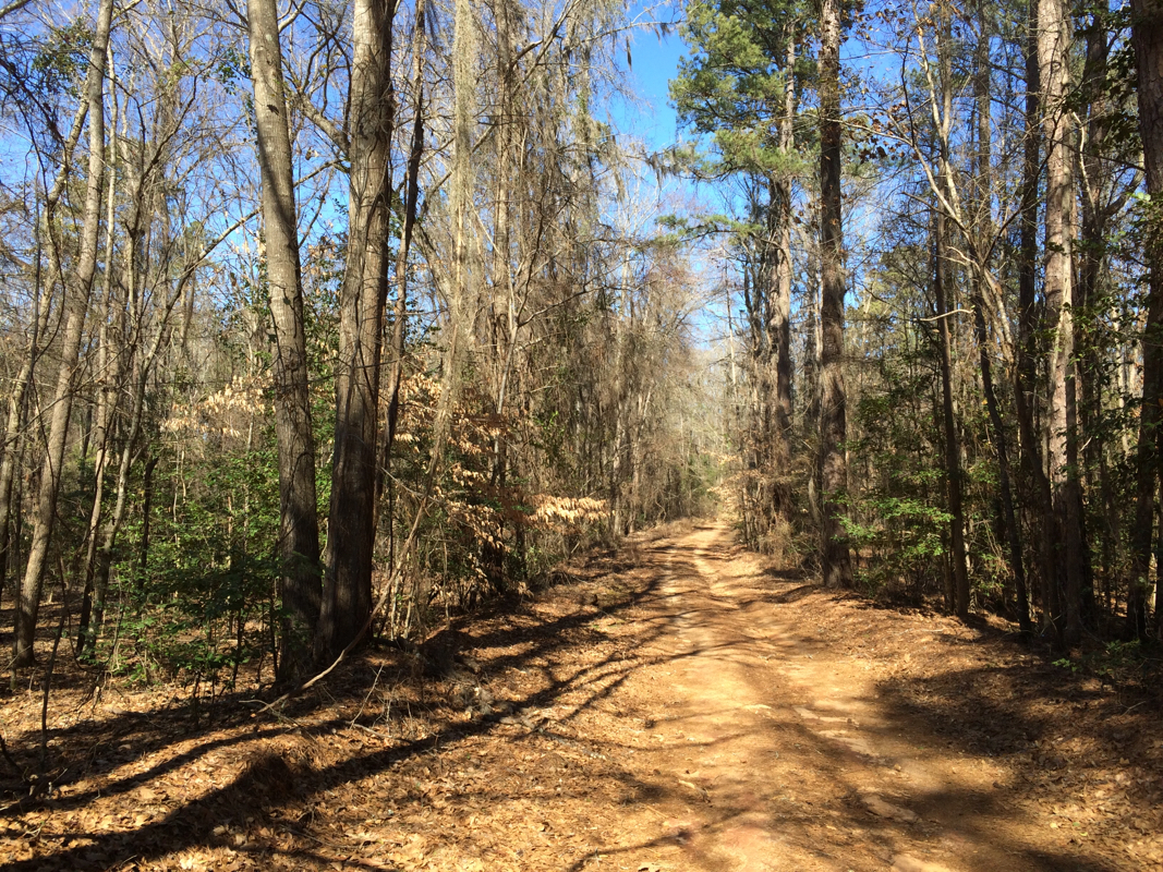
It's been mostly asphalt before, but this time I've been on dirt roads -- more correctly sand roads, since as we've exited the coastal plain we've entered sand hills, the result of the floor of an ancient sea near its shore.
Anyhow, I've walked these sandy miles, and every step has radiated roadness. A stand of holly -- a ton of holly in these hills -- to the left, commonly a pine farm to the other side. Dips down to creeks, rises to plateaus, and occasionally a home site or church, a graveyard, a stand of deciduous trees showing that once upon a time a home stood nearby. It's a lovely kind of walking that makes you feel that you simply are where you ought to be. To be sure, Route 261, the state asphalt two-lane that generally follows the same path only more smoothly and faster, is a half-mile to the west. But this sand road, skirting the edge of the swamp, exudes a kind of patient assuredness that its adolescent asphalt cousin cannot duplicate.
Lawson describes this path, mentioning camping "by a small swift Run of Water, which was pav'd at the Bottom with a Sort of Stone much like to Tripoli," a kind of silica schist often called rottenstone or fuller's earth. I passed while walking this segment at the Tavern Creek, whose banks are covered with just that, and it flows just as swiftly as ever. More important, when Lawson and his friends told their Indian guide, Santee Jack, that they'd like to hang around the creek another day, he assured them they'd be happier half a day further.
I've been walking along a sand road that has probably been trodden by human feet for a thousand years of more. It follows a route that was an Indian path during the Mississippian period, stretching all the way to the Santee Mound we visited during our last trek. The Indians walked it. Lawson and his group walked it. Colonials walked it. "There aren't too many roads in American that are a thousand years old," my friend and fellow Lawsonian Val Green says. "But this one is." (More on Val soon, by the way.) (And by the way, calling Val a "fellow Lawsonian" is a bit like calling LeBron James a fellow basketball player; Val is the king of the hill, by an order of magnitude.)
Anyhow. I spoke to Val as I planned this segment, which follows the swamp on the northeastern edge of the Wateree River, which joins the Congaree to form the Santee, on which the Trek has spent so much time. These rivers are named for the native tribes who lived along them, and Lawson describes them all, visiting their towns as he moves along.
But the path he describes would have lain, naturally, on the far edge of the swamp -- the path that could have been depended on to be dry most times, regardless of the state of the river or swamp. Last segment we visited the Santee Indian Mound, considered the easternmost edge of the Mississippian Indian culture. Since then, more or less, we've been following a trail along the Santee and Wateree that would have connected all the tribes along the waterway.
It's been mostly asphalt before, but this time I've been on dirt roads -- more correctly sand roads, since as we've exited the coastal plain we've entered sand hills, the result of the floor of an ancient sea near its shore.
Anyhow, I've walked these sandy miles, and every step has radiated roadness. A stand of holly -- a ton of holly in these hills -- to the left, commonly a pine farm to the other side. Dips down to creeks, rises to plateaus, and occasionally a home site or church, a graveyard, a stand of deciduous trees showing that once upon a time a home stood nearby. It's a lovely kind of walking that makes you feel that you simply are where you ought to be. To be sure, Route 261, the state asphalt two-lane that generally follows the same path only more smoothly and faster, is a half-mile to the west. But this sand road, skirting the edge of the swamp, exudes a kind of patient assuredness that its adolescent asphalt cousin cannot duplicate.
Lawson describes this path, mentioning camping "by a small swift Run of Water, which was pav'd at the Bottom with a Sort of Stone much like to Tripoli," a kind of silica schist often called rottenstone or fuller's earth. I passed while walking this segment at the Tavern Creek, whose banks are covered with just that, and it flows just as swiftly as ever. More important, when Lawson and his friends told their Indian guide, Santee Jack, that they'd like to hang around the creek another day, he assured them they'd be happier half a day further.
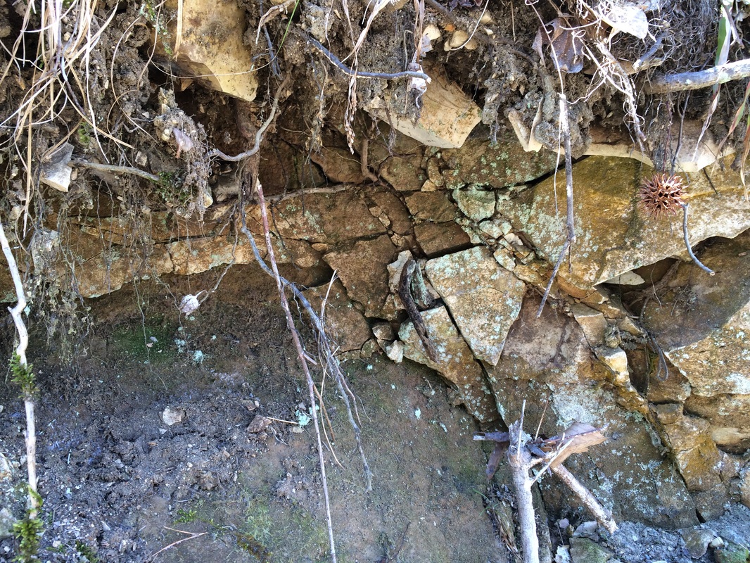 Call it Tripoli, as Lawson did, or Fuller's Earth or rottenstone, this stuff crumbles from the banks of the Tavern Creek, assuring historian Val Green that he had pegged Lawson exactly where Green thought he was. And me too, once Green pointed the way. | 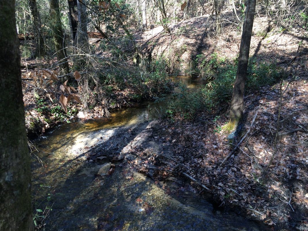 Swift running to be sure, to say nothing of lovely and delightful. If I hadn't been chilly, I'd have sat down for lunch by this shady spot. |
So they went -- as did I -- and a half day further we were all rewarded with the view from the overlook at Poinsett State Park. (Named for Joel Poinsett, the South Carolinian for whom we name the Poinsettia). Atop a genuine hill -- it's several hundred feet up, and you notice it when you climb -- you look to the west, down across the swamp the road has skirted for miles.
""We mov'd forwards, and about twelve a Clock came to the most amazing Prospect I had seen since I had been in Carolina; we travell'd by a Swamp-side, which Swamp I believe to be no less than twenty Miles over, the other Side being as far as I could well discern, there appearing great Ridges of Mountains, bearing from us. W.N.W."
If you go to Poinsett State Park (and I think you should), there is an Overlook Shelter, a little gazebo atop the park's high point. and from it, looking west and northwest, you have a view over the swamps that is, truly, the first great prospect you'll find as you travel into the Carolina midlands. Val Green (him again!) met me here, and he pointed out that if you look carelessly you easily see the ridge of pines on the far edge of the Wateree Swamp, which is several miles distant. But if you look very carefully -- I brought binoculars against just such a possibility and was glad of it -- you can see, in distant, faded blue, the line of hills on the far side of the Congaree swamp, a good twenty miles distant.
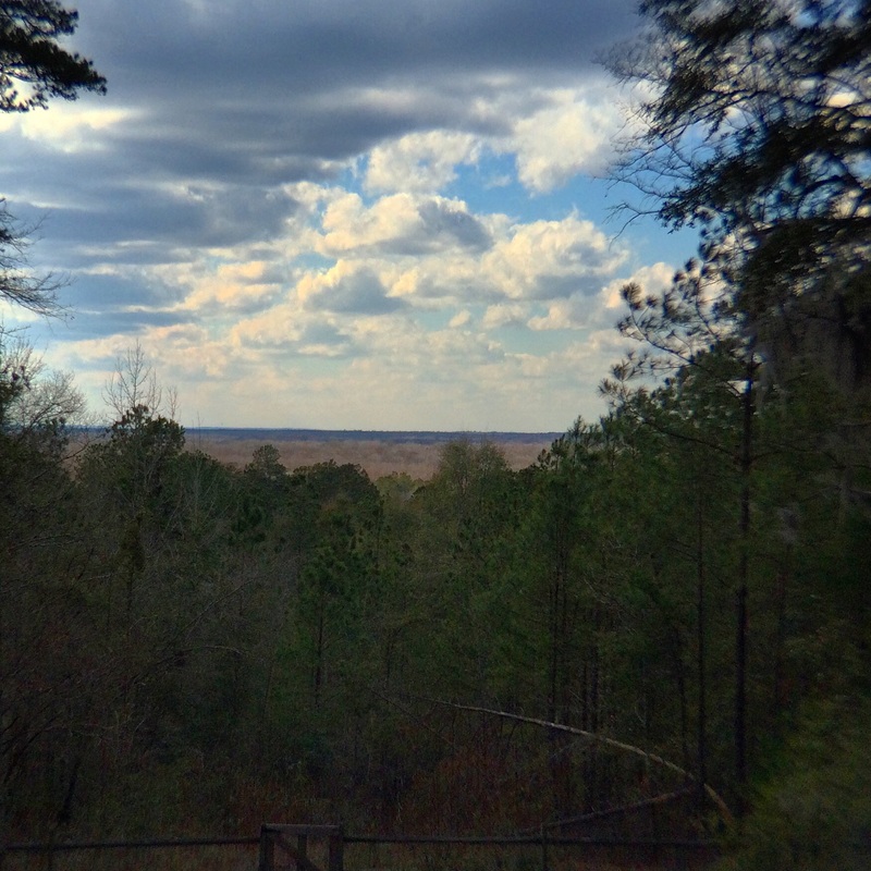
If you look carefully, you can see more than the close row of trees, which defines the far edge of the Wateree Swamp -- the other edge of the swamp along the river Lawson was following. You can also see, towards the left of the horizon, another deep blue line. That's the range of hills on the far edge of the Congaree Swamp. And just as Lawson thought, it's a good 15 to 20 miles distant. An amazing Prospect indeed.
Lawson mentions that "One Alp, with a Top like a Sugar-loaf, advanc'd its Head above all the resst very considerably," and until recent years, both Val and park manager Zabo McCants tell me, you could see Cook's Mountain, ten or so miles away to the north-northwest. Timber has grown up to block the view, but since a paper mill now stands in that direction too, Zabo says he's loth to cut down the screening woods, because exposing the charming Cook's Mountain would expose much that is less lovely.
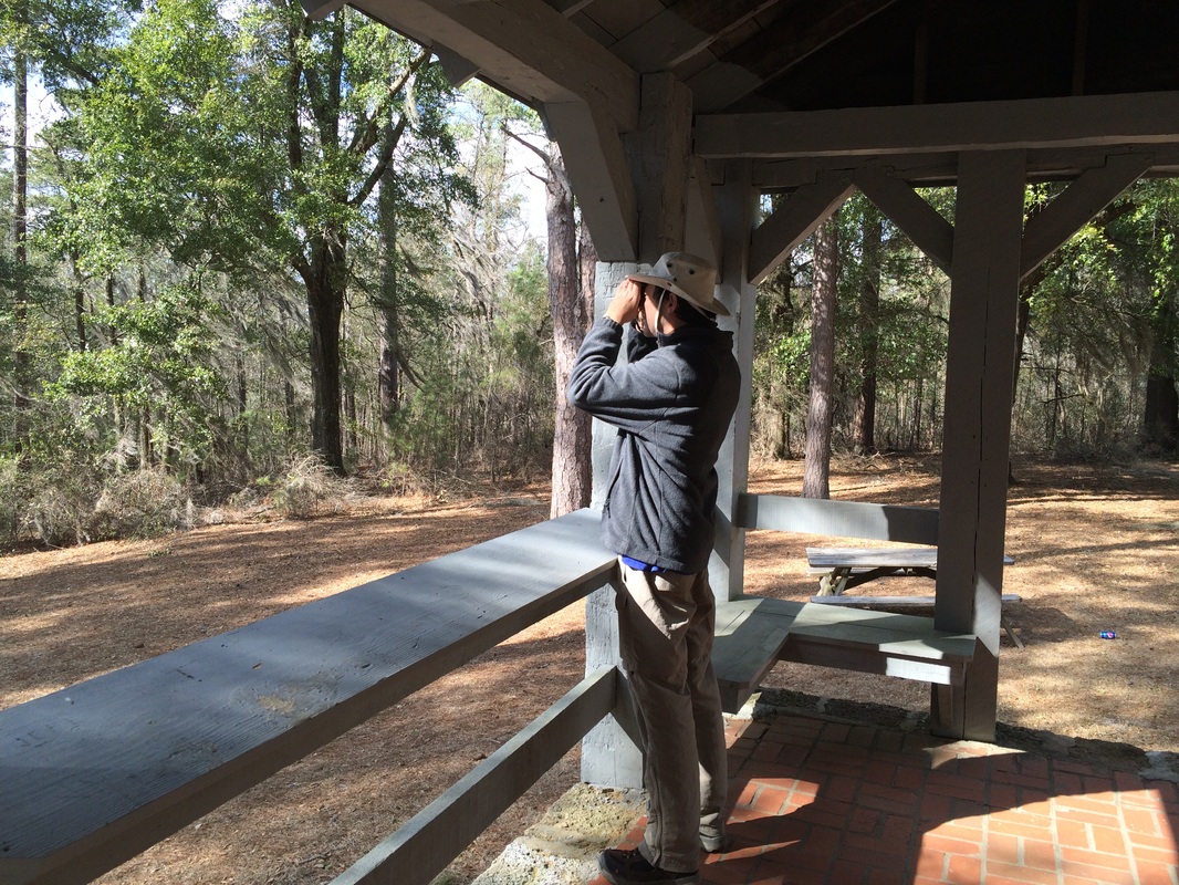 That's me in the gazebo, making with the stoic pose, looking through binoculars at the far row of hills. | 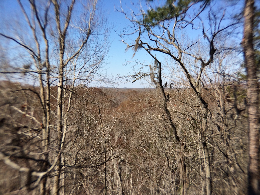 Kinda hard to see, but if you look right in the middle, you can see one "peak" higher than the others. I believe that's the same mountain Lawson saw, now called Cook's Mountain, even though it's only 300 or so feet high. |
In any case. I stood atop a ridge where Lawson stood and I saw what he saw. And above all I left tracks in the sand along the same path trodden by Lawson, by Val, by traders and colonists and Indians -- and by walkers and timber farmers and locals today. I don't think many asphalt roads can equal this.
I spent a few days on the road -- a REAL road.
I recommend it.
I spent a few days on the road -- a REAL road.
I recommend it.
 RSS Feed