. That feeling when you have recently been in a little momentary difficulty outdoors with your kids. I would never say danger, because come on. But a wobbly canoe in conditions that are windier than is really safe, with not just wind waves but a surprising swell on the wide Pamlico, still a river where we were, not yet the sound but with a fetch that allowed an unkind headwind full access to our every square inch. Meanwhile everybody wearing life vests, no less, and able to swim.
But still. Scudding clouds, that 15-mph headwind that would turn the canoe sideways regardless of my wishes, a frustrated 10-year-old in the front seat working as hard as he could but still more sail than powerplant. A cheerful 7-year-old clutching the yoke, keeping low as he had been trained, shouting, "This is so fun!" as the swell lifted the front of the canoe, then slapped it down, sometimes wobbling widely enough that we all leaned hard counter-wobble. By which point I had stopped thinking it was fun one bit.
Anyhow: after about an hour of this we wrestled our craft safely to a dock, then to shore, and help came. We had the remainder of our day, about which more later, but -- every now and then, all afternoon. Gussie, 7, would pull me and his brother near, and instigate long, tight, hungry group embraces; Louie, 10, did not show his usual resistance. And I would see them walking, or playing, or talking to new friends, and suddenly that hollow feeling, and the elevator drop in my stomach, and we were in the water and it was windy and i wasn't sure if i could control the canoe and these are my babies and it's just the Pamlico and if we get blown to the other side we'll be fine but oh god my babies and again: no real genuine danger. But still.
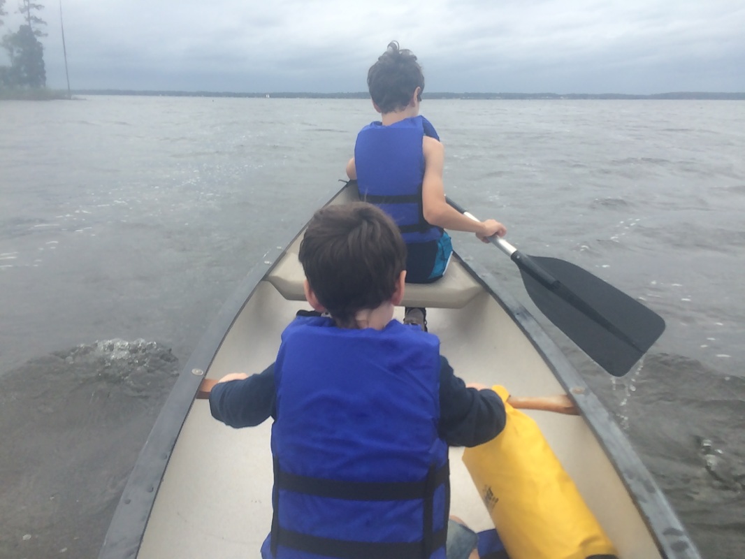
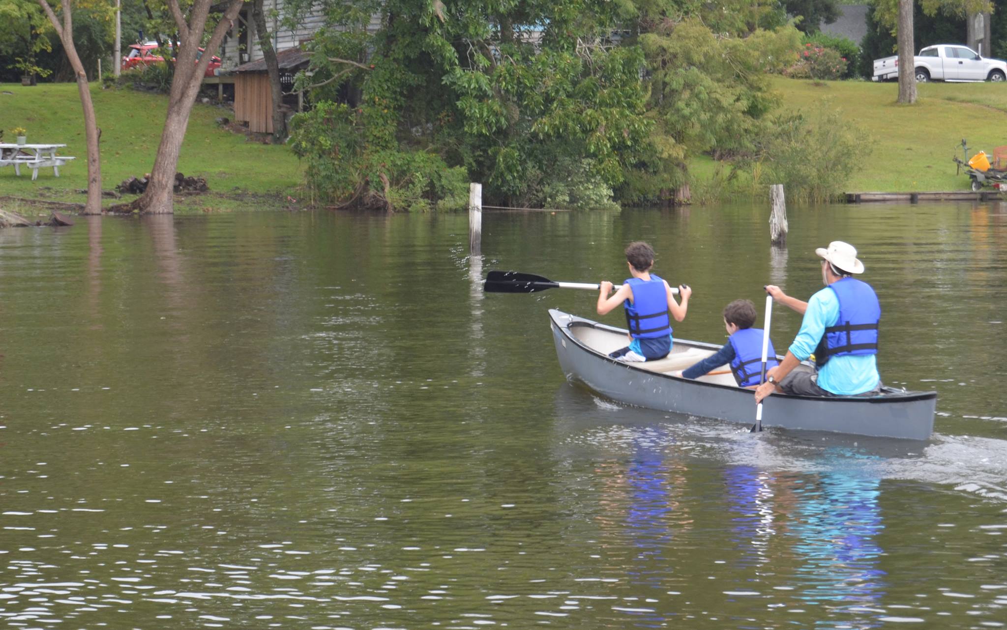
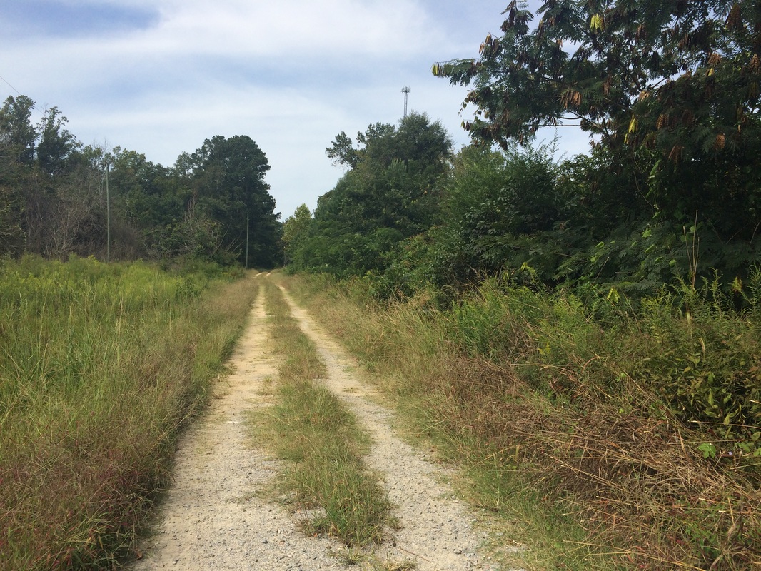
This is the only picture I took during the canoe trip. you can see the water just starting to get wavy, and the point on the left means we're just nearing the mouth of Duck Creek. In about another two minutes we found ourselves on the Pamlico River and there wasn't time for any more pictures after that.
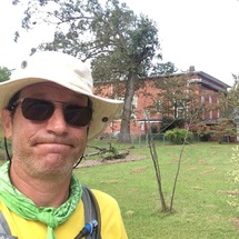
 Photo from Flickr by Lesley Loop.
 So anyway, to the beginning of this last Lawson Trek adventure story.
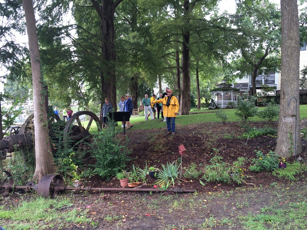
Leigh Swain, who's in charge of things at Historic Bath, has been a supporter of the Trek from the start, and she reached out as we neared the finish and asked whether, since Lawson himself co-founded Bath, owned properties there, and lived there for a while, we'd like to give the Trek a ceremonial finish by paddling in to Bath and addressing the assembled townspeople.
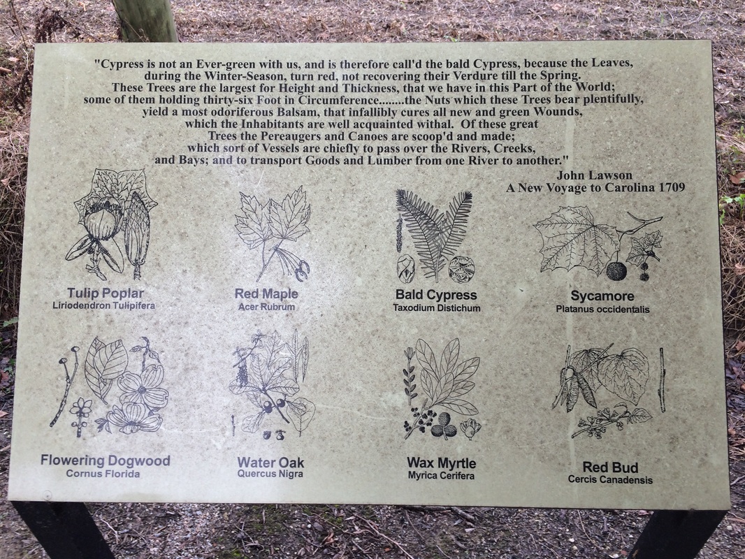
I came to love the idea, especially because it would allow me to bring along Louie and Gus and would, neatly, allow me to finish my undertaking by stepping out of a canoe, just as I had begun it by stepping into one last October. Lawson spent the first week of his trek in a canoe, making his way through the tidal creeks along the South Carolina coast before heading up the Santee River, where he and his companions quickly abandoned their canoe and took to the trails. He finished near what is now Washington, NC, a couple months later, and a few years after that helped to found and survey Bath, so Bath is probably the place most associated with Lawson in this world. They have a historical marker there for him and the Lawson Walk, a little dirt path on which grow several trees and other plants Lawson wrote about. They even have, if Vince Bellis is to be believed, a pile of bricks and stones that might be fragments of the chimney of Lawson's old home.
Leigh Swain, who's in charge of things at Historic Bath, has been a supporter of the Trek from the start, and she reached out as we neared the finish and asked whether, since Lawson himself co-founded Bath, owned properties there, and lived there for a while, we'd like to give the Trek a ceremonial finish by paddling in to Bath and addressing the assembled townspeople.
I came to love the idea, especially because it would allow me to bring along Louie and Gus and would, neatly, allow me to finish my undertaking by stepping out of a canoe, just as I had begun it by stepping into one last October. Lawson spent the first week of his trek in a canoe, making his way through the tidal creeks along the South Carolina coast before heading up the Santee River, where he and his companions quickly abandoned their canoe and took to the trails. He finished near what is now Washington, NC, a couple months later, and a few years after that helped to found and survey Bath, so Bath is probably the place most associated with Lawson in this world. They have a historical marker there for him and the Lawson Walk, a little dirt path on which grow several trees and other plants Lawson wrote about. They even have, if Vince Bellis is to be believed, a pile of bricks and stones that might be fragments of the chimney of Lawson's old home.
But I was going to tell you about gratitude.
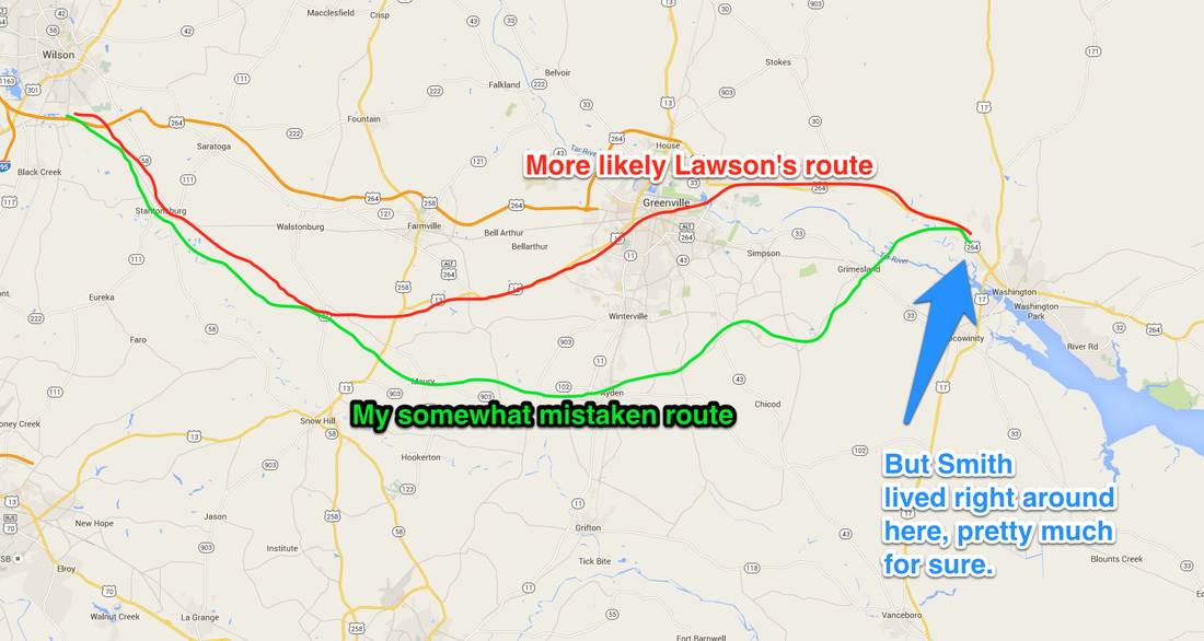
To my ears Leigh's idea that we paddle in initially had originally sounded a little overmuch to me -- I wished to end as Lawson had, at Richard Smith's land west of Washington. And I did, but all I did there was stop walking. Much as Lawson had, of course, but it lacked a certain sense of finality, especially as the very next thing I did was start walking again, to get to my car in Washington (I got a ride for the last couple miles from Russ Chesson of the Estuarium in Washington). Fortunately by the time of that slight anticlimax I had already arranged with Leigh to paddle in to Bath, so I had a new Finish to look forward to, and if it was a bit conjured up, well, isn't this entire enterprise a bit conjured up?
So I planned for Bath, and my two boys wanted to come with me, which felt even more fun. They had stood on the dock and waved me out as I began this journey last October, accompanied by a guide and some bottlenose dolphins, and I liked the idea of steeping back out of the canoe with them along at the end. I gathered up canoe, life vests, paddles. Where to put in was a quandary. There was nothing authentic about the journey, so we could start anywhere. We considered simply going from Bonner's Point at the southern tip of Bath up Bath Creek to the community dock, but at less than a mile of paddling that seemed a little small. So I grazed Google Maps, finding various likely docks along the Pamlico, figuring that somewhere a mile or two upstream would be a pleasant dock and a family that wouldn't mind us using it to dump in. Once we saw that the weekend was going to be all over rain and wind, we gave up ideas of camping at Goose Creek State Park and decided to just drive down early Saturday, the day of our paddle.
Enter Seth Effron. An old friend from my days at the News & Observer, Seth and his wife, Nancy, have put up a house on a piece of the land Nancy grew up on -- and the house, which they planned to be staying at that weekend, was on Duck Creek, about a 5-mile paddle from Bath. Seth reached out to say they'd be coming to the event at Bath to hear me talk after we landed. Where did I plan to stay? Would I like to stay with them and put in from Nancy's brother's dock next door?
I would. Thus did three Lawson Trekkers bed down in their delightful house, breakfasting on eggs from next door, bacon from a pig who had been known to the neighborhood when he was still using the bacon himself, and toast with blueberry ginger jam Nancy had made herself. The day had dawned cool, drizzly, and windy. The breakfast helped.
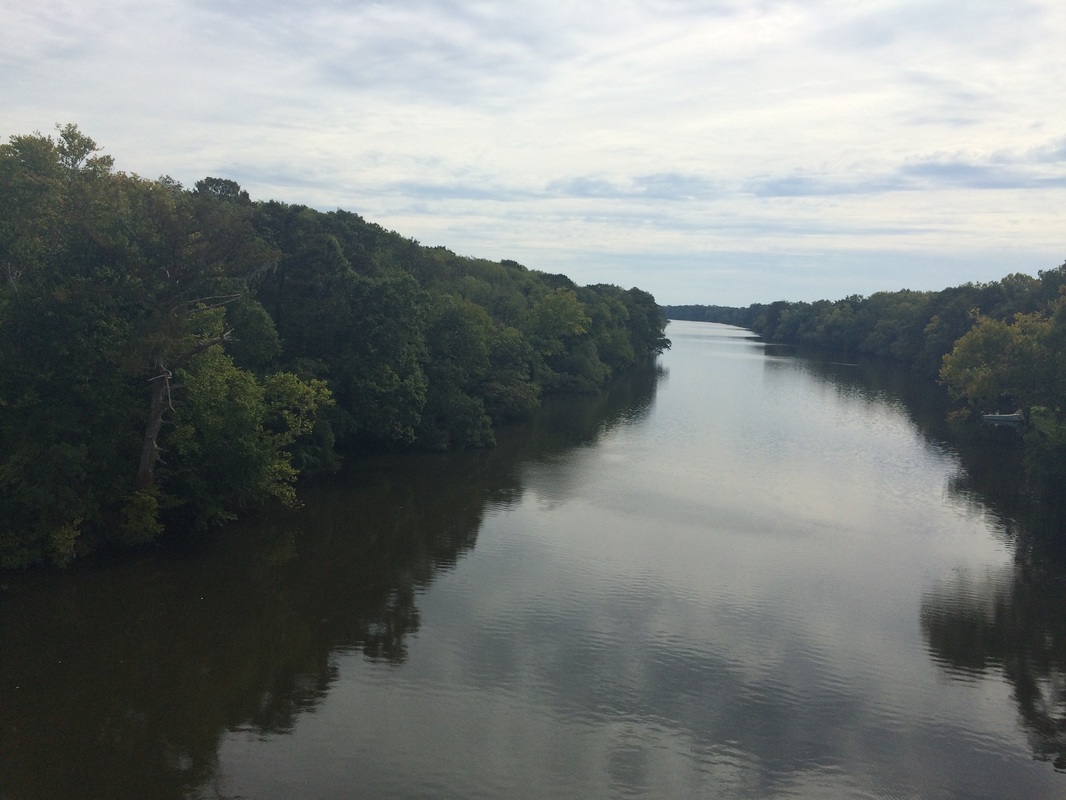
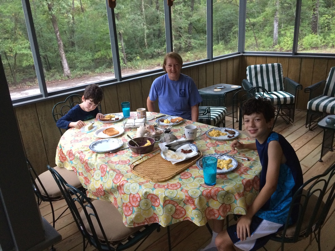 Gus, Nancy, and Louie enjoying breakfast on Seth and Nancy's delightful screen porch. You can see Duck Creek from the porch, and you can see across the Pamlico from the creek. | 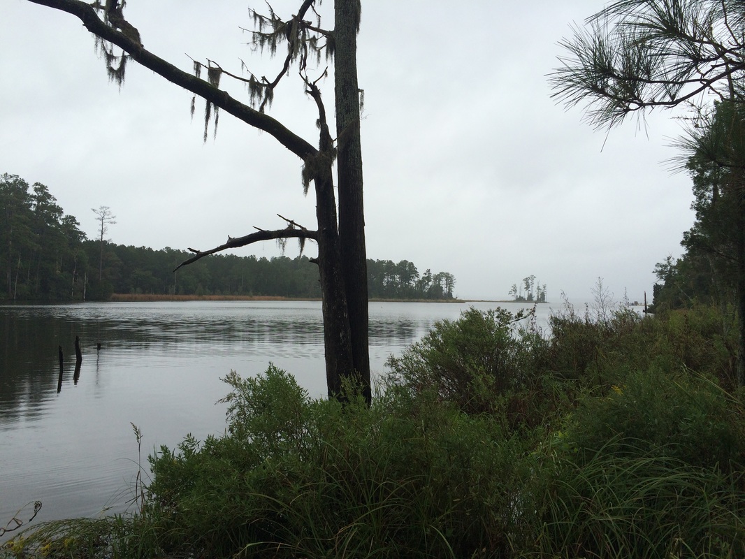 The Duck, and the Pamlico beyond. The trees and the Spanish moss and the grasses just posing because they're hams. |
We put the canoe on the dock, drove to Bath to leave my car there, enjoyed some of the activities, and headed back so Seth and Nancy could drop us in around noon, to arrive in Bath by paddle around 2 p.m.
Right. The paddle started nicely -- we put in on the Duck, Seth took our picture, and off we went. The Duck runs southwest towards its mouth, so though a strong breeze pushed us effortlessly down, I didn't worry.
Right. The paddle started nicely -- we put in on the Duck, Seth took our picture, and off we went. The Duck runs southwest towards its mouth, so though a strong breeze pushed us effortlessly down, I didn't worry.
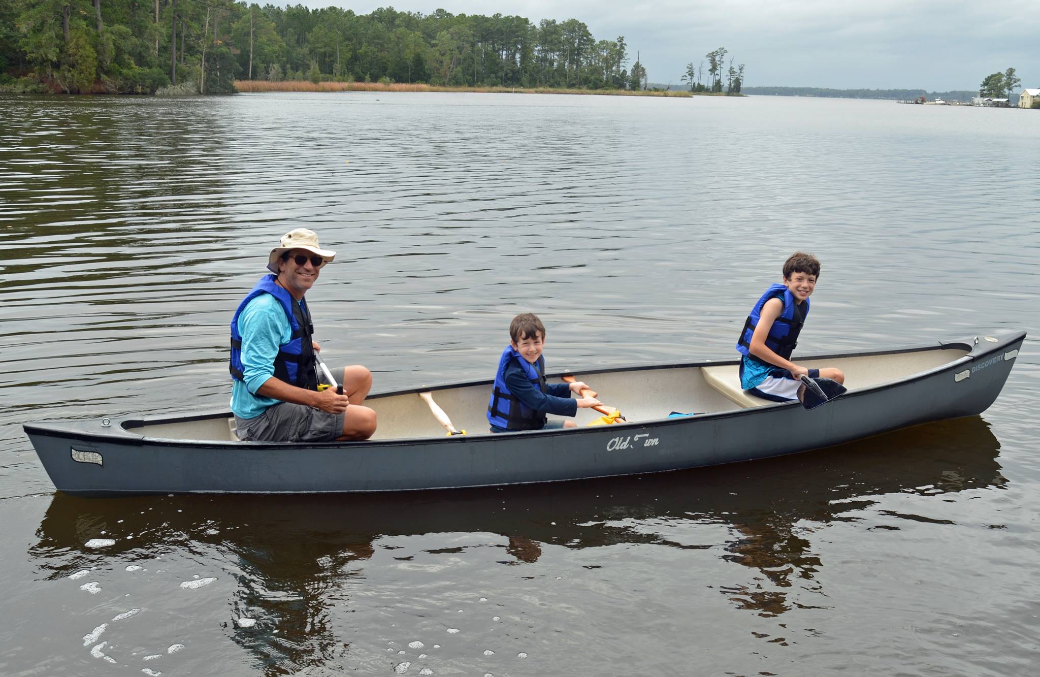 Intrepid travelers set out on the Duck Creek. Photo by Seth Effron. | Dumbass. Any breeze strong enough to push a canoe without paddling will make you very unhappy if you don't happen to be going exactly downwind. Which, once we hit the Pamlico River, were were doing the exact opposite of. Louie instantly had to wrestle manfully with his paddle just to keep it in the water, and Gus clutched the yoke, shrieking with glee as we were blown hither and yon. I had sometimes to tell Louie to pull in his paddle and scrunch down in the bow so I could get us oriented nose in to the headwind, and then as soon as he sat back up and lifted his paddle, he'd function as a sail and the craft would turn sideways and there we were again, being |
blown towards the southwest shore of the Pamlico instead of paddling northeast towards the mouth of Bath Creek, a couple miles downstream.
As I mentioned above, I took one picture while we were enjoying the tailwind, and once we rounded the point never took my hand off my paddle. On the map it looks like where I finally called the coast guard -- Seth and Nancy -- was about 1.6 miles' paddle from the dock, but I'm going to guess it was at least 50 percent longer for all the being blown backwards. We got turned sideways and around enough times ("Whee! This is so fun, dad!") that I eventually doubted our capacity to make it another mile and a half to the Bath, to say nothing of another couple miles up the Bath. To say nothing of coming home and telling my wife, "Well, I made it to Bath and the Trek is done, and we have at least half as many kids as I started out with, so that's good, right?"
I wrestled us over to a dock, between whose slats the water would geyser up when the swell came by. I hauled the canoe up, then Louie and I hauled it to the actual shore. I called Seth and Nancy; Nancy took the kids for milkshakes while Seth and I got the canoe and loaded it onto my car. Nancy was not having any of this "we're done" business -- we were just going to put back in at Bonner's Point and the boys and I would paddle up the half-mile to the town dock like we had said we'd do.
Which we did, but not before another half-hour of precision canoe drilling, with me shouting Louie into the bottom of the canoe and even Gus getting that this was just way harder than it needed to be as we got blown backwards and clear across the creek.
But it ended well. I finally got us pointed right, took advantage of a brief drop in the wind to get us across the creek, and got Louie to head us in, as reward for his hard work. "You have the bridge, Mr. Sulu" -- and he never looked prouder. A gathering on the shore cheered us in, and I can pledge to you that I have never been happier to step out of a canoe. Finished indeed.
 Seth in the yellow, Nancy in the blue, and a good dozen or more others cheered us in. And you know what? By that point I actually felt like we deserved it. | 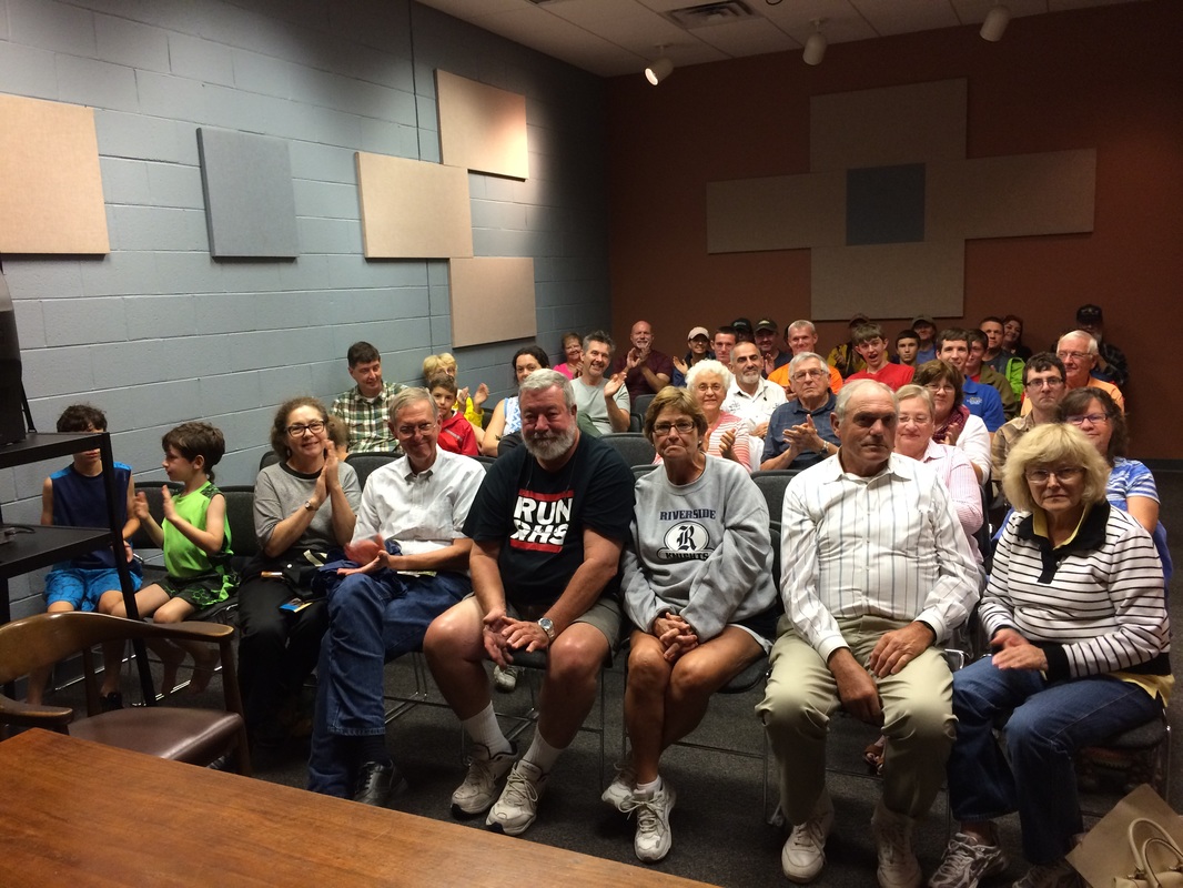 And this is what it looked like when I stood up to talk to people who care a lot about Lawson at the Historic Bath visitors' center. Gratified that so many braved bad weather to come hear us. |
Lawson had his own canoe misadventures -- he describes almost being blown to sea by "a tart Gale at N. W. which put us in some Danger of being cast away, the Bay being rough, and there running great Seas between the two Islands," and another time he tells how his "Canoe struck on a Sand near the Breakers, and were in great Danger of our Lives, but (by God's Blessing) got off safe to the Shore," and I am inclined now to believe he in no way exaggerated. And he had five friends and four Indian guides paddling -- and no children to worry about.
I told the audience at Bath that I could see now why Lawson took his journey before he had any children to worry about, and I got a good laugh, but I wasn't kidding. We were never in danger. But I was scared. Those are my kids.
I told the audience at Bath that I could see now why Lawson took his journey before he had any children to worry about, and I got a good laugh, but I wasn't kidding. We were never in danger. But I was scared. Those are my kids.
The Lawson Trek heading in to shore at last.
Anyhow. Then a delightful hour spent talking at and with a room full of fellow Lawsonians, a fond farewell to our various hosts, and a dinner with Val Green, my forever guide, and then we were driving home through more driving rain.
Lawson started his journey with unexpected friends in Charleston, was taken in and cared for by every group of settlers and Indians he met, and finished it with generous hosts near Washington. I started mine with the vast and unexpected generosity of Kathie Livingston and Nature Adventure Outfitters last October, met almost nothing but a constant parade of generosity, support, and kindness on the way, and finished the outdoor portion of this project with yet another outpouring of help unlooked for and enormous assistance at Bath.
I stepped in a canoe in Charleston October 12, 2014, and stepped out of one in Bath on Saturday, September 26, 2015. Every second -- well, maybe not the seconds where I was wondering whether I was going to drown my children, but every other second -- was a delight. It has been an honor to share Lawson's journey with you.
What's Next?
The Lawson Trek will be a book before it's done, and I'll share pieces of it as I produce it. In coming weeks and months I'll blog about people -- Val Green who knows more about Lawson than any other living person, John Jeffries of the Occaneechi, my many friends with the Catawbas, the people in the Lancaster and Boykin and Camden and Durham. I'll blog about stories -- von Graffenreid's insane narrative of the founding of New Bern and the death of Lawson, for example. I'll tell you about science -- the missing apex predators like wolves, the new ones like coyotes, the destruction of the rivers of the Carolinas and the invasion of the invasives.
And I expect I'll tell you about cool stuff I come across and about how good it feels to be just in my office writing, too.
Anyhow, the Trek itself is done, but the Lawson Trek isn't going anywhere.
Actually, let me say that again, because gracious, after a year of constant motion, it has a lovely sound: the Lawson Trek isn't going anywhere.
 RSS Feed