The Lawson Trek
  • Home
    • About
    • Interactive Map
    • The Trek
  • Along the Path: Blog
  • John Lawson
    • "A New Voyage to Carolina"
    • The Carolina Colony
  • Talk to us!
  • Store
  • Press

Along the Path

Updates as we learned about Lawson's journey and times -- and reports from the trail as we progressed along it. Plus tales of the process of publishing the result.

The General Store

2/26/2015

1 Comment

 
Picture
One of the greatest joys of the Lawson Trek, it all but goes without saying, is the people. South Carolina people tend to have stayed put for generations; they have stories to tell.

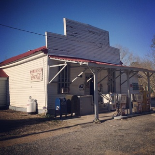
And stories are why I'm out there, really. I finished the fourth and most recent segment of my trek at the tiny town of Horatio, where I stopped at the Lenoir Store, which has been at the crossroads since at the very least before 1808, though how long before that nobody knows -- it pops up in the historical record in the will of one Isaac Lenoir that year, and it's been in the same Lenoir family ever since, represented on a maps from 1825 and another from 1878, by which point the current building stood. It turns out to be the longest-standing continuously run business in Sumter County and probably the whole state, according to my guide, Bubba Lenoir.

The Lenoir name is far from unknown in the south -- Lenoirs in South Carolina, North Carolina, and Tennessee all trace their line back to mariner and tobacco farmer Thomas Lenoir (the French name gives a clue that he, like many other French, came to the colony seeking the religious freedom Carolina offered) who lived first in Virginia before finally settling in North Carolina. Of his sons,Isaac was a soldier in the Revolutionary war and brother to General William Lenoir, who has a namesake city and county in North Carolina. South Carolina has this store.

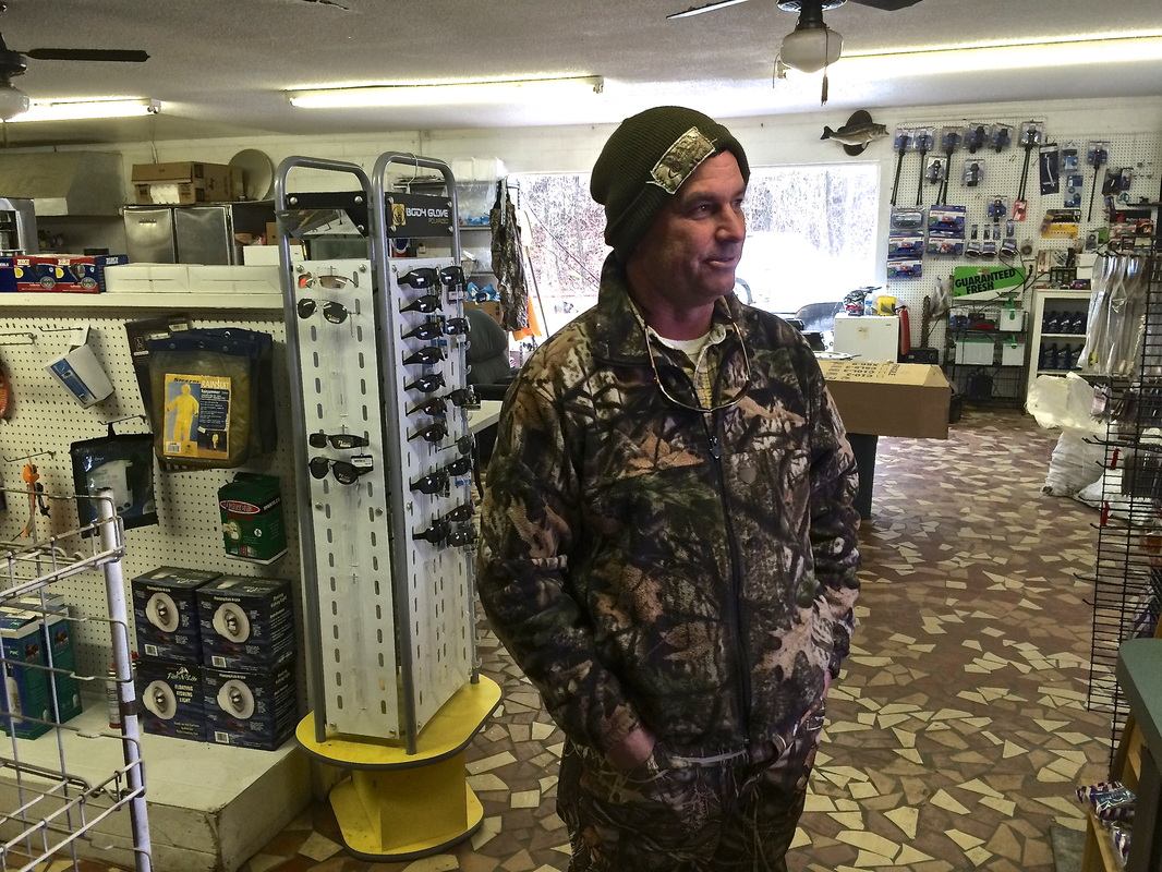
I learned much of this from Beverly Johnson, who was tending the store when I wandered up, cold and hungry, after the last night of that most recent trek. I had been told -- erroneously -- I could get a hot breakfast at the store, which that morning had encouraged me to skip cooking oatmeal and coffee, especially since the thermometer that morning read 10 degrees Fahrenheit, which would have made standing around waiting for water to boil a misery. I walked to Horatio with great expectations of a ham biscuit that would probably be a life highlight.

No such luck. When I came into the store footsore, hungry, and cold, I found no coffee or hot food -- there just aren't enough people in Horatio to justify it, Beverly told me. Like many of South Carolina's small towns, Horatio is losing population, and left behind are large plantation farms and retired people. Given that the store didn't even have central heat -- Beverly stood in front of a space heater and smoked wearing gloves -- I was glad for the shelter, the company, and the surroundings.

And the story. Beverly clued me in, giving a tour of the various old objects still on the store shelves, reading some aloud, and filling me in on family lore. It's one of the oldest post offices in the country and has been the subject of considerable resistance when the USPS considers closing it. As much as I loved it, I didn't want to move in, so I reached out for my ride. But when I called my associates 30 miles south at Pack's Landing, a supply store and boat landing on Lake Marion where I had left my car days before, I found that nobody was prepared at that moment to come get me, and though someone certainly would come and get me, exactly when wasn't entirely certain, nor at that moment easy to predict. 
Picture
Stevie Pack, of the Pack's Landing Packs, whose family has owned the lakeside store and restaurant on and off for 70 years.
So by mutual agreement I went looking for another ride while I waited, and I found that ride not 50 feet away when behind the wheel of a white Chevy pickup that had driven to the mailbox in the frigid weather I found Bubba Lenoir, Beverly's cousin, who not only ferried me back to Pack's Landing but on the way gave me a historical tour of that segment of Sumter County. The Lenoirs, he said, are the subject of the book Happy Valley, which discusses the history of the Yadkin valley in North Carolina, where Lenoir sits. 

The house Bubba had emerged from was built in 1954, and Bubba told me the story of its predecessor, built in 1760, burning on Thanksgiving morning, 1953: "Daddy said 'Don't grab nothing, just get out,'" he recalled. "The whole house was built out of fat lighter" -- pitch pine, which burns like a candle. "We just did get out." Bubba stopped at St. Mark's Episcopal Church, to which he had the keys, and we explored the cemetery and the church itself, established in 1757 and currently in a building, created of local clay, built a century later. 
Picture
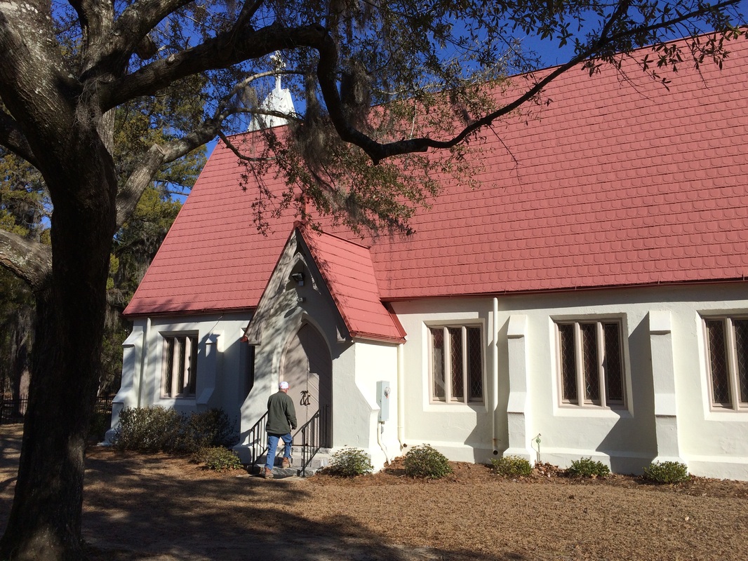
Bubba Lenoir opens up St. Mark's Episcopal Church as he tours me around. To the right, the lovely view down the nave.
Picture
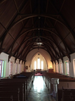
"There were a lot of Richardsons around here," he says, when we look through the graveyard. The Richardson cemetery is a few miles away, and there is buried Richard Richardson, perhaps the most important of all colonial South Carolinians -- born in 1704, a Revolutionary War hero, and the progenitor of a family that has provided South Carolina with six governors, all of whom worshiped at this church. Little means more in South Carolina than the name Richardson -- when my new friend Zabo McCants, manager of Poinsett State Park, told me about himself, he mentioned that  "my grandmother is actually a Richardson." The South Carolina state song is the Richardson Waltz, passed down for 300 years by ear from Richardson to Richardson (click on the link -- you can hear it played by an actual Richardson).

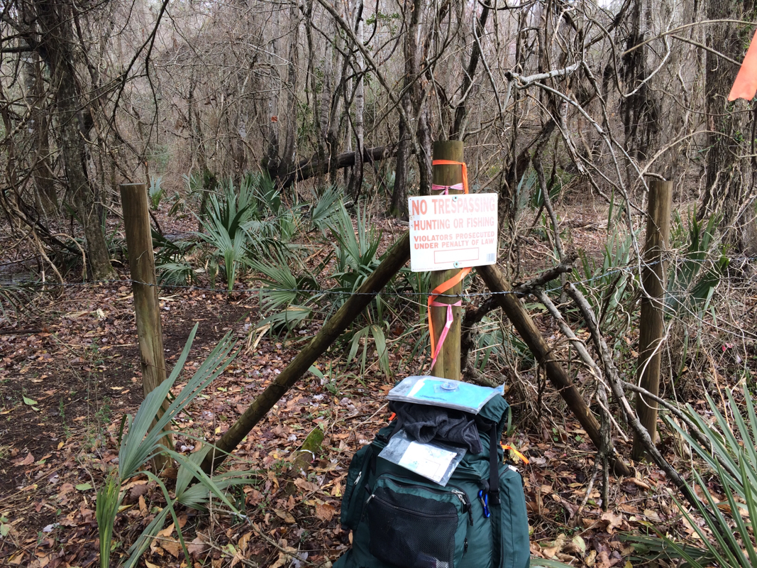
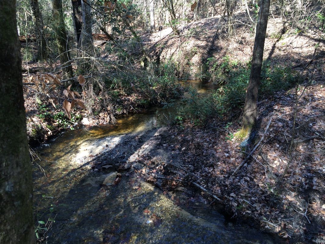
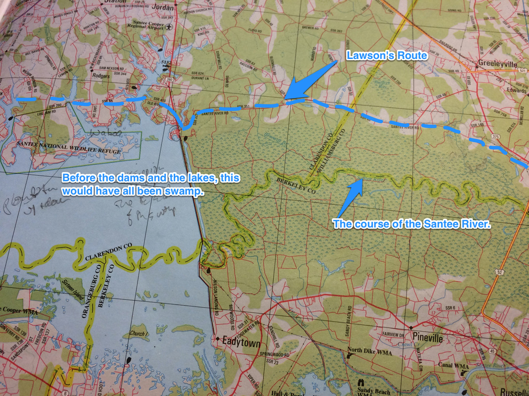
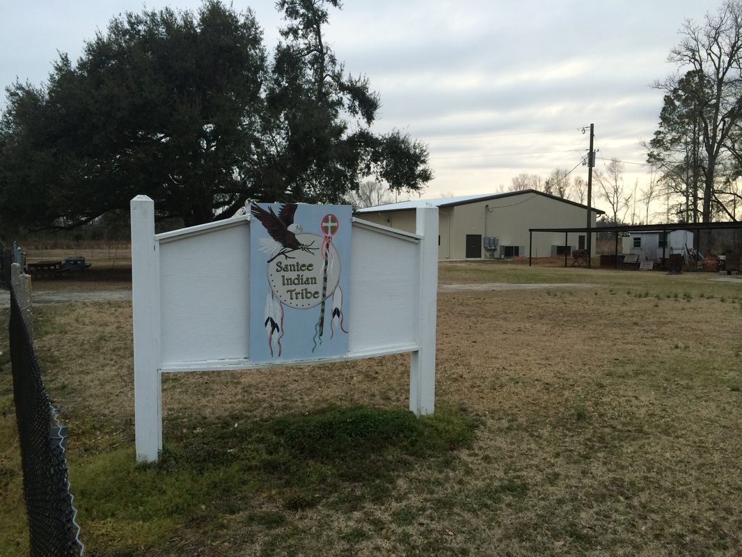
Anyhow, between the Richardsons and the Lenoirs and the abandoned railroad I had camped near I got to feeling I had really managed to learn a bit about Sumter County, to say nothing of the route Lawson would have trod. The Lenoir Store only stood where it did because the old Mississippian Indian trail to the Santee Indian Mound ran by there, and that trail had become the dirt road along which I had walked, and that had given rise to the railroad -- since abandoned -- and the asphalt Horatio-Hagood Road I'd finished my trek segment on. 

Bubba and I cheerfully conversed until we pulled into Pack's Landing, where talk instantly turned to  the kind of good natured foolery that makes places like Pack's Landing -- and the Lenoir Store, and for that matter Sumter County -- the wonderful places they are. "What's the population of Horatio?" needled a fellow named Duck, who would have come to pick me up had I been more patient. He pronounced it HO-ratio. "Well, this morning it's about 25, since I'm down here," Bubba said, and off they went. They got into game wardens and how to manage them, they teased me about sleeping outdoors the night before in 10-degree weather ("You didn't have to worry about no mosquito bugs," Duck said, meaning me and Lawson at this time of year), and when I left they were talking about someone Bubba had played football against in high school.

Lawson took his long walk, basically, to see what was out there -- to meet the inhabitants and see the country. I felt delighted to have done just that. 
Picture
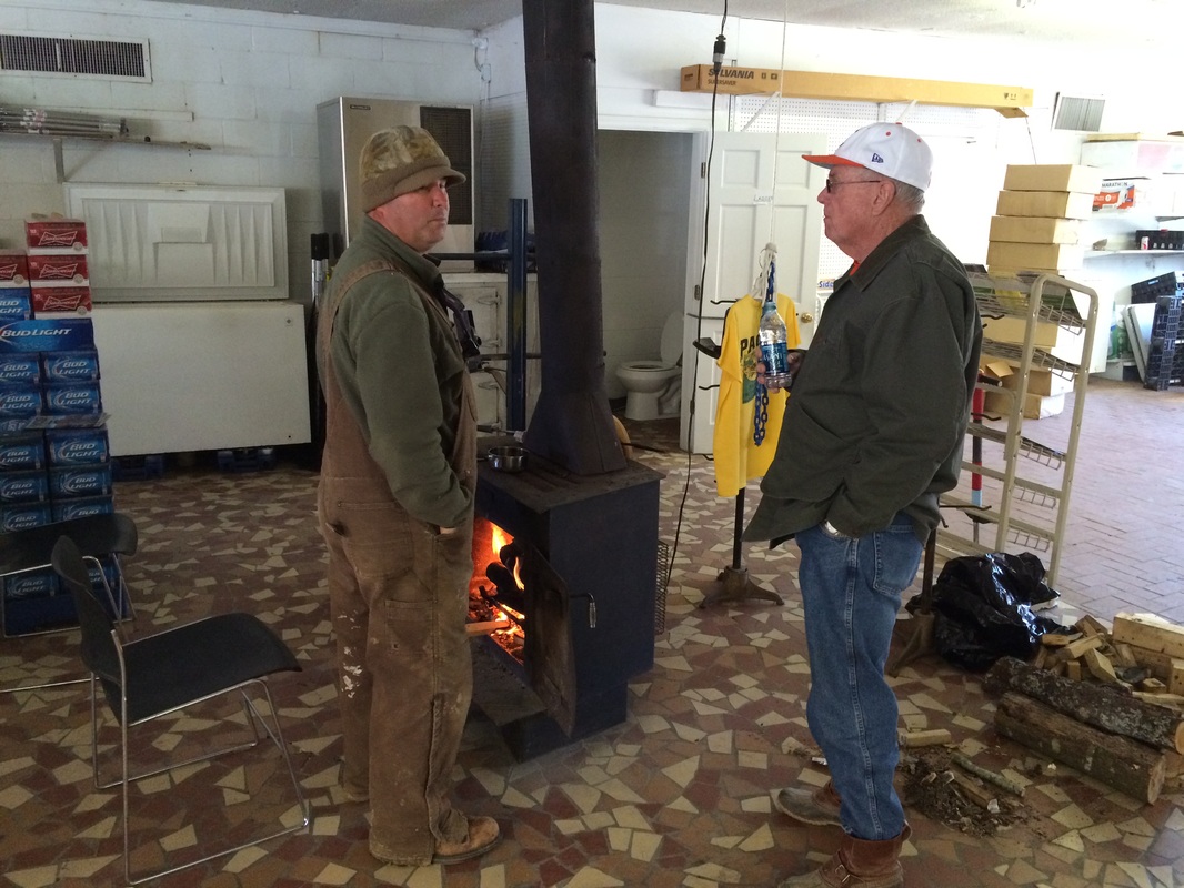
Andy Pack, left, and Bubba Lenoir chat around the stove at Pack's Landing after Bubba drove me down there at the end of my walk. Pack's Landing is a good place.
1 Comment

The Roadness of Roads

2/23/2015

0 Comments

 
At the intersection of swamp and No Trespassing, the trail ran out. No sign, no further blazes, no marking: nothing. It just ran out there in the swamp.
Picture
So I did what you do, wandering and poking and eventually finding A path, which was going sort of in the right direction and eventually hooked up with THE path, a quarter mile away or so, and I went along my way. But this is what comes of walking on wilderness paths rather than roads, and I have walked a good bit on both over the last segment of the Trek and, surprising nobody, I have something to say about it.

My friend Dale Loberger not long ago gave a small seminar on how to find old roads -- I remember thinking he was talking about the Roadness of roads. That is, a road is a fairly simple thing: it starts someplace travelers are, and it leads someplace travelers wish to be. Whether those travelers are animals, native Americans, colonists, carts, railroad trains, or automobiles -- or, as in many cases, each of those in succession -- a road is a connector. Perhaps not the shortest but the best way between two points.


Look at an old map, Loberger told us, and the drawings of roads worried less about exact representations of twists and turns than on connections: from the Indian town to the good place to ford the river; from the trading post to the harbor; from the town to the good pass through the mountain. A road in some way invented itself. It partook, Platonists might say, of Roadness.

Picture
Like, for example, the way I've been traveling this Trek, when i'm not cursing my way along sometimes-maintained wilderness trails whose organizations are trying to do a great deal with few resources. (The trail that frustrated me this time was the Palmetto Trail, a fine trail-in-progress stretching the length of South Carolina that suffers from logging that destroys it and, again, with trying very hard to do much with little.)

I've been walking along a sand road that has probably been trodden by human feet for a thousand years of more. It follows a route that was an Indian path during the Mississippian period, stretching all the way to the Santee Mound we visited during our last trek. The Indians walked it. Lawson and his group walked it. Colonials walked it. "There aren't too many roads in American that are a thousand years old," my friend and fellow Lawsonian Val Green says. "But this one is." (More on Val soon, by the way.) (And by the way, calling Val a "fellow Lawsonian" is a bit like calling LeBron James a fellow basketball player; Val is the king of the hill, by an order of magnitude.)

Anyhow. I spoke to Val as I planned this segment, which follows the swamp on the northeastern edge of the Wateree River, which joins the Congaree to form the Santee, on which the Trek has spent so much time. These rivers are named for the native tribes who lived along them, and Lawson describes them all, visiting their towns as he moves along.

But the path he describes would have lain, naturally, on the far edge of the swamp -- the path that could have been depended on to be dry most times, regardless of the state of the river or swamp. Last segment we visited the Santee Indian Mound, considered the easternmost edge of the Mississippian Indian culture. Since then, more or less, we've been following a trail along the Santee and Wateree that would have connected all the tribes along the waterway. 

It's been mostly asphalt before, but this time I've been on dirt roads -- more correctly sand roads, since as we've exited the coastal plain we've entered sand hills, the result of the floor of an ancient sea near its shore. 

Anyhow, I've walked these sandy miles, and every step has radiated roadness. A stand of holly -- a ton of holly in these hills -- to the left, commonly a pine farm to the other side. Dips down to creeks, rises to plateaus, and occasionally a home site or church, a graveyard, a stand of deciduous trees showing that once upon a time a home stood nearby. It's a lovely kind of walking that makes you feel that you simply are where you ought to be. To be sure, Route 261, the state asphalt two-lane that generally follows the same path only more smoothly and faster, is a half-mile to the west. But this sand road, skirting the edge of the swamp, exudes a kind of patient assuredness that its adolescent asphalt cousin cannot duplicate.

Lawson describes this path, mentioning camping "by a small swift Run of Water, which was pav'd at the Bottom with a Sort of Stone much like to Tripoli," a kind of silica schist often called rottenstone or fuller's earth. I passed while walking this segment at the Tavern Creek, whose banks are covered with just that, and it flows just as swiftly as ever. More important, when Lawson and his friends told their Indian guide, Santee Jack, that they'd like to hang around the creek another day, he assured them they'd be happier half a day further. 
Picture
Call it Tripoli, as Lawson did, or Fuller's Earth or rottenstone, this stuff crumbles from the banks of the Tavern Creek, assuring historian Val Green that he had pegged Lawson exactly where Green thought he was. And me too, once Green pointed the way.
Picture
Swift running to be sure, to say nothing of lovely and delightful. If I hadn't been chilly, I'd have sat down for lunch by this shady spot.
So they went -- as did I -- and a half day further we were all rewarded with the view from the overlook at Poinsett State Park. (Named for Joel Poinsett, the South Carolinian for whom we name the Poinsettia). Atop a genuine hill -- it's several hundred feet up, and you notice it when you climb -- you look to the west, down across the swamp the road has skirted for miles.

""We mov'd forwards, and about twelve a Clock came to the most amazing Prospect I had seen since I had been in Carolina; we travell'd by a Swamp-side, which Swamp I believe to be no less than twenty Miles over, the other Side being as far as I could well discern, there appearing great Ridges of Mountains, bearing from us. W.N.W."

If you go to Poinsett State Park (and I think you should), there is an Overlook Shelter, a little gazebo atop the park's high point. and from it, looking west and northwest, you have a view over the swamps that is, truly, the first great prospect you'll find as you travel into the Carolina midlands. Val Green (him again!) met me here, and he pointed out that if you look carelessly you easily see the ridge of pines on the far edge of the Wateree Swamp, which is several miles distant. But if you look very carefully -- I brought binoculars against just such a possibility and was glad of it -- you can see, in distant, faded blue, the line of hills on the far side of the Congaree swamp, a good twenty miles distant.
Picture
If you look carefully, you can see more than the close row of trees, which defines the far edge of the Wateree Swamp -- the other edge of the swamp along the river Lawson was following. You can also see, towards the left of the horizon, another deep blue line. That's the range of hills on the far edge of the Congaree Swamp. And just as Lawson thought, it's a good 15 to 20 miles distant. An amazing Prospect indeed.
Lawson mentions that "One Alp, with a Top like a Sugar-loaf, advanc'd its Head above all the resst very considerably," and until recent years, both Val and park manager Zabo McCants tell me, you could see Cook's Mountain, ten or so miles away to the north-northwest. Timber has grown up to block the view, but since a paper mill now stands in that direction too, Zabo says he's loth to cut down the screening woods, because exposing the charming Cook's Mountain would expose much that is less lovely.
Picture
That's me in the gazebo, making with the stoic pose, looking through binoculars at the far row of hills.
Picture
Kinda hard to see, but if you look right in the middle, you can see one "peak" higher than the others. I believe that's the same mountain Lawson saw, now called Cook's Mountain, even though it's only 300 or so feet high.
In any case. I stood atop a ridge where Lawson stood and I saw what he saw. And above all I left tracks in the sand along the same path trodden by Lawson, by Val, by traders and colonists and Indians -- and by walkers and timber farmers and locals today. I don't think many asphalt roads can equal this.

I spent a few days on the road -- a REAL road.

I recommend it.
0 Comments

A Good Camp

2/18/2015

1 Comment

 
Picture
Picture
Picture
Picture
Picture
1 Comment

Snow

2/13/2015

0 Comments

 
John Lawson mentioned encountering snow -- once.


Which might have been surprising, given that he took his journey during the coldest period of the Little Ice Age. 
Picture
WInter Landscape, by Jacob von Ruisdael, was painted a few years before Lawson's journey and hangs in Mauritshuis, The Hague.

Lawson took his trek mostly over the winter of 1701, and he complained no small amount of the weather, though his first mention concerned its failure to kill pests: "Although it were Winter, yet we found such Swarms of Musketoes, and other troublesom Insects, that we got but little Rest that Night," he says of his third night on the trail, which would have been late December, 1700.

About a week later, he describes his first night inland, on the Santee River, as "lying all Night in a swampy Piece of Ground, the Weather being so cold all the Time, we were almost frozen ere Morning, leaving the Impressions of our Bodies on the wet Ground. We set forward very early in the Morning, to seek some better Quarters."

He further mentions the cold when he approached the Santee Indians, whose descendants I found so welcoming. Lawson and one of his companions got dunked in a river (they were drunk): "All our Bedding was wet," he says. "The Wind being at N.W. it froze very hard, which prepar'd such a Night's Lodging for me, that I never desire to have the like again: the wet Bedding and freezing Air had so qualify'd our Bodies, that in the Morning when we awak'd, we were nigh frozen to Death, until we had recruited our selves before a large Fire of the Indians."

My point is not that he was cold -- it was winter; he mentions being snowed on only on his last night on the trail. My point is only that snow was not an enormous part of Lawson's experience, so we lack recollections in his cheerful, observant tone of how colonists dealt with snow.

The Lawson Trek visited Cambridge last weekend, though, and snow was very much a part of my experience. Boston has set records for snowfall all winter long this year -- Juno, the storm immediately preceding my visit, was the sixth-largest snowfall in the city's history; the storm that accompanied my visit (and lengthened it through a delightful flight cancellation) was its seventh-largest accumulation in history,
making February 2015 Boston's snowiest month.

Ever.

I lack Lawson's perspicacity, but as someone born to snow in Cleveland, Ohio, I did not merely glory in the snow experience. I also took delight in, as Lawson would have done, trying to draw conclusions about my subjects through observation. 

Cambridge thinks its streets should have as little snow on them as possible. It snowed on and off from Thursday evening when I arrived and then full-time from sometime Sunday Feb. 8,  as I recall,
getting 22 fresh inches before I got out. The first night, before acclimating, I awoke all night to reversing trucks and grumbling plows. When I flew out Tuesday, through those huge airport windows I watched enormous melters belch clouds of smoke as they sloshed loader buckets full of scrapings into roiling grayish brown soup. Every minute I spent outdoors the entire weekend I could either see or hear vehicles noisily pushing, plowing, salting, digging, carrying, or otherwise assaulting snow. Blinking yellow lights glinted off the snow especially at night. 
Picture
Anywhere you point your camera, yellow lights.
Picture
Though to be honest, once you're in the magical night time, Cambridge is pretty awesome in the snow with or without blinking machines.
They plowed the sidewalks too, mind you. Getting the snow moved so you could get from here to there? They do that constantly. On Monday, in the teeth of the storm, trucks circulated Cambridge streets picking up the recycling. 

On the other hand, their public transit doesn't mean much to them. MTBA is the nation's oldest public transit system, and it appears it's old enough now to break in the snow, which it did, shutting down train traffic completely on Monday Feb. 9. Fortunately, they plowed the streets so well my friend had no trouble driving me to the airport. The transit head noisily resigned after the trouble, but it was hardly her fault: you can't run what won't run. 

People cleared out their cars once a day, creating in the blocklong snowbanks of five feet or higher car sized niches, as though for statuary. Cantabridgians often put chairs in the niches when they drive off -- you don't want to spend several hours clearing a parking space in front of your house just so someone else can park there. They seemed to like to wait until plows had gone by once or twice before attacking the piles; that way they could dig out once instead of having a plow suddenly fill back up a once-cleared spot.

Overnight, many pulled their wipers perpendicular to their windshields so they didn't freeze. Kids were coopted for labor, though roving pairs of older kids with shovels appeared to seize the capitalist opportunity to create value with their labor.

What I did was walk. Thrilled by the snow, I walked from my guest digs in far North Cambridge to MIT, on the Charles, time after time, taking every opportunity to walk through -- and get lost in -- the various squares, yards, bookshops, and other enterprises called Harvard. 
Picture
Can Amazon do this?
Picture
Let's go out and play in the yard!
These walks were an almost unimaginable joy. I told one of my fellow KSJatMIT fellows that going into the Cambridge streets was like opening the door and walking out into my childhood. Having grown up in Cleveland and never spent appreciable time in another city that regularly experienced enormous winter storms, I had fallen out of my snow habits. 

There are rules, for example, about one-lane sidewalks, resulting from enough plowing and shoveling that instead of a clear sidewalk you have little more than a path between two huge snowbanks. You politely stand aside in a driveway or other shoveled spot for the person coming the other way to pass. If you wish to overtake someone going the same direction, do it like a car: wait for a wide spot.

If you're walking in the street, it's your own job to keep clear of the machinery. They're busy, and they have work to do.

You leave the house with one pair of boots and all the clothes you'll need all day -- for the freezing weather, the walk that warms you up, the overheated apartment you visit, the underheated office you work in, and the chilly subway station. Clever layer applications help, but patience (and an extra pair of socks in your coat pocket) works best. 

Slush comes in white, gray, black, and two browns, wet and dry. Icee slush looks (and probably is) exactly the consistency of a frozen soda pop. A big bootsplash directly into slush looks like fireworks.
Picture
I love the frozen splash at the bottom.
Picture
i would make a Coneheads joke but no one would get it.
The thicker the socks, the better the skating on well-waxed hallways.

Walks take extra time not because you have to work through deep snow or have to avoid impassable banks or get lost because pathways clearly on your map simply do not exist in snow, though all of that is true.

Walks take extra time because you just keep stopping to look at stuff. Icicles caused by ice dams; houses turned magical by feet of snow. The sound, when it gets one magical degree colder, of snow suddenly starting to squeak; the view up or down an environment ineradicably changed, in a way that makes you never want to forget what you see.

And above all, there is watching snow in streetlights. Squadrons of snowflakes dipping and circling through the cone of light thrown by a streetlamp are the built environment version of the Northern Lights -- limitlessly watchable manifestations of the silent mysteries of night time.

In Cambridge, as annoying and frustrating as, literally, foot after foot of snow could be, I got to stand and watch snow come down through a streetlamp. I'm sorry Lawson never did -- I would love to have his perceptions. 

I hope you all get to do the same.
0 Comments

"A well-humour'd and affable People"

2/4/2015

6 Comments

 
In my first two treks I spent quite a bit of time with the descendants of the French Huguenots, settlers along the lower Santee River who welcomed and housed Lawson after he had made his way down the coast and started up the Santee. Just like their ancestors, the Huguenot descendants fed me, found me places to sleep, directed me, and wished me well.

From the Huguenot settlement Lawson continued north, likely following an Indian path along the edge of the swamp on the northeast bank of the Santee River, now called the Santee Swamp. The first native people he met there were the Santee Indians, whom he described as "a well-humour'd and affable People; and living near the English, are become very tractable."
Picture
Lawson talks about Santee skills in making corncribs, on stilts and daubed with mud, that kept out rodents, thus enabling them to leave them unguarded, "always finding their Granaries in the same Posture they left them."  They needed significant corn storage, "there being Plantations lying scattering here and there, for a great many Miles [along the Santee River]." Especially beans and corn, the Santee, whose name means something like "river people," were great farmers in the rich bottomlands near the Santee River.

Says Lawson, "They came out to meet us, being acquainted with one of our Company, and made us very welcome with fat barbacu'd Venison," and let me promise you, Carolinians have been welcoming visitors with barbecue ever since. 


All of this is to say, from the wonderful hospitality of the Huguenots (which their descendants recreated with me), Lawson advanced to the wonderful hospitality of the Santee, and I was anxious to see if I could meet their descendants and see how time had treated them. I was thus thrilled when Chris Judge of the Native American Studies Center of the University of South Carolina-Lancaster gave me contact information for the current chief and vice-chief of the Santee, Randy Crummie and Peggy Scott. Chief Crummie was working seven days a week keeping body and soul together, so he asked me to reach out to vice-chief Scott, whom I now think of as Peggy and regard as a friend, and who welcomed me to her region just as openly as her ancestors did centuries ago.
Picture
Vice-chief Scott at the South Carolina State House. Red, black, and white are Santee colors.
Picture
Peggy Scott, vice-chief of the Santee Tribe, drove up in a Mustang and greeted with a hug. Wherever Lawson and her ancestors are sitting around retelling old stories, they're probably happy.
We had invited Peggy to meet us on the road, and to walk along with us for a while as part of the Trek. But schedules grew complex and we ultimately met Peggy in our luxe cabin at Santee State Park, named for her ancestors.

Peggy shared the life of a modern member of the Santee Indian Tribe, and let me tell you, it's not all barbecue and affability. "We're the only race to have to prove who you are," she says of American Indians as a minority group. By the way, like many I've spoken with, Peggy tells me she perceives Indian and Native American as equally inoffensive terms; I use the two interchangeably. 
Given that the U.S. government has a Bureau of Indian Affairs, I'm loth to get offended on anybody's behalf. And when I asked Peggy whether she'd grown up identifying as a Santee, she said, "We were identified as a derogatory name, that I don't choose to repeat."

She attended an Indian school, segregated and denied resources to the point where she says "I didn't know what a gymnasium was. I didn't even know what a library was." A couple of her friends went to the high school but were treated so badly they left. She says when she was in fourth grade the Indian school closed and she moved into the middle school, where she describes a segregated system having white and black drinking fountains. If an Indian child was thirsty? "The teacher or principal would go get you a paper cup of water."

It's no surprise, of course. Indigenous peoples like the Santees were already reeling from the results of European contact by the time Lawson met them in 1700. Smallpox had devastated them, rum had taken them unawares, and they had been not only uprooted from their land but commonly enslaved -- Indian slavery was such an enormous undertaking that before 1715, Charleston actually exported more Indian slaves than it imported African slaves. The Santees numbered around 1000 in 1600 but declined as precipitously as their neighbors. In 1711 they fought with the British against the Tuscarora (who had killed Lawson), though by then their number was so reduced that according to The Indian Slave Trade they sent only a portion of a group of 155 that comprised at least seven tribes' worth of warriors. in the 1715 Yamassee War in South Carolina that finally sealed the fates of the Southeastern tribes, they fought with their Indian neighbors against the colonists, but it was basically over when the Yamassee lost. The remnant of the Santee (80 or so people in two villages) moved up the river to join the Catawba or melted into the swamps, just trying to keep away from the colonists, over the years mixing with other outcasts like escaped slaves and poor whites. The wonderful Those Who Were Left Behind tells the story of the South Carolina tribes who remained, explaining how the current Santees may descend from a group of indeterminate Indian background who found themselves a small piece of land southeast of the Santee River in the mid-1700s and have been around there ever since, reasserting the name "Santee" in the 20th century. Exactly what blood runs in whose veins is a subject for debate -- constant debate, given that the Santee Tribe is currently recognized by South Carolina but not the federal government -- but Peggy has no doubts.

"I was born in the middle of my tribe," she says. "My father and the elders delivered me in my mother's bedroom."
Picture
Picture
Things changed for Peggy when her father, in the military, served at Fort Polk in Louisiana. The Army famously sees only green, so for the first time in her life she was taught history and encouraged -- even allowed -- to ask questions. "When you are not educated, when you do not understand your history," she says, "you're lost." She talks about discovering Lawson's book in college: "He is like a huge part of my life," she says of Lawson, who described her ancestors kindly and with admiration. "It's like the whole world opened up when you have access to your history."

It's still complex. She has a son. "The old saying is you have to have one to put in this world and one to put in the other world," she says -- a child for the Tribe and a child for the greater society. For her part, she has embraced all aspects of her complicated background, though that's not always the case. She talks of tribe members who feel no need of tribal culture, seemingly buying into the old image of Indians as uncivilized. When her son was born, her father urged him to take advantage of his light skin, but Peggy smiles. "I raised him differently." He lives in Charleston, fully integrated into the world at large. But now engaged, he wants to be married on tribal land and include Santee tribal customs in his wedding.

She's worked much of her life for the betterment of her tribe. She's taken the special training you have to take as you try to work your tribe towards federal recognition, she's traveled to pow-wows hither and yon, and she has spent years of her life helping her tribe get, literally, back on the map. "We have land," she says. The U.S. Forest Service had an unused fire tower near Holly Hill, South Carolina, she says, and "We got an idea." 

She worked it, eventually getting the South Carolina Department of Natural Resources to donate the land, and the Orangeburg County Council provided money for a building, which opened in 2013.
Of that new building, Peggy told a an amazing story. Much of our discussion had to do with persecution, with the difficulties of gaining recognition, with the troubles of growing up Indian in a country that has never known what to do with you. "Even as a child it used to irk me," she recalls. "You came here, you tell us we're savages," she says. And then, when you try to get recognition for your tribe, "now, hundreds of years later, they say go find your history, your heritage -- that we took from you."

Some of it they can't have, though. 

"I'm part of the South Carolina Native American Ladies Traditional Dance group," she says. There was a time, after a significant accident, when Peggy could barely function, much less dance. But as her rehabilitation continued, she ended up able to dance, and a dance was scheduled at a pow wow the Santee hosted.

Let her tell you about it.
The Santees have waned and waxed again, growing stronger in recent years -- from only a few in the 1700s back to near a thousand now, the Santees remain by the river. Peggy brought us their welcome, and we certainly can be no less grateful for it than Lawson was.
6 Comments

    Archives

    January 2020
    October 2019
    May 2019
    February 2019
    November 2018
    October 2018
    May 2018
    March 2018
    August 2017
    May 2017
    August 2016
    June 2016
    March 2016
    February 2016
    November 2015
    October 2015
    September 2015
    August 2015
    July 2015
    June 2015
    May 2015
    April 2015
    March 2015
    February 2015
    January 2015
    December 2014
    November 2014
    October 2014
    September 2014
    August 2014

    Categories

    All
    Adventure
    African American
    Angie Clemmons
    Anthropocene
    Apothecary
    Appalachian
    Archaeologists
    Archaeology
    Army-navy
    Art
    Artifacts
    Atlanta
    Backpack
    Banking
    Barbecue
    Barry Beasley
    Bath
    Beaufort
    Beckee Garris
    Beetle
    Beginning
    Ben Franklin
    Berm
    Bill
    Birds
    Blister
    Book
    Bookstore
    Boston
    Botanical
    Boykin
    Breach
    Brent Burgin
    Brownlee
    Buck
    Buffer
    Cabelas
    Cambridge
    Camden
    Camera
    Canoe
    Canty
    Catawba
    Chain
    Charleston
    Charlotte
    Chelsea
    Chocolate
    Chris Judge
    Church
    Cincinnati
    City Of Raleigh Museum
    Civilization
    Coe
    Comment
    Community
    Concord
    Confederate
    Contentnea
    Cornwallis
    Country Music
    Couture
    Crawford
    Creek
    Croatoan
    Cutler
    Cypress
    Danger
    Davis
    Death
    Delightsome
    Delk's
    Denton
    Devices
    Drake
    Drawing
    Drunk
    Duck
    Durham
    Eagle
    Earnhardt
    Earth Day
    East
    Ecologist
    Effron
    Embankment
    End
    Error
    Evans
    Exhibit
    Expeditions
    Facebook
    Feather
    Fern
    Finish
    Fire
    Flag
    Flintlock
    Flood
    Francis
    French
    Gaillard
    Gander Mountain
    Garden
    Geology
    Gimpy
    GIS
    Google
    Great Wagon Road
    Green
    Greenville
    Grifton
    Guerry
    Gun
    Guns
    Haigler
    Hallenbeck
    Hampton
    Hanging
    Hannah Smith
    Harris
    Hartford
    Harvest
    Heat
    Hempton
    Highway
    Hillsborough
    Hips
    Historic Bath
    Hollow Rocks
    Home
    Homeness
    Hortus Siccus
    Hospitality
    Huguenots
    Huntley
    Indians
    Instagram
    Interstate
    Island
    Ivy
    Ivy Place
    Jamaica
    Jarvis
    Jennifer Landin
    Jered
    Jimmy White
    John Jeffries
    John White
    Journalism
    Kadaupau
    Kannapolis
    Katawba Valley Land Trust
    Katie Winsett
    Kayak
    Kershaw
    Keyauwee
    King
    Knife
    Lame
    Land
    Language
    Lawson
    Lawsonians
    Lecture
    Legacy
    Legare
    Legislators
    Leigh Swain
    Lenoir
    Lenoir Store
    Lenses
    Library
    Lichen
    Lies
    Loberger
    Locke
    London
    Longleaf
    Lost Colony
    Lynch
    Lynching
    Magnuson
    Mansplaining
    Maps
    Mass Shooting
    Match-coat
    Mathematical
    Meerkat
    Memorial
    Mental Floss
    Mill
    Millstone
    Miniature
    Monkeyshine
    Moonshine
    Museum
    Museum Day Live
    Musings
    Nancy
    Nascar
    Native American Studies Center
    Natural History Museum
    Nature
    Nesbit
    Netherton
    Neuse
    Newspaper
    Nonfiction
    Notebooks
    Occaneechi
    Orlando
    Pack's Landing
    Palmetto
    Pamlico
    Park
    Patent Leather
    Pedestrian
    Peggy Scott
    Periscope
    Petiver
    Photography
    Physic
    Pig
    Pig Man
    Pittsburgh
    Pocket
    Poinsett
    Polo
    Potsherd
    Pottery
    Preparation
    Presentation
    Press
    Process
    Proofreading
    Property
    Publishing
    Raccoon
    Racing
    Racism
    Racist
    Raleigh
    Rape
    Ray
    Readings
    Reconsideration
    Records
    Revolution
    Richard Smith
    Richardson
    Rights
    Riparian
    Rivulet
    Road
    Roadness
    Roanoke
    Robert Off
    Roland Kays
    Rolling Stone
    Roombox
    Rules
    Salisbury
    Santee
    Sapona
    Sassafras
    Scan
    Sconc
    Seneca
    Seth
    Shakespeare
    Sir Walter Raleigh
    Slavery
    Slime Mold
    Sloane
    Slope
    Small Town
    Smith
    Smithsonian
    Snow
    Sore
    Sounds
    Spanish Moss
    Specimens
    Speedway
    Spencer
    State Fair
    Steve Grant
    Stewart
    St. Mark's
    Suburban
    Sumter County
    Surveying
    Swamp
    Tar River
    Technology
    Textile
    Tide
    Tobacco
    Toms River
    Tool
    Towel
    Trade
    Trading Ford
    Trading Girls
    Trail
    Trap
    Traunter
    Tree
    Tree Farming
    Trek
    Trilobite
    Troi Perkins
    Truth
    Tryon
    Tupelo
    Turkey
    Tuscarora
    Twitter
    Ugly
    Unc
    Val
    Val Green
    Virginia
    Virginia Dare
    Virginia Historical Society
    Walking
    Washington
    Waxhaw
    Weather
    Website
    White
    Writing
    Wrong
    Yadkin
    Yoga

    RSS Feed

Proudly powered by Weebly