The Lawson Trek
  • Home
    • About
    • Interactive Map
    • The Trek
  • Along the Path: Blog
  • John Lawson
    • "A New Voyage to Carolina"
    • The Carolina Colony
  • Talk to us!
  • Store
  • Press

Along the Path

Updates as we learned about Lawson's journey and times -- and reports from the trail as we progressed along it. Plus tales of the process of publishing the result.

Spartina Mon Amour

10/24/2014

1 Comment

 
Picture
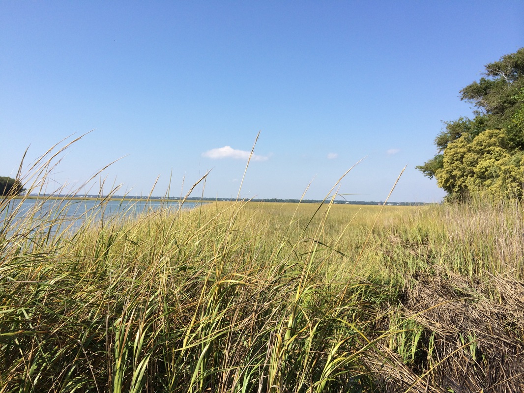
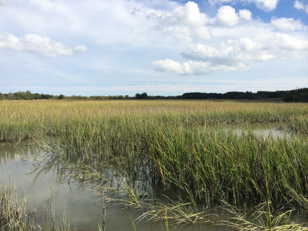
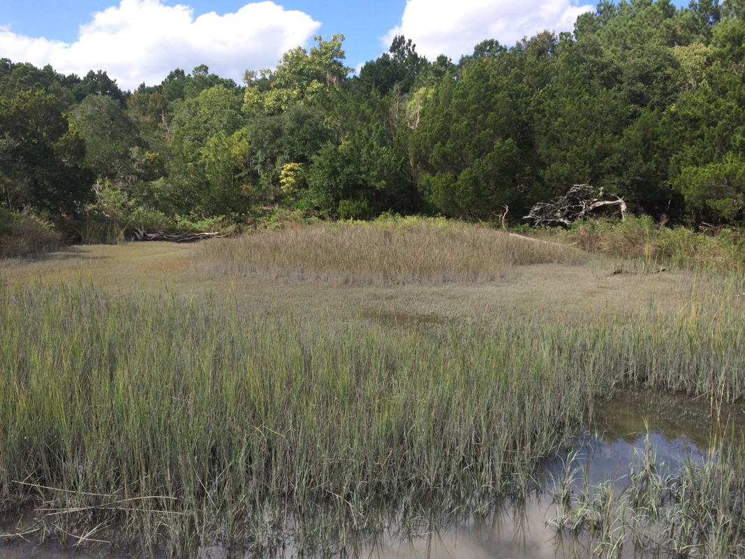
For mile upon mile and day upon day we paddled along nothing but Spartina alterniflora. It was mesmerizing and lovely.
I am in love with the grass.

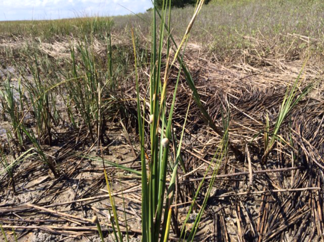
Not regular grass -- with marsh grass. Cordgrass, you might call it, but the naturalists call it Spartina alterniflora, and as we paddled by acres and acres and acres of it my guide Ed Deal told me he thought it was one of the most important plants in the world.

After research, I agree.


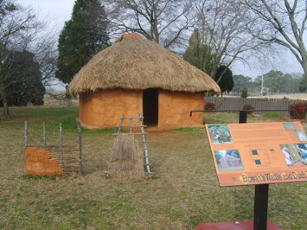
When I spoke with James Morris, director of the Baruch Institute of Marine and Coastal Sciences at the University of South Carolina, he told me the salt marshes I’d be paddling through would be very much like the ones John Lawson had paddled through in 1700. “Much of the South Carolina is unspoiled,” he said. “South Carolina is unique in that regard in that we have so much protected coastline.” Long before slaves would have cleared the tidal swamps and freshwater marshes for the rice and indigo plantations that made South Carolina rich, in 1700 “it still would have been really, really wild.” And whereas freshwater marshes, further in on the coastline, are riots of different plant species, the salt marshes are “monospecific,” Morris said.
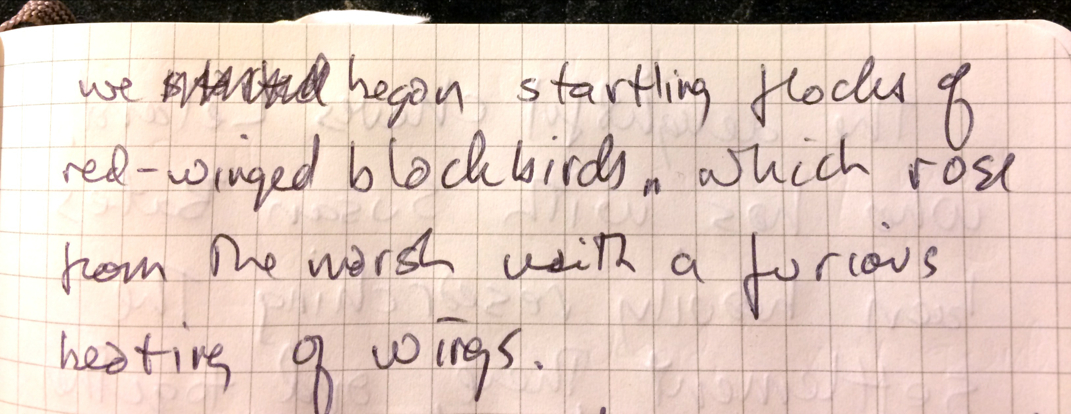
They’re spartina alterniflora, and that’s about it. “He would have smelled rotten eggs,” Morris said. “You’ll smell it too. That rotten egg odor is hydrogen sulfide, and it’s a natural byproduct of the decay of leaves and roots in a salt marsh marine environment.” I smelled it. To me it smelled great.

Here’s the story. Spartina does an amazing thing: It creates its own freshwater to live. Designed to prosper in the tidal zone where sediments accumulate and sea and soil meet, it has learned to excrete excess salt, not only making it able to withstand the salty tidal water but making it attractive to species like periwinkle snails, which come by to lap up the delicious minerals the Spartina doesn’t want. The snails, using rows of replaceable hooklike sharp teeth in a mouthlike thingy called a radula also help to decompose the dead Spartina.
Picture
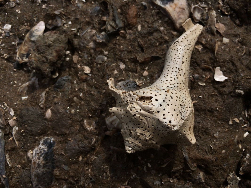
This little whelk was food for sponges, and now its shell is providing exactly what oysters and other growing bivalves need.
Picture
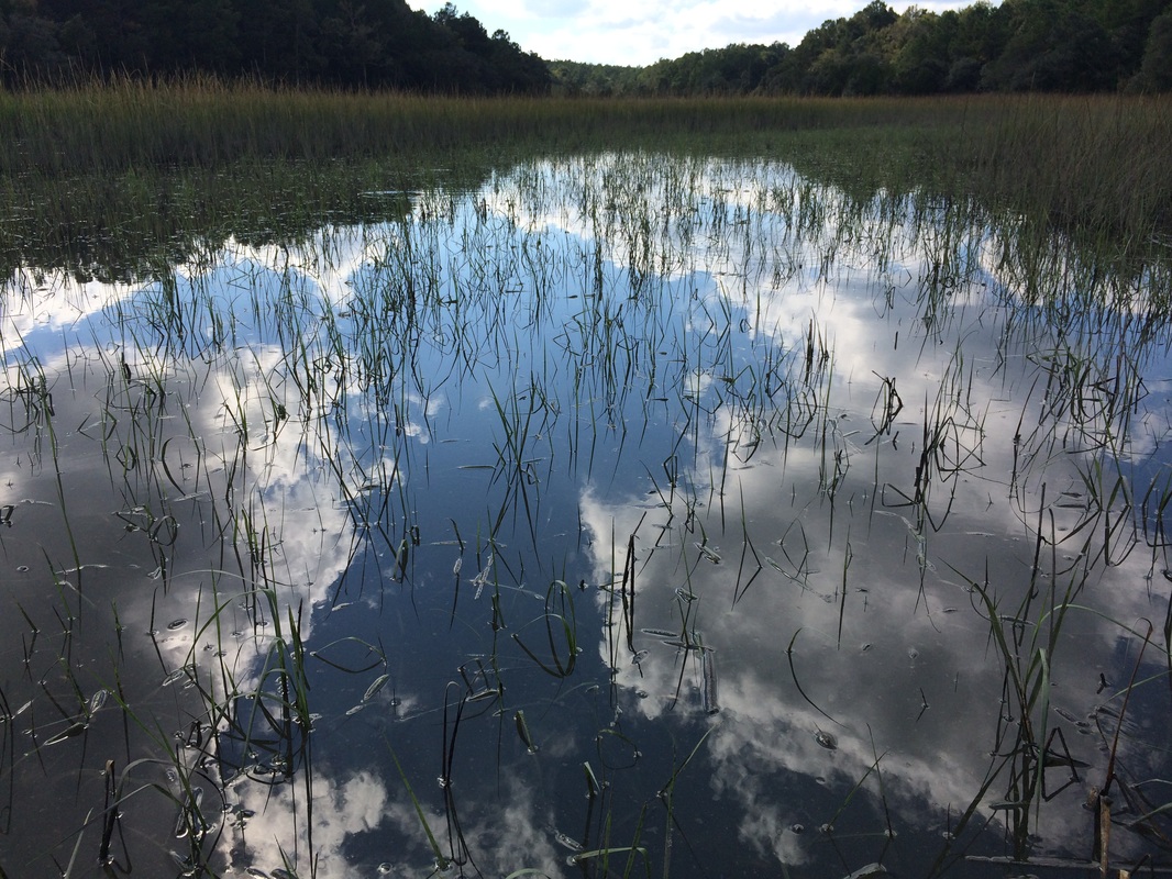
Yep. Just another picture of Spartina. I just put this one in because I thought it was so pretty.
egrets (snowy and great), ibises, oystercatchers, black skippers, black skimmers, bald eagles, osprey, willets, short-billed dowagers, the not-quite-as-endangered-as-it-used-to-be brown woodstork, and an enormous variety of gulls and the plovers, sandpipers, and sanderlings that, like grandchildren, even guides can’t always tell one from another (though my guide Elizabeth Anderegg pointed out spotted sandpipers, identifiable by their stuttery wingbeats: b-r-r-r, coast; b-r-r-r, coast).

Elizabeth even pointed out a pair of roseate spoonbills, who were just then coming in on their migratory path. Elizabeth also explained why the double-crested cormorants we saw tended to stand stoic atop pier pilings, wings open, as though doing sun salutations or posing for a “Karate Kid” poster. The cormorant’s feathers are not particularly oily, she says -- this gives it less buoyancy and enables it compete by diving deeper for fish. But that means the feathers get wet, so the fish is heavy and needs to dry off before it can again fly well. If we came upon one not yet dry, when it flew away from us it sank right to the surface of the channel, where -- whap! whap! whap! -- it patty-caked its feet along the surface until it had enough speed to rise.
Picture
Hard to see, but those are periwinkle snails on some Spartina showing its length at low tide.

The dropping down of little fragments of dead Spartina called detritus begins to create mud, which of course becomes matrix for more Spartina, which spreads through long, hollow rhizomes. What’s more, the marsh also attracts diatoms and other phytoplankton, which when the tide goes out form a surface scum that helps stabilize the mud, further encouraging Spartina growth and providing habitat and food for things like snails, oysters, and clams and other filter feeders, to say nothing of the fiddler and ghost crabs that all but cover the shoreline. All together those animals form the base of an incredibly rich habitat. The Spartina stabilizes the shoreline with its rhizomes, allowing oysters to get -- literally -- a foothold. Between the Spartina and the oysters the water is cleaned and the habitat improved. Many fish -- my guides loved to point out mullets and menhaden -- love the cover of the Spartina, especially for juveniles. Oysters mean more oysters, and the oyster shoals their shells create further stabilize the coastline. Sponges come along and eat the whelk, snails, and other invertebrates by drilling into them (those tiny holes you see in found shells? Spongesign.), after which the shells slowly dissolve back into the water, their calcium carbonate just what new baby oysters need. Nothing wasted in the Spartina.

Lots of little fish equals lots of big fish who like to eat them and lots of shorebirds who like to eat the big and little fish. In one five-day period I saw brown pelicans (who live there, and white ones, migrating through), herons (great blue, little blue, and tricolor), 
Picture
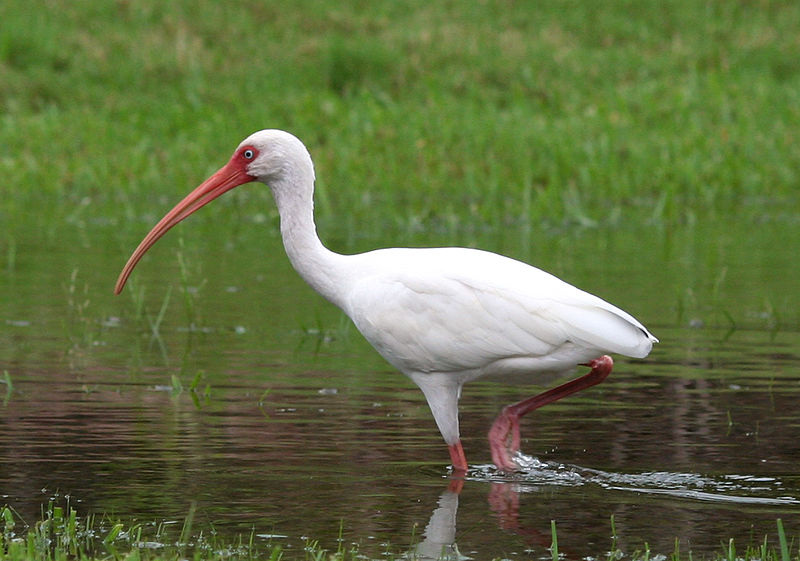
A white ibis. Image by Terry Foote, from Wikimedia Commons.
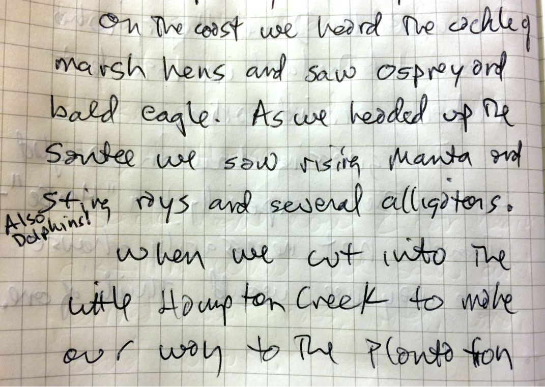
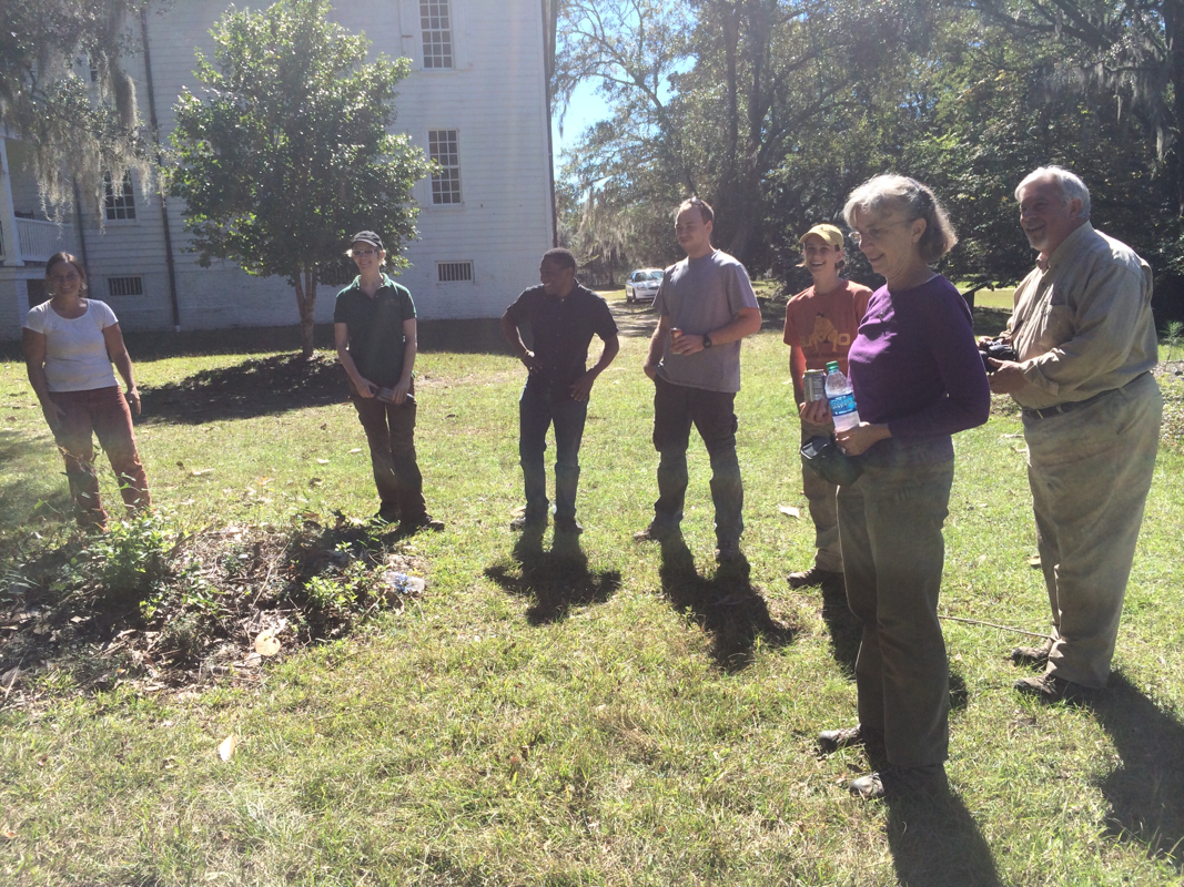
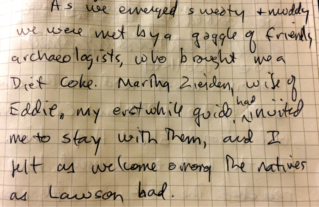
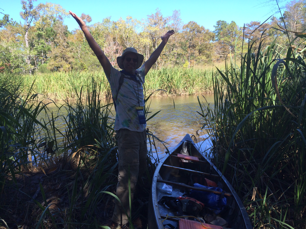
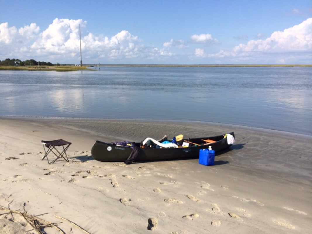
“Hang around the edge,” Ed liked to say as we paddled. “That’s where the action is,” and he was right. At the edge of the marsh not only did we see less current and feel less wind but we saw bottlenose dolphin engaging in various hunting habits for the menhaden, rising manta and stingrays, and other fish that came and went too quickly for us to recognize.

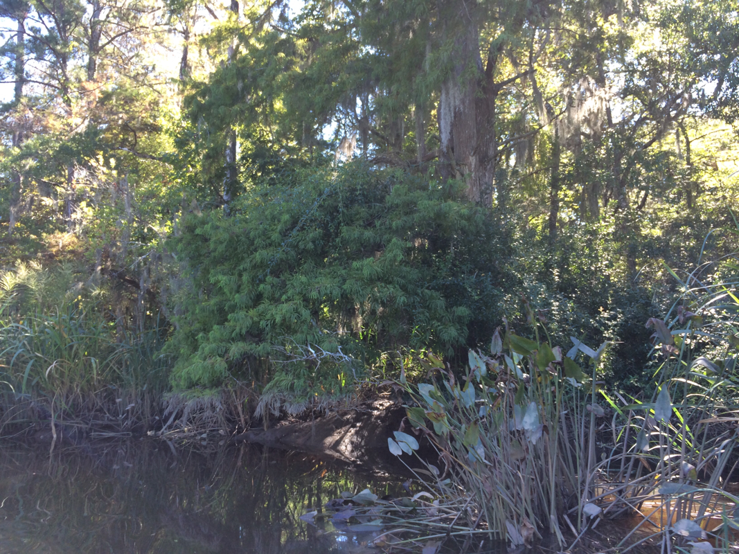
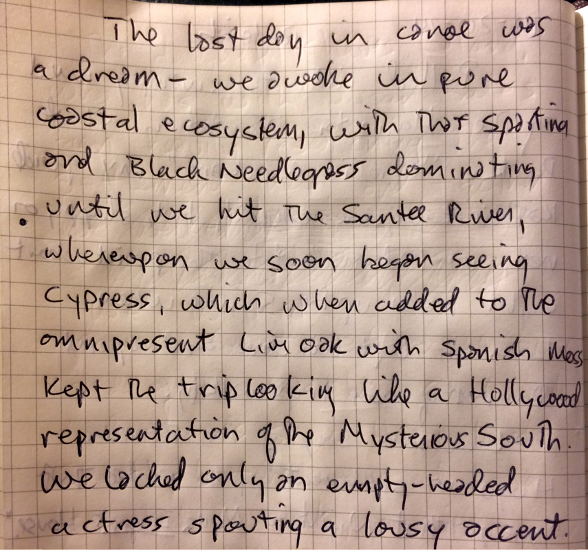
Go further in towards shore and you get smaller Spartina (less able to grow above the tide), then black needlerush and goldenrod and other plants more suited to brackish or freshwater. Trees like loblolly pines and holly, yaupon and salt cedar and of course the omnipresent palmetto, which Lawson said grew so slowly that you couldn’t chart its progress in a single lifetime. Not quite, say the locals, but they are slow.

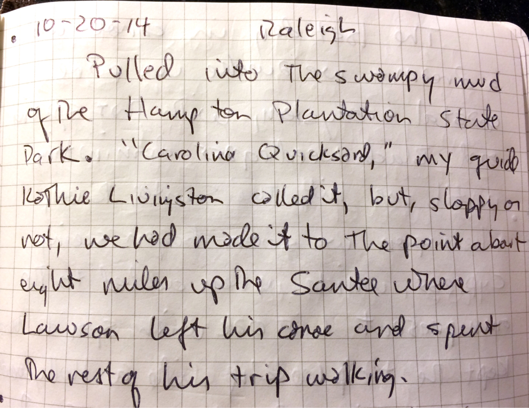
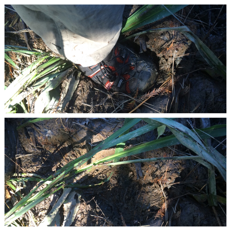
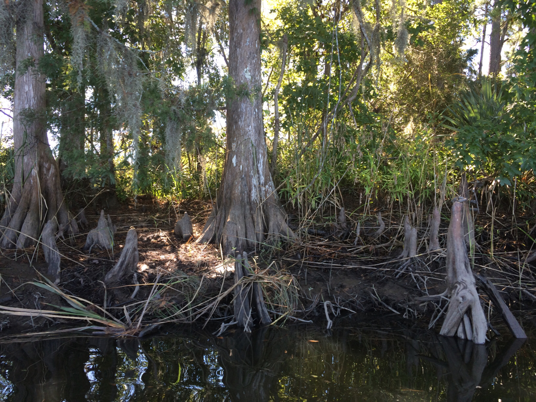
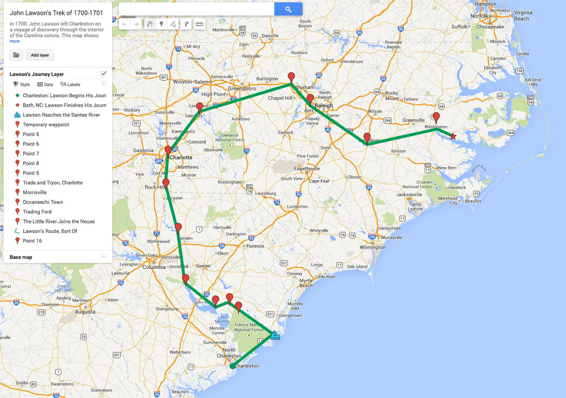
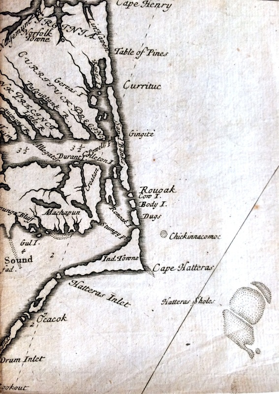
Lawson found the salt marsh almost not worth describing. He never mentioned the grasses, but then again he barely mentioned wind and tides either, so he was just paying attention to other things. In response to Morris’s note that the salt marshes hadn’t changed much in 300 years, Ed Deal said, “well, you are taking a shortcut.” Referring, of course, to the Intracoastal Waterway, the series of bays, channels, and canals partially natural and partially artificial that’s been growing since the early 1800s. So once I paddled across Charleston Harbor, I did not have to paddle to the ocean side of Sullivan’s Island and then ride the tide in through an inlet called “the Breach” (“At 4 in the Afternoon, (at half FLood) we pass’d with our Canoe over the Breach”), which the locals say is treacherous at best. (British troops tried to cross it during the Revolutionary Battle of Sullivan’s Island and failed.) Instead we crossed the harbor, took a left, and could have paddled pretty much straight for 40 miles or so to the mouth of the Santee. Very different from the tidal creeks and inlets that Lawson described as “the most difficult Way I ever saw, occasion’d by Reason of the multitude of Creeks lying along the Main, keeping their Course thro’ the Marshes, turning and winding like a Labyrinth, having the Tide of Ebb and Flood twenty Times in less than three Leagues going.” And I will say as beautiful as I found the grasses along the waterway, when I paddled along inlets or up creeks, in their winding silence I felt like I was truly seeing nature at her ease, going about her business as she had done for centuries. Nature, as it were, in her housedress.
The Intracoastal Waterway is far from the only change wrought on salt marshes in the last centuries. The South Carolina Department of Natural Resources estimates that South Carolina has more salt marsh -- 344,500 acres -- than any other state on the East Coast. It also estimates a good 50 percent of salt marshes have been destroyed since Lawson’s time. That’s a loss of more than just habitat. As paddlers, we knew to head right towards the marshes when speedboats and yachts went by with no thoughts of the damage their wakes would do. The marsh absorbed wave energy, so within its protection we might be joggled but would not likely be swamped. If you’re wondering how loss of salt marshes plays out on a large scale, ask New Orleans how it’s doing without the marshes that used to protect it.
And things aren’t looking up. Another 30 percent of our remaining salt marsh is threatened by runoff, by sea level rise, by attempts to control mosquitoes, and above all by development. This is far from a Southern problem. In New England in the nineteenth and twentieth centuries salt marsh area declined by approximately two-thirds; in San Francisco in the same time period it declined by 79 percent. And with it go ecosystems, filter feeders that clean water, and the storm protection marshes naturally provide.

For now though, at least along the South Carolina coast I traversed, protected by the Francis Marion National Forest and the Cape Romain National Wildlife Refuge, my beloved Spartina has someone to look out for it.
1 Comment

Home, Sort Of

10/22/2014

3 Comments

 
Picture
This is what the Hampton Plantation looks like from the creek. Good thing Kathie knew where we were going.
Picture
Picture
Extremely squishy mud.
Picture
Picture
Picture
The creek by the plantation is mislabeled -- it's the Hampton, and it runs into the Wambaw at the upper left. Somewhere just across the Wambaw there is where Huger would have lived.
Picture
Picture
Cypress knees demonstrate we've left salt and entered a fresh-water ecosystem.
Picture
Picture
A bunch of nice archaeologists met us as we emerged from the brush. Martha Zierden brought me a soda pop.
Picture
Picture
Picture
Picture
Click through to the article!
Picture
Picture
Cheves Leland, researcher and archivist of the Huguenot Society of South Carolina, points out a possible site o M. Huger's house to Martha Zierden, curator of historical archaeology at the Charleston Museum.
Picture
Picture
Picture
Could Lawson have slept right here?
Picture
Picture
This is a recreation of a wattle-and-daub house at Etowah State Park in Georgia. Sticks and grasses woven together, mud daubed onto it. The style is seeing a rebirth as a use of simple and local materials. Click through to a full story.
Picture
3 Comments

Spartina, Clams, and Shell Rings: a Blog Using a Quaintly Outdated Technique

10/16/2014

2 Comments

 
Picture
Picture
Picture
Picture
Picture
Picture
Picture
Picture
Picture
Picture
Picture
Picture
Picture
Picture
2 Comments

The Canoe: A Like Story

10/14/2014

1 Comment

 
Picture
Loaded to the gunwales, Kathie Livingston's green monster is my home for the week.

John Lawson spent the first week of his journey to North Caroline from Charleston in a canoe, travelling through the what is now called the Inland Passage -- the complex, all but trackless series of tidal creeks among the marshes and barrier islands off the South Carolina coast.

Here is what he had to say about tides: he mentions that as his group got started, they got int the canoe, "having the Tide of Ebb along with us" they set out. This makes sense -- from Charleston the journey across the bay into the tidal marshes is towards the sea, so if you don't catch the tide going out you're figthing the sea. He mentions that when his gang of ten passengers made the five miles to the inlet called The Breach the tide had gone out so far they couldn't get in over the breach -- the passage between two islands that then gave access to the tidal marshes. And he mentions, a couple days later, that they are nearly cast away when a gale comes up, but fortunately there was "a strong Furrent of a Tide setting in and out," which, whatever that means, somehow set them aright and gave them shelter in a part of Bull's Bay.

That's it. Six days of paddling in creeks and water so confusing and unpredictable, so hard to predict, that one of my own guides -- she makes her living paddling these waters -- has said she just lets the tides do what they will.

But let me promise you -- paddling against the tide is a different project than paddling wih the tide, though Elizabegth was certainly right -- in a system with tidal creeks inerconnecting and leading to and from inlets, which way the current will flow in a particular creek during a particular tidal flow is a mug's game.

Wind is a different matter entirely. My first-day guide, Ed Deal, piloted his kayak all but effortlessly regardless of wind. Low in the water and hydrodynamically sound, his kayak seemingly kept him under the wind, gliding along like a water strider.

My canoe not so much. Tall and with a flad bottom, the canoe carries gear like a wonderful pack mule but it runs like one too. When at the end of our day we ran into a stiff headwind -- I estimate it Beaufort 5, "small trees in leaf begin to sway" -- I had all I could do to make forward progress. "You are a sailboat," Ed said. "And you are the sail."

In any case this comes back to Lawson because my first conclusion on this project is that Lawson did not paddle his canoe -- not once. I'm convinced he did not pick up a paddle. After two days in a canoe in the nice conveniently straight Intracoastal Waterway, I'm constantly thinking about tides and winds, and Lawson barely mentions them. That tells me that his four native guides and five friends did much of the work while Lawson jotted down notes.

So from the beginning of the Lawson Trek may I start by saying: I am jealous of John Lawson. I love the big green honker provided for me by Kathie Livingston at Nature Adventure Outfitters, and I'm loving making my way up the waterway. Two little blisters so far, by the way. I use a kayak paddle which gives me enormous control but fills my canoe with water, which I pump and sponge out. Kathie's also provided guides, who've filled me with information and understanding. My new true love is Spartina alterniflora, and more about that soon.

Picture
This is Spartina alterniflora, which my guide Ed Deal called one of the most important plants on the planet. I was convinced. Guide Elizabeth Anderegg pointed out the periwinkle snails you can see here. The Spartina actually gets its freshwater by desalinating, and the snails come for the minerals. Mind blown? Wait till you hear the rest.

But my major take-home from my first to days is: it's better to have nine OTHER people paddling your canoe than to paddle it yourself. Nine other people versus one YOU person. You do the math.

Lawson of course would have used a dugout canoe, and I got a wonderful lesson in dugout creation from But Hill of the Village Museum in McClellanville, which has an old dugout found in the local mud.

Picture
not a shark bite -- just what happens to a dugout canoe when you leave it buried in the mud for a few hundred years.
Picture

The native Americans made the dugouts by burning a log -- cypress, commonly -- on one side, then scooping out the charred part, then burning more, and so on in enough cycles until you had the canoe you wanted.

The colonists added elegance, Bud explained by pointing out a circular hole in the old canoe. They drilled holes and put in a dowel of the thickness they wanted the hull to have at any particular point, he said. Then you burned and chiseled until you hit the dowel. Presto -- a canoe hull exactly as thick as you wanted it to be.

They also left in seat supports, chiseling out around little shelves. Thus the seat, instead of being attached sideways, which was a weak point of attachment and even pushed out against the sides of the boat, which then wanted to crack in the middle, became a point of support. The seat stayed in, pegged in from the top instead of the side, and the seat thus pegged provided force holding the sides together rather than pushing them apart.

People have been smart for a long time.

1 Comment

Finding Something New

10/11/2014

1 Comment

 
We cannot get away from ourselves.

Camp in the savanna and look up at the contrails. Hike the trail by GPS. Climb the mountain and get better reception. You probably got there in the first place following the advice of a way-finding system accurate to the capacity of saying, “The OTHER side of the street, you idiot.” Or maybe you referred to a map that you bought in easily obtainable staple-bound book form at any number of places within a five-minute drive from your house. Or, if that wasn't satisfactory, you went to an office in a state government building and bought a USGS topographical quadrant map that gives you so much detail about your terrain that you know not only every ten-foot change in elevation but every building on every lot, down to sheds and outhouses.

And that's all good: Google Maps can show you everywhere on the planet; Wikipedia shares information on every place and culture. But no doubt this rising tide of information can feel a bit overwhelming. No surprise, then, that the days when there were still holes on the maps—when uncertainty still held a post of honor—seem attractive.

Picture
Lawson’s book, A New Voyage to Carolina, was widely popular and reprinted several times, with credit and without. Source: North Carolina Collection, University of North Carolina at Chapel Hill

"I accidentally met with a Gentleman, who had been Abroad, and was very well acquainted with the Ways of Living in both Indies," Lawson says in A New Voyage to Carolina, the book that a decade later resulted from this chance meeting. "Of whom," he goes on, "having made Enquiry concerning them, he assur'd me that Carolina was the best Country I could go to; and, that there then lay a Ship in the Thames, in which I might have my Passage. I laid hold on this Opportunity, and was not long on Board before we fell down the River, and sail’d....”


And now you know almost as much as anyone else in the world about the beginning of Lawson's remarkable journey through what is now North Carolina and South Carolina. The two-month journey produced a book of incomparable observations about the Carolina land, inhabitants, flora and fauna; a map that is widely known, if not much of a cartological advance; and a personal story of adventure and tragedy that ended in 1711 with Lawson’s death at the hands of the native people he had befriended.

I stumbled onto Lawson's tale the way most Carolinians do: I wanted to know more about where I was. Interested in the history of my own little piece of ground in Raleigh, I first tried to trace its deed backwards only to quickly land in an insoluble tangle of developers selling it back and forth. So I thought I'd start from the various piedmont Indian tribes, who owned it in 1663 when through the Carolina Charter King Charles II of England first granted it to the eight Lords Proprietors. No luck, but I learned about Lawson’s journey and thought it might hold some clues.
Picture
Either this is the only existing portrait of John Lawson or there isn’t one. It’s the right time period, the right attitude, the right name, and the right artist, but questions remain (for example, Lawson was never knighted, but the portrait’s history identifies him as “sir”). From the private collection of Elizabeth Sparrow. Used by kind permission.
Imagine young John Lawson. In 1700 Lawson was 25, and the well-educated, well-connected son of a physician drifted in London like any young man in any age, searching for a way to make a name for himself – looking for something to do and a good reason to do it. Fascinated by the scientists of the new Royal Society who met at Gresham College in London, where Lawson had attended lectures, Lawson yearned for adventure, accomplishment, notoriety and gain. Which is to say, Lawson was a young man, and it’s easy to understand his interest in the natural world, in science, in discovery.

Hooke, Wren and Halley had made the famous coffee house wager that caused Isaac Newton to write his Principia Mathematica barely 15 years before; it was published when Lawson was a teen. The best map of North America looked like an unfinished child's drawing. DeSoto had wandered and died in the southern region of the modern day United States a century and half before, but little mappable knowledge had emerged from his enterprise. LaSalle had done the same around the Great Lakes and Mississippi River during Lawson's childhood with much the same result. So it hardly surprises to learn that when Lawson considered attending the Grand Jubilee in Rome (it was a big deal, a celebration held every quarter century, and honestly, it was something to do) it took only a casual conversation to quite literally turn him around.
Picture
Lawson saw a lot of cool animals. He describes the turtle grabbing the snake and pulling its head in, the snake killing another snake, and the raccoon going crabbing, using its tail for bait. We don’t think Lawson drew the pictures. Source: North Carolina Collection, University of North Carolina at Chapel Hill.

Yet it held no clues about my property’s history because nobody had ever written a book retracing its exact path—which sounded like something somebody ought to do.

By 1670 the British had planted a colonial city in Carolina: Charles-Town, on the Ashley River. It moved in 1680 to Oyster Point, the spit at the Ashley’s confluence with the Cooper, which made for a more convenient—and not coincidentally defensible—base. Earning its name in the Civil War, the bottom of Charleston is to this day a defensive seawall called the Battery. Lawson certainly sailed there in 1700, and on December 28 of that year certainly set off on a journey, first by canoe and then on foot, that over the subsequent months took him through much of what is now the Carolina interior. Whether he set off because the Lords Proprietors suggested he do so, or because it seemed like something interesting to do, nobody can say for certain, though people have strong opinions on both sides.

What nobody disagrees about is the record Lawson left. Lawson spent the better part of the next decade collecting horticultural specimens, developing land, surveying and learning about the Native Americans. Along with a detailed journal of his long walk, the book Lawson eventually created includes an entire natural history of Carolina, listing plants, animals and native tribes and describing the terrain, rivers and settlements—native and colonial—he encountered. Lawson was above all a model of 17th-century science. He observed and gave full voice to what he saw, regardless of how it squared with what he expected. The book has been called “one of the best travel accounts of the early eighteenth-century colonies.” In an unpublished paper archaeologist Stephen Davis of the University of North Carolina says its significance comes from being, “the first book to provide a detailed, clearly written description of the backcountry, including its fauna, flora, geology, topography, and people.”

Lawson, that is, had his eyes open. Unusual among explorers of the time, Lawson understood he was seeing not a virgin continent, but rather the ragged end of a devastated great civilization, ruined by disease, alcohol, slavery and displacement. He described simply what he encountered, and his record is all the more vital (“uncommonly strong and sprightly,” another historian called it) for its honesty.

Since nobody has ever retraced Lawson’s footsteps, I plan to do exactly as Lawson did. Not just to slavishly retrace his path, but to look around with eyes wide open, trying to leave preconceptions behind and, with the help of historians, geologists, biologists, adventurers and ecologists, record what has changed in 300 years and what, in another 300 years, those who come after might find valuable to know.

Comparing today to the past is foundational to science, and we do it all the time. Recent years have seen scientists return to the observations of Thoreau to document the effects of climate change by comparing the dates of the blossomings and migrations he saw to our current observations; to the works of environmentalist Aldo Leopold to document what he would have heard (Stanley Temple has tried to recreate the sounds he would have encountered in the morning); to the Grinnell-Storer transect of Yosemite to see how the animal populations have changed in the century since the original observations. Climatologists have for years been returning to ships' logs to gather data from centuries ago about wind, temperature and current.

I hope, with help from scientists and other observers (and support from the Knight Science Journalism Fellowships at MIT), to add in a small way to that scientific enterprise, and I’m preparing by learning what I can. But I hope much more simply to add to the conversation by seeing, by spending my months in-country as Lawson did, observing what I see rather than what I expect, and hopefully getting people who understand it—scientists, historians, natives, locals—to help me understand. I’ve begun a website, and I’ll update the blog regularly; I’ll post on Instagram, Twitter and Facebook. I think Lawson would have done the same had those tools been available to him.
Picture
This is a fairly good estimate of Lawson’s journey, though people’s ideas of where he went have changed over time. I expect this one to change a lot as I go. Source: Google Maps, with map points added by the author.
We live our lives in the fog of detail, focusing on our appointments and our phones while the universe desperately tries to whisper its secrets into our ears. We think that if we’ve seen things once, there’s nothing more to notice.

I like to think of the properly observed life as living as though you were on your junior year abroad, when the kind of ticket you get for the bus, the smell of the funicular railroad, the food a vendor sells, is not just the daily detail you pass by. It’s the essence of life. It’s what the people eat, how they get around, how they adapt to hillside, shoreline, riverbank. It’s what you’ll remember and what you’ll tell other people. I think we should live our entire lives paying attention to things like that.

Lawson did. Lawson, a scientist at heart, consciously opened his ears and allowed the universe to whisper to him, and as a result he documented, perhaps better than anyone else of his time, a world that within a few decades had all but disappeared.

With a changing climate and rising seas, our own world may be about to undergo radical change, so it seems appropriate to head out to document it. For my first segment of this trip, like Lawson, I’ll paddle by canoe from Charleston to the mouth of the Santee River and upriver a day – about 50 miles in total. Like Lawson, I’m depending on the kindness of strangers and the guidance of locals.

There are no holes in the map anymore. The holes in our understanding, however, remain. So we go out into the field and hope to fill those.
1 Comment

The Things I'll Carry

10/9/2014

1 Comment

 
I haven't even left home yet and I'm learning things by the bushel basket. Here's a picture of what I'm packing:
Picture
Food, tent, clothing of various specialty fabrics, water carriers, electronics and ways of gathering power for those electronics, special plastic sleeves to keep the electronics dry. And I hate to say it, but this is only most of it.
In response to a picture of way less of this stuff that I shared last week, the inestimable @Dale Loberger shared this picture on Twitter, which he's kindly given me permission to share with you, and he said this: "I saw your preparations for the trek on Instagram. Here would be my initial suggestions..."

@huler I saw your preparations for the trek on Instagram. Here would be my initial suggestions... pic.twitter.com/fpk0ahECcm

— Dale Loberger (@DaleLoberger) October 9, 2014
When I asked if I could share that picture, he said, "You certainly may. I imagine everything there is correct for Lawson. Items for protection, sustenance, amusement, mending garments.." Which in the first place reminded me I'd better make sure I included a sewing kit besides the high-tech taping kit for malfunctions of tent or rain jacket. But in the second place how could I fail to make the comparison, by which I lose rather significantly? Mind you, I'm not apologizing. I'm glad I have bags full of dehydrated crap and energy bars to eat and won't have to shoot possums or munch on beat little pieces of hardtack. And like Lawson I'm bringing a bag, ways to carry water (and other beverages), knives, and notebooks. So we're not so different. But who am I kidding? We're plenty different.

When I'm back I'll talk with Dale and other sources to compare my equipment to what someone like Lawson, traveling at the beginning of the eighteenth century, would have carried. That's assuming I get back.
1 Comment

Goodbye Old Friend

10/4/2014

1 Comment


My heart aches, and a drowsy numbness ... oh hi! Didn't see you there. I'm just immersing myself in the sadness of the demise of my oldest backpack: the big honking old Lowe's Alpine Systems internal frame job I got as a gift before heading off on my year abroad (in 1979!).

Picture

So no way am I complaining -- I've had all this pack could give. It's been all over Europe with me and on hundreds of miles of trails -- including about a fifth of the Appalachian Trail. And when ready to begin packing for the Lawson Trek I pulled it out for the first segment. Since I'll be traveling by canoe, I figured instead of my much more comfortable framed pack I'd take advantage of its saggy old capaciousness.

But the main zipper is broken. I'm sure there's a way to resolve it, but even Lifehacker failed me here, so I'm just moving on. And I have another sizeable(ish) internal frame -- an Eagle Creek job with a removable knapsack and all that. So I'lll be fine.

The thing is, when I opened up the old Eagle Creek, I found a couple old around-the-neck passport holders. Cool, but when I was poking around in the departing Lowe's, I found bootlaces and a ruined knife sheath. The Lowe's was used to roughing it with me, and I was hoping for one more trip together, so I'll miss it. I even had a place all picked out for the new patch it would get from the Lawson Trek.

It's not a particularly big deal, the death of a backpack, but it's a moment. The old saggy black beast squeezed through train aisles with me from Florence to Trondheim, hiked part of the South Downs Way in southern England and Hadrian's wall in the north.

It helped me through those awful early-twenties years when a new apartment or city always seems like it will solve your problems, and its cavernous main space always provided carriage for some last-minute item almost forgotten.

Its overstuffed profile, sagging almost to my knees (they hadn't quite got the hang of internal frames in 1979), became familiar to hiking partners and travel companions. A big-bag pack rather than a many-pockets pack, it gave me the excuse to mess with my gear for hours around the campsite every night, itself no small benefit, though I confess when I replaced it with a framed many-pockets pack I discovered I spent no less time fooling around with gear of an evening. I guess I'm just that kind of camper.

So anyhow. Farewell, big black bear of a backpack. Into the attic with you. The new patch will go onto the new pack. Perhaps someday I'll go back and pull the old patches off the black one and transfer onto something new. Until then the patches guarantee your survival, if not your utility.

See you when I get back

1 Comment

The Thing Itself

10/1/2014

0 Comments

 
It's almost impossible to remember, as we update blogs and create work that can be seen simultaneously by everyone on the planet seconds after we create it, that once upon a time a thing existed only physically, and that thing had a limited lifespan and could be rare. That there could be only a few of something, and just having it could be a wonder.

I'm thinking now of John Lawson's book, A New Voyage to Carolina, in the presence of which I spent several hours the other day. In the North Carolina Collection of the Wilson Library of the University of North Carolina in Chapel Hill reposes an actual physical copy of that book, published in 1709, though even that requires explanation.

Lawson's story first came out as part of A New Collection of Voyages and Travels: With Historical Accounts of Discoveries and Conquests in All Parts of the World, a periodical printed by a consortium of London booksellers that came out in regular editions. Lawson's contribution was part of the May 1709 edition. In January 1710, perhaps because people began to recognize just how much there was to learn, the publication grew a new headline:

Picture
Evidently the editors felt "all Parts of the WORLD" didn't quite convey the breadth their publication covered. I think we can all agree that as reports like Lawson's came in, readers did in fact get a new View of the Univerfe.
Picture
Lawson showed up in London eight years after his journey and found the people of Pater-Noster-Row encouraging and his Original Voyages worth Printing. Let's hope I do half as well.
In any case, Lawson's work also came out as its own entire volume, also in 1709. I looked at both versions in the lovely Wilson Library rare books reading room. To save the books you get little foam pads to hold them from opening too wide; you get tiny weighted strings to hold the pages open so you don't paw at them too much; and if you want to, say, open a fold-out map, a librarian comes over and helps you, whispering conspiratorially the whole time, surrounded by busts and wooden shelves and beneath formal chandeliers and a balcony. Now that's how you treat a book, if you don't mind saying.

Holding Lawson's volume -- something he could have held himself, but that certainly his contemporaries did -- brought his journey to life in a way Google Books, for all its inestimable value, cannot. Until we find a way to share books online in smell-o-vision, until we can duplicate online the feeling your finger gets as it carefully traces a brittle, aging paper edge, physical reality still has a lot to brag about compared with the online version.

I try to keep that in mind as I prepare to -- on Oct. 12! -- venture, in Lawson's wake, into physical reality.
Picture
What with Europeans taking over the rest of the world and all, people wanted to know what was up. "Discoveries and Conquests" indeed. Lawson's work showed up in this publication in May 1709.
0 Comments

    Archives

    January 2020
    October 2019
    May 2019
    February 2019
    November 2018
    October 2018
    May 2018
    March 2018
    August 2017
    May 2017
    August 2016
    June 2016
    March 2016
    February 2016
    November 2015
    October 2015
    September 2015
    August 2015
    July 2015
    June 2015
    May 2015
    April 2015
    March 2015
    February 2015
    January 2015
    December 2014
    November 2014
    October 2014
    September 2014
    August 2014

    Categories

    All
    Adventure
    African American
    Angie Clemmons
    Anthropocene
    Apothecary
    Appalachian
    Archaeologists
    Archaeology
    Army-navy
    Art
    Artifacts
    Atlanta
    Backpack
    Banking
    Barbecue
    Barry Beasley
    Bath
    Beaufort
    Beckee Garris
    Beetle
    Beginning
    Ben Franklin
    Berm
    Bill
    Birds
    Blister
    Book
    Bookstore
    Boston
    Botanical
    Boykin
    Breach
    Brent Burgin
    Brownlee
    Buck
    Buffer
    Cabelas
    Cambridge
    Camden
    Camera
    Canoe
    Canty
    Catawba
    Chain
    Charleston
    Charlotte
    Chelsea
    Chocolate
    Chris Judge
    Church
    Cincinnati
    City Of Raleigh Museum
    Civilization
    Coe
    Comment
    Community
    Concord
    Confederate
    Contentnea
    Cornwallis
    Country Music
    Couture
    Crawford
    Creek
    Croatoan
    Cutler
    Cypress
    Danger
    Davis
    Death
    Delightsome
    Delk's
    Denton
    Devices
    Drake
    Drawing
    Drunk
    Duck
    Durham
    Eagle
    Earnhardt
    Earth Day
    East
    Ecologist
    Effron
    Embankment
    End
    Error
    Evans
    Exhibit
    Expeditions
    Facebook
    Feather
    Fern
    Finish
    Fire
    Flag
    Flintlock
    Flood
    Francis
    French
    Gaillard
    Gander Mountain
    Garden
    Geology
    Gimpy
    GIS
    Google
    Great Wagon Road
    Green
    Greenville
    Grifton
    Guerry
    Gun
    Guns
    Haigler
    Hallenbeck
    Hampton
    Hanging
    Hannah Smith
    Harris
    Hartford
    Harvest
    Heat
    Hempton
    Highway
    Hillsborough
    Hips
    Historic Bath
    Hollow Rocks
    Home
    Homeness
    Hortus Siccus
    Hospitality
    Huguenots
    Huntley
    Indians
    Instagram
    Interstate
    Island
    Ivy
    Ivy Place
    Jamaica
    Jarvis
    Jennifer Landin
    Jered
    Jimmy White
    John Jeffries
    John White
    Journalism
    Kadaupau
    Kannapolis
    Katawba Valley Land Trust
    Katie Winsett
    Kayak
    Kershaw
    Keyauwee
    King
    Knife
    Lame
    Land
    Language
    Lawson
    Lawsonians
    Lecture
    Legacy
    Legare
    Legislators
    Leigh Swain
    Lenoir
    Lenoir Store
    Lenses
    Library
    Lichen
    Lies
    Loberger
    Locke
    London
    Longleaf
    Lost Colony
    Lynch
    Lynching
    Magnuson
    Mansplaining
    Maps
    Mass Shooting
    Match-coat
    Mathematical
    Meerkat
    Memorial
    Mental Floss
    Mill
    Millstone
    Miniature
    Monkeyshine
    Moonshine
    Museum
    Museum Day Live
    Musings
    Nancy
    Nascar
    Native American Studies Center
    Natural History Museum
    Nature
    Nesbit
    Netherton
    Neuse
    Newspaper
    Nonfiction
    Notebooks
    Occaneechi
    Orlando
    Pack's Landing
    Palmetto
    Pamlico
    Park
    Patent Leather
    Pedestrian
    Peggy Scott
    Periscope
    Petiver
    Photography
    Physic
    Pig
    Pig Man
    Pittsburgh
    Pocket
    Poinsett
    Polo
    Potsherd
    Pottery
    Preparation
    Presentation
    Press
    Process
    Proofreading
    Property
    Publishing
    Raccoon
    Racing
    Racism
    Racist
    Raleigh
    Rape
    Ray
    Readings
    Reconsideration
    Records
    Revolution
    Richard Smith
    Richardson
    Rights
    Riparian
    Rivulet
    Road
    Roadness
    Roanoke
    Robert Off
    Roland Kays
    Rolling Stone
    Roombox
    Rules
    Salisbury
    Santee
    Sapona
    Sassafras
    Scan
    Sconc
    Seneca
    Seth
    Shakespeare
    Sir Walter Raleigh
    Slavery
    Slime Mold
    Sloane
    Slope
    Small Town
    Smith
    Smithsonian
    Snow
    Sore
    Sounds
    Spanish Moss
    Specimens
    Speedway
    Spencer
    State Fair
    Steve Grant
    Stewart
    St. Mark's
    Suburban
    Sumter County
    Surveying
    Swamp
    Tar River
    Technology
    Textile
    Tide
    Tobacco
    Toms River
    Tool
    Towel
    Trade
    Trading Ford
    Trading Girls
    Trail
    Trap
    Traunter
    Tree
    Tree Farming
    Trek
    Trilobite
    Troi Perkins
    Truth
    Tryon
    Tupelo
    Turkey
    Tuscarora
    Twitter
    Ugly
    Unc
    Val
    Val Green
    Virginia
    Virginia Dare
    Virginia Historical Society
    Walking
    Washington
    Waxhaw
    Weather
    Website
    White
    Writing
    Wrong
    Yadkin
    Yoga

    RSS Feed

Proudly powered by Weebly