The Lawson Trek
  • Home
    • About
    • Interactive Map
    • The Trek
  • Along the Path: Blog
  • John Lawson
    • "A New Voyage to Carolina"
    • The Carolina Colony
  • Talk to us!
  • Store
  • Press

Along the Path

Updates as we learned about Lawson's journey and times -- and reports from the trail as we progressed along it. Plus tales of the process of publishing the result.

Oops I Did It Again

11/5/2018

3 Comments

 
Picture
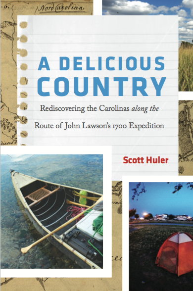
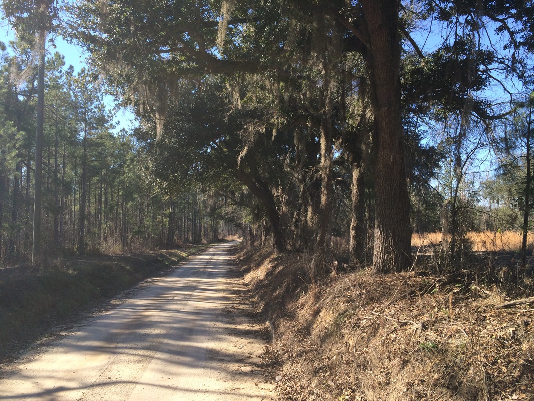
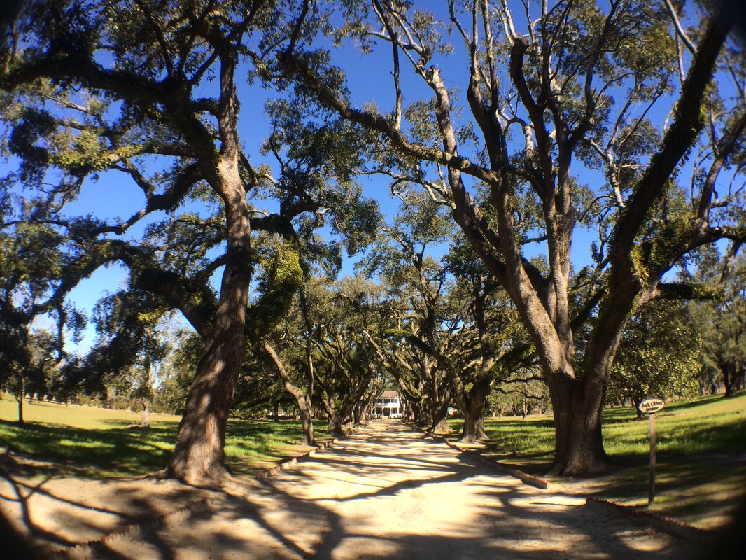
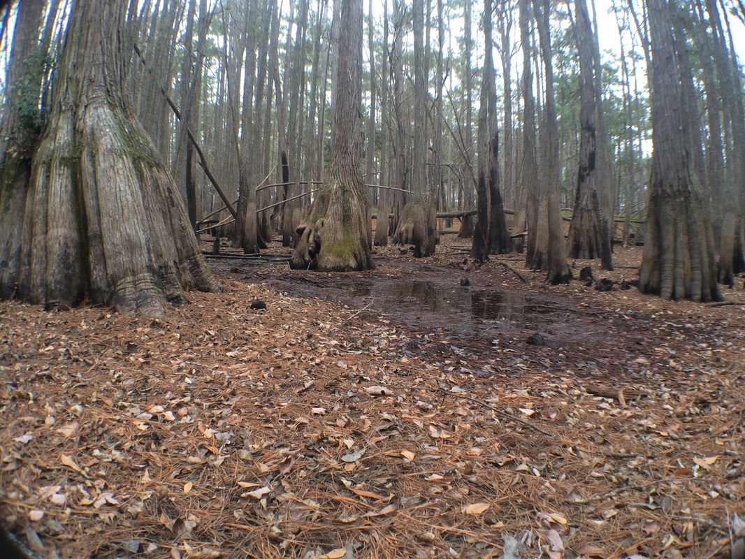
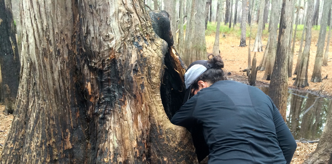
You guys it seems to have happened again. After a decade or so engaged with a topic, after years of walking along roads and talking to people and trying to make sense of a person, a time, an enterprise, a whole long-gone world. After trying to look at our own world the way we would have looked at that one, after comparing and contrasting and all the usual stuff, after writing and rewriting and proofreading and all that, it seems like we have a book. 

In March 2019 it will be in bookstores, but starting this very second you can order it online right here. If you want to see what the publisher,  the University of North Carolina Press, has to say about it, click the link. If you want to see what they have to say about me, click here. It ain't much. If you're hungry for more information about me and my other work, try my home website, here. I'm very interesting.

Of more account, here are some initial responses to this book, by writers I deeply admire and whose praise means an enormous amount to me.

"An absorbing read. Huler's experiences during his modern trek do not, of course, duplicate what John Lawson found so long ago, but forms of beauty and dispossession rhyme down the centuries in thought-provoking patterns."
--Charles Frazier, author of Varina
 
"It's been said that one of the only true plots is this: A man goes on a journey. In A Delicious Country, Scott Huler demonstrates why that narrative arc retains such strength. His retracing of John Lawson's epic circumnavigation is thoughtful, relaxed, humorous, and generous. It retrieves for us a lost world of discovery and wonder and reminds us that the goal of every departure is to learn to value home."
--Maryn McKenna, author of Big Chicken: The Incredible Story of How Antibiotics Created Modern Agriculture and Changed the Way the World Eats
 
"An eye-opening journey through the contemporary South. As he does in his other excellent books, Huler reminds us in A Delicious Country that the present and the past coexist all around us. He writes with great specificity about each topic at hand, but he never loses sight of the larger human story. The book excels as a work of exploration, history, and science. It is also simply what reviewers like to call 'a rousing good read.'"
--Michal Sims, author of The Adventures of Henry Thoreau
 
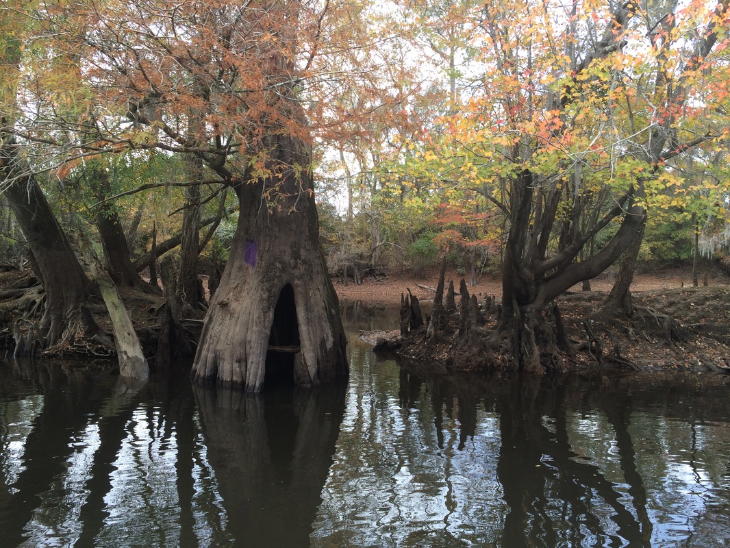
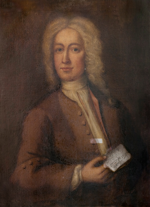
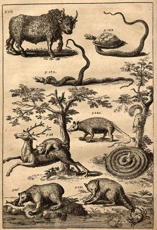
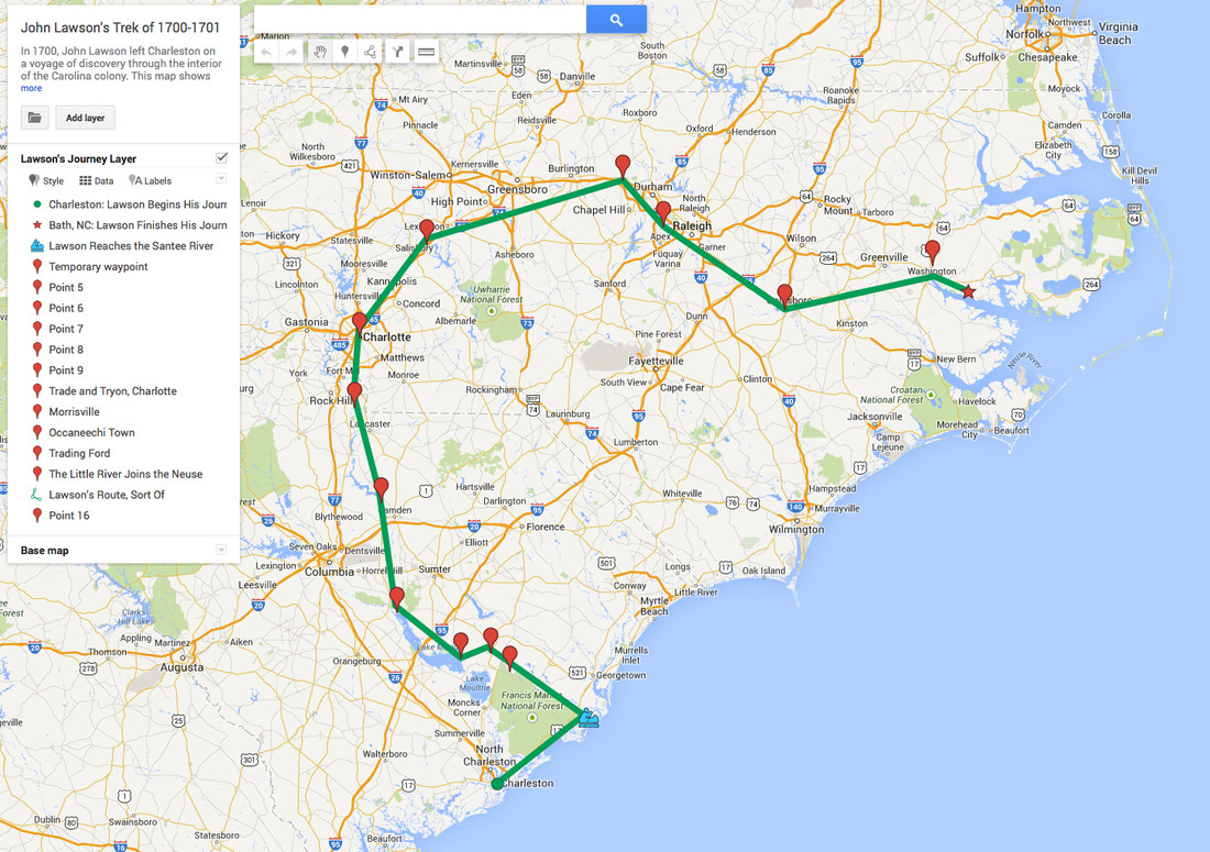
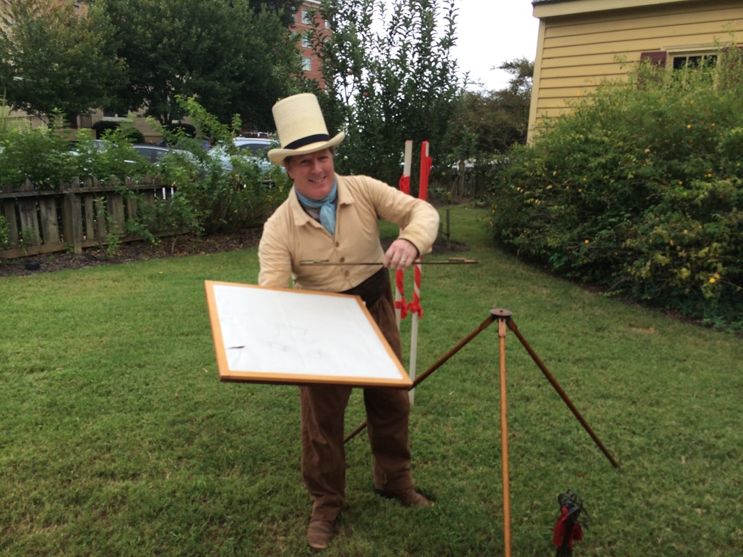
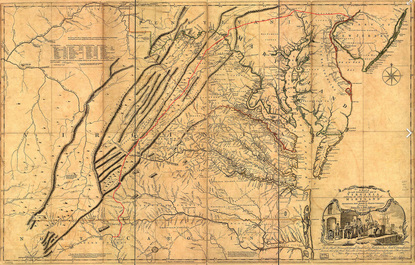
"From the boggy salt marshes near Charleston to the parking lot of the Charlotte Motor Speedway and beyond, Scott Huler has breathed new life into the English explorer John Lawson's all-but-forgotten 1700 journey through the Carolinas. While much of the physical landscape has changed over the centuries, the characters who inhabit it are still vibrant, still contradictory, still completely unforgettable. Only a storyteller as warm and witty as Huler could wrangle such a sprawling, complex natural history into an engrossing travelogue that leaves the reader wanting nothing but more."
--Bronwen Dickey, author of Pit Bull: The Battle over an American Icon

Next come all the inevitable moments of weirdness that come with publishing a book One day a truck comes to our house, and then there's a box of books. And you open the box and there it is, and there's your work, and there's your name, and it all seems a little embarrassing, and you want to apologize that you've put everyone to so much bother. I worked in a bookstore when I was just out of college, and we were all writers of course, and we used to open the boxes of books, glossy book covers of Michener and Stephen King, and smooth shiny paperbacks, and we would clutch them, rub them against our cheeks: "One day," we would murmur, "one day, this will be me. ..." And then one day is here again, yet once again without the trumpet voluntary and footmen in livery that seemed so likely back when it was only imaginary. 

Then will come bookstore events with unpredictable attendance, and media appearances where I sound like a knucklehead and how could they have gotten so much wrong, and reviews of some other book the reviewer must have mistakenly conflated with mine, and then the occasional panel discussion and festival where the author next to me will have a line of well-wishers out the door and my handler will say of my few greeters, "Oh, this always happens! But you were up against [almost anyone else], so please don't feel bad" and then will disappear out of awkward embarrassment into her  or his mobile phone.

I have been here before. But I must also say: of these many years of work I will now have a record, and those authors above, august company indeed, consider it worthy of comment, and so for the moment, at least I will say only, like that creepy tall guy said in "Twin Peaks," It is happening again. Let's all hope for the best, shall we?

3 Comments

Gimpy Old Men

1/29/2015

0 Comments

 
By the time the Lawson Trek finished its second segment it was one ecologist down; pal Katie Winsett had begun suffering enough knee pain that she peeled off at a nearby road, allowing Trek patron saint Kathie Livingston to send someone to pick her up. She continued helping and camping, but three walking days took it out of her.

This third segment brought along not a young ecologist but Rob Waters, a friend and colleague who had time to come along because he's retired. He and I walked together along roadways and on dirt paths through lovely old stands of live oaks and along fields some miles long.
Picture
Rob took this photo. We completely cannot figure out why the fuzzy outline, but it's pretty and very accurately depicts the lovely walk we had along a path very, very likely trod by Lawson himself.
But what was by far the best part of Rob's companionship was his age. That is, Rob is retired -- I'm 55, and he's a bit older than me, so we took our walking like people our age do: we stretched, and we rolled around, and we grunted, and we gimped along, taking things slowly enough that we didn't hurt ourselves. 
Picture
I am borderline certain Lawson did not bring one of these foam rollers with him in 1700, though I could be wrong. If he did, he doesn't mention it.
This had great meaning for me because it reminded me: when Lawson took this trek things were very different for him. And I don't just mean that I have the benefits of antibiotics, modern dentistry, and Buzzfeed. I mean Lawson began his trek the day after his 26th birthday. I'm more than twice his age, and to be honest all the Gore-tex  and Velcro in the world -- to say nothing of daily doses of ibuprofin, which I and all of my partners so far have gulped in big, Lawson-Trek-sized doses -- are not going to make 55 feel like 26.

Which isn't bad, and I'm not complaining -- I'm just pointing out. What Lawson undertook was a very physical business, and every Trek segment brings that home to me. That is, we're outdoors, all day long, every day. If it's hot and sunny, we hide under hat brims. If it's cold, we bundle up. If it's raining, we get all wet.
Picture
Rob takes advantage of the shade offered by the brim of his hat to check in on things back home.
Which I love. The first two segments were all camping. We walked and canoed in heat and cold, in sun and rain. I set up a tent most nights. This third one involved no tents, since we stayed in the cabins at Santee State Park, which are, frankly, the lap of luxury. We ended each day with showers (!) and began each day putting one car at our stopping point, drove to our beginning point, and then walked, retrieving the first car with the second at end of day. 

This may sound like cheating to you, but remember: I have previously pointed out how Lawson clearly never paddled his canoe, and I will also point out that Lawson didn't carry much of his own stuff, either. The day he gets out of his canoe he describes "having hir'd a Sewee-Indian, a tall, lusty Fellow, who carry'd a Pack of our Cloaths, of great Weight; notwithstanding his Burden, we had much a-do to keep pace with him." He describes other Indian guides as he goes along and is less clear about who's carrying what, but I don't think it's unreasonable to expect an English gentleman traveling with experienced traders and Indian guides to have kept away from most of the heavy lifting. 

Anyhow, all this walking is hard on a body, and had you hung around with us in our luxe state park cabin while we popped our ibuprophin and complained about our maladies you probably would have laughed. And that was after days of easy walking -- next segment I'll be back to carrying my house on my back, so we enjoyed our ease while we could, and it was a treat to spend the days of this trek very lightly laden: knapsack with extra clothes, journal, copy of Lawson; fanny pack with lunch and water; little belt pack, worn wrong-side-to, with map, notepad, pens, iPhone, and lens kit -- and, of course, trail mix. I'm not saying it was a walk in the park, but it was a walk along the road, which turned out to be very pleasant.

Just the same, here's a picture of me walking down the road during the second trek, just so you can see what I looked like fully loaded.
Picture
Note big honking boots -- contraindicated for asphalt, I learned the hard way. Used because we'd be spending much time in swamps, I replaced them with a nice lightweight pair of trail runners for the third Trek and didn't regret it.
But that outsideness. When I walked with Katie, she was a champion at reading the forest roads and the lay of the land, perceiving the depression of a swamp from hundreds of yards, recognizing trees and mushrooms and plants. Rob is more of a bird guy, so I loved hearing him watch the skies: "Is that a buzzard?" he said once, as we watched a lone wingspan circling a thermal. "No -- that's more of a soaring bird," he said. "That's a red-shouldered hawk. Thank you. Thank you for the show."

That cheerful attitude never left Rob. After spending much of our first day walking along the asphalt of SC Route 375 we turned onto a dirt path through old fields, and though he admitted he'd be glad to be done, he took infectious joy in the dirt path, and we both just gloried in the loveliness of the last hours' passage. We were outside, in comfortable clothes, walking among trees and crops, seeing birds above and swamps below, passing beneath swaying beards of Spanish moss. It was not hard to just be happy, seeing the world.
Picture
You can always tell where a house was -- a bunch of old deciduous trees, shading a vanished roof or lining a somehow still extant drive.
What was most fun with Rob was seeing the modern use of lands that had once been native farms and then probably rice plantations. We passed by an enormous broadcast antenna, and Rob said, "It's probably broadcasting a fundamentalist sermon even as we walk by." As for our less-constructed surroundings, we saw mostly tree farms and cotton fields -- actually, we saw almost nothing but tree farms and cotton fields, leaving us thrilled when one day we got to see some actual tree farming. Long before we noticed it we started hearing a grinding. We commonly came upon gated forest roads -- some of the gates have metal images of birds or deer on them, but the roads are all private and gated, and signs warn you off. The Lawson Trek does its best when possible to respect such warnings.

But the noise grew loud enough that we noticed it, and we kept approaching for more than an hour, and finally one gate lay open with  godawful noise emanating from within, so we had to creep in. We had seen clear cut fields, fields of new trees, and fields of uniform growth up to full size, but this was the only time we witnessed actual tree farming. And though nobody much likes a clearcut -- and the regular rows of a tree farm look like anything but nature -- a tree farm is still a bunch of pine trees, full of deer and wrens and woodpeckers, so we didn't complain. This Trek was rural pretty, not nature pretty.

All day long we had seen lumber trucks coming and going, loaded with a couple dozen narrowing trunks, or empty and on their way back. Rob recalled a summer he had spent back when they were still logging old growth timber near Seattle -- a single trunk of that old growth timber would fill the back of one of these lumber trucks, he said.
Picture
Anyhow, we heard the shrieking of the saws, we wandered in to take a peek, and I like nothing more than to watch a big old machine blithely do the work of dozens of people. The trees had already been cut and lay in piles -- we watched a front-end loader pick them up and pile them carefully for loading, dragging them through a machine that stripped them of branches and trimmed them when they needed it. The Lawson Trek will eventually become a book, and we may have this week walked by its future pages. 
We sat for lunch one day in front of a plantation called Longlands, which we are told is basically a 37,000 acre retreat for Du Pont heirs to hunt pheasant on, but we'll get more to you on that; until then I promise nothing. But we saw signs for Longlands on every side for miles, always reminding us that the place was patrolled by dogs at night and we were most unwelcome to trespass. Still, the place itself was quite lovely, so we were thoroughly interested in its background. We never seem to be able to raise anybody on the phone (supporting the assertion that it's a lot closer to a retreat than a working farm), but here's a picture, and we'll let you know when we find out more.
Picture
Remember! "Canine patrolled from sundown to sunup"!
Anyhow. I've said it before, but if I've learned nothing more so far on this project it's that being outside, walking along the byways, experiencing what this world has to offer -- whether a nice walk on a sandy road or a glimpse into tree-farming practices or the sore knees, hips, and lower back that come from just walking around when you're twice John Lawson's age -- is its own reward. 

Coming up next: introductions to two marvelous people -- Peggy Scott, vice-chief of the Santee Indian Tribe, a descendant of the people who treated Lawson so kindly, and Val Green, chief of all the Lawsonians, who knows more about Lawson than anyone alive and has kept us on the path from the very start of this adventure.

Stay tuned. And take an ibuprofin. It helps.
0 Comments

Travels with My Ecologist.

1/16/2015

2 Comments

 
Picture
On the first day of Trek Two, in a cypress/tupelo swamp of deep browns and greys, one mostly dead cypress provided a particularly atmospheric yawning stump, maw gaping about four feet above the current waterline. Naturally my companion, NC State University ecologist Katie Winsett, dropped her camera in it.

This I did not see -- but I turned towards her in time to see her arms and head disappear within, as she scrabbled inside to recover them. Seeing her southern latitudes extending from the tree while northern hemisphere wrestled with the insides of the cypress, I found it impossible not to think of Pooh bear.
Picture
Not for the first or last time, I was glad she was along. The Lawson Trek has been committed from the start to getting people who know things to come along. This turns out to be very Lawsonian.

Traditional description of Lawson's trek involves some sort of assignment from the eight Lords Proprietors of the Carolina Colony. In the introduction to the current version of Lawson's A New Voyage to Carolina the author says thus: "Nothing is known of Lawson's sojourn in Charleston until December, 1700, when he was appointed by the Lords Proprietors to make a reconnaissance survey of the interior of Carolina." Interesting enough, but as we say in academic circles, nuh-unh. Lawson clearly took his journey, as his delightful book amply documents. Why he took his journey remains enigmatic. Lawson's family was well connected in London and could easily have had contact with people of that stature, and Lawson was quickly well connected with influential colonials like James Moore, who became governor of Carolina in 1700 and had before that made forays himself into the western backcountry. But we have no evidence that anybody paid, told, or even asked Lawson to go on his journey. We just know he went.
Picture
Picture
She was a boon to the enterprise. She pointed out resurrection ferns on one Live Oak: "They look dried up now, but when they get wet they come back to life," she said -- they can lose up to 97 percent of their water, shrivel up, and still come right back with wetter weather. Same with a moss she saw near the roots, looking wizened: "It'll wake up when the water comes up." Then she pointed out lichens and moss growing on the tree. "Sure, you see them, but look closer," she said, counting different types. She got to six before stopping, point made: there is a lot more going on if you look closely. "The interesting stuff is the small stuff," she said.

She reads the country like a tracker, too. We found our first cypress swamp when an hour or so into our first day of hiking she narrowed her eyes and said, "That drops off quickly," pointing to a line of trees evident to her but not to me. We left the forest road, descended a few feet, and yes -- there was a swamp: a low bowl, with the obligatory bald cypress knees, tupelos with spreading bells at their trunk bases, and water rendered black by the tannins from leaves, bark, and pine needles.
Picture
First came a disquisition on the nature of those wide trunk bases of the trees comfortable with their feet in the water: the spread is largely for stability. Some say the cypress knees have the same job of mostly engineering; others believe that when the water rises the knees derive oxygen from the air denied to underwater roots.
Picture
Next the dropped camera, which led to the discovery of some lovely mushrooms in the tree trunk, and most excitingly to the discovery of slime molds, in which Katie is expert. "You never see these in January," she said. "I'm excited to see them." When we started walking back towards the forest road, which naturally tracked a little ridge to stay dry, she called out changes. We stopped squishing in the ground, the palmetto vanished, the cypress and tupelo diminished, and then, roadside, we were surrounded by pines. We couldn't have climbed more than four vertical feet. "We climbed a mountain," Katie said. "An ecological one, anyways."


Days passed like this. As an ecologist Katie's training is, basically, in noticing things. My friend and fellow Lawsonian Tom Earnhardt has described Lawson as "a great noticer" -- his book is full of things that he points out, in lovely, satisfying prose, simply because he notices them. That's the value of his book -- not so much that he discovered things, but that he put down what he saw in a way that we can still understand. On Bull's Island, on the coast, for example, he described the first jellyfish he'd ever seen: "There was left by the Tide several strange Species of a mucilagmous slimy Substance, though living, and very aptly mov'd at their first Appearance; yet, being left on the dry Sand, (by the Beams of the Sun) soon exhale and vanish." The slime molds Katie studies Lawson never mentioned, but they’re bizarre creatures that are not fungi, though they used to be classified as such. Some of them exist in enormous supercells with thousands of nuclei; others exist as single-celled protists but on a chemical signal suddenly begin functioning as a unified organism. (Neither of the two we saw in the tree stump looked about to league together to take over the world, but to be honest I’m worried about that now.)
Picture
Katie's descriptions are not always as literary but are every bit as pleasant. When I asked more about those microscopic slime molds, she corrected me. "They're not microscopic so much as teensy," she said, and until you have had a scientist describe something to you as teensy you have not spent enough time with scientists. She is very interested in scale -- she says a big part of her job is training her students to see scale as more gradual than they see it. "They see three levels: big, small, and microscopic. But nature doesn't work that way." Nature is comfortable on many levels. Katie recommended to me the classic The Scale of Nature, by biologist (and slime mold expert) John Tyler Bonner, which discusses nature from the scale of galaxies to subatomic particles and has become my bedside reading.
We lay one night in the darkness, each in our own tents out of evening rain, our voices murmuring back and forth across various tent and rainfly walls. A full moon hung in a sky of scudding clouds, shadows of swaying pines scratching illuminated nylon as drizzle occasionally spattered down. Katie free-associated about cypress intraspecies variation: If an animal drags, say, an unusual seed into one bog and not another, the two differ. "Each individual bog develops a personality," she said, with particular species of microorganism in the water -- and water samples from the same bog will differ significantly in the life they contain depending on whether you take the sample from open water or from beneath leaves at the shore, a foot away, she said. "When you work with microorganisms you get a sense of how complicated things are the smaller you get. All those swamps we saw would be considered cypress/tupelo, but each one had a little different character for whatever reason.

"It's not just about deer and squirrels. It's not just a longleaf pine forest. I think it's more interesting what's going on down in the soil. On the level of the microorganisms.”

The rain stopped awhile and we heard only the wind high in the pines. The slime molds we had seen could grow in a short warm spell. “They fruit very quickly,” she said. “But I’ve never seen them in January.” 

More silence. “I like that it’s all more complex than we can really organize in our minds,” she said later.

Overnight we heard owls. The next day we learned the lake we slept near was full of hibernating alligators. 
Picture
2 Comments

Hospitality

1/7/2015

4 Comments

 
Picture
Not recycling my pack, but this was the only shelter around.
We found shelter from a steady downpour beneath the overhang of the Shulerville used oil recycling center. Katie and I managed to exchanged soaked capilene for dryer materials from our packs without scandalizing any passersby, and then we waited for our new friend, Douglas Guerry, to drive by to pick us up.

I had heard from Douglas during the previous segment of the trip. Douglas was a descendant of one of the original settlers, Pierre Guerry, one of the original Huguenots who settled the lower Santee in the 1680s. He wondered whether as I approached Jamestown, currently mainly a crossroads near the end of my trail in the Francis Marion National Forest, would I like to see the site of the original town of the French Huguenots among whom Lawson spent a few days, the site now owned by the Huguenot Society of South Carolina.
Picture
Picture
Well, yes, I would.

So we kept in touch, and when I headed down for the next segment we texted back and forth. I have lived in two countries and eight states, so the idea of spending time with a man who was born not two miles from where his great-great-great-great-great-great-grandfather hacked his home site out of raw forest was very exciting. Plus, like Lawson, I was traveling through to see what I could see; like the Huguenots of 1700, he was offering hospitality. It sounded like a fit.

Ecologist Katie Winsett and I planned to meet him on the second afternoon of our hike. We awoke that morning in our Francis Marion State Forest campsite and began our day by finding our complicated way to what are called the Blue Springs, one of the sources of the Echaw Creek that eventually feeds the Santee River. The springs are not on the map, and the roads through the forest are anybody’s guess, though with enough maps and texts we found them. Though the swamp was too high for the springs to be blue, we did find the swamp, perhaps the loveliest of the cypress-tupelo swamps in the forest. Katie has been astonished at how similar these swamps are to the ones she's studied in Texas and hopes to compare them. The wide bells of the cypress trunks, the knobby knees emerging out of the black water like serpents, the swaying spanish moss all made this one seem like a swamp right out of central casting. We refilled our water jugs.
Picture
An absolutely breathtaking cypress-tupelo swamp. Lawson never mentions how beautiful they are. Then again, Lawson didn't have gore tex boots.
From there we made our way down forest roads deeper into the woods, through a stand of longleaf pine as lovely as any we'd ever seen. Katie teaches a trick in a stand of longleaf or any fire-managed trees: allow your eyes to lose their focus and see the fire line emerge. The trick works just as well in the swamps -- allow your eyes to relax and there's the water line, the highest level the water commonly reaches. You can tell by where the moss ends, but the tree trunks change, the color of the bark lightens, too. Learn the trick and you begin not just to see but to perceive.
Picture
Let your eyes relax and there it is -- the water line, about two-thirds of the way up the picture where the tree trunks get light.
Picture
Same here -- this exquisitely managed forest shows its fire line. It's a beautiful world.
What causes the swamps to rise is of course rain, and rain we'd had plenty of the night before -- and the area had had for the last few weeks. So we kvelled over the swamp, took pictures, absorbed the water line, and as the rain began again, instead of turning deeper into the forest for more exploration we started heading out to the road, where we could message Douglas, who planned to take us to see the Huguenot memorial at the site of the original town.
We know Lawson went to the original town only because he mentions it in a backhanded way. Across the Santee from the Huguenot town, he mentions that his group "lay all Night at a House which was built for the Indian Trade, the Master thereof we had parted with at the French Town, who gave us Leave to make use of his Mansion." So Lawson must have been to the French town, though he found nothing there worthy of note. He does tell us the French settlers treat him and his friends very courteously: "a very kind, loving, and affable People, who wish'd us a safe and prosperous Voyage." The French ferry him across the limitless creeks through the swamp in dories, feed him and offer nights' lodging. We've already had enormous assistance from our friends Cheves Leland and Susan Bates of the Huguenot Society, so we were excited to meet Douglas and continue the tradition of kindness to wanderers by Huguenots. We emerged from the forest road looking for shelter, and found it at the oil recycling station.

Douglas drove up twenty minutes later, with his brother, Mark, and his mom, Jean, in the car with him. They piled cheerfully out and announced that we wouldn't be able to see the original plot of land after all -- it's right on the Santee River, but surrounded on all sides by another property owner who is touchy about people crossing his land. About what may cause the owner to fear for the outcome if we were allowed to cross his land you may draw your own conclusions.
Picture
That's Mark Guerry to the left, Jean in the middle, and Douglas on the right. It was because Douglas reached out that we got to have a wonderful time with the Guerry family -- and a dry night in the St. James United Methodist Church.
Anyhow, the rain stopped and we stood in the parking lot with the Guerrys, chatting about the Huguenots and three centuries of hanging around in the same spot. Mark, 57 and working in the energy industry, figures the French Huguenots ended up on the Santee because the English didn't want them in Charleston. "They said, we'll send you up here, and you fight the Indians and the Spanish." The Huguenots, Protestant refugees from religious persecution in Catholic France, surprised them by surviving -- and, in fact, thriving. In the very preface to his book Lawson describes French industry and capability: “In this Point, the French outstrip us,” he says of observation, but his passage praises the French highly. The Huguenot Society in South Carolina is proud of its heritage, and Douglas is a member. He’s a ninth-generation resident, he said, and when my eyebrows shot up, Jean smiled: “The Guerrys are long-lived.” To be sure.

We conversed briefly about the history of the Santee River. Its waters were mostly diverted into the Cooper, towards Charleston, in the 1940s, creating Lake Moultrie and Lake Marion, but the diversion compromised the Santee ecosystem and filled Charleston Harbor with silt. A rediversion canal was built in the 1980s, which is helping, but the mingled waters of the Santee and the Cooper will never be the same as the rowdy, untamed Santee floods Lawson describes. Steamboats plied the Santee until the lakes were built. About the family denying us access to the Huguenot site Jean said only of their tenure in the community, “They’re not old.” She narrowed her eyes and nodded: “I know.” And mind you, Jean is herself a relative newcomer: she can trace her family only back to 1720 -- she’s the longest-standing member of the South Carolina Historical Society, but she hasn’t made the cut for the Huguenot Society, though her sons have, on account of their father. And when our good friend and sometime guide Eddie Stroman from McClellanville stopped by, it took her only a moment to connect with his people and place him with approval. So if Jean says a family isn’t old enough for her, Jean gets the win.

Then she invited us over for cake and coffee.
Picture
Yes, yes, Lawson had it good with the French Huguenots and the Indians. I think Katie and I had it pretty good with the Huguenot descendants. Lawson never says a word about bundt cake.
She brought us into her immaculately clean home: wide hardwood floors, oriental rugs, traditional wooden furniture. Even the books on the bookshelves were neat, though the copy of Lawson Jean had been reading in preparation for our meeting lay open on the sofa.

Jean made us coffee and brought out a bundt cake. “Welcome to Jamestown,” Douglas had said, “population 74 -- when Mark and I come home it goes up to 76.”

We had a lovely time. We discussed that in South Carolina, whose legal system is based on English Common Law, only the coroner is empowered to arrest the sheriff -- regrettably, the point had become germane recently. We talked about whether the misguided commingling of the waters of the Cooper and the Santee hadn’t accidentally protected the Santee from development, keeping much of the land of the national forest pristine. We talked about the area churches -- the first recorded Episcopal clergy appeared in 1687 (Lawson talks of being assisted across the creeks by “very officious” French settlers, “whom we met coming from their Church”), though no trace of that church remains. A newer one went up on the old Georgetown road in 1768 -- it’s a red brick church that still stands on the old dirt road, with lovely cylindrical brick columns and cypress pew boxes. Jean told us that in its early days mistrust between the French and English settlers obtained: “the Huguenots used the back door -- the English used the front.” We discussed the Peachtree Oak, a live oak hundreds of years old on the nearby Peachtree Plantation, which stood until the 1930s, when it died. “If it hadn’t,” Jean said, “Hugo would have got it.” You can’t talk for more than 15 minutes in South Carolina without Hurricane Hugo coming up. 

Anyhow. We probably stayed with Jean and Douglas and Mark (and Mark’s daughter, who showed up for a bit) for a couple hours. We ate cake and drank coffee, and we even chatted about political and social topics about which we very agreeable didn’t particularly agree. I would call it one my most delightful afternoons ever -- exactly what I left home for. Probably why Lawson left home, too.
PictureWe loved the St. James United Methodist Church as a place to eat and sleep. When the skies opened up in the middle of the night we appreciated it even more. Thank you, St. James United Methodist Church!
Jean and Douglas opened up the St. James United Methodist Church around the corner for us, where warm and dry we planned out our next day’s walk and slept in comfort on padded pews. Along with the delightful Nina Gilbert, who had allowed us to park Katie’s car during our trek in front of her church in the tiny SC burg of Lane, the Lawson Trek felt plenty of love from the churches of the lowlands this time -- more than enough to offset our sadness at people closing their land to us or fencing in an area we had hoped to traverse. When the skies opened that night and the church protected us from the downpour, we were pleased to note that one of our correspondents cited Psalm 55, verse 8, “I would hasten my escape from the windy storm and tempest.”

As we stopped to take a picture on our way out the next morning, Jean’s sister pulled up to meet Jean for church. She showed us a picture of her great grandchild, Malachi James, born in December. That makes him a Lawson Trek baby, and we hope the hospitality his ancestors showed rebounds to him all his life. Jean’s sister, by the way, introduced herself as Hazel. “Hazel Hughes,” she said. “No kin to Howard.” Rich just the same, if you ask us.

Picture
Hazel Hughes and young Malachi James. Welcome to the world, Malachi James! The Lawson Trek wishes you the results of the hospitality of your ancestors. Times a million.
4 Comments

Expeditions!

12/4/2014

1 Comment

 
Picture

The newest post of the Lawson Trek on the Scientific American Blog Network site Expeditions is up. Go see us there!

Updates: 
--Next segment scheduled for late December
--Interesting people to meet coming soon: Val Green knows where Lawson slept every night and seemingly everything else there is to know about Lawson; one Richard Traunter seems to have written an unpublished sketch of a journey similar to Lawson's taken two years before Lawson's; I have cool photos of sketches of flora and of Charleston made several years before Lawson showed up; I have been speaking to an artist who is both planning to draw on the trek with me and putting the illustrations from Lawson's book into context; and I have befriended an ecologist who plans to trek with me during my next segment.

In short, I am very excited to be heading out again.
Picture
1 Comment

The Place of Lawson's Death

11/13/2014

1 Comment

 
Like Lawson, I spent the first week of my trek in a canoe, making my way among the Spartina and tidal creeks along the South Carolina shore. But following that, our paths have briefly diverged. Lawson continued directly on, walking for nearly two months until he finished his journey in what is now Washington, NC.

But Lawson, as I tell people, did not have teacher conferences to manage and recycling to separate and Sunday school carpool to organize. So I’m going about this piecemeal. My next segment of the main trek will be through the Francis Marion National Forest, though I’m being hugely careful to make sure I avoid the part of deer hunting season where they chase the deer with dogs. I’m all good with hunting and hope an orange vest will keep me safe from responsible hunters, but on the days they let the dogs out, I prefer to be in.
That said, there are plenty of outings to make in the meantime. I got to make a weird bookend to my beginning trip by visiting the town of Grifton, NC, which Nov. 7 and 8 celebrated John Lawson Legacy Days, which commemorate Lawson’s awful death at the hands of the Tuscarora Indians ten years after his famous journey. So inside of a few weeks I’ve retraced Lawson’s first steps and his last.

You can get a little more detail on Lawson's demise here -- his actual death came sometime in the middle of September, 1711. He and Baron von Graffenreid, with whom he was developing the town of New Bern at the mouth of the Neuse River, decided to take a journey up the Neuse in search of a better trade route to Virginia. One member of their party scouting ahead stumbled into Catchna, a Tuscarora settlement, where the Tuscarora were organizing the raids they planned to begin September 22. The Tuscarora had given up on either going along with the English or moving away and figured that it was time to stand and fight. Though Lawson showing up on their doorstep made him the Tuscarora War's first casualty, as an agent of the changes that were destroying their lives, Lawson likely had a target on his back either way.
Picture
Um, you guys! Hi! We were, um, just coming up to check and see how you're doing! We brought Doritos! You guys? Aw, hell.

The area that archaeologists think was Catechna has everything you'd want in a settlement: clear access to the river, high spots that stay dry, a small creek useful for gathering water. Yet what was most powerful about the spot came later, when the entire festival hiked out to the spot and placed a magnolia wreath there. "In Memory & Honor of All Those Who Came Before," it said. "May they rest in Peace." Standing on one side, dressed much as Lawson would have been dressed, was Wayne Hardee, who manages the Grifton Museum and has helped organize the festival for all of its four years. Standing on the other side was Vince Schiffert -- a descendant of the Tuscarora people, down from New York state, where much that remained of the tribe relocated after their inevitable devastation in the war that began with Lawson's death. The moment of silence all observed was a sweet end to the day. Vince hopes to walk with me on part of the trek, and I very much hope he -- and any compatriots he cares to bring -- do join me. The descendants of the settlers and the descendants of the Tuscarora very much seem to consider themselves part of the same community, which was, after all, what Lawson himself had originally hoped for, advocating marriage between settlers and natives as a way of combining the two cultures to the advantage of each:
Picture
Wayne Hardee, president of the Grifton Historical Museum, dressed not unlike Lawson would have dressed in the early 1700s. I love the hat; Lawson probably didn't have the watch, though.
The thing I enjoyed most from Lawson Legacy Days was the boat trip up the Contentnea Creek to what archaeologists are beginning to agree is the site of Catechna. Tim Bright, a resident of Grifton, ran a small boat up the Contentnea, past stands of ancient bald cypress old enough that Lawson likely saw them. Bald cypress doesn't grow terribly high, but you can estimate age by girth (kind of like people, huh). As we putted along, Tim constantly said: "TELL me that tree's not 300 years old." I never did.
Picture
On the right, Wayne Hardee of the Grifton Museum, in Lawson-era garb; on the left, Vince Schiffert of the Tuscarora nation. At the spot where Lawson may well have been killed, a moment of silence.
Picture
They tell me you gauge bald cyprus age by girth, not height. This one's been around a while.
In my opinion, it's better for Christians of a mean Fortune to marry with the Civiliz'd Indians, than to suffer the Hardships of four or five years Servitude, in which they meet with Sickness and Seasonings amidst a Crowd of other Afflictions, which the Tyranny of a bad Master lays upon such poor Souls, all which those acquainted with our Tobacco Plantations are not Strangers to.
       This seems to be a more reasonable Method of converting the Indians, than to set up our Christian Banner in a Field of Blood, as the Spaniards have done in New Spain, and baptize one hundred with the Sword for one at the Font. Whilst we make way for a Christian Colony through a Field of Blood, and defraud, and make away with those that one day may be wanted in this World, and in the next appear against us, we make way for a more potent Christian Enemy to invade us hereafter, of which we may repent, when too late.

Again -- Lawson wanted to turn the Indians into Europeans, so it’s not like he was a saint, and he hoped intermarriage would help settlers learn the local terrain and customs, too, so he was mostly merely pragmatic. But instead of slaughtering the Native Americans Lawson thought settlers ought to marry them; it’s rather a significant difference. One can wonder how that would have worked had it been tried.

Lawson Legacy Days had otherwise been dedicated to the cultures of both Lawson and the Tuscarora. A small longhouse in the Tuscarora style stands on the shore of the creek where one might have stood 300 years ago, and among other qualities it shows how the tribe used bark, peeled in full diameters from trees, to roof their huts. Among the drawings of such huts that we still have is that by Von Graffenreid himself, and the one at Grifton looks exactly right; it helped me finally understand something I'd had a hard time imagining.


Most satisfactorily, he demonstrated how to make fire with only sticks, bending a stick into a bow, adding a piece of string, and winding the string around another piece, which he then spun in a depression in a third piece. Friction caused smoke within a few strokes of the bow, he caught the spark in some tinder, and he had flames inside of half a minute. It was remarkable to see it work, reminding me that though the matches and lighters and firestarters modern campers take for granted make fire simple, people have been starting fires for a long time. Lawson and those like him could start fires with relative ease, even without Piggy’s glasses from Lord of the Flies. I hope to try it myself one trip (though as a backup I do in fact wear very strong glasses).

Anyhow. Lawson’s been dead a long time, and the Tuscarora have been around for longer. Lawson Legacy Days started in 2011, the 300th anniversary of Lawson’s death. I expect I'll be there next year too. Maybe I'll walk.
Picture
Lawson describes Indian houses as covered in bark, and I had the worst time imagining what he meant. Now I get it.

Joe Herbert demonstrated traditional pottery methods, making and firing pots using native clay and a fire; Schiffert told the story of how the Tuscarora originally separated from their Iroquois family when a grapevine that was helping them across the Mississippi River broke. Tom Magnuson of the Trading Path Association described ancient pathways and roads. 

Hardee and others kept a fire burning in a dugout canoe they were working on, and next to it sat another one, all but finished. At one point the fire went out, and I rebuilt it, blowing it to life; I also used an oyster shell to dig out some of the char. An expert in historic technology, Scott Jones of Media Prehistoria, demonstrated how to chip out a projectile point, then explained the progress from the spear to the atlatl to the bow and arrow, with a small side trip to the blow gun (hollow river cane, sharp thorn or piece of bone or antler, fuzzy cattail for its feathery back -- shockingly simple).

Picture
This little depression might have provided easy access to water so the Tuscarora would not have had to go directly to the Contentnea. Some think Contentnea is how the word "Catechna" has come down over three centuries.

1 Comment

Finding Something New

10/11/2014

2 Comments

 
We cannot get away from ourselves.

Camp in the savanna and look up at the contrails. Hike the trail by GPS. Climb the mountain and get better reception. You probably got there in the first place following the advice of a way-finding system accurate to the capacity of saying, “The OTHER side of the street, you idiot.” Or maybe you referred to a map that you bought in easily obtainable staple-bound book form at any number of places within a five-minute drive from your house. Or, if that wasn't satisfactory, you went to an office in a state government building and bought a USGS topographical quadrant map that gives you so much detail about your terrain that you know not only every ten-foot change in elevation but every building on every lot, down to sheds and outhouses.

And that's all good: Google Maps can show you everywhere on the planet; Wikipedia shares information on every place and culture. But no doubt this rising tide of information can feel a bit overwhelming. No surprise, then, that the days when there were still holes on the maps—when uncertainty still held a post of honor—seem attractive.

Picture
Lawson’s book, A New Voyage to Carolina, was widely popular and reprinted several times, with credit and without. Source: North Carolina Collection, University of North Carolina at Chapel Hill

"I accidentally met with a Gentleman, who had been Abroad, and was very well acquainted with the Ways of Living in both Indies," Lawson says in A New Voyage to Carolina, the book that a decade later resulted from this chance meeting. "Of whom," he goes on, "having made Enquiry concerning them, he assur'd me that Carolina was the best Country I could go to; and, that there then lay a Ship in the Thames, in which I might have my Passage. I laid hold on this Opportunity, and was not long on Board before we fell down the River, and sail’d....”


And now you know almost as much as anyone else in the world about the beginning of Lawson's remarkable journey through what is now North Carolina and South Carolina. The two-month journey produced a book of incomparable observations about the Carolina land, inhabitants, flora and fauna; a map that is widely known, if not much of a cartological advance; and a personal story of adventure and tragedy that ended in 1711 with Lawson’s death at the hands of the native people he had befriended.

I stumbled onto Lawson's tale the way most Carolinians do: I wanted to know more about where I was. Interested in the history of my own little piece of ground in Raleigh, I first tried to trace its deed backwards only to quickly land in an insoluble tangle of developers selling it back and forth. So I thought I'd start from the various piedmont Indian tribes, who owned it in 1663 when through the Carolina Charter King Charles II of England first granted it to the eight Lords Proprietors. No luck, but I learned about Lawson’s journey and thought it might hold some clues.
Picture
Either this is the only existing portrait of John Lawson or there isn’t one. It’s the right time period, the right attitude, the right name, and the right artist, but questions remain (for example, Lawson was never knighted, but the portrait’s history identifies him as “sir”). From the private collection of Elizabeth Sparrow. Used by kind permission.
Imagine young John Lawson. In 1700 Lawson was 25, and the well-educated, well-connected son of a physician drifted in London like any young man in any age, searching for a way to make a name for himself – looking for something to do and a good reason to do it. Fascinated by the scientists of the new Royal Society who met at Gresham College in London, where Lawson had attended lectures, Lawson yearned for adventure, accomplishment, notoriety and gain. Which is to say, Lawson was a young man, and it’s easy to understand his interest in the natural world, in science, in discovery.

Hooke, Wren and Halley had made the famous coffee house wager that caused Isaac Newton to write his Principia Mathematica barely 15 years before; it was published when Lawson was a teen. The best map of North America looked like an unfinished child's drawing. DeSoto had wandered and died in the southern region of the modern day United States a century and half before, but little mappable knowledge had emerged from his enterprise. LaSalle had done the same around the Great Lakes and Mississippi River during Lawson's childhood with much the same result. So it hardly surprises to learn that when Lawson considered attending the Grand Jubilee in Rome (it was a big deal, a celebration held every quarter century, and honestly, it was something to do) it took only a casual conversation to quite literally turn him around.
Picture
Lawson saw a lot of cool animals. He describes the turtle grabbing the snake and pulling its head in, the snake killing another snake, and the raccoon going crabbing, using its tail for bait. We don’t think Lawson drew the pictures. Source: North Carolina Collection, University of North Carolina at Chapel Hill.

Yet it held no clues about my property’s history because nobody had ever written a book retracing its exact path—which sounded like something somebody ought to do.

By 1670 the British had planted a colonial city in Carolina: Charles-Town, on the Ashley River. It moved in 1680 to Oyster Point, the spit at the Ashley’s confluence with the Cooper, which made for a more convenient—and not coincidentally defensible—base. Earning its name in the Civil War, the bottom of Charleston is to this day a defensive seawall called the Battery. Lawson certainly sailed there in 1700, and on December 28 of that year certainly set off on a journey, first by canoe and then on foot, that over the subsequent months took him through much of what is now the Carolina interior. Whether he set off because the Lords Proprietors suggested he do so, or because it seemed like something interesting to do, nobody can say for certain, though people have strong opinions on both sides.

What nobody disagrees about is the record Lawson left. Lawson spent the better part of the next decade collecting horticultural specimens, developing land, surveying and learning about the Native Americans. Along with a detailed journal of his long walk, the book Lawson eventually created includes an entire natural history of Carolina, listing plants, animals and native tribes and describing the terrain, rivers and settlements—native and colonial—he encountered. Lawson was above all a model of 17th-century science. He observed and gave full voice to what he saw, regardless of how it squared with what he expected. The book has been called “one of the best travel accounts of the early eighteenth-century colonies.” In an unpublished paper archaeologist Stephen Davis of the University of North Carolina says its significance comes from being, “the first book to provide a detailed, clearly written description of the backcountry, including its fauna, flora, geology, topography, and people.”

Lawson, that is, had his eyes open. Unusual among explorers of the time, Lawson understood he was seeing not a virgin continent, but rather the ragged end of a devastated great civilization, ruined by disease, alcohol, slavery and displacement. He described simply what he encountered, and his record is all the more vital (“uncommonly strong and sprightly,” another historian called it) for its honesty.

Since nobody has ever retraced Lawson’s footsteps, I plan to do exactly as Lawson did. Not just to slavishly retrace his path, but to look around with eyes wide open, trying to leave preconceptions behind and, with the help of historians, geologists, biologists, adventurers and ecologists, record what has changed in 300 years and what, in another 300 years, those who come after might find valuable to know.

Comparing today to the past is foundational to science, and we do it all the time. Recent years have seen scientists return to the observations of Thoreau to document the effects of climate change by comparing the dates of the blossomings and migrations he saw to our current observations; to the works of environmentalist Aldo Leopold to document what he would have heard (Stanley Temple has tried to recreate the sounds he would have encountered in the morning); to the Grinnell-Storer transect of Yosemite to see how the animal populations have changed in the century since the original observations. Climatologists have for years been returning to ships' logs to gather data from centuries ago about wind, temperature and current.

I hope, with help from scientists and other observers (and support from the Knight Science Journalism Fellowships at MIT), to add in a small way to that scientific enterprise, and I’m preparing by learning what I can. But I hope much more simply to add to the conversation by seeing, by spending my months in-country as Lawson did, observing what I see rather than what I expect, and hopefully getting people who understand it—scientists, historians, natives, locals—to help me understand. I’ve begun a website, and I’ll update the blog regularly; I’ll post on Instagram, Twitter and Facebook. I think Lawson would have done the same had those tools been available to him.
Picture
This is a fairly good estimate of Lawson’s journey, though people’s ideas of where he went have changed over time. I expect this one to change a lot as I go. Source: Google Maps, with map points added by the author.
We live our lives in the fog of detail, focusing on our appointments and our phones while the universe desperately tries to whisper its secrets into our ears. We think that if we’ve seen things once, there’s nothing more to notice.

I like to think of the properly observed life as living as though you were on your junior year abroad, when the kind of ticket you get for the bus, the smell of the funicular railroad, the food a vendor sells, is not just the daily detail you pass by. It’s the essence of life. It’s what the people eat, how they get around, how they adapt to hillside, shoreline, riverbank. It’s what you’ll remember and what you’ll tell other people. I think we should live our entire lives paying attention to things like that.

Lawson did. Lawson, a scientist at heart, consciously opened his ears and allowed the universe to whisper to him, and as a result he documented, perhaps better than anyone else of his time, a world that within a few decades had all but disappeared.

With a changing climate and rising seas, our own world may be about to undergo radical change, so it seems appropriate to head out to document it. For my first segment of this trip, like Lawson, I’ll paddle by canoe from Charleston to the mouth of the Santee River and upriver a day – about 50 miles in total. Like Lawson, I’m depending on the kindness of strangers and the guidance of locals.

There are no holes in the map anymore. The holes in our understanding, however, remain. So we go out into the field and hope to fill those.
2 Comments

Finding the Old Road

9/11/2014

5 Comments

 
One awesome thing about undertaking a project like retracing the route taken by someone like Lawson is that amazing people almost instantly begin flinging themselves at you out of the ether. Consider Dale Loberger. A geographic information system (GIS) specialist, Loberger works with Bradshaw Consulting in South Carolina, using GIS to improve people's lives and their understanding of their world -- through systems that connect information with maps (it's not just a fire hydrant; it's a fire hydrant last painted in 2007 and last maintained in 2012; it's not just an address, it's an address with a 17 percent likelihood of generating a 911 call within the next year). That U.S. map showing which NFL team each county prefers? That's a GIS map.
Picture
Dale Loberger in 19th-century surveyor garb, with a plane table. He has loads of cool stuff like that.
PictureThe Great Wagon Road drawn on a perfectly vague map from 1755
Anyhow, I've known Loberger on email for some time -- a mutual friend introduced us when he learned of our mutual interest in old maps and trails. And when I got interested in Lawson, Dale began telling me about his interest in uncovering the old roads in the Charlotte area where he lives: the Great Wagon Road, the Trading Path, and other ancient trails that lead through the area -- trails which Lawson almost surely trod. As someone skilled in GIS, he knew how to take the old maps he was familiar with and link them to modern maps, but he still wondered how he could find his way to the actual spots where the original roads lay.

In the seventeenth and eighteenth centuries, Loberger said, something like the Great Wagon Road "was less a name than a description." The Road referred to various ways leading, in general, from Philadelphia in the northeast down into Georgia, generally following the eastern edge of the Appalachians -- and, not coincidentally, the Trading Path, which existed before the Wagon Road, and the animal paths that probably existed before that. Roads were moving-around things in those days before significant paving -- they moved to accommodate new towns, to avoid swamps or ditches, to solve the needs of new kinds of wagons.

More, he says, the maps were meant to be nothing like we think of maps now, and returning to old maps trying to get specific pathways from them is a game of "teasing information from maps never designed to give that information." Speaking in an 18th century museum house in Raleigh, Loberger used a highly 21st-century ArcGIS Explorer* presentation while wearing his 19th-century surveying garb (don't worry, he assured me -- he has plenty of eighteenth-century gear more appropriate to Lawson's time). To understand those maps Loberger learned to survey. Most educated men of the 18th century would have learned surveying -- less as a job skill than as a way to truly learn math and computation. (Seriously, every educated man. Surveyor joke: What does a surveyor say when looking at Mt. Rushmore? "Well, there's three surveyors, but who's that other guy?" Teddy Roosevelt was the non-surveying president.) And surely Lawson knew surveying -- in 1708 he ended up as the Surveyor-General of the Carolina colony. Surveying in those days, Loberger has learned, often focused to a level of detail no greater than a single link in a surveyor's chain (7.92 inches) or even a single surveyor's pole (16.5 feet). Once you realize that the original surveyors figured that three person-lengths ("Smoots," to MIT students) was close enough, you're going to feel a little foolish trying to apply your phone's calculation of your position in degrees to 14 decimal points.

But not so fast. Loberger didn't give up. "These are not documents of truth," he says of old maps. But "they're documents full of secrets." He reasoned that the roads drawn on early maps were closer to legend images, like picnic tables for parks or big question marks for information centers, than actual representations of specific paths: all they did was say, "Charlotte and Salisbury are connected by road," not "the road from Charolotte to Salisbury looks like this." Just the same, the paths had to exist -- and if they did, they'd do what roads always did. They'd go the easiest way possible from point of interest to point of interest -- village, watering hole, mountain pass -- following the most sensible path: choosing solid places where you can easily ford a creek, following dry ridges where you can avoid insects and moisture plus not constantly climb and descend, traversing open land where you didn't have to wrestle through underbrush.

So Loberger turned to modern maps. The Natural Resources Conservation Service, he saw, rates soils for various purposes -- including limitations on utility for paths and trails. He realized that hydric soils -- those formed under conditions of wetness -- would make for bad roads, given that the wet conditions may remain. Soils indicative of thick undergrowth during formation would give the same hint: why would people -- or animals -- wrestle
Picture
From a 1972 USDA soil conservation study
PictureLoberger's composite suitability model
through the brush if they could easily avoid it? Same with hilly terrain -- horses and wagons are just as dangerous on slopes as an 18-wheeler, so Loberger included slope, soil type, proximity to landmarks, and other elements as he began to develop a sort of diagnostic tool for terrain. It ranks places on a 0-10 scale for road suitability. And as he's begun to apply it to old maps and old descriptions -- he hasn't published his results yet -- he's found, at least anecdotally, that his method works. 

Hoping to come within a mile of somewhere a road's original travelers would have walked, he describes a road he looked for near Charlotte. He found a road that he thought was likely the exact spot and felt certain that, given the uncertainties of old surveying methods and the assumptions of his model, he was probably in the ballpark, within 15 or 16 miles of Charlotte. After he once explained what he had done, someone approached him with a question. "Would you like to see one of the markers?" And took Loberger to a granite stone, marked "XV To C." Loberger wasn't sure whether a Roman "I" followed the "V," but the guy assured him. "That's 15," he said. "I know where 16 is" -- it had been used in a fence.

If I had to begin looking for Lawson's trail to bring me finally to Loberger? It's already worth it. Loberger will join us on the trail, probably around Charlotte, and he'll not only help us know exactly where Lawson would have gone but teach us to use the surveying tools that Lawson would have used. This one is called a Gunter scale, named after surveyor Edmund Gunter, who invented it as a sort of pre-slide rule, using logarithmic scales to simplify calculations.Of course Gunter had to become professor of astronomy at Gresham College, where Lawson took classes, because once you start looking for connections that's how it always happens. He was there long before Lawson was, but still.

Loberger has tons more cool stuff and ideas, and he'll tell us all about them when he joins us on the trek, probably sometime in the winter or spring.

*Oops. I originally called this a PowerPoint. My bad.
Picture
Dale Loberger's Gunter's scale. I suppose it's possible that stuff gets cooler than turn-of-the-eighteenth-century surveying equipment, but seriously: how?
5 Comments

The Passenger Pigeon -- Returning to the Original Observers

8/30/2014

2 Comments

 
Picture
We're hearing a lot about the centenary of the death of the last passenger pigeon -- her name was Martha, and she lived in the Cincinnati zoo, and she died September 1, 1914. Apart from the wonderful discussions found elsewhere -- in National Geographic, in the Times, in books, on video, in various other places -- this is a moment to turn to our own John Lawson as well.

For those new to this site, John Lawson
was the first European settler to explore the Carolinas and describe them in detail. The passenger pigeon extinction centenary reminds me exactly why we're undertaking this project of retracing his journey. Because Lawson, it turns out, left one of the best early descriptions of what those monstrous flocks of pigeons looked like in 1701, when Lawson wrote these words:

"In the mean time, we went to shoot Pigeons, which were so numerous in these Parts, that you might see many Millions in a Flock; they sometimes split off the Limbs of stout Oaks, and other Trees, upon which they roost o' Nights. You may find several Indian Towns, of not above 17 Houses, that have more than 100 Gallons of Pigeons Oil, or Fat; they using it with Pulse, or Bread, as we do Butter, and making the Ground as white as a Sheet with their Dung. The Indians take a Light, and go among them in the Night, and bring away some thousands, killing them with long Poles, as they roost in the Trees. At this time of the Year, the Flocks, as they pass by, in great measure, obstruct the Light of the day." [A New Voyage to Carolina]

Returning to the words of those first observers gives us opportunities to re-gather their data, to see again what they saw and compare it with what we see now. Recent years have seen scientists return to the observations of Thoreau, to document the effects of climate change; to the works of environmentalist Aldo Leopold to document what he would have heard (Stanley Temple has tried to recreate the sounds he would have heard in the morning); to the Grinnell-Storer transect of Yosemite to see how the animal populations had changed in the century since the original observations. Climatologists have for years been returning to ships' logs to gather data from centuries ago about wind, temperature, and current.

So it's a sad time to recall the extinction, through pure human madness, of a creature whose numbers once, in passage, would "obstruct the Light of the day." But it's a good time to be returning to the trenchant observations of Mr. Lawson, whose entertaining book will inspire us for months of journeying.

I expect to begin our first segment of the journey in mid-October in Charleston, by the way.
Stay tuned.

2 Comments

Sun, Aug 10, 2014, 10:15 pm; 35.8061, -78.6317

8/10/2014

3 Comments

 
Picture
I am setting up the Lawson Trek website, idling beneath a ceiling fan in my living room. June calls this room the den -- living room to her intimates a formal room of uncomfortable furniture set up in rectilinear fashion. Ours is filled with craigslist furniture and repurposed bookshelves; soft and lived in. The room sometimes feels as though it is upholstered in grandmas.

Different word choices, perhaps because June is a native to Raleigh, and words like dinner and supper and living room have long associations with a rural past i do not share. Perhaps it's nothing of the sort. In any case let's call this a blog post.


3 Comments

    Archives

    January 2020
    October 2019
    May 2019
    February 2019
    November 2018
    October 2018
    May 2018
    March 2018
    August 2017
    May 2017
    August 2016
    June 2016
    March 2016
    February 2016
    November 2015
    October 2015
    September 2015
    August 2015
    July 2015
    June 2015
    May 2015
    April 2015
    March 2015
    February 2015
    January 2015
    December 2014
    November 2014
    October 2014
    September 2014
    August 2014

    Categories

    All
    Adventure
    African American
    Angie Clemmons
    Anthropocene
    Apothecary
    Appalachian
    Archaeologists
    Archaeology
    Army-navy
    Art
    Artifacts
    Atlanta
    Backpack
    Banking
    Barbecue
    Barry Beasley
    Bath
    Beaufort
    Beckee Garris
    Beetle
    Beginning
    Ben Franklin
    Berm
    Bill
    Birds
    Blister
    Book
    Bookstore
    Boston
    Botanical
    Boykin
    Breach
    Brent Burgin
    Brownlee
    Buck
    Buffer
    Cabelas
    Cambridge
    Camden
    Camera
    Canoe
    Canty
    Catawba
    Chain
    Charleston
    Charlotte
    Chelsea
    Chocolate
    Chris Judge
    Church
    Cincinnati
    City Of Raleigh Museum
    Civilization
    Coe
    Comment
    Community
    Concord
    Confederate
    Contentnea
    Cornwallis
    Country Music
    Couture
    Crawford
    Creek
    Croatoan
    Cutler
    Cypress
    Danger
    Davis
    Death
    Delightsome
    Delk's
    Denton
    Devices
    Drake
    Drawing
    Drunk
    Duck
    Durham
    Eagle
    Earnhardt
    Earth Day
    East
    Ecologist
    Effron
    Embankment
    End
    Error
    Evans
    Exhibit
    Expeditions
    Facebook
    Feather
    Fern
    Finish
    Fire
    Flag
    Flintlock
    Flood
    Francis
    French
    Gaillard
    Gander Mountain
    Garden
    Geology
    Gimpy
    GIS
    Google
    Great Wagon Road
    Green
    Greenville
    Grifton
    Guerry
    Gun
    Guns
    Haigler
    Hallenbeck
    Hampton
    Hanging
    Hannah Smith
    Harris
    Hartford
    Harvest
    Heat
    Hempton
    Highway
    Hillsborough
    Hips
    Historic Bath
    Hollow Rocks
    Home
    Homeness
    Hortus Siccus
    Hospitality
    Huguenots
    Huntley
    Indians
    Instagram
    Interstate
    Island
    Ivy
    Ivy Place
    Jamaica
    Jarvis
    Jennifer Landin
    Jered
    Jimmy White
    John Jeffries
    John White
    Journalism
    Kadaupau
    Kannapolis
    Katawba Valley Land Trust
    Katie Winsett
    Kayak
    Kershaw
    Keyauwee
    King
    Knife
    Lame
    Land
    Language
    Lawson
    Lawsonians
    Lecture
    Legacy
    Legare
    Legislators
    Leigh Swain
    Lenoir
    Lenoir Store
    Lenses
    Library
    Lichen
    Lies
    Loberger
    Locke
    London
    Longleaf
    Lost Colony
    Lynch
    Lynching
    Magnuson
    Mansplaining
    Maps
    Mass Shooting
    Match-coat
    Mathematical
    Meerkat
    Memorial
    Mental Floss
    Mill
    Millstone
    Miniature
    Monkeyshine
    Moonshine
    Museum
    Museum Day Live
    Musings
    Nancy
    Nascar
    Native American Studies Center
    Natural History Museum
    Nature
    Nesbit
    Netherton
    Neuse
    Newspaper
    Nonfiction
    Notebooks
    Occaneechi
    Orlando
    Pack's Landing
    Palmetto
    Pamlico
    Park
    Patent Leather
    Pedestrian
    Peggy Scott
    Periscope
    Petiver
    Photography
    Physic
    Pig
    Pig Man
    Pittsburgh
    Pocket
    Poinsett
    Polo
    Potsherd
    Pottery
    Preparation
    Presentation
    Press
    Process
    Proofreading
    Property
    Publishing
    Raccoon
    Racing
    Racism
    Racist
    Raleigh
    Rape
    Ray
    Readings
    Reconsideration
    Records
    Revolution
    Richard Smith
    Richardson
    Rights
    Riparian
    Rivulet
    Road
    Roadness
    Roanoke
    Robert Off
    Roland Kays
    Rolling Stone
    Roombox
    Rules
    Salisbury
    Santee
    Sapona
    Sassafras
    Scan
    Sconc
    Seneca
    Seth
    Shakespeare
    Sir Walter Raleigh
    Slavery
    Slime Mold
    Sloane
    Slope
    Small Town
    Smith
    Smithsonian
    Snow
    Sore
    Sounds
    Spanish Moss
    Specimens
    Speedway
    Spencer
    State Fair
    Steve Grant
    Stewart
    St. Mark's
    Suburban
    Sumter County
    Surveying
    Swamp
    Tar River
    Technology
    Textile
    Tide
    Tobacco
    Toms River
    Tool
    Towel
    Trade
    Trading Ford
    Trading Girls
    Trail
    Trap
    Traunter
    Tree
    Tree Farming
    Trek
    Trilobite
    Troi Perkins
    Truth
    Tryon
    Tupelo
    Turkey
    Tuscarora
    Twitter
    Ugly
    Unc
    Val
    Val Green
    Virginia
    Virginia Dare
    Virginia Historical Society
    Walking
    Washington
    Waxhaw
    Weather
    Website
    White
    Writing
    Wrong
    Yadkin
    Yoga

    RSS Feed

Proudly powered by Weebly