The Lawson Trek
  • Home
    • About
    • Interactive Map
    • The Trek
  • Along the Path: Blog
  • John Lawson
    • "A New Voyage to Carolina"
    • The Carolina Colony
  • Talk to us!
  • Store
  • Press

Along the Path

Updates as we learned about Lawson's journey and times -- and reports from the trail as we progressed along it. Plus tales of the process of publishing the result.

Corrections and Reconsiderations

8/26/2015

0 Comments

 
One of the great things about this online storytelling is I get to go backwards and fix things I've got wrong, clarify things, and revisit things. I'll do all of the above here as I revisit my consideration of Salisbury and its past, which I discussed on this blog a month ago when I trekked through there.

I went on at some length about the confederate flag and such, and I learned a good deal from a good many people, including that Salisbury still had a standing tree from which three men were lynched in 1906.

Not so fast! 

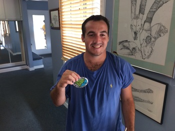
I've since heard from my friend and guide Susan Sides, who was very helpful to me while I was there, that the tree no longer stands. She suggested I contact Susan Barringer Wells, whose book A Game Called Salisbury details the lynching and the murder that led to it. Sides's email said that Wells's book claimed the tree still stands, and after publication (in 2010) she heard from many people that that was not the case. So I reached out to Wells to check. Wells told me that though she did hear from people who said the tree had come down, she's just not sure. There was another lynching in 1902, and some think the same tree was used both times; others are not so sure. 
Picture
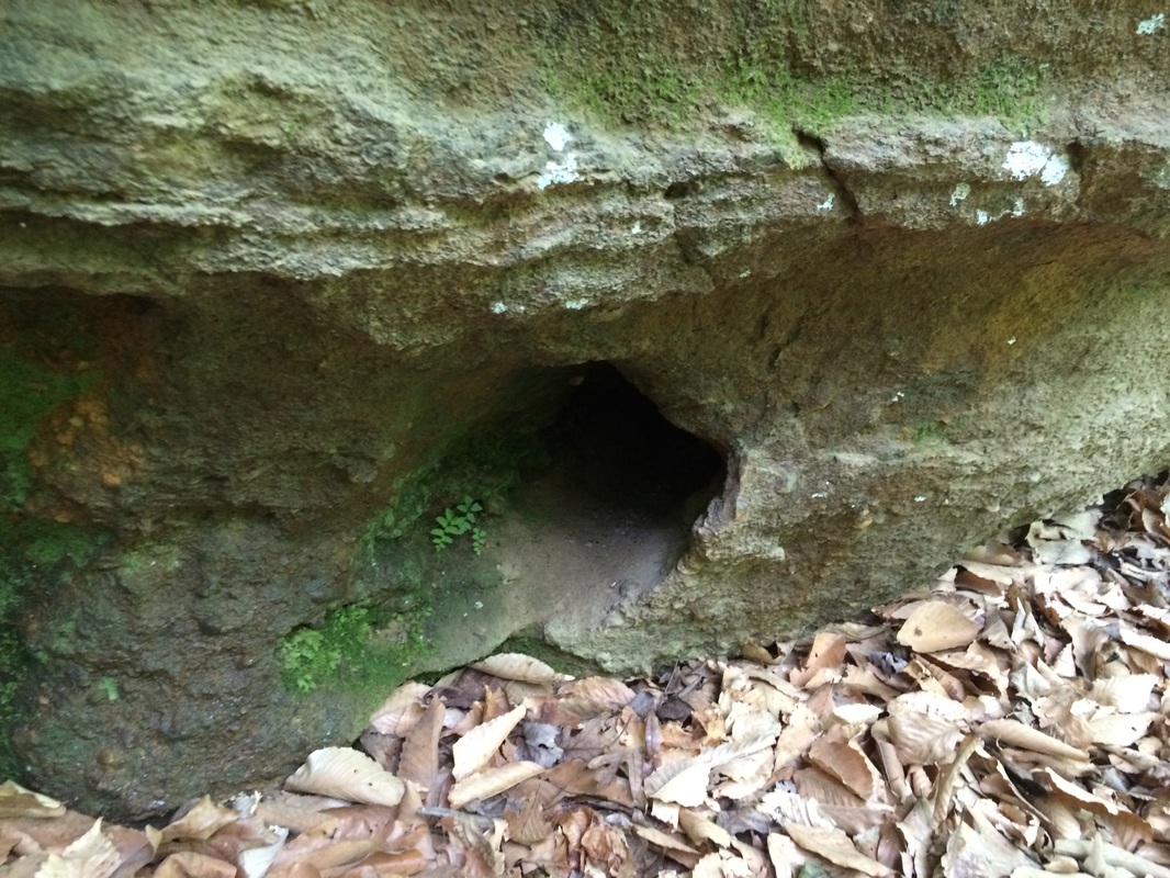
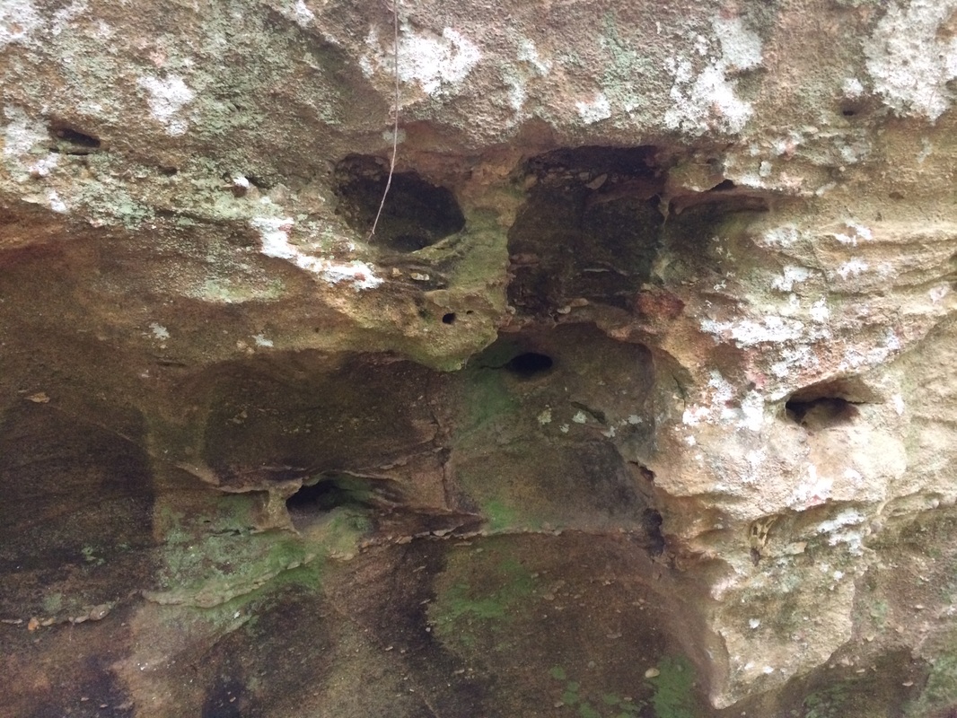
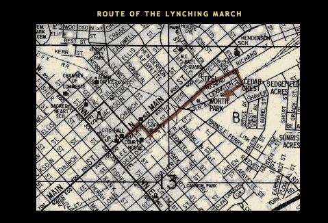
This is the route taken in the 1906 lynching. Image taken from the author's website: http://1906lynching.blogspot.com/
Picture
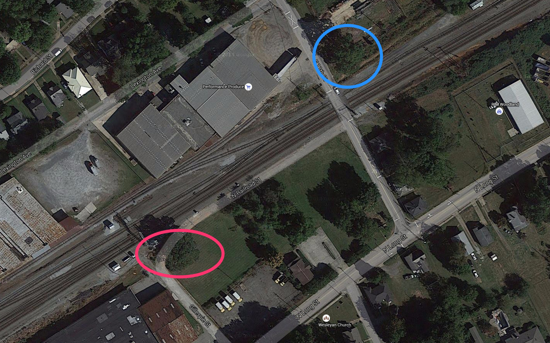
Here's a Google Maps satellite image of the end of the route. Blue is the tree I took a picture of, which looks to be wrong no matter what. Red is a tree that could be in the right spot, but ... who knows?
A member of the black community took her to a tree in 2006, she says, which would have fit the descriptions in the newspapers of the day (it had to be close to the railroad because Vaughan says passengers described passing the hanging bodies the next day). Others say the tree (or trees) came down, perhaps when the property turned to industrial use.

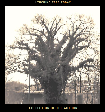
In any case, it's important that I back off from my claim. It's likely the tree I identified is not the lynching tree, and it's also likely that tree no longer stands. As Susan Sides said in her email, "I just want you to know our town does not have a hanging tree." Though I'm not at all sure there's certainty here (and I did acknowledge even in the original piece that I was far from certain about the tree), it's very certain that I don't have it.

Now, that said, I'm not sure whether that's a good or a bad thing. Lynching is an unquestioned evil. But the many monuments to the confederacy help us remember what stories we were telling ourselves about the confederacy and when. According to a brilliant recent piece by Timothy Tyson, those monuments built in North Carolina were overwhelmingly built after 1898, in a time of increasingly virulent, vicious, and violent white supremacy movements and increasing danger for African Americans. In 1898 white North Carolinians violently prevented black citizens from voting and took over the government. That is, the  confederate monuments, as Tyson put it, "reflected that moment of white supremacist ascendency as much as they did the Confederate legacy." Salisbury's own confederate monument went up in 1909 as part of this movement.
Picture
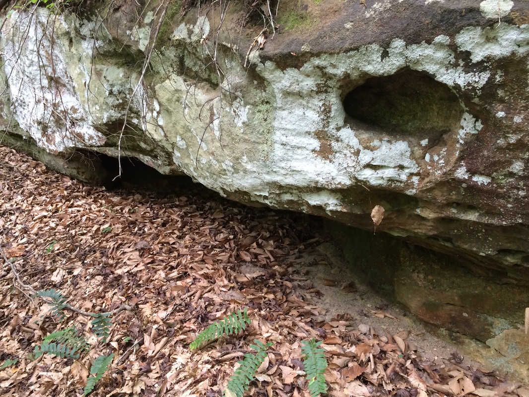
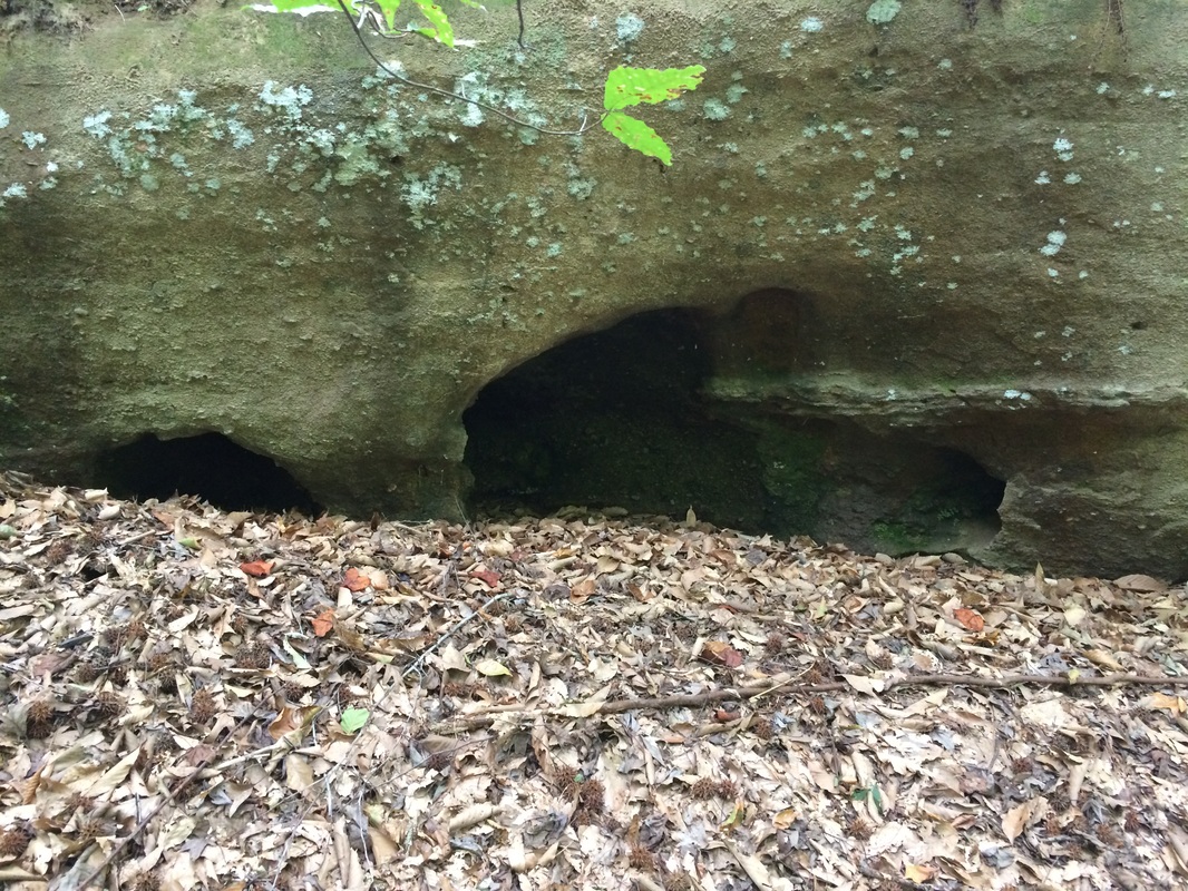
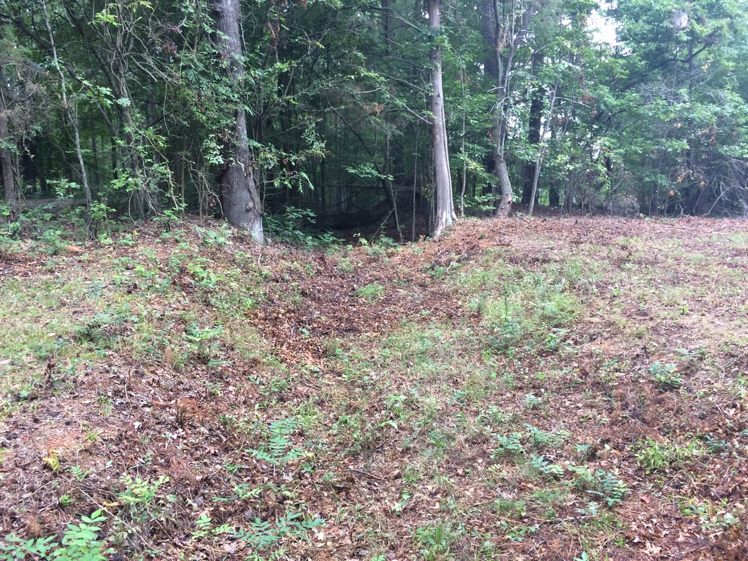
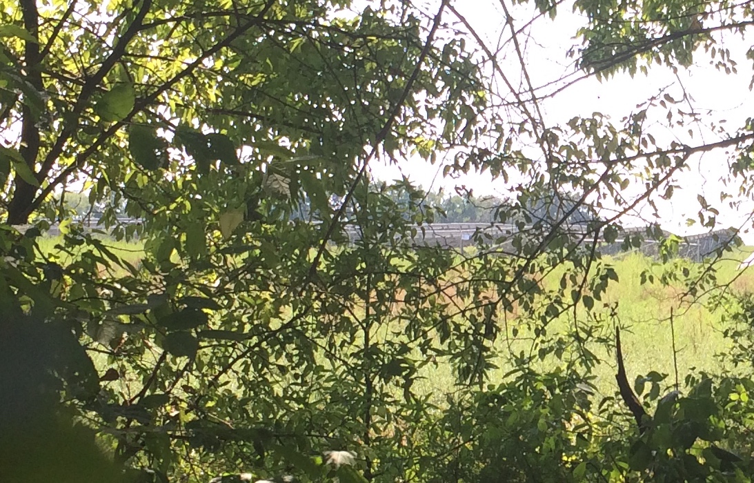
This is meant to be the tree from the 1902 lynching. You got to wonder what it's like to live in a place where you can't keep track of the lynching trees.
I think the fact that the two African American men I spoke with sent me to the tree -- whether the actual tree remains or not -- speaks loudly. I discussed with many people the symbolism of the confederate flag in the post I wrote about Salisbury and its environs, and the divided opinion on the flag and those many confederate monuments affected me. I found it -- and still find it -- stunning that with the overwhelming evidence that the flag stands for slavery, white supremacy, and violence against African Americans, people still manage to believe they are expressing some sort of historical respect by flying it. Anybody who wonders whether the wounds of slavery and the war fought in its defense have healed need only check Salisbury, where the community of those who were lynched still sees the shadow of lynching in the trees that remain. Whether they are the actual trees from which their ancestors hung seems almost beside the point. The point is, tree or not, monuments or not, racism and its legacy are far from historical to African Americans.
I heard from more people in response to that piece too.  One of my interviewees, Tony, said at one point, "Rowan county is built on hatred." That seemed rather incendiary to me, so I didn't use his comment in my piece. Then people started sending me links. On the good side, the 1906 lynching was a moment of change for North Carolina. The governor at the time, Robert Glenn, actually sent the military to try to stop the lynching, though those actually there trying to prevent it were overwhelmed and the soldiers arrived too late.
In fact, when George Hall, the leader of the lynch mob, was arrested, in a horrible irony, Glenn did send soldiers to guard the jail -- though this time to prevent the mob freeing him. Hall was prosecuted and sentenced -- a milestone in North Carolina. The American Law Review, volume 40, cites the Boston Evening Transcript as trumpeting this as "a triumph for law and executive authority, and even more for civilization."  Even the previous governor, Charles Aycock, had begun fighting the practice of lynching. Just the same, like Glenn, Aycock was an 
overt white supremacist, and his name, inscribed above the doors of buildings on campuses in Chapel Hill, Durham, Greenville,  and elsewhere has been part of the discussion in North Carolina about the celebration of a legacy with such negative aspects. So far nobody has taken a chisel to a pediment (and I'll be surprised and not especially pleased if anybody does), but people are talking.

But back to Rowan County and whether it was founded on hatred -- it does have a rather off-putting legacy of klansmanship. A recent American Experience documentary about the North Carolina Klan in the 1960s focuses on Rowan County and its resident Bob Jones, who led the Klan through its last insurgence, during which the North Carolina chapter became the largest in the nation. 

Lest you think even this, fifty long years ago, is long forgiven and forgotten, consider this horrific current event: within the last month, Rowan County swore in as the chair of its Board of Elections one Malcolm Butner, who has a history of overtly racist remarks. Read about them here; I don't want to repeat them. Again, the point: We don't know whether a lynching tree still stands or if one does which one it is. But that the spirit of lynching remains very much alive for North Carolinians? There's no question. I'm glad Susan Sides brought this up. One can never go back to this topic too often. Lawson 

On another topic, the Lost Colony, I discussed a current somewhat crazy theory that the famous Lost Colony vanished in pursuit of a global conspiracy to produce sassafras. I suggested that Lawson would have found the entire question perverse: he took as simple fact that the remainder of the colony had filtered in among the natives and been absorbed. "The English were forced to cohabit with them, for Relief and Conversation; and that in process of Time, they conform'd themselves to the Manners of their Indian Relations," Lawson said.  

It turns out that Lawson was exactly right, says Mark Horton, an archaeologist whose work is described by the National Geographic. "The evidence is that they assimilated with the Native Americans but kept their goods," he says, describing broken bowls, a sword hilt, and other evidence found on Hatteras Island. It's a conclusion for which archaeologists have found evidence barely three centuries after Lawson took it as perfectly obvious.

Like I said at the beginning of this piece -- it's always good to go back and check in on what you've already said.
0 Comments

The Hollow Rocks

8/19/2015

1 Comment

 
Picture
This could be the hollow rock of which Lawson speaks, but there's tons of them. I love seeing the exact things he did.
PictureChristopher Jacques: Hero of the Lawson Trek.
Not long after he left the Occanneechee village that we know was on the Eno River at present-day Hillsborough, Lawson tells of a strange custom his Indian guides demonstrate.

"The next day, we went over several Tracts of rich Land, but mix'd with Pines and other indifferent Soil. In our way, there stood a great Stone about the Size of a large Oven, and hollow; this the Indians took great Notice of, putting some Tobacco into the Concavity, and spitting after it. I ask'd them the reason of their so doing, but they made me no Answer."

Given which, when you find that your path takes you by the Hollow Rock Racquet & Swim Club in western Durham, you have to feel like you're on the right track. Not that I found this by myself, mind you; my ever trustworthy guide Val Green sent me looking for the rock, which he's found himself, and when I couldn't get exact directions I did what any reporter would do: I reached out to the club. 

Within a day or two I had heard from activities and camp director Christopher Jacques, who told me that his query caused a nameless board member to go on a quest he'd meant to make for five years: "namely, where is the actual Hollow Rock," the member said. Well, not far off, as it happens. Just down Erwin Road from the club you follow a private drive up to the New Hope Creek, which runs along a seam of granite on its south side, the creek a good ten feet or more below the gravel road above. In  the side of that outcropping that is almost a cliff, beneath the lichens and the mosses, are many large  expressions of granite, and in some of them you find little potholes -- rendering the stone hollow, just as Lawson said. 

Potholes in granite on the top are easy to understand -- rain collects in low places, begins to erode the rock, whether because of acids in the water or the action of freezing and cooling. That makes the depression deeper and soon you have a pothole; in rivers or areas that food the flow of water, swirling around sediment that scours the hole, makes the pothole even deeper.

What makes a pothole in the side of a rock I have no idea; I'll check with a geologist and get back to you.

Anyhow, along the way from Hillsborough to western Durham, Lawson followed what Tom Magnuson of the  Trading Path Association called "the old central coast road -- it goes all the way from the mountains to the sea." Magnuson doubts that Lawson ever actually made it to Hillsborough, mind you -- he believes he stopped somewhat short of there and didn't cross the Eno until days later -- but from that area to the Indian settlement Lawson called Adshusheer, the central coast road was the way. That road turned into Old NC 10, which I walked along towards the Hollow Rocks. 

Picture
This one?
Picture
No tobacco or spit in here.
Picture
Hollower and hollower.
Magnuson and my constant inspiration and informer Val Green disagree about Lawson's exact route here -- Magnuson has him walking north of the hollows and Green has him coming up from the south. Green's route has to recommend it that it actually walks right past them, but either route takes you within a quarter mile of these potholes. I explored them and found utterly thrilling that I was where I KNEW Lawson had been. By what route he got there seemed somehow less important. I had no tobacco, and I didn't spit. Val tells me he's heard from somewhere that the Indian families used to tell their children that lightning would hide in those holes, so they should keep their hands out of them. Val suspects the tall tale was a scare tactic to keep children from sticking their hands in and encountering venomous snakes.

Magnuson, already generous with his time, became a true Hero of the Lawson Trek by taking me on a driving tour of the area, stopping here and there to show me spots where fragments of the old road still exist. I loved seeing them -- you can usually tell because there are berms to the side, showing where road builders dug to maintain slope, which Magnuson links back to the English Highways Act of 1555, which first organized highway cost and maintenance as an obligation of the population.
Picture
It's obviously an old road when Tom Magnuson tells you it is. But I walked right by it without noticing it a couple hours later.
Picture
That's Tom Magnuson, driving me all over hell and gone to show off old pieces of the paths Lawson trod -- and help me get started.
Of all the things I found at the hollow rocks, though, I most loved two things. One was how easy it is to see these old roads -- when you have Tom or Val to point them out, as I so often have. But with Tom I found, as I have with Val, that even though when they point me in their direction in the morning, I am perfectly capable of walking past an old road and utterly failing to notice it by noon that same day. This stuff takes work, and their hours of study enriches us all.

The other thing I deeply loved was Lawson's note that the Indians just refused to answer his question. "Hey, you guys -- why'd you spit in that rock, huh? What's the deal with the tobacco, too?" No answer. Shut up, tourist -- not everything is your business. Anybody who's ever been a reporter or interviewed anybody for any reason at all recognizes this interaction. No matter how helpful people are, after a while even the nicest and most patient just get sick of you. Lawson had been following Indian guides for nearly two months, and though he went from guide to guide, one can easily imagine they were getting sick of his questions.

So as I stood at the hollow rocks, because of the patient, generous help of countless people answering constant questions, I took a moment of pure gratitude. Lawson never mentioned it, but I suspect that when he noted for one of the very few times in his book that someone refused to answer one of his questions, he took a moment to reflect on how grateful he was that mostly they did answer him.

I know I did.
1 Comment

Heroes of the Lawson Trek

8/7/2015

1 Comment

 
I say constantly that the best part of this project is the people I meet. This segment, starting in Julian, NC, and walking towards Hillsborough, has made that especially clear.

Even Lawson seems to have felt the same way on this segment of his journey. First, though, terrain. Lawson said of this portion of the trail, as the Piedmont's higher hills (in the thousand-foot range) diminish to rolling, "We pass'd through a delicate rich Soil this day: no great Hills, but pretty Risings, and Levels, which made a beautiful Country." Hear, hear, Mr. Lawson. I noted on my last trek -- which ended in Julian -- that as I came down out of the hills I noted a couple enormous radio broadcast antennae: a sure sign that you're on the edge of the big hills. This time, leaving from Julian, I never stopped marveling at the rolling landscape -- hills to gently climb, then gracefully descend, covered with green meadows, omnipresent white-and-silver barns, and
Picture
I always think of barns with red sides. Lately it's been all white barns with silver roofs and I am in love with them.
Picture
And grassy meadows. Also: like ten skillion acres of soybeans, but they're just not photogenic.
crops like corn, soybeans, and hay. It's truly a lovely part of the world; when walking through it, Lawson said, "The Savages do, indeed, still possess the Flower of Carolina, the English enjoying only the Fag-end of that fine Country."

It's been vastly hot, too, but I'm tired of talking about that.

What I love talking about right now are the Heroes of the Lawson Trek, who have been out in force this segment. 

I started out this segment accepting a ride from Michael Johnston, himself passed on to me from Speed Hallman, a Lawsonian who had read about the trek and reached out to introduce himself and offer general assistance. When I said I could use a ride to help me place my car in Hillsborough, where I was finishing this segment, and then get me to Julian, where I was starting,  Speed reached out to Johnston, a pharmacist in Pleasant Hill, not far from Julian. Johnston gladly made the run to Hillsborough to grab me up and get me to Julian before going to work that day.
Picture
Michael Johnston turned out to be not only interested in Lawson but married to a direct descendant of Baron de Graffenried, the last European to see Lawson alive.
That's nice, and wonderful, and the kind of thing that makes this trek so much fun. But the universe being the trickster that it is, Johnston turned out not to be just a Lawsonian, which he became when he and Cristin, his wife (then his girlfriend), visited New Bern and learned about its history -- and its founding in 1710 by Lawson and de Graffenreid. Entranced with New Bern's history, the pair talked about moving there -- and a relative of Cristin's told her shat she was the eighth-great-granddaughter. "He sent her a whole packet of family tree stuff," Johnston said. De Graffenried was the guy with Lawson when the two were captured (and Lawson killed) by the Tuscarora in 1711.

That's an amazing coincidence, and I look forward to meeting and speaking with Cristin. But I loved hearing how Johnston fell for Lawson: "I just struck a liking for Lawson because of his attention to detail, natural history, his relationship to the natives.

"What I wouldn't give be able to go back and do what he did in an untainted new world," he said.

I couldn't have agreed more.

The next Hero of the Lawson Trek I stumbled onto was Ann Tilley, a seamstress and textile artist who was waiting to get her oil changed at Shoffner's, the service station/restaurant/store about halfway between Julian
Picture
Picture
Cedarock Park, the awesome Alamance County park where I planned to spend my first night. Not only did we have a delightful conversation about Lawson but she told me about the farm where she lived: "it's my boyfriend's stepdad's sister's husband's childhood home." Which, in a region where everybody I meet seems to have relatives stretching back to Lawson's time, is about par for the course. What's more, she told me that like so many, the farm doesn't work any more -- or actually, it does: "It's a solar farm," she said, harvesting sunlight now for utility companies. She told me about another one I'd pass along my way -- I did my best to take a picture of it. You think that's good? Then since she and her boyfriend, Adam, were going to Cedarock to play disc golf that evening, she picked me up later and drove me there, obviating the need for me to walk miles off Lawson's path to get to the park. She brought watermelon. Hero of the Lawson Trek indeed.
Picture
It's not easy to see -- I couldn't get too close without going into poison ivy -- but this farm along the old Trading Path trades in sunshine now. If you look in the center you can see the solar panels.
Picture
I'm sure Lawson had better hospitality at some point, but watermelon on a hot day? I'm happy.
Still more cool people, and mind you this is in two days total. The Trading Path has big mojo -- people have been walking along it for centuries, since long before Lawson. When you have a place that people tend to go, stuff tends to happen there. Civil War troop movements, for example -- and the Battle of Alamance. Years before the Revolution, in 1771, the Regulators, a group of Piedmont farmers who wanted protection from government officials taking advantage of their positions. Skirmishes led to an actual battle in 1771, where the Regulators got their buts kicked but lay down the early groundwork for government resistance. I visited the battleground, then wandered into the visitors center to escape the heat. There I met Lisa Cox, who had learned, once she started working there, that the Trading Path, Lawson's path, ran right through the 
Picture
Lisa Cox of the Alamance Battlefield visitors center talked Trading Path, Lawson, and Regulators. Yay, Lisa!
Picture
This gang was out for a walk on a hot day. Like me! They were all super nice, and naturally knew everything about the area.
battlefield. She also learned that she was a direct descendant of not one but two of the Regulators -- Simon Dixon and Brinsley Barnes, you're wondering. Lisa showed serious Lawson interest, so I took her picture.  And as I neared my stopping point for the night -- the Hampton Inn near Mebane, where after a night camping in the rain I confess I am enjoying the AC and the dry -- I ran into a group of four people out for a nice walk. Janet Eckleberger (in the black) had driven out to visit Lee and Betty Vernon (in the white hats) and Betty's brother, Kemp Kimrey. We were less than a block from Kimrey Road, because roads named for your family is how it is around here. We talked of course about Lawson, but just about the high point of the day came when Eckleberger described her experience writing down the directions she followed to the Vernons' home. With the various Old Hillsborough Roads and Salem Church Roads and Saxapahaw Bethlehem Church Roads, "I felt like I was walking through a historical short story just to get to her house." I knew just how she felt.

I'm closing with a picture of Detario, the dude who helped me get organized to drop bags, get a room, and walk my way to the Hampton Inn. It may be because I'm so glad to be sleeping comfortably tonight, but it may be just because this segment has been a party of Lawson helpers and he's a cool guy. So anyhow, it's nice to have a segment where with the beautiful countryside, the history, and the astonishing elements of Lawson's story, I just got to tell you about the people on the way.
Picture
Detario!
1 Comment

Walking into the Past

8/4/2015

1 Comment

 
Picture
David Harris's roots stretch generations into the Piedmont hills, and he loves to find out what's back of him. He offered me a ride but I wouldn't take it. I'm out here to walk.
PictureYou could probably find a better fried bologna and cheese if you looked hard enough, but if it was me I would just eat the one at the Village Restaurant in Denton and be happy.
From Denton, North Carolina, to Julian, North Carolina, what I can tell you is it's hot. Hot, hot, hot. If you walk in late July, you can plan on sweating enough to go through a couple shirts a day and still stink something awful, which is what I did.

I had in mind one thing when I left Denton, just east of Salisbury and the Yadkin River: Archaeology. I was interested in archaeology, because I knew I was going to pass by the site of Keyauwee Town, the site on the Caraway Creek of not only the Keyauwee Indians Lawson visited (though uncertainty remains about the exact location of that town) but of the dawn of scientific archaeology in North Carolina. In 1933, one Joffre Lanning Coe, born and educated in North Carolina, attended the first meeting of the Archaeological Society of North Carolina, whose president, Douglas Rights, was the dean of the nascent North Carolina study of archaeology. It was Rights, in fact, who in 1931 published the article "The Trading Path to the Indians," which included a first attempt to figure out Lawson's path. In 1947 his book The American Indians in North Carolina contained "Lawson's Long Trail," a chapter that detailed the trail in far greater depth, as far as Rights could trace it; until I met Val Green, I thought Rights was as close as I was going to get. 

Anyhow, so as I left Denton I was excited to be heading off to not only Lawson's history but the history of NC archaeology. I had made arrangements with Delk's Army-Navy Surplus Store, possibly the greatest surplus store in the world, to set up camp on their front lawn, which I had only seen on Google Earth. It was within a quarter mile of the Keyauwee site, plus it was a good day's walk from Denton. I got the always-helpful Katie Winsett to drop off my camping stuff there; we had left my car in Julian, NC, where I expected to finish a day later, and I bought Katie lunch at the Village Restaurant in Denton. If you learn nothing else from this website, please learn that you should go to lunch someday at the Village Restaurant in Denton.

 Lawson speaks of visiting the Keyawees a day after leaving the Sapona, and finding a town that he says that "Nature hath so fortify'd this Town, with Mountains, that were it a Seat of War, it might easily be made impregnable; having large Corn-Fields joining to their Cabins, and a Savanna near the Town, at the Foot of these Mountains.... And all this environ'd round with very high Mountains, so that no hard Wind ever troubles these Inhabitants."  He says it's 5 miles northwest of the Uwharrie River (he calls it the Heighwarrie), though that turns out to be a misprint: on Caraway Creek, almost exactly 5 miles northEAST of the Uwharrie, flows the Caraway Creek.

There on the Caraway the society believed it had in 1936 found part of the Keyauwee Village mentioned by Lawson, after members had begun digging there a year before. (Much of this story as I relate it comes from discussions with professor Stephen Davis at the University of North Carolina, or from the book he coauthored, Time Before History: The Archaeology of North Carolina.) The spot sits on the river, with plenty of farmland spreading as Lawson describes, and the Caraway runs right through the Caraway Mountains, the northern branch of the Uwharrie Mountains, supporting Lawson's description of the spot's protected environs. Lawson also describes the food provided to some of his party: "Two young Fawns, taken out of the Doe's Bellies, and boil'd in the same slimy Bags Nature had placed them in, and one of the Country-Hares, stew'd with the Guts in her Belly, and her Skin with the Hair on. This new-fashion'd Cookery wrought Abstinence in our Fellow-Travellers." I was glad I'd enjoyed the fried bologna at the Village.

PictureThis isn't Mr. Harris's millstone, but it wasn't far from where he and I talked. Such stones are common here -- relics of the time when these creeks and rivers were the power source that made meal or flour of everybody's grain.
Anyhow, as I was walking along the hot road, thinking about archaeology and this region, a white pickup slowed down next to me and asked if I wanted a ride. This is a nice thing that happens fairly often, and as I commonly do I said I preferred to walk, and I briefly explained about Lawson and the whole point of this undertaking being to walk along the ground, not to bicycle or drive or take helicopters or something. Walking put me right on the earth, where Lawson had been, and you just see better. David Harris, whose picture you see at the top of this post, broke into an enormous smile and we began to talk. He talked about his family -- he's a Harris, his wife is a Johnson, and there used to be a mill called the Harris Johnson Mill down on Toms Creek, a tributary of the Uwharrie River just off Brantley Gordon Road, where we chatted, near his property. He runs a logging and chipping company, but he loves history and has looked back into the stories on his property. 

PictureThis is from Coe's report on the excavation at the Keyauwee site. Those are graves up at the top.
His family eventually acquired a piece of that mill property: "Mr. Johnson lived back there -- he had a two-story house," he says. "They got a picture of it in the Randolph County archives." He's built himself a cabin where that old house stood: "It's by the same oak trees. They're huge!" The mill was a few hundred yards away, but most traces of it are gone, though searching around he's found parts of an old safe, the back cover of a pocket watch, and an old mill stone, which he's pulled out and used as ornament. He's done a lot of research since then. It seems that piece of land that used to be Harris Johnson's house is landlocked -- surrounded by other properties with no road in. "There was a woods road in there, and the state abandoned it in the 1930s," instead maintaining Richey Road, which parallels it. "I have to go over three separate landowners to get to it," he says of his property now, and one unfriendly neighbor won't give an easement, so Harris has spent hours, and thousands of dollars, and miles driving back and forth to Raleigh looking up property records to demonstrate his claim for an easement. "I walk through the woods and follow the old road beds," he says. "I pass two, three old house places," abandoned but still standing -- one even still has power.

But lost roads are the way of things. "That was a big thing in these areas," he says. "Everyone went to the watermill to get their wheat and corn ground. Then the power come, and they all shut down and everyone went into town." His aunt, born in 1918 but still sharp, tells him stories. "She was born back in there, and she told me of all the people that lived down in there."

Though he doesn't think his last name is connected to Mr. Johnson's first name, Mr. Harris liked the fact that he is a Harris and his wife is a Johnson -- "she's a double-barrelled Johnson," he laughed. "When they got married they didn't even have to change their name!" 

In all my reading about the Caraway site of Keyauwee Town I have learned that the site Coe excavated  was likely not the exact site of Lawson's visit. The graves they found at the site show virtually no signs of the trade goods that demonstrate contact with Europeans: beads, axeheads, iron goods, and so forth. "But they had one pit they excavated that had glass beads in it," said Stephen Davis of UNC. "So it's the best candidate. We have nothing else to rival it, and the material evidence from the site, you could argue that it has artifacts that date to that site."

Anyway -- the point for me was that just as Coe was doing archaeology at the Keyauwee site, so was Mr. Harris at his old mill. Finding the evidence -- road depressions, millstones, the safe, the pocket watch back. Checking the stories -- his aunt, his wife, the library, Raleigh. The story of the place lives in those road beds, those deeds and plats, those millstones and safes and pocket watch backs.  Those empty house places tell a story of how the land was once, and the new cabin he's built tell a new story. And someday, one presumes, a new deed and entry in the plat book will show how a piece of land has a road easement, and the ghost road the state abandoned will reassert itself, a century later

One more thing. Here's my campsite at Delk's -- possibly my championship weirdest and coolest campsite on the whole Trek so far. Delk's was very kind to me, and though their yard was a bit like a junkyard (including open 55-gallon drums serving as mosquito breeding tanks), I loved camping here, even when someone who didn't get the memo came roaring up to my campsite in a pickup at about 9 pm, assuring me that oh no I WASN'T camping on Delk's front lawn. A quick phone call of course resolved that, and no harm done, and he roared off again. Still -- when I dropped off my stuff early in the day, there had been a truck with a helicopter chassis loaded on it parked there, and I was going to camp between it and the rest of the yard, lightly sheltered from the all night Route 64 traffic. Delighted by the chopper, I spent all day thinking up
Picture
This may actually be one of the coolest places I've ever camped in my whole life. Still bummed about the helicopter, though.
"Apocalypse Now" jokes to accompany the photos with which I planned to bombard Instagram. Imagine my heartbreak when I came to Delk's at end of day and found no helicopter. Best I can do now is guess my pickup antagonist was trying to terminate my Trek with extreme prejudice, but without the helicopter, to be honest the joke just falls kinda flat.
1 Comment

    Archives

    January 2020
    October 2019
    May 2019
    February 2019
    November 2018
    October 2018
    May 2018
    March 2018
    August 2017
    May 2017
    August 2016
    June 2016
    March 2016
    February 2016
    November 2015
    October 2015
    September 2015
    August 2015
    July 2015
    June 2015
    May 2015
    April 2015
    March 2015
    February 2015
    January 2015
    December 2014
    November 2014
    October 2014
    September 2014
    August 2014

    Categories

    All
    Adventure
    African American
    Angie Clemmons
    Anthropocene
    Apothecary
    Appalachian
    Archaeologists
    Archaeology
    Army-navy
    Art
    Artifacts
    Atlanta
    Backpack
    Banking
    Barbecue
    Barry Beasley
    Bath
    Beaufort
    Beckee Garris
    Beetle
    Beginning
    Ben Franklin
    Berm
    Bill
    Birds
    Blister
    Book
    Bookstore
    Boston
    Botanical
    Boykin
    Breach
    Brent Burgin
    Brownlee
    Buck
    Buffer
    Cabelas
    Cambridge
    Camden
    Camera
    Canoe
    Canty
    Catawba
    Chain
    Charleston
    Charlotte
    Chelsea
    Chocolate
    Chris Judge
    Church
    Cincinnati
    City Of Raleigh Museum
    Civilization
    Coe
    Comment
    Community
    Concord
    Confederate
    Contentnea
    Cornwallis
    Country Music
    Couture
    Crawford
    Creek
    Croatoan
    Cutler
    Cypress
    Danger
    Davis
    Death
    Delightsome
    Delk's
    Denton
    Devices
    Drake
    Drawing
    Drunk
    Duck
    Durham
    Eagle
    Earnhardt
    Earth Day
    East
    Ecologist
    Effron
    Embankment
    End
    Error
    Evans
    Exhibit
    Expeditions
    Facebook
    Feather
    Fern
    Finish
    Fire
    Flag
    Flintlock
    Flood
    Francis
    French
    Gaillard
    Gander Mountain
    Garden
    Geology
    Gimpy
    GIS
    Google
    Great Wagon Road
    Green
    Greenville
    Grifton
    Guerry
    Gun
    Guns
    Haigler
    Hallenbeck
    Hampton
    Hanging
    Hannah Smith
    Harris
    Hartford
    Harvest
    Heat
    Hempton
    Highway
    Hillsborough
    Hips
    Historic Bath
    Hollow Rocks
    Home
    Homeness
    Hortus Siccus
    Hospitality
    Huguenots
    Huntley
    Indians
    Instagram
    Interstate
    Island
    Ivy
    Ivy Place
    Jamaica
    Jarvis
    Jennifer Landin
    Jered
    Jimmy White
    John Jeffries
    John White
    Journalism
    Kadaupau
    Kannapolis
    Katawba Valley Land Trust
    Katie Winsett
    Kayak
    Kershaw
    Keyauwee
    King
    Knife
    Lame
    Land
    Language
    Lawson
    Lawsonians
    Lecture
    Legacy
    Legare
    Legislators
    Leigh Swain
    Lenoir
    Lenoir Store
    Lenses
    Library
    Lichen
    Lies
    Loberger
    Locke
    London
    Longleaf
    Lost Colony
    Lynch
    Lynching
    Magnuson
    Mansplaining
    Maps
    Mass Shooting
    Match-coat
    Mathematical
    Meerkat
    Memorial
    Mental Floss
    Mill
    Millstone
    Miniature
    Monkeyshine
    Moonshine
    Museum
    Museum Day Live
    Musings
    Nancy
    Nascar
    Native American Studies Center
    Natural History Museum
    Nature
    Nesbit
    Netherton
    Neuse
    Newspaper
    Nonfiction
    Notebooks
    Occaneechi
    Orlando
    Pack's Landing
    Palmetto
    Pamlico
    Park
    Patent Leather
    Pedestrian
    Peggy Scott
    Periscope
    Petiver
    Photography
    Physic
    Pig
    Pig Man
    Pittsburgh
    Pocket
    Poinsett
    Polo
    Potsherd
    Pottery
    Preparation
    Presentation
    Press
    Process
    Proofreading
    Property
    Publishing
    Raccoon
    Racing
    Racism
    Racist
    Raleigh
    Rape
    Ray
    Readings
    Reconsideration
    Records
    Revolution
    Richard Smith
    Richardson
    Rights
    Riparian
    Rivulet
    Road
    Roadness
    Roanoke
    Robert Off
    Roland Kays
    Rolling Stone
    Roombox
    Rules
    Salisbury
    Santee
    Sapona
    Sassafras
    Scan
    Sconc
    Seneca
    Seth
    Shakespeare
    Sir Walter Raleigh
    Slavery
    Slime Mold
    Sloane
    Slope
    Small Town
    Smith
    Smithsonian
    Snow
    Sore
    Sounds
    Spanish Moss
    Specimens
    Speedway
    Spencer
    State Fair
    Steve Grant
    Stewart
    St. Mark's
    Suburban
    Sumter County
    Surveying
    Swamp
    Tar River
    Technology
    Textile
    Tide
    Tobacco
    Toms River
    Tool
    Towel
    Trade
    Trading Ford
    Trading Girls
    Trail
    Trap
    Traunter
    Tree
    Tree Farming
    Trek
    Trilobite
    Troi Perkins
    Truth
    Tryon
    Tupelo
    Turkey
    Tuscarora
    Twitter
    Ugly
    Unc
    Val
    Val Green
    Virginia
    Virginia Dare
    Virginia Historical Society
    Walking
    Washington
    Waxhaw
    Weather
    Website
    White
    Writing
    Wrong
    Yadkin
    Yoga

    RSS Feed

Proudly powered by Weebly